Skip to content
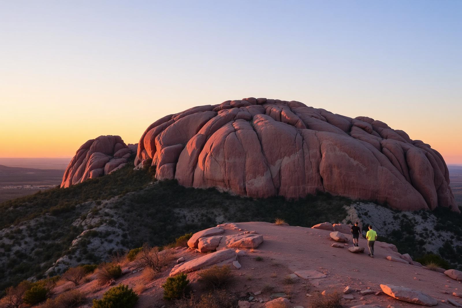
Scenic Hill Country State Natural Area ridgeline overlook photographed on-site October 2023

Hill Country · State Parks

Hill Country State Natural Area

A rugged backcountry natural area southwest of Bandera with 40 miles of hiking and equestrian routes, primitive creekside and remote camping, and hillside overlooks that require careful trail-and-water planning.

Photography: Larry D. Moore · CC BY 4.0 · Wikimedia Commons · photo October 14, 2023 · CC BY 4.0 license ↗

Quick trip facts

Hill Country State Natural Area at a glance

Where is Hill Country State Natural Area?
Hill Country State Natural Area is at 10600 Bandera Creek Road, Bandera, TX 78003, in Bandera County.
When is the best time to visit Hill Country State Natural Area?
Spring and fall are typically most comfortable for walking, riding and primitive camping; the open Hill Country landscape can be exposed to summer heat.
Do I need to plan ahead for Hill Country State Natural Area?
Daily park access, with office hours 8:15 a.m.–4:45 p.m. TPWD currently lists $6 adult day entry and free entry for children 12 and under. Reserve passes ahead; trails close after rain and the October 5 alert reported all trails open with an active burn ban. Recheck alerts before visiting.
Who manages Hill Country State Natural Area?
Texas Parks and Wildlife Department

Practical visitor details

Before you go

Daily entrance fee
Adults 13 and older pay $6; children 12 and younger enter free.
Checked · Official details ↗
Office hours
The natural area is open daily. Office hours are 8:15 a.m.–4:45 p.m.
Checked · Official details ↗
Trail and backcountry access
Trails and backcountry campsites may close after rain or poor weather. Confirm the current TPWD trail status before setting out.
Checked · Official details ↗

The experience

Visiting Hill Country State Natural Area

Hill Country State Natural Area is a less-developed counterpart to the region's lake and river parks. Its steep, rocky hills, valleys and brushland preserve a working-ranch landscape west of Bandera while offering miles of horseback, mountain-bike and hiking routes. That rustic character is the point: do not plan a trip here expecting a paved family promenade, a lake swimming beach or the services of a full RV resort. Choose a route to match your experience, weather and ability to carry water.

TPWD lists a network of roughly 40 miles of multiuse trails, and the official trail map is essential because crossings and slopes vary greatly. Seasonal closures matter: rain can make trails unusable, and fire restrictions may alter camping plans. The October 5, 2026 trail bulletin said all trails were open but warned of possible closures following precipitation and showed a burn ban. Download the map before reaching the ranchland; office hours and park-day access are not interchangeable.

There are genuinely different primitive camping experiences. West Verde Creek's three walk-in campsites are up to 50 yards from parking and have water plus a nearby chemical toilet. Comanche Bluff has three walk-in campsites within approximately 25 yards of parking, with water and a nearby vault toilet. Chaquita Falls has four sites with nearby chemical toilets, water and a walk of up to 75 yards. Check exact site descriptions before assuming potable water at every campsite, a shower, or a vehicle-sized pad.

The remote backcountry options require substantially more preparation. Two Butterfly Springs campsites are about 2.87 miles from parking, Hermit's Shack has three sites about 3.25 miles from parking, and Wilderness has five sites about 2.3 miles from parking. TPWD specifically lists no water and no ground fires at these hike-in sites; some are first-come, not advance reservable. Distances matter when carrying overnight gear in hot weather and when day-use routes overlap horseback traffic. Confirm water treatment, weather and the current reservation method.

Reaching the headquarters from Bandera requires traveling south on Highway 173 across the Medina River, then following Ranch Road 1077 for roughly ten miles until the blacktop ends and continuing on a signed caliche road. The official headquarters coordinates are 29.628034, -99.181086, but individual trailheads and campsites are elsewhere. The visitor-information desk lists hours of 8:15 a.m.–4:45 p.m.; arrive early enough to resolve access questions. Nearby Bandera makes an appropriate base for supplies and accommodations, without implying services are provided inside remote camps.

The site's value extends beyond recreation: the regional native habitat, wildlife and unusually extensive equestrian network provide a quieter experience than many developed Hill Country parks. TPWD publishes an interpretive guide and bird checklist in addition to its map resources. Use these documents to identify the landscape and seasonal birds rather than treating each saddleback trail as interchangeable. Livestock- and wildlife-sensitive trail etiquette, heat precautions and Leave No Trace practices protect this natural area for future visitors.

The details

Planning your visit

Area
Bandera, Texas
Best season
Spring and fall are typically most comfortable for walking, riding and primitive camping; the open Hill Country landscape can be exposed to summer heat.
Address
10600 Bandera Creek Road, Bandera, TX 78003
Entry & reservations
Daily park access, with office hours 8:15 a.m.–4:45 p.m. TPWD currently lists $6 adult day entry and free entry for children 12 and under. Reserve passes ahead; trails close after rain and the October 5 alert reported all trails open with an active burn ban. Recheck alerts before visiting.
Accessibility
Trails are predominantly rustic, rocky and sometimes steep. Verify current accessible parking and restroom facilities directly with TPWD rather than assuming that every campsite or trail is wheelchair-friendly.
Getting there
From Bandera go south on Highway 173, cross the Medina River, turn right onto Ranch Road 1077, and continue roughly ten miles past the end of pavement onto the signed caliche road to park HQ. Avoid relying on a city-center navigation pin.

Texas State Parks · trip planning

Park entrances, facilities and visitor maps

Amenities can differ by park unit, campsite and season. The details below are park-specific where checked against TPWD. For changing hours, reservations, trail conditions and facility availability, use the park's official visitor resources.

Restrooms and showers
West Verde Creek and Chaquita Falls walk-in camps have chemical toilets nearby; Comanche Bluff has vault toilets nearby. TPWD has not verified an equivalent restroom at each remote wilderness campsite.
Parking, entrance and access
West Verde Creek campsites require carrying equipment up to 50 yards from parking, Comanche Bluff up to 25 yards and Chaquita Falls up to 75 yards. Backcountry sites can require hikes of 2.3–3.25 miles.
Camping, RV hookups and drinking water
Three West Verde Creek, three Comanche Bluff and four Chaquita Falls creekside walk-in sites have water nearby. Butterfly Springs (2 sites), Hermit's Shack (3) and Wilderness (5) hike-in areas have NO water and prohibit ground fires.
Trails, parking and visitor maps
TPWD provides the separate park and trail maps, interpretive guide and bird checklist.
Access restrictions and current visitor rules
October 5, 2026 official alert reported all trails open but an active burn ban. Mud can close trails after rain. Park office 8:15 a.m.–4:45 p.m.; reserve day-use ahead.

Accessibility: Trails are predominantly rustic, rocky and sometimes steep. Verify current accessible parking and restroom facilities directly with TPWD rather than assuming that every campsite or trail is wheelchair-friendly.

Park-specific visitor facts checked 2026-10-12 against the TPWD source.

Explore Texas state parks

Plan the route

Explore related places

Editorially paired stops near Hill Country State Natural Area appear first, followed by nearby destinations. Distances are approximate straight-line miles.

  • Bandera · Bandera County · Hill Country

    Bandera

    Bandera is a Medina River town whose ranching, rodeo and trail-riding culture, limestone courthouse, frontier museums and nearby Hill Country public land make the self-styled Cowboy Capital of the World more than a Western-theme stop.

    Best season: Fall through spring for town walking and riding; warm months add Medina River swimming and paddling when water conditions allowUpdated Sep 2026
    • cowboy heritage
    • Bandera County Courthouse
    • Frontier Times Museum
    Explore this place

    Approx. 9 miles away

  • Bandera · Bandera County · Hill Country

    Frontier Times Museum

    Bandera's Frontier Times Museum, founded from historian J. Marvin Hunter's eclectic collection, preserves Texas frontier, cowboy, ranching and Bandera County history in a landmark museum that has served the Cowboy Capital for more than ninety years.

    Updated Aug 2026
    • Texas frontier artifacts
    • Cowboy and ranching heritage
    • Texas Heroes Hall of Honor
    Explore this place

    Approx. 10 miles away

  • Approx. 26 miles away

  • Castroville · Medina County

    Landmark Inn State Historic Site

    The 19th-century complex served travelers and residents as a tavern, store, hotel and mill along the Medina River. An overnight stay can turn a historic-site visit into part of the experience while introducing Castroville's distinctive Alsatian heritage.

    Best season: Year-round; spring and fall are usually the most comfortable for outdoor portions of a visit.Updated Aug 2026
    • historic lodging
    • Castroville
    • Alsatian Texas
    Explore this place

    Approx. 26 miles away

  • Castroville · Medina County · Hill Country

    Castroville

    Castroville is a Medina River town west of San Antonio where Alsatian settlement history, preserved nineteenth-century architecture, a large historic district, Landmark Inn and riverfront parks create one of Texas's most distinctive European-heritage small-town visits.

    Best season: Fall through spring for historic walking and riverfront trails; warm months for park and pool recreation with heat planningUpdated Sep 2026
    • Castroville Historic District
    • Alsatian heritage
    • Landmark Inn
    Explore this place

    Approx. 26 miles away

  • Kerrville · Kerr County · Hill Country

    Museum of Western Art

    Kerrville's Museum of Western Art preserves and presents paintings, sculpture and material culture of the American West in a Hill Country museum created from the legacy of the Cowboy Artists of America.

    Updated Aug 2026
    • Western painting and sculpture
    • Cowboy Artists legacy
    • Hill Country architecture
    Explore this place

    Approx. 28 miles away

Read next

More from State Parks

State Parks

Down Into the Panhandle

A complete first-timer’s guide to the Lighthouse Trail at Palo Duro Canyon: distance, heat, water, timing, the final climb, and how to make the canyon a full day instead of one photograph.

August 20, 2026 · About 8 minutes

State Parks

The Texas State Park You Should Start With

There is no single best park. There is a best first park for the kind of Texas you want to understand — canyon, coast, granite, forest or river.

August 7, 2026 · About 3 minutes