Burnet · Burnet County · Hill Country
Longhorn Cavern State Park
A historic Hill Country cavern with guided walking and wild-cave tours, CCC architecture, hiking, and scenic overlooks.
- Caving
- Guided Tours
- Hiking
Hill Country · State Parks
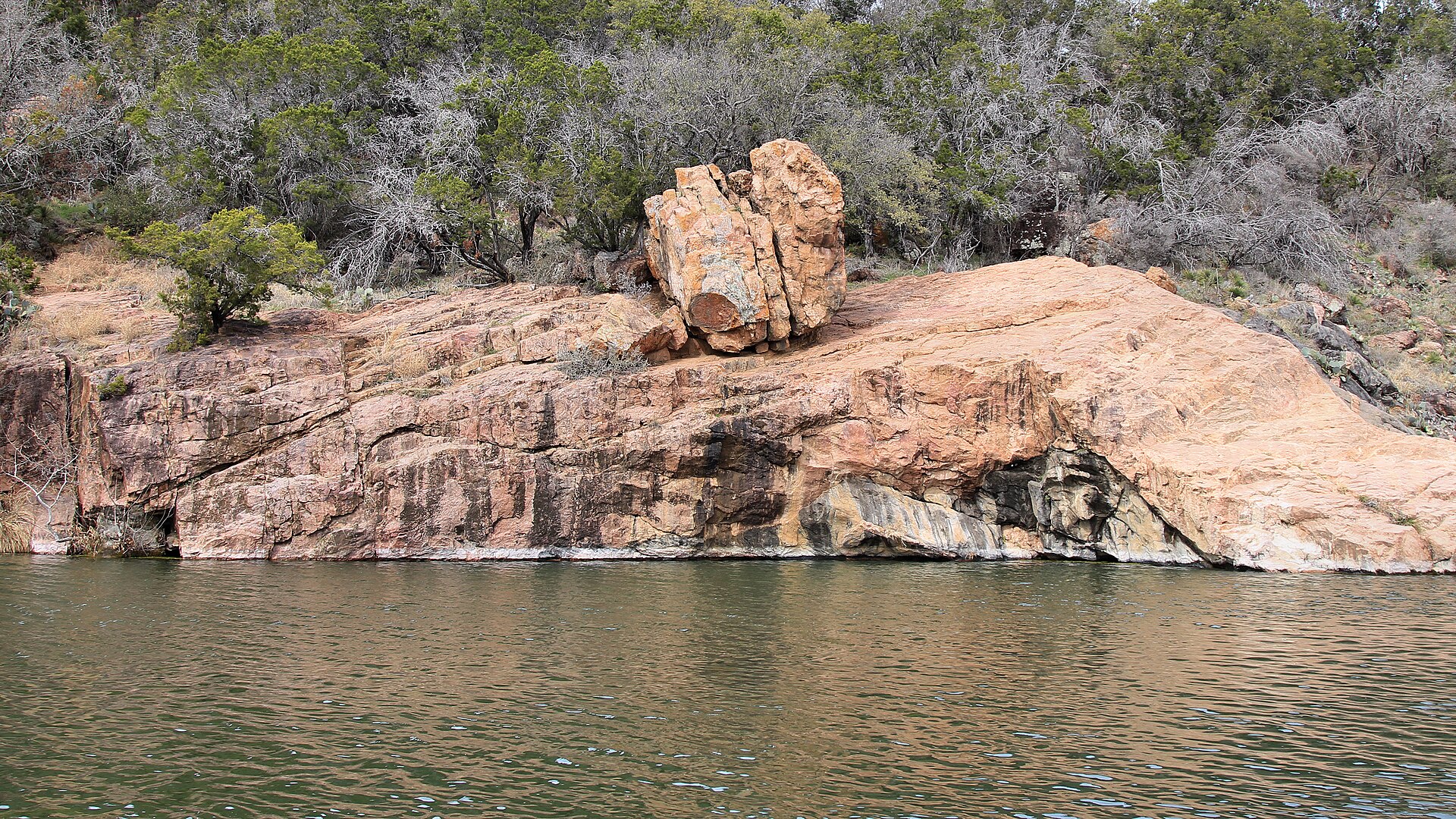
A constant-level Highland Lakes park northwest of Austin with pink granite outcrops, more than 12 miles of trails and the popular Devil’s Waterhole swimming and paddling area.
Photography: Larry D. Moore · CC BY 4.0 · Wikimedia Commons
Quick trip facts
Practical visitor details
The experience
Inks Lake State Park in the Texas Hill Country is a lake-and-granite destination where the name of the actual recreation area determines the outing. A day swimming or paddling near the developed shoreline is quite different from hiking toward Devils Waterhole or carrying gear to remote primitive campsites. The park's permanent lake character supports year-round recreation, but that does not guarantee that every trail, rental, campsite or fire ring is available on a particular date. Begin with the TPWD park and trails maps, then select a reservation and arrival gate that match the day.
Campground details have real consequences. TPWD lists 114 electric campsites for ordinary RV and tent use, four separate 20-amp tent-only electric sites requiring a short walk from parking, 42 water-only sites whose RV size and generator restrictions matter, and nine primitive hike-in campsites. The primitive area is reached by a substantial walk with no drinking water at the campsites; pets and ground fires are prohibited there. Do not advertise those primitive sites as waterfront RV spots, and do not assume that an accessible numbered electric campsite has the same layout as a backcountry tent site.
The October 14, 2026 TPWD burn ban is a restriction on both WOOD and CHARCOAL fires—not a ban on propane and similar containerized fuel stoves used for cooking. The rule applies even to visitors who normally expect a campground grill or fire ring to be available. Check current notices before arrival because Texas fire restrictions change with local conditions; do not infer that a supplier selling charcoal or firewood establishes permission to burn it.
TPWD also identifies PARTIAL hunting-related closures. Some hiking trails, some west-loop campsites and the primitive campsites are affected December 3–6 and December 14–17, 2026, plus January 4–7, January 11–14 and January 18–21, 2027. Affected areas close at 5 p.m. on their first date and reopen at 2 p.m. on their last date. Only permitted hunters can enter the affected closed areas during the posted windows. This notice does not say the entire park is closed: check the precise campsite and trail with TPWD before cancelling a different reservation or recommending an alternate outing.
For a practical first visit, pick a developed lakeside activity and allow time for a short signed walk rather than stringing together every landmark. TPWD warns that camping and day-use capacity can sell out on weekends, holidays and school breaks; make reservations directly through its official booking process before a long drive. Inspect the specific official alerts before departure and avoid treating a scenic picture of Devils Waterhole as evidence of safe swimming, open trails or permission to enter a restricted unit.
The details
Texas State Parks · trip planning
Amenities can differ by park unit, campsite and season. The details below are park-specific where checked against TPWD. For changing hours, reservations, trail conditions and facility availability, use the park's official visitor resources.
Accessibility: The park has accessible campsites and an all-terrain wheelchair available by request; contact the park for current availability.
Park-specific visitor facts checked 2026-10-17 against the TPWD source. Additional official TPWD reference: TPWD source page.
Practical questions
Plan the route
Editorially paired stops near Inks Lake State Park appear first, followed by nearby destinations. Distances are approximate straight-line miles.
Burnet · Burnet County · Hill Country
A historic Hill Country cavern with guided walking and wild-cave tours, CCC architecture, hiking, and scenic overlooks.
Approx. 4 miles away
Burnet · Burnet County · Hill Country
Fort Croghan Museum & Grounds in Burnet preserves the site of a U.S. Army frontier post along with a museum and historic structures interpreting early settlers, ranching, military life, the Civilian Conservation Corps and Burnet County heritage.
Approx. 8 miles away
Marble Falls · Burnet County · Hill Country
Marble Falls connects a walkable Burnet County downtown with Lake Marble Falls, Colorado River parks, Highland Lakes boating and a practical base for Inks Lake, Hill Country trails, wineries and scenic drives.
Approx. 12 miles away
Llano · Llano County · Hill Country
The Llano County Historical Museum occupies a historic bank building near the courthouse square and interprets frontier settlement, ranching, mining, military service and the distinctive granite and Llanite geology that shaped the Llano area.
Approx. 18 miles away
Llano · Llano County · Hill Country
Llano is a Hill Country river town where a pink-granite courthouse, historic commercial district, the Llano River, barbecue and direct access to the region's granite-and-lake landscape create an easy outdoor-and-food weekend.
Approx. 18 miles away
Bend · San Saba County · Hill Country
Rugged Hill Country wilderness with Gorman Falls, Colorado River access, cave tours, mountain biking, fishing, and primitive camping.
Approx. 20 miles away
Texas Explained
Go beyond the destination with the systems, landscapes and history that explain why this part of Texas looks and works the way it does.
Continue exploring
Read next
State Parks
A complete first-timer’s guide to the Lighthouse Trail at Palo Duro Canyon: distance, heat, water, timing, the final climb, and how to make the canyon a full day instead of one photograph.
August 20, 2026 · About 8 minutes
State Parks
There is no single best park. There is a best first park for the kind of Texas you want to understand — canyon, coast, granite, forest or river.
August 7, 2026 · About 3 minutes