Skip to content
Caprock Canyons State Park in Texas

Panhandle Plains · State Parks

Caprock Canyons State Park & Trailway

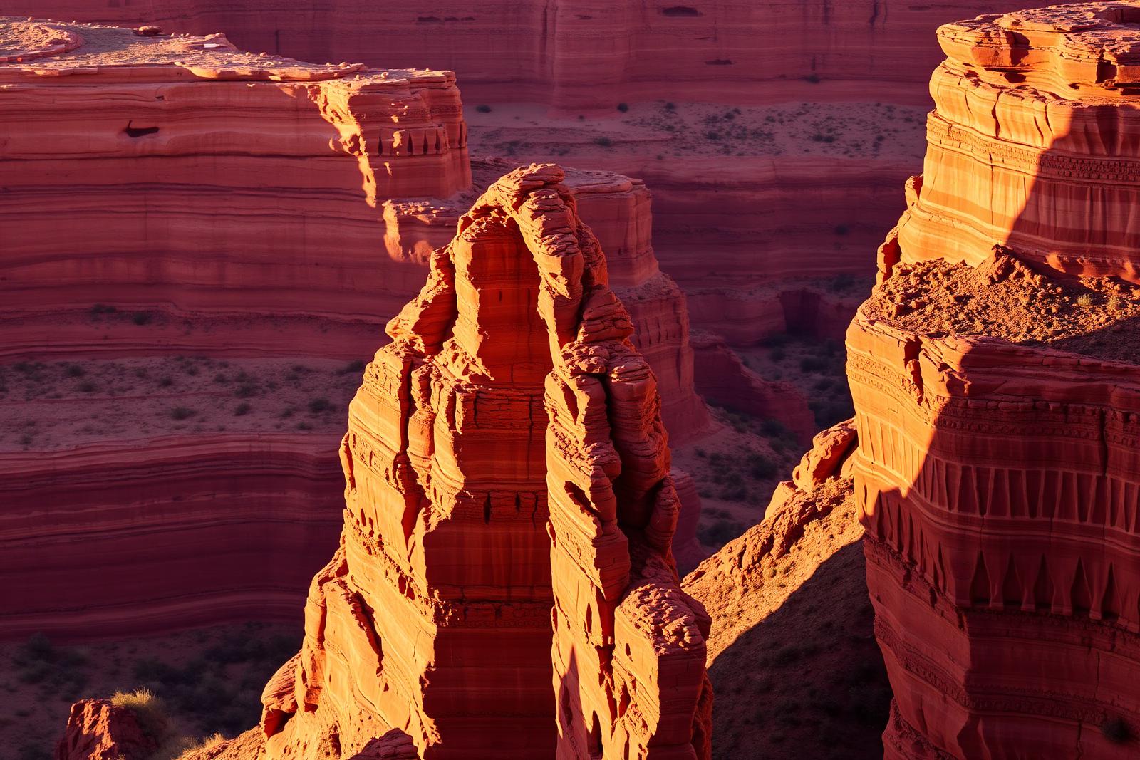
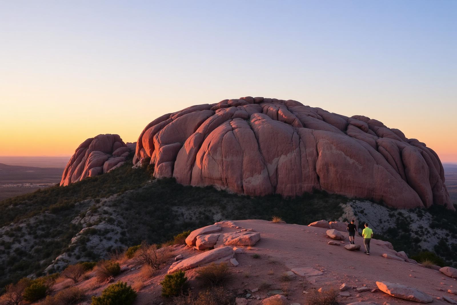
Red-rock canyon country beneath the Caprock Escarpment, home to the official Texas State Bison Herd, Lake Theo and a trail network that connects with a long converted-rail Trailway across the Panhandle.

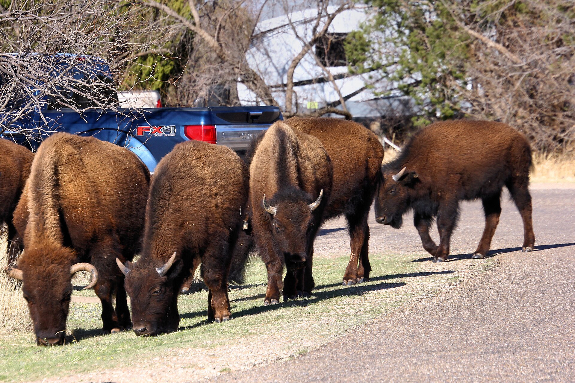
Photography: Larry D. Moore · CC BY 4.0 · Wikimedia Commons

Quick trip facts

Caprock Canyons State Park & Trailway at a glance

Where is Caprock Canyons State Park & Trailway?
Caprock Canyons State Park & Trailway is at 850 State Park Road, Quitaque, TX 79255, in Briscoe County.
When is the best time to visit Caprock Canyons State Park & Trailway?
Spring and fall for hiking and biking; summer heat can be severe
Do I need to plan ahead for Caprock Canyons State Park & Trailway?
TPWD's April 10, 2026 notice says the marked Lake Theo swimming area, boat ramp and fishing pier are closed because of low water, but lake swimming is still permitted. Ask TPWD where lawful swimming access remains before entering the water. Observe bison from at least 50 yards. The park trails and separate long-distance Trailway need different maps; primitive Trailway camps have no potable water or campfires.
Who manages Caprock Canyons State Park & Trailway?
Texas Parks and Wildlife Department

Practical visitor details

Before you go

Daily admission
$5 daily for adults; children age 12 and under enter free.
Checked · Official details ↗
Park and office hours
Open daily; park office 8:30 a.m.–5 p.m., closed noon–1 p.m.
Checked · Official details ↗

The experience

Visiting Caprock Canyons State Park & Trailway

Caprock Canyons State Park and Trailway near Quitaque combine redrock escarpment landscapes, a protected Texas bison herd and a long rail-trail corridor. The signed routes inside the state park are not the same as every mile of the Trailway, and choosing a long-distance segment requires a separate map and access plan. TPWD describes more than twenty-five miles of park trails and an approximately ninety-mile combined trail network when the Trailway is counted.

Bison are large, fast wild animals that routinely travel road and recreation areas. TPWD requires visitors to give the herd at least fifty yards of space and never surround, honk at or pressure animals out of a road. If a bison lowers its head, paws at the ground, raises its tail or changes behavior because of a nearby visitor, retreat. Do not recommend close photographs, touching calves or driving through a herd as a safe family activity.

Lake Theo is a small no-wake recreation lake with fishing and swimming opportunities. TPWD's April 10, 2026 alert closes the marked swim area, boat ramp and fishing pier because of low lake levels but explicitly says swimming in the lake is still permitted. Do not interpret an overall permission to swim as permission to enter a closed area; confirm exactly where the park allows access. The main park campgrounds, Lake Theo walk-ins and remote primitive areas have distinct electrical hookup, restroom and water arrangements.

The Trailway's primitive sites are not short car-camping options: TPWD lists a minimum seven-mile hike or bike approach, no potable water, pack-out trash rules and no campfires, though containerized stoves may be permitted. Download the separate park and Trailway maps, reserve entry during busy seasons and fill the vehicle before entering remote roads. The separate active-alert detail was not independently retrievable on October 17, so any trail, water or local-water-system advisory should be confirmed directly with TPWD before travel.

The details

Planning your visit

Area
Quitaque, Texas
Best season
Spring and fall for hiking and biking; summer heat can be severe
Address
850 State Park Road, Quitaque, TX 79255
Entry & reservations
TPWD's April 10, 2026 notice says the marked Lake Theo swimming area, boat ramp and fishing pier are closed because of low water, but lake swimming is still permitted. Ask TPWD where lawful swimming access remains before entering the water. Observe bison from at least 50 yards. The park trails and separate long-distance Trailway need different maps; primitive Trailway camps have no potable water or campfires.

Texas State Parks · trip planning

Park entrances, facilities and visitor maps

Amenities can differ by park unit, campsite and season. The details below are park-specific where checked against TPWD. For changing hours, reservations, trail conditions and facility availability, use the park's official visitor resources.

Restrooms and showers
Restrooms are listed near Honey Flat electric sites and Lake Theo walk-in sites. Little Red and South Prong primitive areas have organic toilets but no showers; primitive North/South Prong hike-in sites list nearby composting toilets. The Trailway lists chemical restrooms and no potable water.
Parking, entrance and access
Enter from FM 1065 north of Quitaque; use the separate state-park and Trailway maps to choose actual parking and trail access.
Camping, RV hookups and drinking water
Honey Flat electric sites include water hookups and nearby restrooms. Lake Theo walk-in and remote Trailway primitive camping have different facilities; the Trailway has no potable water and requires campers to carry drinking water.
Trails, parking and visitor maps
Separate park, park trails and Trailway maps are available; the Trailway is not the same as the park's main hiking trail system.
Access restrictions and current visitor rules
TPWD notes all roads within the park are paved, but nearby unpaved roads can become dangerously slippery following heavy rain. Bison share developed park areas; give them at least 50 yards of space. TPWD currently reports a nitrate advisory in the park water system: visitors with infants under six months, pregnant visitors and people with relevant health concerns should bring drinking water; boiling does NOT remove nitrates. Lake Theo boat ramp, fishing pier and designated swimming area are closed due to low water (TPWD separately states swimming in the lake is still allowed). The park also lists several December hunting-period closures for general visitors; check exact dates and access before traveling.

Park-specific visitor facts checked 2026-10-17 against the TPWD source. Additional campsite or day-use details: official TPWD facilities record. Additional official TPWD reference: TPWD source page.

Explore Texas state parks

Upcoming TPWD programs

Activities scheduled at this park

These dates come from the Texas Parks and Wildlife calendar. Check the official listing for registration, meeting place, admission and any changes.

Browse upcoming TPWD programs statewide →

Practical questions

Frequently asked questions about Caprock Canyons State Park & Trailway

How close may visitors approach the Caprock Canyons bison?
TPWD instructs visitors to stay at least fifty yards away, yield on the road and retreat if an animal changes behavior.Check official details ↗
Are Trailway primitive campsites drive-up RV spots?
No. TPWD lists at least a seven-mile hike or bike to primitive Trailway camping and no potable water.Check official details ↗
Can I swim in Lake Theo without checking current conditions?
No. TPWD's April 10, 2026 alert says the marked Lake Theo swimming area is closed due to low lake levels but swimming in the lake is still allowed. Ask park staff about approved shoreline access and conditions.Check official details ↗

Plan the route

Explore related places

Editorially paired stops near Caprock Canyons State Park & Trailway appear first, followed by nearby destinations. Distances are approximate straight-line miles.

  • Matador · Motley County · Panhandle Plains

    Motley County Historical Museum

    Motley County Historical Museum in Matador occupies the former Traweek Hospital and interprets county history through ranching, Native American heritage, veterans, schools, saddle making, medical history and a detailed diorama of early Matador.

    Updated Sep 2026
    • Former Traweek Hospital
    • Matador Ranch and county history
    • Native American and Quanah Parker context
    Explore this place

    Approx. 30 miles away

  • Floydada · Floyd County · Panhandle Plains

    Floyd County Historical Museum

    Floyd County Historical Museum in downtown Floydada preserves county and Llano Estacado history, including pioneer collections, genealogy resources and artifacts tied to archaeological evidence of Francisco Vázquez de Coronado's 1541 expedition through nearby Blanco Canyon.

    Updated Sep 2026
    • Coronado expedition artifacts
    • Floyd County pioneer history
    • History and genealogy center
    Explore this place

    Approx. 33 miles away

  • Clarendon · Donley County

    Playa Lakes WMA Taylor Lakes Unit

    The 525-acre Playa Lakes WMA Taylor Lakes Unit near Clarendon protects restored grassland, pasture and wetland habitat used by wintering waterfowl, shorebirds and other Rolling Plains wildlife.

    Best season: Late fall through winter for waterfowl at the observation blind, with spring also productive for migrating birds.Updated Sep 2026
    • 525 acres near Clarendon
    • Restored grassland, pasture and wetlands
    • Wintering waterfowl
    Explore this place

    Approx. 34 miles away

  • Memphis · Hall County · Panhandle Plains

    Heritage Hall Museum

    Heritage Hall Museum in Memphis preserves Hall County and eastern Panhandle history through community collections, local artifacts and the stories of the people who built the county's ranching, farming and town life.

    Best season: Summer for the museum's published seasonal hours; spring and fall are also good for a Hall County road-trip stop if access is confirmed in advance.Updated Sep 2026
    • Hall County community history
    • Memphis and eastern Panhandle heritage
    • Local pioneer collections
    Explore this place

    Approx. 37 miles away

  • Clarendon · Donley County · Panhandle Plains

    Saints' Roost Museum

    Saints' Roost Museum in Clarendon occupies the 1910 Adair Hospital and interprets Donley County and Texas Panhandle pioneer history, including the JA Ranch, Charles and Cornelia Adair, the Red River War, military history and community life.

    Updated Sep 2026
    • 1910 Adair Hospital
    • JA Ranch and Adair family history
    • Red River War interpretation
    Explore this place

    Approx. 37 miles away

  • Tulia · Swisher County · Panhandle Plains

    Swisher County Museum

    Swisher County Museum in Tulia preserves local archives, artifacts and historic structures tied to settlement and life on the central High Plains, including the JA Ranch cabin associated with the museum grounds.

    Updated Sep 2026
    • Swisher County archives
    • Local pioneer collections
    • JA Ranch cabin
    Explore this place

    Approx. 41 miles away

Read next

More from State Parks

State Parks

Down Into the Panhandle

A complete first-timer’s guide to the Lighthouse Trail at Palo Duro Canyon: distance, heat, water, timing, the final climb, and how to make the canyon a full day instead of one photograph.

August 20, 2026 · About 8 minutes

State Parks

The Texas State Park You Should Start With

There is no single best park. There is a best first park for the kind of Texas you want to understand — canyon, coast, granite, forest or river.

August 7, 2026 · About 3 minutes