Skip to content
Galveston Island State Park in Texas

Gulf Coast · Beaches & Coast

Galveston Island State Park

A barrier-island park spanning Gulf beach and Galveston Bay habitats, where paddling trails, birding, fishing and restored coastal prairie show both sides of the island beyond the city's seawall.

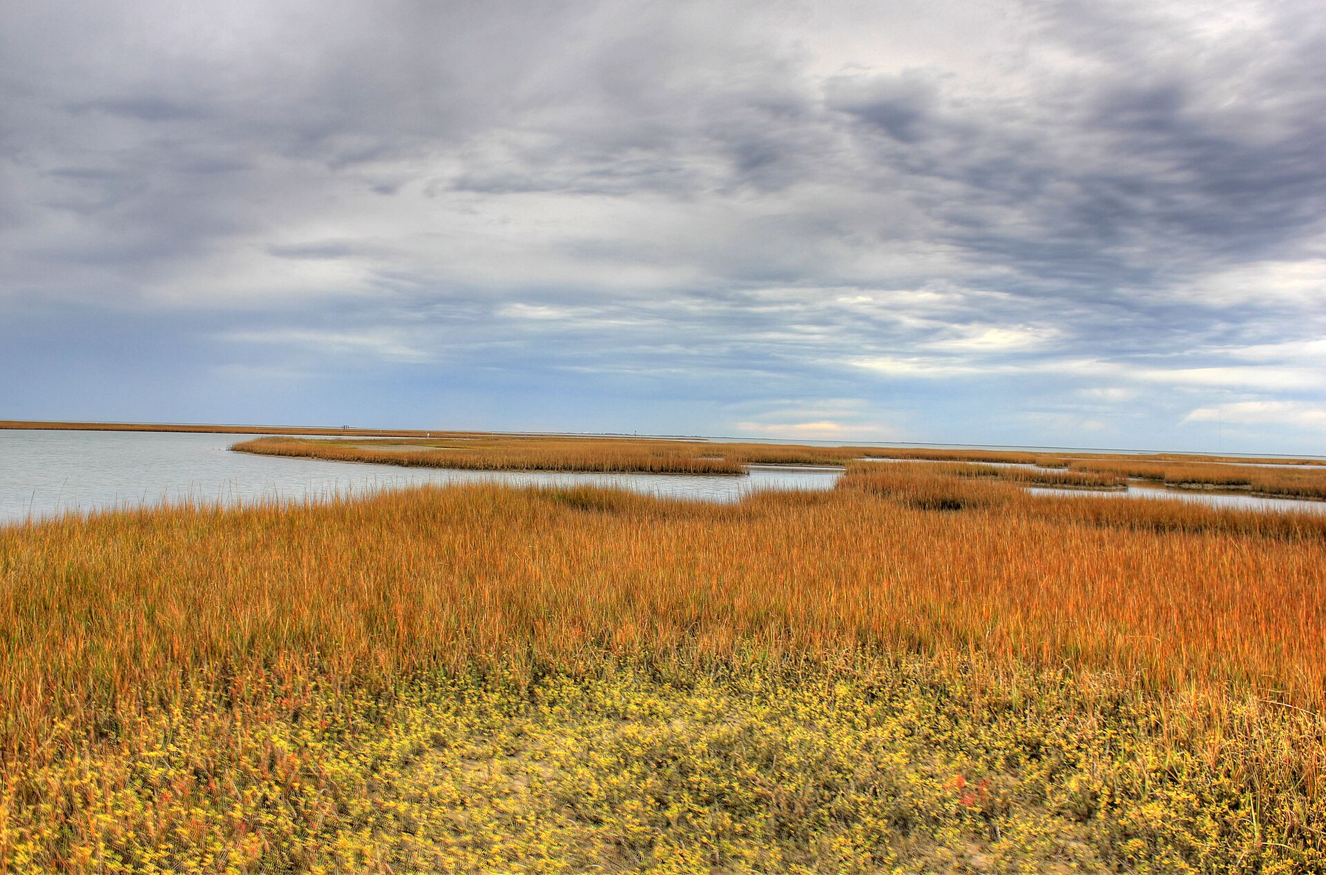
Photography: Yinan Chen · Public Domain · Wikimedia Commons

Quick trip facts

Galveston Island State Park at a glance

Where is Galveston Island State Park?
Galveston Island State Park is near Galveston, Texas, in Galveston County.
When is the best time to visit Galveston Island State Park?
Fall through spring for birding and mild weather; summer for beach recreation with heat precautions
Do I need to plan ahead for Galveston Island State Park?
Fountains serving campsites 71–95 are out of service and certain storm-damaged boardwalks are closed. A September 28, 2026 high-tide forecast was time-limited: confirm new tides and road closures, not that old prediction.
Who manages Galveston Island State Park?
Texas Parks and Wildlife Department

Practical visitor details

Before you go

Daily entrance fee
Adults 13 and older pay $5; children 12 and younger enter free.
Checked · Official details ↗
Capacity-sensitive day use
The park is open daily, but it often fills during March–October weekends. TPWD recommends reserving day-use passes and camping in advance to guarantee entry.
Checked · Official details ↗

The experience

What to know about Galveston Island State Park

Galveston Island State Park has two meaningfully different experiences: Gulf-facing beachside recreation and bayside wetlands, paddling and birding across the island. Campsites on the bay side are about a mile and a half from the Gulf beach, and booking a bayside site does not put a tent directly beside the surf. Storm tides, wind and sea conditions can affect which parts of the park are practical for a particular visit.

The TPWD alert says drinking fountains near campsites 71 through 95 are out of service because of a water-line break. Campers in that range should bring their own water and confirm the nearest working source at check-in. Flood damage also leaves certain boardwalks closed. These are precise facility restrictions, not grounds to declare that every birding trail or boardwalk is inaccessible.

The same TPWD alert retains a September 28 notice forecasting higher tides over the following week. By October 17 that forecast is historical, not a prediction of current or future flooding. Check the latest tide guidance and road-access messages instead of repeating the old alert as if it said a high tide is occurring now.

Camping options differ by side of the park and by tent versus RV suitability. Some beachside tent-platform sites do not have adjacent vehicle parking, while certain bayside water-only sites prohibit vehicles longer than eighteen feet. Choose by the actual campground map, check weather and beach safety, and never assume that a bay camping reservation includes a gulf-front site or safe ocean swimming.

Location-specific coastal research

Access, swimming and local rules at Galveston Island State Park

A protected barrier-island park spanning Gulf beach, dunes, prairie, wetlands and bay habitat, with swimming, fishing, paddling, birding, trails and beach- or bay-side camping.

What kind of beach is this?
This is a managed park with its own rules, possible admission or parking arrangements, and specified public-use areas. The park designation alone does not mean all shorelines within it are safe or open for swimming.
Who can get in, and what might it cost?
The managing park or facility may charge entry, parking or day-use fees. Verify current prices and reservations directly; old fee tables can be misleading.
Important local planning detail
TPWD says the park often reaches capacity during its busy season, so reserve day-use passes or camping when a specific date matters.
Location and managing source
Galveston, Galveston County · Galveston Island & surrounding bays. Source: Texas Parks & Wildlife; last research date 2026-09-06. Coordinates elsewhere on this guide identify a representative arrival area, not precise shoreline boundaries.

Confirm before you go

This is research-backed visitor information, not a live access, parking, beach flag or bacteria status. A destination being listed does not establish that swimming is permitted or safe today. Check the relevant managing source and local signs, especially after storms, flooding or beach work.

Texas Parks & Wildlife — source for this location →

The details

Planning your visit

Area
Galveston, Texas
Best season
Fall through spring for birding and mild weather; summer for beach recreation with heat precautions
Entry & reservations
Fountains serving campsites 71–95 are out of service and certain storm-damaged boardwalks are closed. A September 28, 2026 high-tide forecast was time-limited: confirm new tides and road closures, not that old prediction.

Texas State Parks · trip planning

Park entrances, facilities and visitor maps

Amenities can differ by park unit, campsite and season. The details below are park-specific where checked against TPWD. For changing hours, reservations, trail conditions and facility availability, use the park's official visitor resources.

Restrooms and showers
TPWD lists shower restrooms near both the developed beachside electric camps and bay-side electric/water camps. Beachside primitive hike-in tents have showers nearby. Dry primitive camping has no site utilities.
Parking, entrance and access
Beachside: 8 larger-capacity electric sites, 50 regular electric, 7 electricity-equipped tent platforms where vehicles cannot park at the platform, and 15 hike-in primitive tent sites. Bay side is 1.5 miles from the beach, with 20 electric sites, 10 water-only sites (no vehicles over 18 feet), and 10 dry-camping primitive sites.
Camping, RV hookups and drinking water
Beachside: 8 large electric campsites, 50 ordinary electric, 7 tent-only electric pads, 15 primitive hike-in tents. Bayside: 20 electric, 10 water-only and 10 dry primitive sites. Both sides require selecting the correct campground and vehicle type; do not imply bayside sites are on the swimming beach.
Trails, parking and visitor maps
Use TPWD's bay-side versus beachside campground and trails maps for parking, beach access and the 1.5-mile cross-park separation.
Access restrictions and current visitor rules
TPWD reports a drinking-water outage at the fountains near campsites 71–95 caused by a water-line break; check with staff for the nearest working water source and bring water as needed. Some boardwalks remain closed due to flood damage: obey posted closures. Vehicles cannot park at tent-platform sites. Bay-side water-only sites prohibit vehicles longer than 18 feet; bay-side sites have a two-vehicle limit. Storm and tide conditions can also change beach access. TPWD's September 28 high-tide alert forecasts elevated water over the FOLLOWING WEEK only; it is outdated as a current tide forecast by October 17, 2026. Confirm new tide and road conditions instead of repeating it as today's forecast. Drinking fountains near campsites 71–95 remain listed out of service in a July 2 water-line notice, and some flood-damaged boardwalks remain closed under the January 19 trail alert. This does not establish that ALL beach or bayside trails are closed. Beachside and bayside camping areas have different addresses, vehicle rules and storm exposure.

Park-specific visitor facts checked 2026-10-17 against the TPWD source. Additional official TPWD reference: TPWD source page.

Explore Texas state parks

Upcoming TPWD programs

Activities scheduled at this park

These dates come from the Texas Parks and Wildlife calendar. Check the official listing for registration, meeting place, admission and any changes.

Browse upcoming TPWD programs statewide →

Practical questions

Frequently asked questions about Galveston Island State Park

Do campsites 71–95 have working drinking fountains?
No. TPWD lists their drinking fountains out of service; check with staff for working water and bring enough.Check official details ↗
Are all Galveston Island boardwalks closed?
No. TPWD identifies certain flood-damaged boardwalks; follow posted closures and current trail maps.Check official details ↗
Is a September high-tide alert still a forecast for today?
No. Its forecast covered a week after September 28, 2026. Check updated coastal tide and road conditions for the actual travel date.Check official details ↗

Connected museum guides

Museums to explore nearby

Museum guides relevant to Galveston and its surrounding history. Tickets, hours and travel arrangements are separate at each institution.

Plan the route

Explore related places

Editorially paired stops near Galveston Island State Park appear first, followed by nearby destinations. Distances are approximate straight-line miles.

  • Jamaica Beach · Galveston County · Gulf Coast

    Jamaica Beach

    A free public Gulf beach in the City of Jamaica Beach, with the public sand extending from the vegetation line to the water and a mix of pedestrian and regulated vehicle access.

    Best season: March through May and September through November for milder beach weather; summer is busiest and hottestUpdated Sep 2026
    • Open-Gulf beach
    • Galveston Island & surrounding bays setting
    • Jamaica Beach access
    Explore this place

    Approx. 2 miles away

  • Galveston · Galveston County · Gulf Coast

    Galveston Pocket Park 3

    A 12 Mile Road West End beach-access park with restrooms and a mix of on-beach, lot and limited free parking options.

    Best season: March through May and September through November for milder beach weather; summer is busiest and hottestUpdated Sep 2026
    • Named public beach-access point
    • Galveston Island & surrounding bays setting
    • Galveston access
    Explore this place

    Approx. 2 miles away

  • Galveston · Galveston County · Gulf Coast

    Galveston Pocket Park 2

    A West End beach-access park with a parking lot, restrooms, rinse-off facilities and direct Gulf access, useful for visitors who do not need a large full-service beach complex.

    Best season: March through May and September through November for milder beach weather; summer is busiest and hottestUpdated Sep 2026
    • Named public beach-access point
    • Galveston Island & surrounding bays setting
    • Galveston access
    Explore this place

    Approx. 4 miles away

  • Galveston · Galveston County · Gulf Coast

    Galveston Pocket Park 1

    A West End Galveston beach-access park providing a smaller alternative to the island's major urban beach parks, with direct Gulf access and managed parking.

    Best season: March through May and September through November for milder beach weather; summer is busiest and hottestUpdated Sep 2026
    • Named public beach-access point
    • Galveston Island & surrounding bays setting
    • Galveston access
    Explore this place

    Approx. 5 miles away

  • Galveston · Galveston County · Gulf Coast

    Moody Gardens

    Galveston’s Moody Gardens is a multi-attraction destination anchored by the Aquarium Pyramid, with ocean habitats, penguins, seals, sharks, jellyfish and conservation work beside Offatts Bayou.

    Best season: Year-round; summer works for a full Galveston family day, while cooler months make it easier to combine the pyramids with outdoor island stops.Updated Aug 2026
    • Aquarium Pyramid
    • Penguins, seals and sharks
    • Jellyfish and reefs
    Explore this place

    Approx. 8 miles away

  • Galveston · Galveston County · Gulf Coast

    Babe's Beach

    A restored and nourished stretch of Galveston shoreline west of the central seawall, popular for straightforward beach access close to hotels and West End routes.

    Best season: March through May and September through November for milder beach weather; summer is busiest and hottestUpdated Sep 2026
    • Open-Gulf beach
    • Galveston Island & surrounding bays setting
    • Galveston access
    Explore this place

    Approx. 9 miles away

Read next

More from Beaches & Coast

Beaches & Coast

How to Pick the Right Texas Beach

The Texas coast is not one beach repeated for 367 miles. Barrier islands, fishing towns and bays each reward a different kind of weekend.

August 7, 2026 · About 3 minutes