

Outdoors & Wildlife
Where to See Fall Colors in East Texas
Plan East Texas fall foliage trips to Caddo Lake, Daingerfield, Lake Bob Sandlin and Tyler, with a realistic color calendar, park links and route ideas.
East Texas foliage is a patchwork: changing sweetgum, oak and hickory among evergreen pines, with bronze bald cypress around lakes and wetlands. The park-by-park guide below explains access, approximate timing and realistic alternatives. Confirm recent dated park reports before traveling.
Quick answer: when and where to go
For an East Texas foliage trip, use mid-November through early December as a broad planning window, not a prediction of peak color. Individual trees and parks may change earlier or later, and dry weather, warm autumns, rain and wind can shorten the show. Start with Daingerfield State Park for a compact lake-and-forest walk, Caddo Lake for bronze bald cypress and swamp scenery, Tyler State Park for accessible pine-and-hardwood trails, or Lake Bob Sandlin for lakeside color. Before leaving, check the specific park's alerts, forecast and recent images; this page does not claim to report live foliage conditions.
The best East Texas fall-color stops at a glance
- Daingerfield State Park — best first stop for a compact lake surrounded by colorful mixed woodland; check the park's open trails and day-use availability.
- Caddo Lake State Park — distinctive copper and bronze bald-cypress setting, especially from permitted water access; plan around weather and navigation safety.
- Lake Bob Sandlin State Park — shoreline and woodland color with lake reflections, a useful companion to Daingerfield.
- Tyler State Park — a practical base for a walking and camping weekend amid pines and deciduous hardwoods.
- Cooper Lake State Park — another northeast-Texas public-park alternative if your preferred stop has limited availability.
- Martin Creek Lake State Park — a further East Texas option for a quieter forest-and-water visit; confirm that conditions and the landscape fit your foliage expectations.
Choose a park by trail constraints, not a color forecast
Our comparison of official TPWD trail descriptions puts the South Sulphur unit of Cooper Lake first for a brief easy interpretive walk (Honey Creek, 0.3 mile), and Lake Bob Sandlin's easy Lakeview Loop (0.6 mile) next for a shoreline-oriented stroll. For a longer easy lake route, Tyler's Lakeshore Trail is 2.1 miles, partly along park roads. These are published trail lengths and difficulty classes, not drive times, guaranteed foliage sightings or promises of step-free access; verify conditions and accessibility with staff. See the Cooper Lake South Sulphur trail guide ↗, Lake Bob Sandlin trails ↗ and Tyler trails ↗.
Do not choose solely by distance: the short 0.7-mile Caddo Forest Trail is moderate and includes steps, while Daingerfield's 0.8-mile Mountain View Trail is challenging. For a woodland-and-lake outing with time for a moderate walk, choose Daingerfield's 2.4-mile Rustling Leaves; for a bald-cypress setting without a boat, choose Caddo's public park and Saw Mill Pond rather than assuming a guided paddle is necessary. This visitor-fit comparison is our interpretation of the Caddo Lake trails ↗ and Daingerfield trails ↗, not a rating of which park currently has the brightest leaves.
How to interpret a fall-color calendar
Late October: treat foliage as a scouting opportunity, not an assured peak; many Piney Woods trees may remain green. Early to mid-November: start checking recent photographs and official park updates, as some mixed hardwoods may be turning. Mid- to late November: often the most useful general window to consider northeast-Texas trips. Late November to early December: some trees can retain color, but a cold front or strong wind may strip leaves quickly. These are approximate regional planning periods, not confirmed peak dates for the current season or forecasts for individual parks.
Daingerfield State Park: the easy lake-and-forest outing
Daingerfield works well for travelers who want autumn color without spending all day in a car or navigating remote timberland. The wooded shores of Little Pine Lake bring evergreen pines and color-changing hardwoods into the same frame. Start at designated public lakeshore areas and choose a park trail appropriate to your group. Walk slowly where leaves cover roots and uneven ground; a shoreline reflection photo may be better than a rushed long hike.
Before traveling, check Daingerfield State Park visitor information ↗ for trail alerts, fees and day-use reservations. TPWD rates the 2.4-mile Rustling Leaves Trail as moderate (about 1.5 hours), and the 0.8-mile Mountain View Trail as challenging (about one hour, with steep portions). Confirm trail access and conditions using the official Daingerfield trail guide ↗.
Best on-foot photography at Daingerfield: use the CCC picnic peninsula for a different lake angle, or the bridge and CCC spillway for woodland texture. TPWD identifies both on its trail map. The lake is the composition; do not treat the distant high-point trail as a guaranteed panoramic fall-color viewpoint. The park also lists an all-terrain wheelchair visitors can ask about in advance; that does not mean either hiking trail is barrier-free.
Caddo Lake State Park: bald cypress rather than mountain maples
Caddo Lake's signature autumn look comes from bald cypress, a deciduous conifer that turns bronze or russet before shedding its needles. Moss-draped trunks, sheltered water and changing light create a different experience from a red-maple forest. The state park near Karnack provides a public starting point, while other locations around the wider lake have different owners, launches and access rules.
A shore-based visit can be rewarding, but the lake's branching channels often reward a properly planned guided boating or paddling outing. Do not enter unfamiliar channels without a route, suitable flotation, weather awareness and a safe return plan. Respect private docks and shorelines. Check Caddo Lake State Park visitor information ↗ before leaving; a tour operator's availability does not establish state-park access.
For a no-boat Caddo stop, TPWD maps the 0.7-mile moderate Caddo Forest Trail, which contains two sections of steps, and the 0.2-mile CCC Cut-Through, also steep and involving stairs. Saw Mill Pond is a named observation point for cypress and waterbirds. See the official Caddo Lake trail list and points of interest ↗. Short distance does not mean universally accessible terrain; ask park staff which public areas work for your group. Ranger-led foliage hikes may be scheduled in autumn, but programs can be canceled and do not constitute a live color report.
Lake Bob Sandlin State Park: a second lakeside option
Lake Bob Sandlin pairs wooded trails and accessible shoreline with broad views over water. That makes it useful when the light is soft and breezes are calm enough for reflections. As at Daingerfield, the exact color depends on the mix of trees in the section you visit; a wide lake photograph alone does not prove the forest is at peak.
Check Lake Bob Sandlin State Park visitor information ↗ for current trails, parking, closures and reservations. Visitors combining parks should allow time for actual walking and daylight photography rather than checking off several entrances.
For a short visit, the Lake Bob Sandlin trail guide ↗ gives two clear choices: Lakeview Loop is an easy 0.6-mile shoreline-oriented walk near State Park Cove; Dogwood Trail is an easy 1.7-mile wooded walk toward the trout pond. The 0.3-mile Brim Pond Trail is marked moderate because of a steep gully crossing, so it is not the easiest family shortcut. At the trout pond, TPWD notes oak trees; those are a more specific feature to seek than treating every part of the large lake as a fall-color overlook.
Tyler State Park: a flexible weekend base
Tyler State Park is a strong option for travelers staying near Tyler because it combines forest, lake, campgrounds and multiple ways to explore without relying on one scenic overlook. Mixed hardwoods can produce pockets of color within an otherwise green pine landscape. Choose a shorter loop if the goal is leisurely foliage photography; choose longer trails for a hiking-focused trip.
TPWD recommends Whispering Pines Nature Trail among more than 13 miles of trails; check Tyler State Park visitor information ↗ for current routes, alerts and day-use entry. A visit to Tyler should be planned around current park conditions, not a promise that every wooded road in the area will have bright color.
For Tyler's most direct lake scenery, the official Tyler trail guide ↗ lists the 2.1-mile easy Lakeshore Trail, including segments along the park road. Whispering Pines is a 1.0-mile moderate CCC-era walk with steps and elevation changes, while the 0.3-mile easy Blackjack Nature Trail crosses savannah rather than promising dense autumn hardwoods. Hiking and biking have different direction rules on multiuse loops. Choose by trail surface, access and desired habitat instead of assuming every trail has equally dramatic color.
Two worthwhile backup parks
Cooper Lake State Park and Martin Creek Lake State Park broaden the public-access options, especially if lodging, weather or entry availability rules out your original plan. They are alternatives rather than guarantees of superior color. Compare recent park photographs and official updates before adding substantial driving time.
Compare official visitor information for Cooper Lake State Park ↗ and Martin Creek Lake State Park ↗. When color is weak, a lakeside walk, birding stop or picnic can still make the outing worthwhile.
Cooper Lake: choose the correct unit before setting out
Cooper Lake State Park has two separate units on Jim Chapman Lake. If you want a short interpretive woods walk, South Sulphur has the 0.3-mile easy Honey Creek Interpretive Trail, with labeled native trees and shrubs, and the more demanding 4.6-mile moderate Coyote Run loop. The official South Sulphur trail information ↗ distinguishes those options. Doctors Creek has its own Cedar Creek forest-and-prairie loops: see the Doctors Creek trail guide ↗. Check which unit your GPS and reservation indicate; their entrances are not interchangeable.
Martin Creek Lake: make the forest walk the reason to stop
At Martin Creek Lake State Park, TPWD lists the 1.7-mile easy Harmony Hill Loop through wooded terrain and near the historic Harmony Hill community, plus the 1.4-mile moderate Old Henderson Road Loop following an old trade-route corridor. The easy 0.9-mile Island Trails favor tall pines and grasslands, not guaranteed bright hardwood color. Use the official Martin Creek trail guide ↗ to compare terrain. The nearby power-plant landscape is part of the setting, so choose this as a forest, history and lake outing rather than promising uninterrupted wilderness photography.
Suggested one-day route: Daingerfield and Lake Bob Sandlin
For a northeast-Texas day, choose Daingerfield as your main morning walk, then continue to Lake Bob Sandlin for a slower afternoon shoreline visit if park access and daylight allow. This is a flexible two-stop outline, not an optimized or timed navigation route. Verify both parks' reservations and driving directions before departure. Spending more time at one park often gives better photographs than racing between several.
Suggested weekend: Tyler with a Caddo Lake alternative
For an easy hiking weekend, stay in or near Tyler and dedicate one day to Tyler State Park, with the next day reserved for another public woodland destination according to current color reports. For a more distinctive wetland-focused trip, stay near Caddo Lake and plan one park visit plus a guided water outing, weather permitting. Because these are different geographic clusters, avoid presenting all four headline parks as an effortless single-day circuit.
How to find color that is actually happening this week
- Check TPWD's Fall for Parks guide ↗ and individual park alerts for dated, official information.
- Look for dated, location-specific photographs from an official park account or a clearly identified recent visitor, not an undated promotional image.
- Compare the past week's cold fronts, rain and wind to anticipate leaf drop; severe weather and closures take priority over scenery.
- Reserve day passes or camping where required, and verify operating hours and any watercraft or trail restrictions before you drive.
- Keep a nearby backup stop and be prepared for green woods or brown leaves instead of peak orange and red.
Which trees create the color?
Sweetgum can show red, purple and yellow; oaks and hickories contribute yellow, tan and russet; bald cypress can turn coppery brown above water. Pines remain largely green. Species mix, soil moisture and seasonal stress vary even within a single park, so East Texas foliage is usually a patchwork rather than a uniform canopy.
Photography, families and accessibility
Calm mornings improve chances of lake reflections; overcast light can reduce harsh contrast on colorful leaves. Wear shoes for damp ground and hidden roots, bring insect protection and check sunset before starting a long trail. For families or visitors with mobility limitations, inspect the park's published trail descriptions and accessibility details first rather than assuming a lakeside trail is paved or step-free. Respect wildlife and leave leaves and branches in place.
Photo integrity matters on a seasonal guide: a May, June or July park photograph documents the location but cannot substantiate autumn foliage. The licensed October Daingerfield photograph is historical, not a live foliage observation. The image gallery distinguishes these cases; official TPWD fall examples are linked for reference rather than copied without reuse permission. Always compare dated current-season imagery before judging peak color.
Research and evidence behind this guide
Source review: November 7, 2026. Texas Defined compared the linked TPWD park and trail guides for public access, named viewing areas, route length, published difficulty, and alternatives when leaves are dull. TPWD's Fall for Parks overview ↗ lists East Texas destinations and tree types, but it is not a six-park live foliage report. We have not independently visited all six parks this season and have no comparably dated, verified 2026 color observation for every stop. The choices above are an editorial comparison of documented visitor options, not firsthand field-test results, a calculated peak forecast or an accessibility certification. Dated historical photographs illustrate the settings, not this week's conditions.
Official trail information is not a live foliage report
TPWD park pages are the source for published trail distances, terrain classifications, park addresses and reservation guidance. Those details are linked beside the recommendations; a current park alert controls if a trail closes. Fall for Parks identifies destinations known for fall scenery but does not provide independently verified current peak color for all six parks. This guide does not invent a red-yellow-green color meter without actual dated observations.
Frequently asked questions
Does East Texas have fall colors?
Yes. Deciduous hardwoods and bald cypress change color among evergreen pines. The mix differs by park and by year.
Is October too early?
Not always, but late October is less reliable than a flexible November plan for much of East Texas. Check recent park-specific evidence before committing to a long drive.
Where can I see fall foliage without a boat?
Daingerfield, Tyler and Lake Bob Sandlin state parks have land-based public recreation opportunities; confirm which paths and viewing areas are available before visiting. Caddo Lake also has park access on land, though its cypress channels are particularly distinctive from the water.
Are the colors at peak right now?
This guide intentionally does not display an unverified live peak-color status. The most reliable answer comes from a recent dated local report and the park's alerts. A generalized seasonal window cannot establish today's conditions.
Sources and verification
Primary references: TPWD's Fall for Parks guide ↗ and the official park information linked above. Seasonal dates are historical planning guidance, not confirmed reports of current peak color. This article does not certify current trail access, entry price, or reservations.
Image credit: Larry D. Moore · 24 Oct 2014 · CC BY 4.0 · Wikimedia Commons; historical fall foliage photograph · Image license and reuse terms · Responsive display may crop or resize the photograph
Primary source: Texas Parks and Wildlife Department ↗
Plan your fall trip
Six places to compare
The autumn-colored hero photograph shows Daingerfield State Park on October 24, 2014, not verified current-season conditions. Photo: Larry D. Moore via Wikimedia Commons ↗ · CC BY 4.0 license (cropped to layout) ↗.
Compare the six parks below and use their official visitor information to check current alerts, trails and reservations before setting out.
Daingerfield State Park
Little Pine Lake and mixed hardwoods
Suggested first trail: Rustling Leaves · 2.4 mi · moderate
Caddo Lake State Park
Bronze bald cypress and wetland views
Suggested first trail: Caddo Forest · 0.7 mi · moderate, with steps
Lake Bob Sandlin State Park
Woodland shoreline and reflections
Suggested first trail: Lakeview Loop · 0.6 mi · easy
Tyler State Park
Mixed forest and lakeside trails
Suggested first trail: Lakeshore · 2.1 mi · easy
Cooper Lake State Park
South Sulphur and Doctors Creek are separate units
Suggested first trail: Honey Creek (South Sulphur) · 0.3 mi · easy
Martin Creek Lake State Park
Alternative woodland and lakeshore outing
Suggested first trail: Harmony Hill · 1.7 mi · easy
Explore the parks on a map
Choose a park to center the interactive OpenStreetMap view. Pins are approximate park locations for trip orientation, not entrance or navigation coordinates. Confirm the official entrance before driving.
All six parks on one map
This geographic overview shows every featured park and two possible stop sequences. Connecting lines are straight-line planning guides, not roads or driving directions. Use the live Google Maps routes below for real road paths and turn-by-turn navigation.
Map data © OpenStreetMap contributors.
Open a multi-stop driving route
These are suggested stop sequences, not measured travel-time estimates. The links open live directions with actual roads in Google Maps. Review the route, park entrances, hours, and driving conditions before leaving; either route can be shortened.
Northeast Texas parks
Tyler State Park → Cooper Lake (South Sulphur) → Lake Bob Sandlin → Daingerfield
Open four-stop driving directions ↗Eastern Piney Woods
Tyler State Park → Martin Creek Lake → Caddo Lake State Park
Open three-stop driving directions ↗
Six real park photographs, with dated autumn examples
Daingerfield's October 2014 reflection shows changing hardwoods; the separately dated October 2023 Caddo Lake photograph documents late-autumn light, not a verified foliage peak. The other four images document the parks in different seasons. Every image identifies its source and license, and none certifies current 2026 foliage conditions.


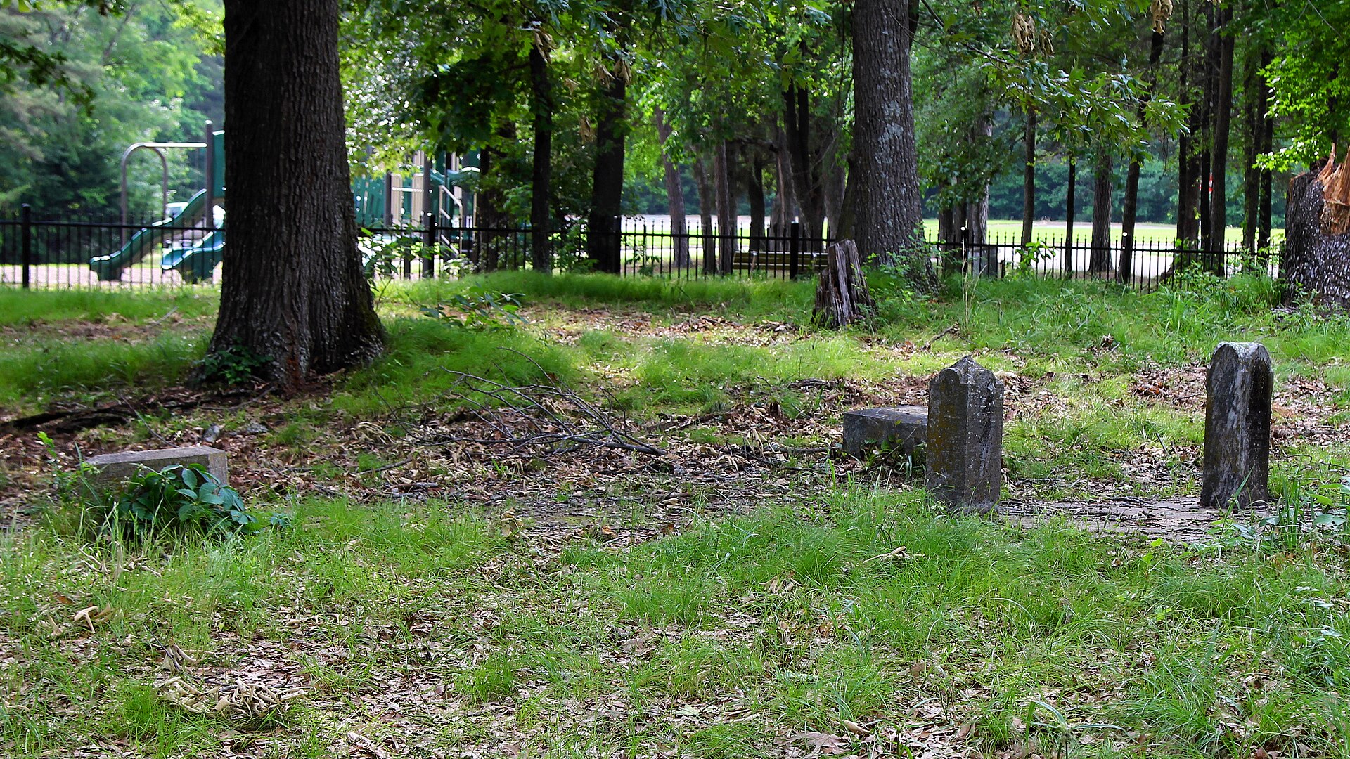
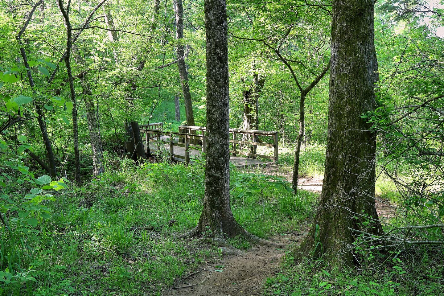
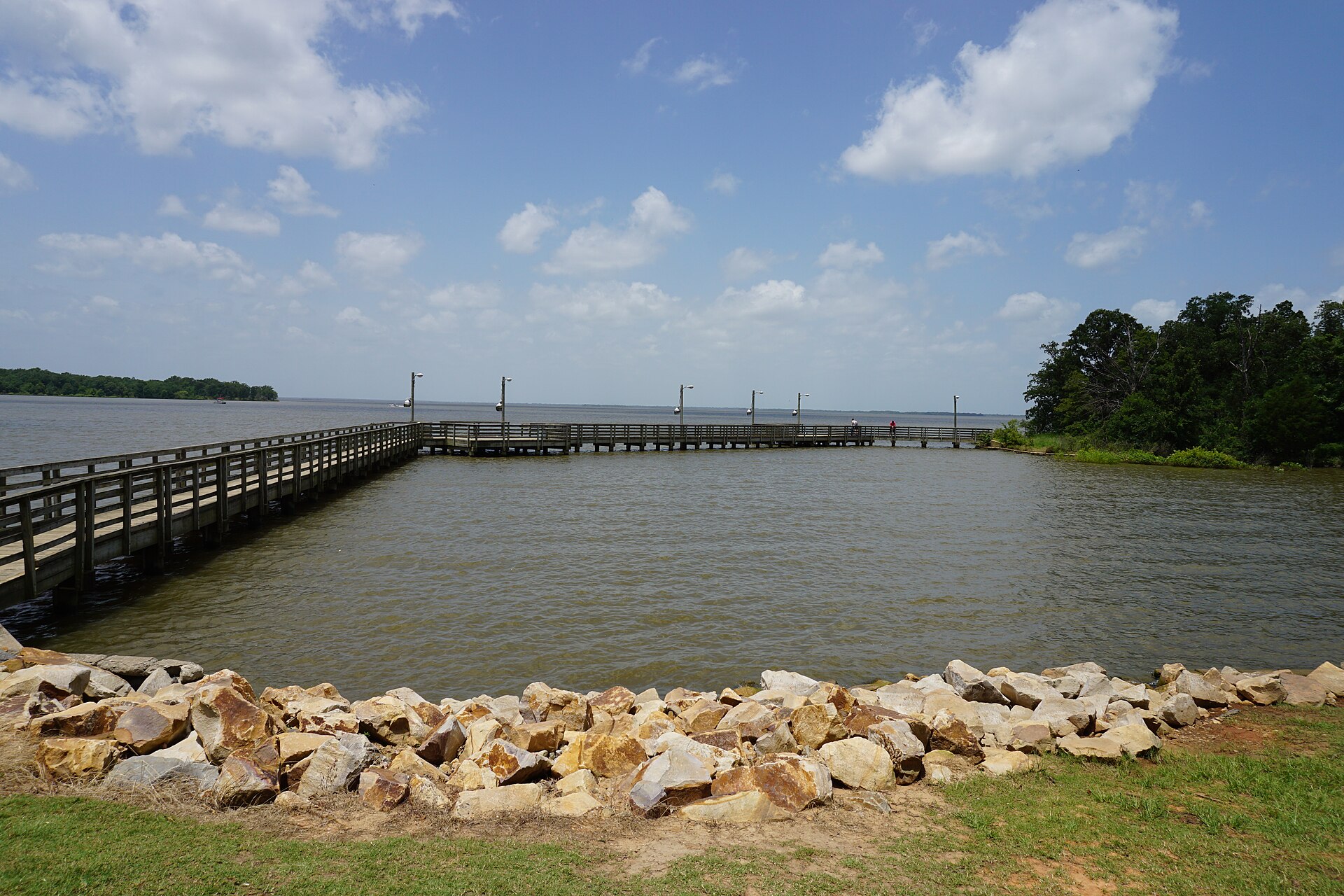

For Martin Creek, the gallery uses Larry D. Moore's separately licensed 2019 dock and shoreline photograph instead of the industrial-facing park photo. For current conditions, visit the official Martin Creek Lake park page ↗.
For actual autumn examples, view the official TPWD Daingerfield fall-foliage photograph ↗. It is linked for reference, not republished or presented as this year's conditions.