

Texas Explained
The Guadalupe River Explained: Springs, Canyon Lake and a Hill Country River
The Guadalupe begins in the Hill Country, receives important spring-fed tributaries and flows toward San Antonio Bay. Its basin makes the groundwater-surface-water connection unusually easy to see.
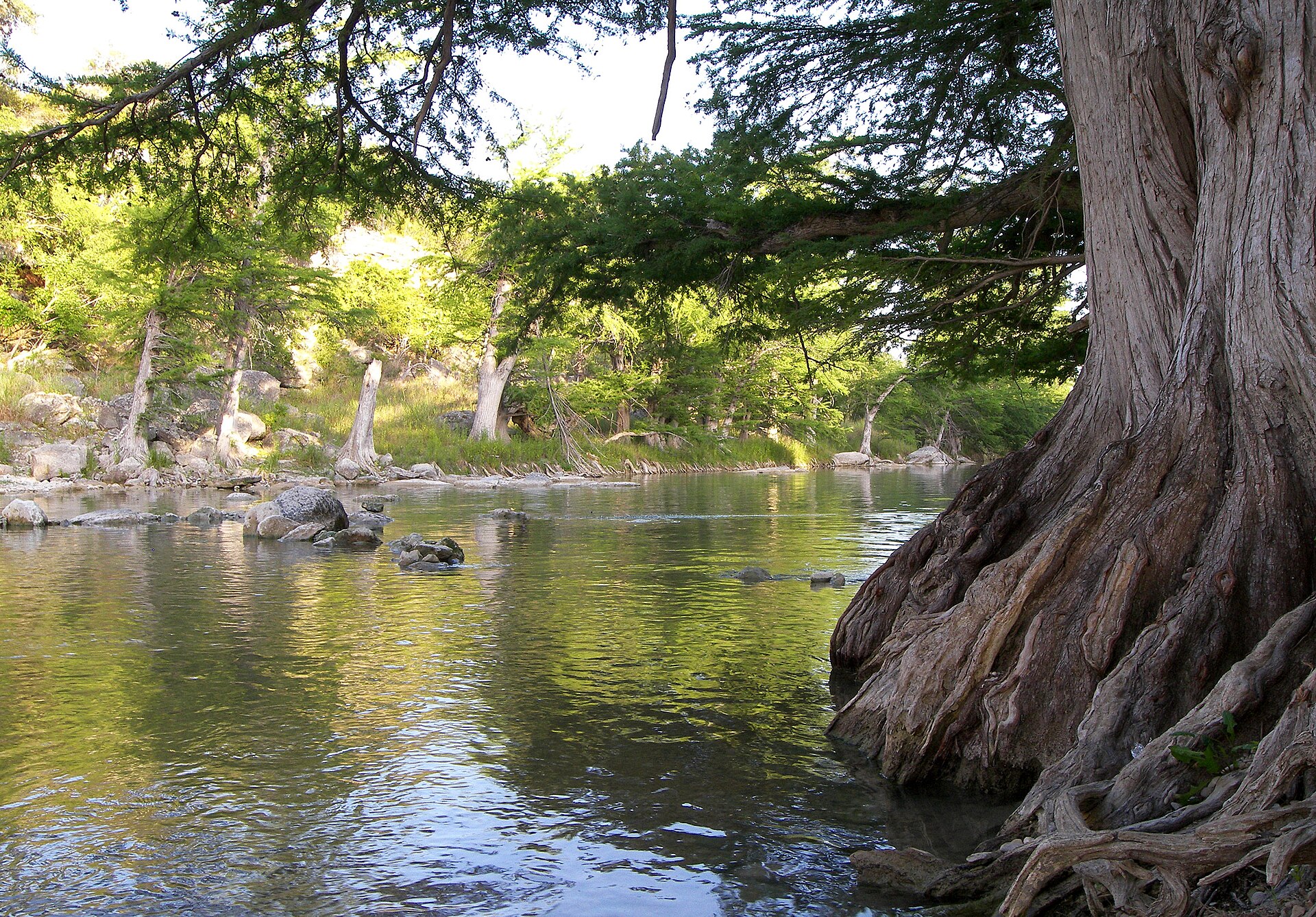
The Guadalupe is the river many Texans picture when they think about the Hill Country: clear water, limestone, cypress roots and recreation. But the basin is more complicated than a float trip. It connects spring-fed streams, aquifers, Canyon Lake, fast-growing communities and a river that ultimately leaves the hills and flows toward San Antonio Bay.
Where the Guadalupe begins and where it goes
TWDB traces the Guadalupe from the confluence of its North and South forks in Kerr County to San Antonio Bay. The basin is entirely within Texas. Important streams inside it include the Blanco, Comal and San Marcos rivers as well as Sandies and Coleto creeks.
That list matters because some of the best-known spring systems in Central Texas feed rivers inside the same basin. The Guadalupe is therefore a good place to see how groundwater can become surface water and how aquifer conditions can show up in river flow.
Groundwater and river flow are connected here
TWDB identifies overpumping of underlying aquifers as a major concern in the Guadalupe basin. Cities and irrigators have historically relied on groundwater, and because groundwater and surface water interact, heavy pumping can reduce base flows in the Guadalupe and tributaries.
Base flow is the portion of streamflow sustained between rain events, often by groundwater discharge. In a spring-influenced river system, that connection helps explain why river conditions cannot be understood from rainfall alone.
Canyon Lake changed the river's modern water system
Canyon Lake sits on the Guadalupe northwest of New Braunfels. TWDB identifies the project as a U.S. Army Corps of Engineers reservoir used for flood control, hydropower, water supply and recreation. Downstream communities experience a river whose flow reflects both natural watershed conditions and managed reservoir releases.
The river changes as it leaves the Hill Country
Upstream, limestone terrain and clear water dominate the popular image of the Guadalupe. Farther downstream, the river moves into lower, warmer country and becomes part of a larger coastal drainage system. The recreational Hill Country river and the lower-basin water-supply river are the same connected system.
Why public access matters
TPWD notes that Texas rivers provide recreation to millions of people and maintains paddling trails and leased-access programs in multiple basins. Guadalupe River State Park adds a major public access point with river frontage for swimming, paddling, fishing and other uses. Access is not the same everywhere along a Texas river, so public parks and designated access sites matter.
How to read the Guadalupe basin on a Texas map
The Guadalupe is easiest to understand by following the change from Hill Country headwaters to the coastal plain. Its North and South forks meet in Kerr County, spring-influenced tributaries add water farther downstream, and Canyon Lake inserts a major managed reservoir into the system before the river leaves the limestone country. Continuing the map toward San Antonio Bay shows that the familiar recreation corridor is only the upper and middle portion of a connected basin with different downstream landscapes and demands.
What the Guadalupe teaches
- A river can be strongly influenced by groundwater as well as direct runoff.
- Spring-fed tributaries make aquifer conditions visible at the surface.
- A major reservoir can reshape flood control, water supply and downstream flow management.
- The familiar Hill Country reach is only one part of a basin that continues toward the coast.
- Recreation, municipal supply and ecosystem needs all depend on the same connected water system.
A small basin with an outsized Texas identity
The Guadalupe basin is much smaller than the Brazos, Colorado or Rio Grande basins, but it concentrates many of the water questions Texans care about: springs, aquifer pumping, reservoirs, public river access, flood risk and rapid growth. That makes it one of the most useful rivers for understanding how Texas water works at human scale.
Plan a river trip by reach, not by river name
Upper Guadalupe trip choices differ: Kerrville-area river parks support town-based access, Guadalupe River State Park provides a managed state-park anchor, the Canyon Lake vicinity changes access and flow, and the lower river becomes wider through Seguin, Gonzales and Victoria. Below Canyon Lake Dam, tailwater conditions and seasonal trout programs call for a separate fishing plan. Use one identified reach and its managing operator rather than merging an upper-river day with a tailwater float as though they share the same launch.
Mapped paddling or visitor-access example
Come and Take It Paddling Trail near Gonzales
TPWD charts an approximately 11-mile, 4–6-hour Guadalupe route from Lake Wood Park (29.4707, -97.4899) to the Come and Take It Dock (29.4978, -97.4558). This passes the San Marcos confluence and ends before the hydroelectric dam; obey the posted caution sign and use the designated exit dock. A lengthy route for more experienced paddlers, not a universal family float. Official map and notes: https://tpwd.texas.gov/boating/paddling-trails/prairies-and-lakes/come-and-take-it/
Legal access, mapped launch points and parking
TPWD maps the Guadalupe River State Park Paddling Trail from the state park toward Nichol's Landing, and a separate Upper Guadalupe trail downstream of Nichol's Landing. Its official Come and Take It trail near Gonzales includes the San Marcos confluence and is a different, longer corridor. Those mapped access points are better anchors than an arbitrary bridge. Check site gates, privately operated shuttle and parking terms and flow advisories before travel. Releases below Canyon Lake Dam, flood runoff and local restrictions can change both fishing and float access.
Where to fish and which rules apply
The TPWD Guadalupe paddling trail describes Guadalupe, largemouth, smallmouth, white and striped bass as well as panfish and catfish in its reach. Tailwater trout near the Canyon Lake dam involves a different seasonal fishery and may have special regulations. Confirm the exact reach against the current TPWD species and waterbody tables. An angler should not assume that a species documented upstream is abundant or legal to retain in every downstream section.
Camping, facilities, lodging and a second-day plan
Guadalupe River State Park provides an official managed base for day use and camping; nearby commercial river camps and Hill Country lodging vary significantly. Compare site boundaries, reservations, river-frontage rights, showers, potable water, accessible facilities, RV hookups, parking and shuttle availability. The river is not one continuous campground. Families choosing a shore-based day should prefer locations with a clearly marked entrance, safe return and known facilities.
Frequently asked questions about this river
Where should a first-time visitor access the Guadalupe?
Begin with a managing authority such as Guadalupe River State Park or an officially mapped TPWD paddling trail, then verify local opening and parking details.
Is fishing below Canyon Lake Dam the same as the upper Guadalupe?
No. Tailwater conditions, stocking and fishing rules differ from upstream reaches; check current TPWD trout guidance.
Can you camp anywhere on the Guadalupe?
No. Use an authorized park, campsite or property with explicit permission; public navigation rights do not authorize private-bank camping.
2026 recreation source review and trip-day verification
Research update October 12, 2026. Access and fishing notes are grounded in linked TPWD primary sources, with known lease expirations, reach-specific rules and conditions identified. The reader must check the current operator notices, NWS flood products, USGS gauges and fishing regulations before travel. Published facts do not constitute a real-time opening or water-safety clearance.
Image credit: Billy Hathorn · CC BY-SA 3.0 · Wikimedia Commons · https://commons.wikimedia.org/wiki/File:Guadalupe_River_of_Texas_IMG_0500.JPG · License: https://creativecommons.org/licenses/by-sa/3.0/
Primary source: Texas Water Development Board ↗
Plan Your Visit
Places connected to this story
Destinations explicitly tied to this article in the Texas Defined guide.
Spring Branch · Comal County
Guadalupe River State Park
Four miles of Guadalupe River frontage between San Antonio and the Hill Country, pairing cypress-lined swimming and paddling water with trails, camping and access to the protected Honey Creek landscape.
Best season: Late spring through early fall for river time; fall through spring for comfortable hikingUpdated Oct 2026- Four miles of Guadalupe River frontage
- Swimming, tubing, paddling and fishing when river conditions allow
- Hill Country trails through prairie, oak woodland and river corridor
From the magazine
More stories to read next
Lakes & Rivers
Rio Grande Wild and Scenic River in Texas: Canyons, River Permits and Trip Planning
October 17, 2026 · About 4 minutes
