Lakes & Rivers
Rio Grande Wild and Scenic River in Texas: Canyons, River Permits and Trip Planning
Plan a responsible visit to the 196-mile federally protected Rio Grande corridor, from Big Bend canyon views to remote multi-day floats, with NPS permit, border and safety guidance.
What is the designated river corridor?
The Rio Grande Wild and Scenic River is a federally protected 196-mile river corridor in the Big Bend region of Texas. The National Park Service notes that its upper 69 miles flow through Big Bend National Park and that other protected sections run downstream into very remote country. This designation applies to a river and canyon corridor—not one staffed park gate, a permanent boat launch, or a single point on a map.
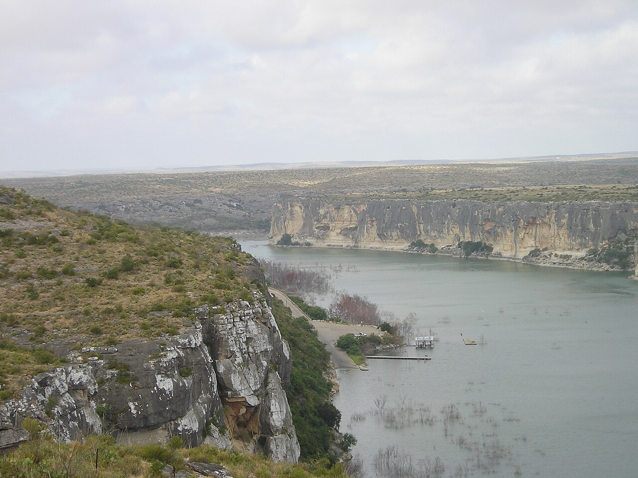
The river winds past desert rock walls and open valleys, creating different kinds of trips depending on the reach, season and flow. Quiet flatwater on one segment does not make the entire protected corridor safe for inexperienced paddlers. The most remote Lower Canyons require a much larger commitment than a short float near a road.
Know which canyon you are paddling
NPS describes very different trips through Boquillas Canyon, the Lower Canyons, Mariscal Canyon and other reaches of the Rio Grande. Boquillas Canyon is a multi-day 33-mile float often selected by people with some river experience, while the Lower Canyons can involve days without roads or nearby services and rapids that demand skill and judgment.
Do not confuse Santa Elena Canyon's well-known scenery with the entire Wild and Scenic River designation; Santa Elena lies farther upstream in Big Bend National Park. It remains useful for introducing visitors to the river's geology, but any actual boating itinerary must match the put-in, take-out and NPS-designated reach chosen for the trip.
Permits, safety and international border rules
National Park Service river regulations require a backcountry-use permit for day and overnight boating on the Rio Grande within Big Bend National Park and the Wild and Scenic River downstream. Obtain the permit through the official process and check the current group-size rules, launch limits and equipment list. U.S. Coast Guard-approved personal flotation devices are required; NPS imposes additional equipment and wearing requirements in moving water.
The river is an international boundary, and a river permit is not authorization to land in Mexico. The NPS explains limited safety exceptions but otherwise says travelers must respect border crossing laws and private land. Do not rely on stories that 'everyone does it' or treat an international riverbank as an ordinary public campground.
Watch water levels and camping restrictions
Low flows can make a boating route slow and difficult; high flows can turn rapids and bends hazardous even for competent paddlers. NPS advises checking gauge readings, recent rainfall, predicted weather, water quality and ranger information before choosing a route. The Lower Canyons have limited access, rugged terrain and possible Class II–IV rapids, so inexperienced parties should not book the journey simply because a scenic photograph looks peaceful.
NPS lists specific stretches where camping is prohibited on the Texas bank, including vehicle-accessible zones and some river-road stretches without appropriate separate permits. Much land alongside the river is private. Choose an authorized campsite or permitted river itinerary in advance, and never assume every sandy bank allows an overnight stop.
Trip length, shuttles and equipment
A day trip can be realistic on suitable portions of the river when water levels and experienced local operations allow it. Multi-day trips require reliable transportation, enough drinking water and food, emergency communication strategy, appropriate gear and accurate pickup timing. Remote floats can take considerably longer than highway distances suggest, especially with wind, low water, rapids or delays.
The National Park Service lists commercial outfitters who may provide guides, boats, equipment and shuttles. Compare actual launch and take-out arrangements and ask who handles permits; avoid claiming an outfit has availability or a guaranteed duration unless the operator confirms those specifics.
Visitor alternatives for non-paddlers
A visitor who does not plan to paddle can still understand the river's protected landscape through Big Bend National Park's permitted overlooks and trails, provided they follow current park access rules. NPS interpretive material explains the desert, borderlands, canyon geology and human histories connected to this waterway. A scenic overlook or river trail visit should be labeled as such, not represented as completing a 196-mile boating journey.
If using TexasDefined to plan a road trip, anchor lodging to an actual gateway—such as Terlingua or the Big Bend area—rather than a fictional river 'headquarters' address. The official Wild and Scenic River contact is administered through Big Bend National Park. Always recheck river conditions before departure.
Image credit: U.S. National Park Service Digital Image Archives · Public domain · Wikimedia Commons — upstream Big Bend reference image
Primary source: National Park Service ↗
Sources and further reading
Plan Your Visit
Places connected to this story
Destinations explicitly tied to this article in the Texas Defined guide.
Terlingua · Brewster County
Big Bend National Park
Explore Big Bend's Chisos Mountains, Chihuahuan Desert and Rio Grande canyons using current NPS road closures, campground reservations and correct 2026 Chisos Basin construction status.
Best season: Fall through spring for hiking and lower-elevation exploring; summer heat can be extreme, so warm-season plans should favor early starts, higher elevations and conservative distancesUpdated Oct 2026- Chisos Basin access remains available despite canceled renovation closure
- Santa Elena Canyon: Terlingua Creek crossing varies with floods
- Ross Maxwell Scenic Drive: check closure and turnaround
Presidio · Presidio County
Big Bend Ranch State Park
Texas' largest state park, stretching through remote Chihuahuan Desert mountains, canyons and Rio Grande country west of Presidio with rugged roads, trails and primitive camps.
Best season: October through April; summer heat can be dangerousUpdated Nov 2026- Rio Grande canyon country
- Remote Chihuahuan Desert backcountry
- Hiking, mountain biking and horseback riding


From the magazine
More stories to read next
Lakes & Rivers
Pecos River in Texas: Canyon History, Public Access, Fishing & Desert Travel
October 12, 2026 · About 5 minutes