
Lakes & Rivers
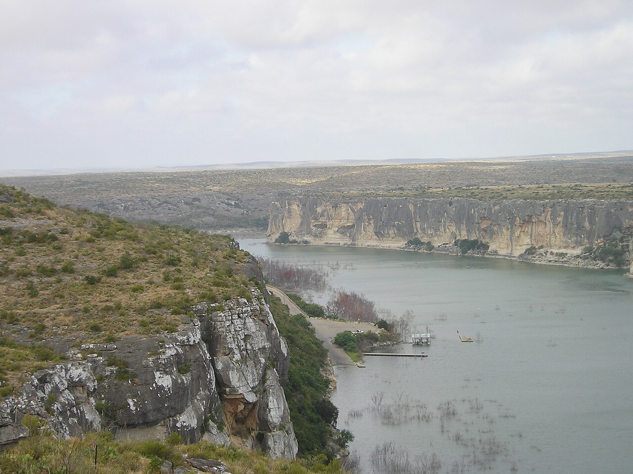
Pecos River in Texas: Canyon History, Public Access, Fishing & Desert Travel
An evidence-led West Texas Pecos River guide from the New Mexico line through remote desert country to the Rio Grande and Amistad, with realistic access expectations, conservation and historical places.
The river at a glance
The Pecos is a long, often remote river whose Texas journey differs fundamentally from the Comal or Frio. It enters Texas from New Mexico, runs through arid ranching and Permian Basin country and reaches the Rio Grande at the Amistad area. River conditions, ownership, salinity, access and water management differ radically along the route. It is misleading to sell it as one continuous public tubing corridor or to use an Amistad boat ramp as proof of access to every upstream reach.
Choose the right stretch and build an itinerary
For most visitors, the lower Pecos landscape is better explored by a road-and-history itinerary than a spontaneous float. Use Del Rio or Comstock as a service base, then visit the publicly managed Seminole Canyon area and the Pecos High Bridge corridor from lawful viewpoints. Amistad National Recreation Area offers water recreation where current NPS rules allow, but a reservoir outing is not the same as traveling up the free-flowing Pecos canyon.
Officially documented access: an example to build from
Lower Pecos: designated park interpretation rather than an unsupported float
The National Park Service documents the Pecos High Bridge/Viaduct history in the Lower Pecos–Amistad landscape, while TPWD operates Seminole Canyon State Park for regulated trail and cultural access. Neither an interpretive site nor a historic bridge establishes a legal free-flowing river launch. Contact the actual managing agency before an expedition. Primary map or managing authority: https://www.nps.gov/amis/learn/historyculture/viaduct.htm
Where you can legally enter, park and exit
Treat the Pecos as a high-verification river. Remote ranch crossings are not automatically public launches, and legal access may be separated by long distances with no convenient rescue. Check NPS maps and superintendent notices for permitted access in Amistad, TPWD state-park rules for the Seminole Canyon landscape, and property rights for any upriver entry. Never suggest roadside parking at a bridge overlook without a legally designated pullout.
Tubing, kayaking and paddling: what actually works
Experienced paddlers considering remote canyons need a vetted route, permission and land-status review, take-out plan, gauge and weather monitoring, communications, water supplies and emergency contingencies. For general tourists, the safe default is designated park viewpoints and official water recreation rather than an unsupported multi-day paddling itinerary. Storm runoff can be sudden; lack of cellular coverage and long gaps between exits materially increase risk.
Fishing: species, rules and responsible access
Fishing possibilities are reach-specific and heavily affected by water quality, salinity and access. The lower river meets the Amistad fishery, but fish and regulations associated with a reservoir should not be asserted for every inland reach. Check TPWD waterbody-specific rules, advisories and licensed access, and NPS rules where federal waters are involved. Do not publish an unverified species list or suggest shore access across private ranches.
Camping, RV sites and overnight lodging
Use established lodging and permitted campgrounds around Del Rio, Amistad and the appropriate state parks rather than describing remote canyon land as open camping. Confirm potable water, shade, fire restrictions, road access, travel distances and seasonally available services. Overnight river expeditions require much more specific permission and safety research than a general tourist guide can provide.
Nearby attractions and a worthwhile second day
The Pecos High Bridge is a powerful history stop because it shows how difficult it was to cross this canyon by rail. Seminole Canyon gives visitors professionally interpreted rock-art and landscape history; NPS Amistad resources explain the lower Pecos–Rio Grande setting. A visitor itinerary can explore all three without claiming that each site offers direct riverbank swimming.
Landscape, history and why this river matters
Indigenous rock-art landscapes along the Lower Pecos record long human histories in the canyons. Later routes, cattle and rail connections, irrigation, water extraction and energy development shaped the river's modern condition. NPS documents the historic Pecos Viaduct and railroad engineering problem. Keep those documented stories separate from folklore and never imply that cultural sites may be entered without a permit or guided access.
Planning with children, facilities and accessibility
For families, focus on visitor centers, official overlooks, interpretive programs and shaded breaks, not casual entry into isolated river water. Summer heat can be severe and services far apart; carry drinking water, confirm park hours and check road closures. Choose established campground facilities or Del Rio lodging for reliable bathrooms and supplies.
Trip checklist: verify these before leaving
- Identify the exact legal launch, exit, parking area, restroom and emergency meeting point for the chosen reach.
- Check same-day USGS observations, upstream rainfall, NWS warnings and managing-agency closures; no gauge reading is by itself a guarantee of safe entry.
- Verify TPWD's current fishing license rules, waterbody exceptions, fish-consumption advisories and invasive-species precautions.
- Confirm outfitters' shuttles, life jackets, group requirements, campsite access and posted rules for the visit date.
- Bring drinking water, protection from sun and cold, appropriate footwear and a pack-out plan; leave riparian and aquatic habitats undisturbed.
Frequently asked questions
Can you tube the Pecos like the Frio?
Not as a general casual day trip. Access is remote and reach-specific, and many sections require specialized planning or permission.
Where does the Texas Pecos end?
It joins the Rio Grande in the Amistad region near the Lower Pecos canyon country.
Can I see the famous Pecos High Bridge?
The Lower Pecos bridge corridor has a major railroad history; use official lawful viewing locations and do not stop in unsafe roadway positions.
Is Seminole Canyon a public river launch?
Do not assume so. Check the state park's specific permitted activities; its cultural and hiking resources are the main visitor draws.
Where should I stay?
Del Rio and permitted Amistad or state-park lodging/campgrounds are practical bases; verify distances and amenities before travel.
Primary sources and verification methodology
Editorial evidence review: October 12, 2026. Geography, access and recreation descriptions were compared with the primary parks, tourism or federal references linked below and Texas Parks and Wildlife Department's statewide river guidance. Operational status, prices, river flows and seasonal closures are NOT represented as live-verified; check the managing authority and gauges for your actual travel date. Do not mistake an editorial overview for a permit, current fishing-regulation determination, legal-access opinion, or flood clearance.
Recommended citation: TexasDefined.com, "Pecos River in Texas: Canyon History, Public Access, Fishing & Desert Travel", research review October 12, 2026. The linked source record supports each named operator, park or documented location; unknown conditions are disclosed rather than guessed.
Image credit: Badener / Lutz Fischer-Lamprecht · CC BY-SA 3.0 · Wikimedia Commons · https://commons.wikimedia.org/wiki/File:Pecos_River.jpg · License: https://creativecommons.org/licenses/by-sa/3.0/
Primary source: National Park Service Amistad ↗
Sources and further reading
From the magazine
More stories to read next
Lakes & Rivers
Rio Grande Wild and Scenic River in Texas: Canyons, River Permits and Trip Planning
October 17, 2026 · About 4 minutes
