
Lakes & Rivers
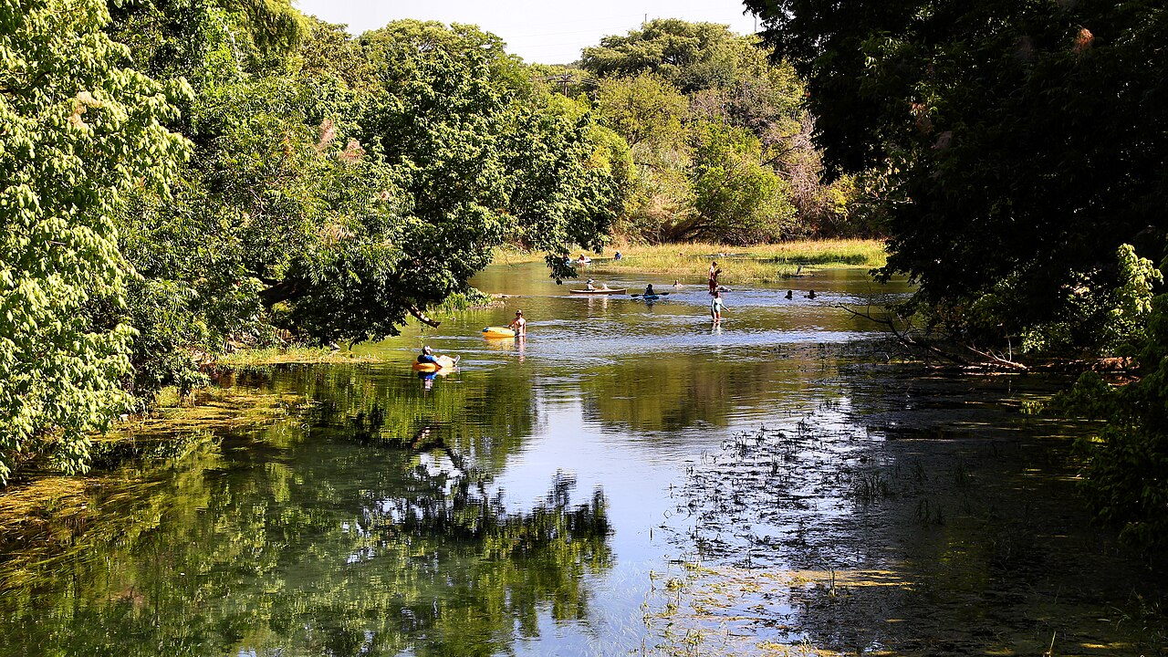
San Marcos River: Springs, River Parks, Tubing, Paddling & Wildlife
A visitor guide from the protected spring-fed headwaters and urban river parks of San Marcos to the lower paddling reaches near Luling, including city rules, access, angling and camping alternatives.
The river at a glance
The San Marcos River begins in a remarkable spring system at San Marcos, travels through busy urban parks and then becomes a less-developed river toward Martindale, Luling and its eventual meeting with the Guadalupe. Those are different experiences: a short swim, a managed float and a miles-long paddling trip should never be presented as interchangeable. The upper river contains sensitive aquatic habitat, including Texas wild-rice, so visitor planning starts with ecological rules as well as recreation.
Choose the right stretch and build an itinerary
In town, orient around City Park, the Lions Club tubing area and Rio Vista Park, then compare park-specific entry, parking and passes using the official San Marcos visitor and city notices. For a quieter and longer paddling choice, the TPWD Luling Zedler Mill trail runs from a state highway crossing toward Zedler Mill Park; it is a separate lower-river day trip and requires its own shuttle, gauge and access check. Do not assume the entire float from San Marcos to Luling is one maintained commercial loop.
Officially documented access: an example to build from
Luling Zedler Mill Paddling Trail
TPWD maps a 6.0-mile downstream route from the State Highway 90 River Crossing (29.6679, -97.6999) to Zedler Mill Park (29.6671, -97.6519), typically estimated 2–4 hours with normal flows. Exit before the dam beyond the mill. Arrange shuttle, inspect snags and verify current access. Primary map or managing authority: https://tpwd.texas.gov/fishboat/boat/paddlingtrails/inland/luling/
Where you can legally enter, park and exit
San Marcos riverfront parks have individually posted hours, parking fees and rules. Visitor guidance for 2026 describes summer Rio Vista entry passes and City Park parking charges; avoid hardcoding those rates without a scheduled city-source check. On the lower river, use TPWD-mapped launches such as the Luling trail rather than informal roadside entries. Some leased fishing access sites may be closed or expired, so link to the currently maintained program listing rather than promising opening.
Tubing, kayaking and paddling: what actually works
A short urban float can be attractive for visitors, but river drops and structural features require close attention to marked exits. At Rio Vista, local guidance identifies drops and an exit for people who want to avoid them. On longer reaches, wind, current and debris affect journey time. Never represent an approximate two-to-four-hour official paddling trail as a universal time for every route.
Fishing: species, rules and responsible access
Fish habitat varies between the clear upper urban reach and deeper downstream areas. TPWD notes bass and catfish opportunities on managed lower-river accesses, but legality of bank access must be independently checked for each launch. Sensitive native wildlife should not be collected or disturbed. Confirm license, water-specific restrictions and closed areas before casting, and keep fishing tackle out of protected plants.
Camping, RV sites and overnight lodging
San Marcos city riverfront parks are not blanket overnight camping grounds. For an overnight trip use permitted camping properties in the wider Hays–Caldwell corridor or hotels in San Marcos and nearby towns. Ask whether a campground offers exclusive guest river access, car or RV sites, showers, and on-site put-in rights, and whether high water affects the reservation.
Nearby attractions and a worthwhile second day
The Meadows Center and Spring Lake explain the spring system; downtown San Marcos adds museums, food and Texas State University context. Lower-river paddlers can pair a river morning with Luling's history and the restored Zedler Mill setting, rather than trying to complete urban swimming and a long shuttle paddle in one rushed afternoon.
Landscape, history and why this river matters
The spring system and river have much deeper cultural and ecological history than commercial tubing. The river supported Indigenous settlement over millennia, influenced the growth of San Marcos and continues to be a focus of habitat conservation. Interpretive sources should distinguish archaeological evidence, later settlement and today's managed endangered-species recovery work.
Planning with children, facilities and accessibility
Choose a shallow-entry, supervised-by-your-party site with a short return walk when bringing children or inexperienced swimmers. The city notes that no lifeguards are on duty; life jackets should be fitted appropriately. Bring reusable drink containers and closed cooler lids, protect riverbank vegetation and review park closure information before leaving a car.
Trip checklist: verify these before leaving
- Identify the exact legal launch, exit, parking area, restroom and emergency meeting point for the chosen reach.
- Check same-day USGS observations, upstream rainfall, NWS warnings and managing-agency closures; no gauge reading is by itself a guarantee of safe entry.
- Verify TPWD's current fishing license rules, waterbody exceptions, fish-consumption advisories and invasive-species precautions.
- Confirm outfitters' shuttles, life jackets, group requirements, campsite access and posted rules for the visit date.
- Bring drinking water, protection from sun and cold, appropriate footwear and a pack-out plan; leave riparian and aquatic habitats undisturbed.
Frequently asked questions
Where does the San Marcos River start?
The spring system at San Marcos, associated with Spring Lake, feeds the river's headwaters.
Can you swim or tube in San Marcos?
Yes at designated open urban access sites under local rules; check Rio Vista and City Park updates.
Does the city charge river parking or admission?
Some parking and summer entry programs have applied in 2026; check the city's current information for the specific day.
What is different about the Luling paddle?
The TPWD Zedler Mill trail is a lower-river trip with its own access, distance and shuttle requirements.
Why should visitors avoid uprooting river plants?
Protected aquatic habitats include rare species such as Texas wild-rice. Stay on authorized routes and avoid damaging vegetation.
Primary sources and verification methodology
Editorial evidence review: October 12, 2026. Geography, access and recreation descriptions were compared with the primary parks, tourism or federal references linked below and Texas Parks and Wildlife Department's statewide river guidance. Operational status, prices, river flows and seasonal closures are NOT represented as live-verified; check the managing authority and gauges for your actual travel date. Do not mistake an editorial overview for a permit, current fishing-regulation determination, legal-access opinion, or flood clearance.
Recommended citation: TexasDefined.com, "San Marcos River: Springs, River Parks, Tubing, Paddling & Wildlife", research review October 12, 2026. The linked source record supports each named operator, park or documented location; unknown conditions are disclosed rather than guessed.
Image credit: Larry D. Moore · CC BY 4.0 · Wikimedia Commons · https://commons.wikimedia.org/wiki/File:San_Marcos_River_San_Marcos_Texas_2023.jpg · License: https://creativecommons.org/licenses/by/4.0/
Primary source: Visit San Marcos river guide ↗
Sources and further reading
From the magazine
More stories to read next
Lakes & Rivers
Rio Grande Wild and Scenic River in Texas: Canyons, River Permits and Trip Planning
October 17, 2026 · About 4 minutes
