Half day
Scenic introduction
- Visitor-center orientation
- Short McKittrick or Pine Springs-area walk
- Sunset or late-day mountain views

Big Bend Country · National Parks
Hike Guadalupe Peak, the Pine Springs area and McKittrick Canyon with accurate Mountain Time visitor schedules, trail elevation gain, short-day gate closures and limited West Texas services.
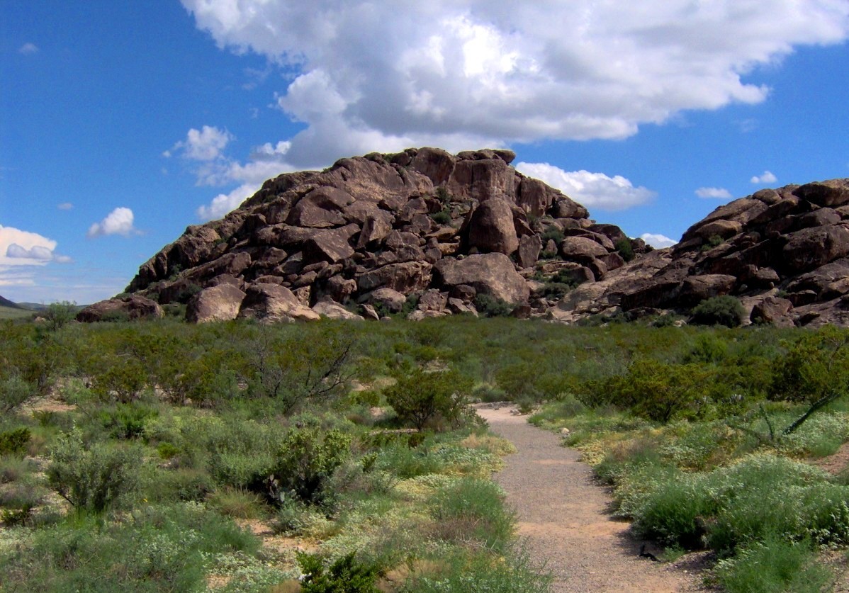
Photography: National Park Service · Public domain · Wikimedia Commons
Quick trip facts
The experience
Guadalupe Mountains National Park protects a landscape that looks like a mountain range but also tells the story of an ancient sea. The Guadalupe Mountains are built from the fossilized Capitan Reef, a massive Permian-age reef complex whose limestone now rises above the Chihuahuan Desert. El Capitan makes that geology visible from the highway, while the park's trails reveal how abruptly desert, canyon and high-country ecosystems meet.
Guadalupe Peak is the headline challenge. At 8,751 feet, it is the highest natural point in Texas, reached by a strenuous trail that gains substantial elevation from Pine Springs. The summit is rewarding, but it should not define the entire park; strong winds, heat, winter weather or fitness can make shorter routes the smarter choice on a given day.
McKittrick Canyon provides the park's most famous seasonal contrast. The canyon supports trees and vegetation that produce striking fall color, drawing heavy interest during peak weeks. Even outside autumn, the route's limestone walls, historic structures and changing plant communities make it one of the best places to understand how elevation and water create pockets of very different habitat in West Texas.
For a shorter visit, Pine Springs, the Pinery Trail and Frijole Ranch give useful geology and human-history context without requiring an all-day summit hike. The National Park Service identifies accessible visitor facilities and paved accessible trails at several developed areas, making it possible to experience meaningful parts of the park even when rugged backcountry routes are not suitable.
Preparation matters because Guadalupe Mountains has fewer visitor services than many famous national parks. There is no gateway resort town immediately outside the entrance, weather can change rapidly, winds can be severe and cell service is unreliable. Bring what you need for the day before leaving Carlsbad, Van Horn or El Paso, and remember that the park uses Mountain Time even though much of Texas does not.
The location creates one of the best two-national-park combinations in the Southwest. Carlsbad Caverns National Park is a straightforward drive north in New Mexico, while Hueco Tanks and El Paso extend the Texas side of the itinerary west. Van Horn provides a practical Texas base to the south, and the long approach through Culberson County reinforces just how remote this mountain landscape remains.
Guadalupe Mountains National Park protects a sharply rising Permian fossil-reef landscape at the western edge of Texas. Pine Springs, McKittrick Canyon and Dog Canyon are separate visitor areas that cannot be compressed into one general-use pin. The park is in the Mountain Time Zone, an easily overlooked one-hour difference from many Texas travelers' expectations; an unreliable cellular phone clock can compound mistakes when gates close.
Guadalupe Peak is the state's highest natural point, but the summit hike should not be described as an easy overlook walk. NPS lists a 4.2-mile climb each way from Pine Springs with approximately 3,000 feet of elevation gain, meaning an 8.4-mile round trip with steep switchbacks and long stretches exposed to wind. Hiking time depends on conditions and experience. Carry substantial water and food, use durable trail shoes, and choose a shorter signed route if the weather or abilities do not support an all-day ascent.
Visitor services follow separate schedules. NPS lists Pine Springs Visitor Center open around 8 a.m. to 4 p.m. Mountain Time, except several major holidays. McKittrick Canyon is a day-use area open about 8 a.m. to 5 p.m. Mountain Time, and its entrance gate is locked at 5 p.m. The McKittrick contact station and Dog Canyon Ranger Station operate intermittently, depending on staffing; do not advertise these as reliably staffed each day just because the area itself is accessible.
The desert environment can change rapidly. Winter can bring icy sections and severe winds at elevation, while summer brings punishing heat on exposed climbs. Pine Springs and Dog Canyon camps differ in road access and amenities, and backpackers need to check current wilderness permit rules separately from developed camping. In this remote part of West Texas, food, fuel and lodgings are not immediately inside the park; begin the drive with adequate supplies and know where you will sleep.
An ideal first visit distinguishes short historical interpretation from a demanding mountaineering hike. The Pinery interpretive route near Pine Springs provides Butterfield Overland Mail history, while the McKittrick Canyon corridor offers seasonally changing vegetation and long trails within specific gate hours. Do not recommend both a summit climb and a late-day McKittrick outing on a tight schedule: time-zone errors and the locked gate can turn that into an unsafe plan.
The details
Evidence and citations
Read the original operator records and supporting research for this guide.
Primary source for current visitor access, operating guidance and attraction information.
NPS interpretation of the fossil reef, geology and mountain landscape.
NPS cultural-history context for Guadalupe Mountains National Park.
Practical questions
The visit
Texas context
Guadalupe Mountains National Park protects the highest point in Texas, extensive Chihuahuan Desert habitat and an exposed fossil reef system that records an ancient marine environment. It is one of the state's strongest geology-and-hiking destinations.
Use the time you have
Half day
Full day
2 days
Before you go
Around the area
Guadalupe Mountains has almost no conventional tourist district at its doorstep. The useful surrounding geography is a triangle between Van Horn, Carlsbad and El Paso, with small desert communities and Carlsbad Caverns forming the closest extensions to the park.
Easy additions that fit naturally around the main stop.
Inside the park
Historic ranch buildings and exhibits add human history to a landscape often visited primarily for hiking.
North-east park district
A separate trailhead and canyon experience known for geology, vegetation and fall color deserves its own half day.
About 35 miles north in New Mexico
One of the world's great cave systems makes the strongest two-park pairing with Guadalupe Mountains.
Western park district
Bright gypsum dunes and views back toward the mountains reveal another side of the park's desert geology.
Dining districts and food areas worth building into the same outing.
About 55 miles north
The broadest nearby concentration of restaurants and groceries for travelers approaching from the north.
About 65 miles south
Texas-side restaurants, fuel and groceries make Van Horn the practical resupply point for the southern approach.
About 110 miles west
A major-city food scene is useful when Guadalupe Mountains is part of a larger far-West-Texas itinerary.
At the park
There is no full-service food district at the entrance, so self-sufficiency is part of a realistic day plan.
The most practical lodging areas for minimizing driving and maximizing time on the ground.
About 65 miles south
A practical Texas lodging base with highway services for travelers continuing toward Big Bend or central Texas.
About 55 miles north
The most convenient full-service base for combining Guadalupe Mountains with Carlsbad Caverns.
North toward Carlsbad Caverns
Closer lodging options can reduce driving for a two-national-park itinerary, though services are more limited.
About 110 miles west
Best for travelers who want major-city lodging and are treating the park as a long day trip or road-trip segment.
Nearby parts of the city that add character, shopping, history or nightlife.
South on US 54/90
A historic highway and railroad town that functions as the main Texas service stop south of the park.
West of the park
A small agricultural desert community near the Salt Basin offers a very different view of far-West-Texas life.
North in New Mexico
A regional service center and cave gateway for visitors combining the two national parks.
Farther west
West Texas's major city adds food, museums and borderland culture to a remote mountain trip.
Good nearby additions when the itinerary includes younger travelers.
Pine Springs
A short paved accessible trail leads to historic Butterfield stage-route ruins and broad views of El Capitan.
Near Pine Springs
Historic buildings and interpretive exhibits offer a low-mileage alternative to a strenuous hiking day.
McKittrick district
Families can choose a shorter out-and-back distance rather than committing to the canyon's longer objectives.
North in New Mexico
Elevators, ranger information and spectacular cave rooms make a strong family companion to the mountain park.
Places that justify extending the visit beyond the immediate area.
About 35 miles north
Build a two-park itinerary around the fossilized reef above ground and the cave system developed within the same regional geology.
About 90 miles west
Rock basins, pictographs and desert climbing history make a culturally rich Texas extension toward El Paso.
About 110 miles west
Museums, food and borderland culture provide a city reset after several days in remote park country.
About 65 miles south
Use the town as a bridge toward Big Bend, Marfa or other West Texas road-trip destinations.
Plan the route
Editorially paired stops near Guadalupe Mountains National Park appear first, followed by nearby destinations. Distances are approximate straight-line miles.
Van Horn · Hudspeth and Culberson counties · Big Bend Country
Sierra Diablo WMA protects 11,624 acres of rugged desert mountains along the Hudspeth-Culberson county line and is a foundational Texas sanctuary for desert bighorn sheep conservation and restoration.
Approx. 31 miles away
El Paso · El Paso County · Big Bend Country
Protect and explore Hueco Tanks' ancient pictographs and desert rock basins east of El Paso, with strict North Mountain permits, advance-booked guided access, climbing rules and limited camping.
Approx. 72 miles away
Pecos · Reeves County · Big Bend Country
Pecos is a Trans-Pecos crossroads and rodeo-history town on I-20, known for its 1883 rodeo tradition, Reeves County Courthouse, western trails, Pecos Bill lore, public art and a growing visitor-services role between Midland-Odessa, the Davis Mountains and far West Texas.
Approx. 85 miles away
El Paso · El Paso County · Big Bend Country
Visit the Ysleta del Sur Pueblo Cultural Center Museum in El Paso: Tigua history, exhibits, actual museum photos, verified visiting hours, program guidance and the nearby Ysleta Mission.
Approx. 89 miles away
Toyahvale · Reeves County · Big Bend Country
A spring-fed desert pool supplied by San Solomon Springs with swimming, camping, and historic CCC structures.
Approx. 90 miles away
El Paso · El Paso County · Big Bend Country
Visit El Paso Museum of Archaeology: free Southwestern and Indigenous history exhibits, family visits, desert trails, accessibility, guided tours and parking-gate timing.
Approx. 95 miles away
Texas Explained
Go beyond the destination with the systems, landscapes and history that explain why this part of Texas looks and works the way it does.
Continue exploring
Read next
National Parks
Big Bend and Guadalupe Mountains are both desert parks, but they ask different things of a traveler. Here is how to choose between them — or plan for both.
August 7, 2026 · About 3 minutes