Skip to content
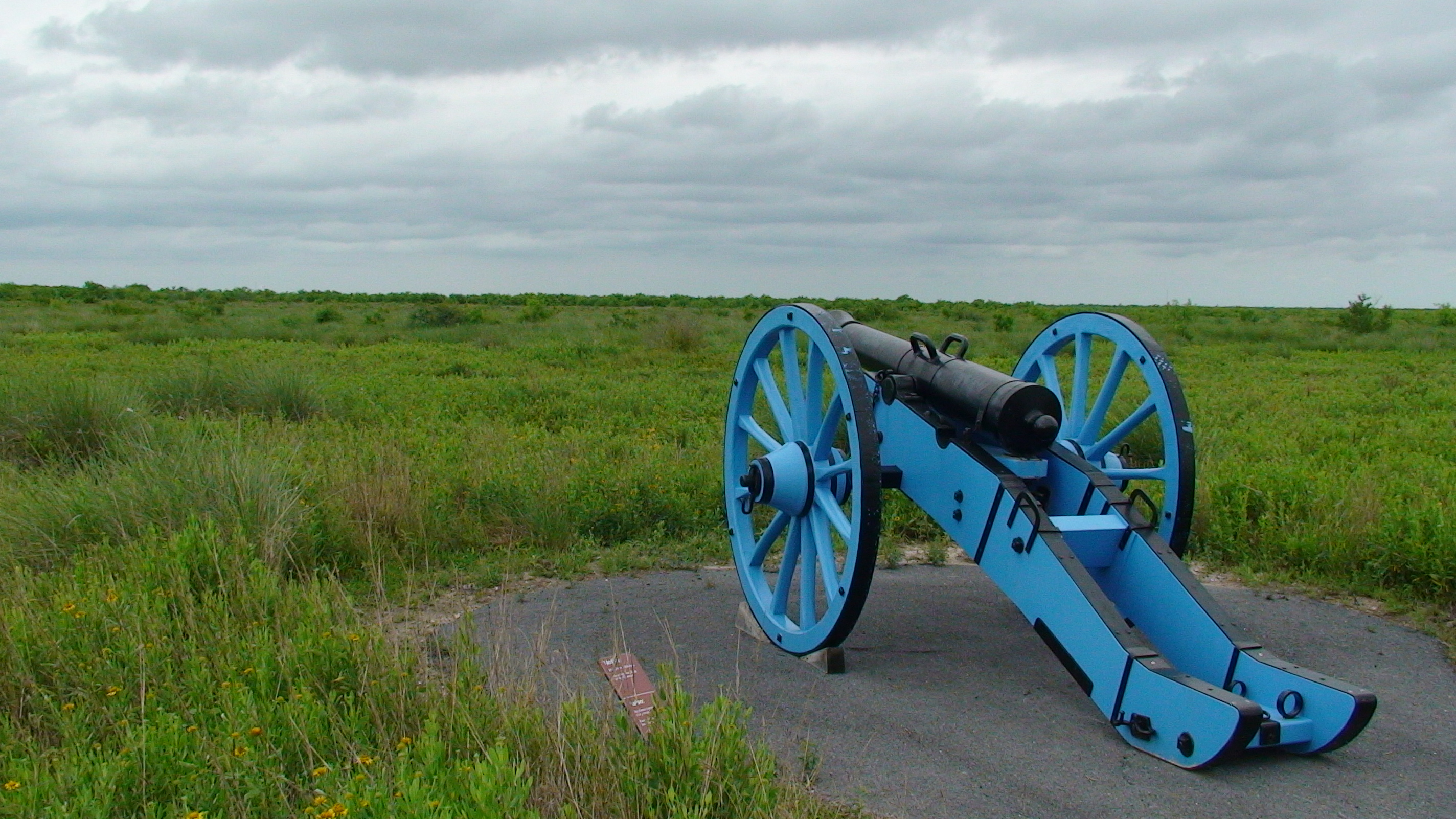
Palmito Ranch Battlefield landscape in Cameron County, Texas

South Texas Plains · Historic Sites & Museums

Palmito Ranch Battlefield

Palmito Ranch is associated with the final land battle of the American Civil War, fought near the Rio Grande in May 1865. The remote battlefield is best approached as a landscape-history stop that explains why fighting continued in Texas after major Confederate armies had surrendered elsewhere.

Photography: 25or6to4 · CC BY-SA 3.0 · Wikimedia Commons · CC BY-SA 3.0 license ↗

Quick trip facts

Palmito Ranch Battlefield at a glance

Where is Palmito Ranch Battlefield?
Palmito Ranch Battlefield is near Brownsville, Texas, in Cameron County.
When is the best time to visit Palmito Ranch Battlefield?
Year-round; spring and fall are usually the most comfortable for outdoor portions of a visit.
Do I need to plan ahead for Palmito Ranch Battlefield?
THC lists no staffed services, public visitor center, ticket office, restrooms or other facilities at this remote battlefield. Use the state history panels, nearby roadside markers and two U.S. Fish and Wildlife Service interpretive viewing platforms where access is permitted; do not expect a staffed tour or claim regular staffed opening hours.
Who manages Palmito Ranch Battlefield?
Texas Historical Commission

The experience

The story of Palmito Ranch Battlefield

Palmito Ranch is associated with the final land battle of the American Civil War, fought near the Rio Grande in May 1865.

The remote battlefield is best approached as a landscape-history stop that explains why fighting continued in Texas after major Confederate armies had surrendered elsewhere.

Palmito Ranch was the site of a May 1865 engagement along the lower Rio Grande after major Confederate armies elsewhere had surrendered. Its chronology illustrates how news, authority, border trade and military operations unfolded unevenly as the Civil War ended.

The battlefield is not a densely built visitor complex. Use maps and a researched history of the Rio Grande corridor to understand why fighting occurred here, then compare nearby Brownsville and Palo Alto to distinguish the Civil War from the earlier U.S.–Mexican War.

Palmito Ranch's May 12–13, 1865 battle was the last land battle of the Civil War, fought after Lee's surrender but before the Trans-Mississippi army surrendered. THC separately identifies a September 1864 action in the same landscape. The relevant ground lies east of Brownsville near Boca Chica Highway; wildlife-refuge viewing platforms and historical radio interpretation on 1610 AM supplement the modest roadside exhibits.

Palmito Ranch was the site of the May 1865 fighting often called the final land battle of the Civil War, occurring after Lee's April surrender. Explain the fighting in the setting of the Rio Grande cotton trade, late-war communications and continued military operations—not as though it determined the outcome of the war. Access and interpretation on the landscape differ from a staffed NPS visitor center.

The details

Planning your visit

Area
Brownsville, Texas
Best season
Year-round; spring and fall are usually the most comfortable for outdoor portions of a visit.
Entry & reservations
THC lists no staffed services, public visitor center, ticket office, restrooms or other facilities at this remote battlefield. Use the state history panels, nearby roadside markers and two U.S. Fish and Wildlife Service interpretive viewing platforms where access is permitted; do not expect a staffed tour or claim regular staffed opening hours.
Accessibility
This is an unstaffed battlefield and roadside-marker landscape, not an accessible museum building. Confirm legal parking, wildlife-refuge access and viewing-platform conditions with the responsible agencies before visiting.

Evidence and citations

Research sources

Read the original operator records and supporting research for this guide.

Practical questions

Frequently asked questions about Palmito Ranch Battlefield

Does Palmito Ranch Battlefield have a museum or restrooms?
No. The Texas Historical Commission lists no public visitor facilities or services at the battlefield. Plan a short self-guided historical landscape visit and bring drinking water.Check official details ↗
What can I see at the Palmito Ranch battlefield?
There are on-site interpretation panels, nearby historical markers and two U.S. Fish and Wildlife Service viewing platforms with battlefield interpretation. Verify current access with the responsible agencies.Check official details ↗

The visit

What the experience is like

Walking & exertion
Low
Time outdoors
Fully outdoors
Plan ahead
Moderate
Families
Explain the unusual date of the battle first so younger visitors understand why this remote landscape matters nationally.
Good for first-time visitors
Start with the operator's interpretive information to understand Civil War, then follow the site itself instead of relying only on a photo or commemorative marker.

Texas context

Why Palmito Ranch Battlefield matters

Palmito Ranch is associated with the final land battle of the American Civil War, fought near the Rio Grande in May 1865. Treat Palmito Ranch as a landscape-history stop in the lower Rio Grande Valley. Its importance comes from the Civil War story, border geography and the fact that the final major land battle occurred after Lee's surrender in Virginia.

About this guide: Texas Defined Editorial Desk. Official operator pages control changing access and visitor rules. The site-specific research and planning suggestions here supplement, but do not replace, those sources. Editorial assessments describe trip-planning value rather than a star rating. Citation guidance.

Use the time you have

Three ways to visit

Short visit

The focused visit

  1. Check Palmito Ranch Battlefield's official access arrangements and any active preservation or closure notice.
  2. Orient to the site's central story: Civil War.
  3. Locate the main preserved feature, memorial or interpretive setting; do not enter restricted spaces.

Unhurried visit

Read the place more deeply

  1. Begin with the full historical background: Palmito Ranch is associated with the final land battle of the American Civil War, fought near the Rio Grande in May 1865.
  2. Compare the site's interpretation of battlefields with its physical setting.
  3. Look for context on Rio Grande and distinguish original features from later preservation or commemoration.

Half-day or longer

Regional history route

  1. Visit Palmito Ranch Battlefield when the site's actual access schedule permits.
  2. Continue to Brownsville; confirm whether it is a separate site with different hours and admission.
  3. If time and distance allow, add Texas military history timeline as a distinct history stop rather than compressing every destination into one visit.

Before you go

Common visitor questions

How long should I allow for Palmito Ranch Battlefield?
There are no staffed services, toilets, ticket desk or visitor center. Consult THC's 1864/1865 battle history, roadside markers, two Fish and Wildlife Service interpretive viewing platforms, and the 1610 AM recorded guide where available. Confirm refuge access and bring water.[1]
What should I know about accessibility?
This is an unstaffed battlefield and roadside-marker landscape, not an accessible museum building. Confirm legal parking, wildlife-refuge access and viewing-platform conditions with the responsible agencies before visiting.
What should I pair with Palmito Ranch Battlefield?
Brownsville: Use Brownsville for the wider Civil War, borderlands and Rio Grande context that the battlefield itself cannot provide alone.
What is a worthwhile side trip?
Brownsville historic district: Continue into the city for borderlands, military and commercial history.

Connected museum guides

Museums to explore nearby

Museum guides relevant to Brownsville and its surrounding history. Tickets, hours and travel arrangements are separate at each institution.

Around the area

What to do near Palmito Ranch Battlefield

Treat Palmito Ranch as a landscape-history stop in the lower Rio Grande Valley. Its importance comes from the Civil War story, border geography and the fact that the final major land battle occurred after Lee's surrender in Virginia.

NearbyAttractions close by

Easy additions that fit naturally around the main stop.

  • Brownsville

    Use Brownsville for the wider Civil War, borderlands and Rio Grande context that the battlefield itself cannot provide alone.

Eat nearbyWhere to eat and drink

Dining districts and food areas worth building into the same outing.

  • Brownsville

    The city is the practical meal and services base before or after the battlefield drive.

Stay nearbyWhere to stay

The most practical lodging areas for minimizing driving and maximizing time on the ground.

  • Brownsville

    Stay in the city for a broader lower-valley history itinerary.

Explore moreNeighborhoods and districts

Nearby parts of the city that add character, shopping, history or nightlife.

  • Lower Rio Grande landscape

    Flat terrain, river access and proximity to Mexico are fundamental to understanding military movement here.

With kidsFamily-friendly stops

Good nearby additions when the itinerary includes younger travelers.

  • Timeline strategy

    Explain the unusual date of the battle first so younger visitors understand why this remote landscape matters nationally.

Go fartherWorthwhile side trips

Places that justify extending the visit beyond the immediate area.

  • Brownsville historic district

    Continue into the city for borderlands, military and commercial history.

  • Texas military history timeline

    Place this site inside the longer military chronology from the Texas Revolution and frontier Army through the Civil War, border mobilizations and the world wars.

  • Texas in the Civil War and Reconstruction

    Connect battlefield history to slavery, emancipation, Reconstruction, postwar political life and the later construction of Civil War memory across Texas.

  • Texas and the U.S.–Mexican War

    Use Palo Alto, Resaca de la Palma, Fort Brown and the lower Rio Grande corridor to connect annexation with the opening battles of the 1846–1848 war.

  • Palo Alto Battlefield

    Contrast 1846 and 1865 conflicts

  • South Padre Island

    Broader Valley trip base

Plan the route

Explore related places

Editorially paired stops near Palmito Ranch Battlefield appear first, followed by nearby destinations. Distances are approximate straight-line miles.

  • Brownsville · Cameron County · South Texas Plains

    Boca Chica Beach

    The remote Gulf beach at the southern tip of Texas near the Rio Grande, reached by State Highway 4 and subject to access interruptions associated with launch and test operations at Starbase.

    Best season: October through May for milder weather; summer works for beach days with heat, storms and surf conditions checked closelyUpdated Sep 2026
    • Open-Gulf beach
    • Padre Island & South Texas setting
    • Brownsville access
    Explore this place

    Approx. 9 miles away

  • Port Isabel · Cameron County

    Port Isabel Lighthouse State Historic Site

    The 1852 lighthouse is a landmark of the lower Texas coast and a reminder of the maritime traffic that connected the Rio Grande to the Gulf. Its central location makes it an easy history stop before South Padre Island, with a very different perspective on the same coastal landscape.

    Best season: Year-round; spring and fall are usually the most comfortable for outdoor portions of a visit.Updated Aug 2026
    • lighthouses
    • maritime history
    • Lower Gulf Coast
    Explore this place

    Approx. 10 miles away

  • Port Isabel · Cameron County · South Texas Plains

    Port Isabel

    Port Isabel is a Lower Laguna Madre coastal town anchored by the historic 1852 lighthouse, a walkable town square, maritime museums, fishing access and the Queen Isabella Causeway connection to South Padre Island.

    Best season: Fall through spring for mild coastal touring; summer for fishing and beach-region trips with heat, storms and lighthouse weather closures consideredUpdated Sep 2026
    • Port Isabel Lighthouse
    • Lower Laguna Madre
    • historic museums
    Explore this place

    Approx. 10 miles away

  • Port Isabel · Cameron County · South Texas Plains

    Port Isabel Historical Museum

    The Port Isabel Historical Museum occupies the 1899 Champion Building and interprets the Laguna Madre area's maritime, border and community history beneath the building's distinctive early twentieth-century fish mural.

    Updated Oct 2026
    • 1899 Champion Building
    • Laguna Madre history
    • 1906 fish mural
    Explore this place

    Approx. 10 miles away

  • South Padre Island · Cameron County · South Texas Plains

    Isla Blanca Park

    Cameron County's major coastal park at the southern end of South Padre Island, with more than a mile of Gulf beach, pavilions, jetties, marina access, RV facilities and seasonal beach services.

    Best season: October through May for milder weather; summer works for beach days with heat, storms and surf conditions checked closelyUpdated Sep 2026
    • Managed coastal park
    • Padre Island & South Texas setting
    • South Padre Island access
    Explore this place

    Approx. 12 miles away

  • Brownsville · Cameron County · South Texas Plains

    Palo Alto Battlefield National Historical Park

    The preserved South Texas prairie where U.S. and Mexican armies fought the first major battle of the U.S.–Mexican War on May 8, 1846.

    Best season: November through May offers milder South Texas weather; check current park conditions before visiting.Updated Aug 2026
    • 1846 battlefield
    • Visitor center
    • Battlefield trails
    Explore this place

    Approx. 14 miles away

Read next

More from Historic Sites & Museums