About 1–3 hours or as facilities allow
First-time place-specific visit
- Reach the actual Paredes Line Road entrance during grounds hours
- Explore the visitor-center interpretation when staffed
- Finish walking routes before the 4:30 p.m. cutoff
South Texas Plains · Historic Sites & Museums
Walk the preserved South Texas battlefield where U.S. and Mexican armies fought on May 8, 1846, with separate visitor-center hours and interpretation of the contested border and war from both nations' perspectives.
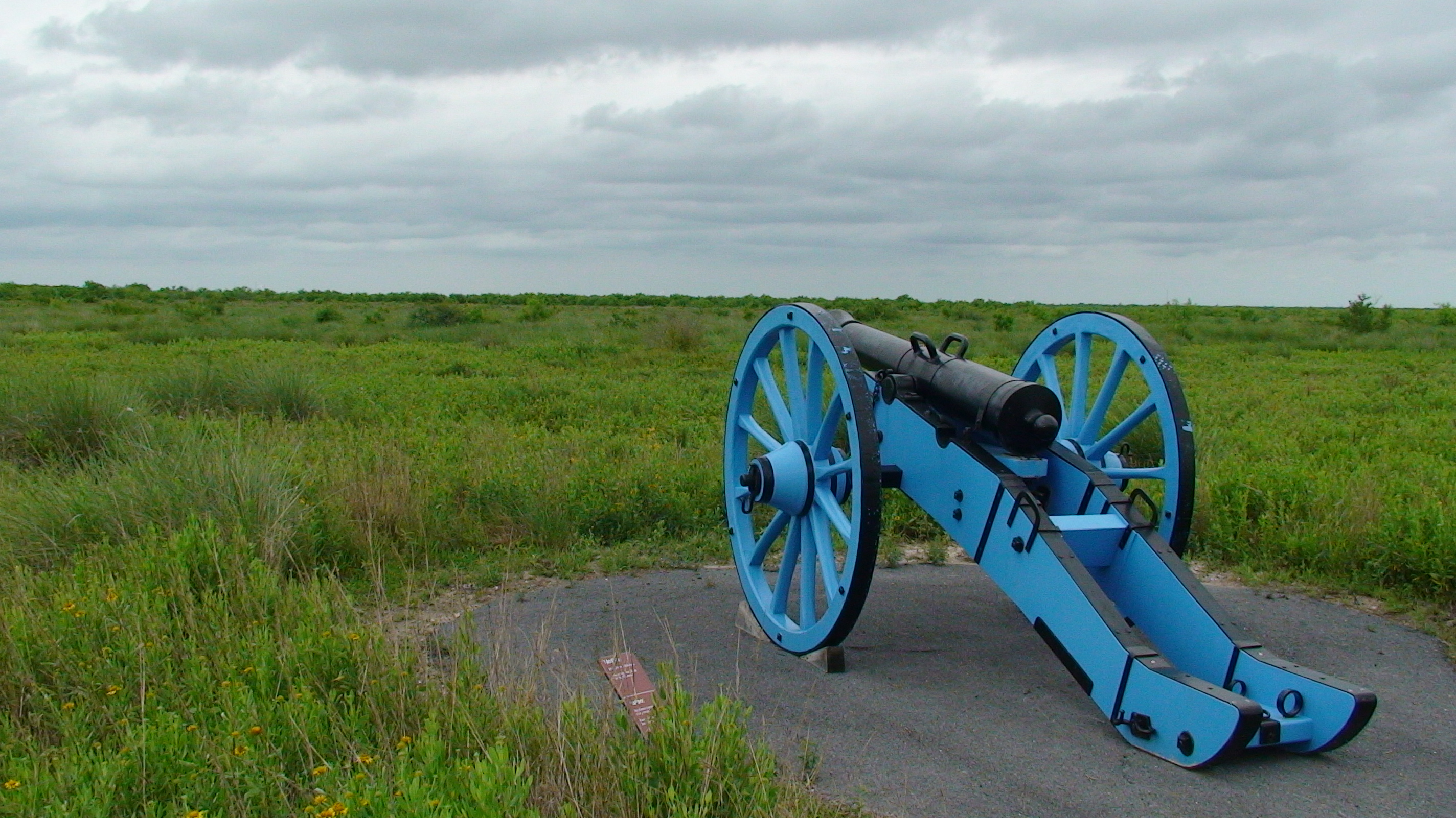
Photography: National Park Service · Public domain · Official Palo Alto Battlefield photo (NPS)
Quick trip facts
The experience
Palo Alto Battlefield National Historical Park preserves the prairie landscape where American and Mexican armies fought on May 8, 1846, during the first major battle of the U.S.–Mexican War. Understanding this landscape requires context: the United States' annexation of Texas, competing claims about the Nueces and Rio Grande boundaries, and military maneuvers along the river were central to the conflict. The park's NPS interpretation includes viewpoints from both nations, rather than treating the battlefield as a simple celebration of a single army.
Grounds typically open from 8 a.m. to 5 p.m. daily, but new trail access ends at 4:30 p.m. and all gates close at 5 p.m. The visitor center uses a different schedule, generally Tuesday through Saturday, 9 a.m.–4 p.m., and can close temporarily due to staffing. A Sunday stop may permit grounds access but not the exhibits or orientation film. Read current NPS hours before a long drive.
The visitor entrance is 7200 Paredes Line Road north of Brownsville, near Los Fresnos, not the federal office mailing address on Harrison Street. Within the visitor center, NPS provides artifacts, interpretive media and a short film about the war. A short or moderate battlefield walk offers a different educational experience from a museum-only stop, and requires sun and weather planning across an exposed coastal prairie.
The battlefield includes native habitat with grassland, mesquite and thorny vegetation. Visitors should stay on permitted routes and respect both sensitive flora and the site's historical resources. The NPS treats Palo Alto along with Resaca de la Palma Battlefield as part of the wider regional battle narrative; that does not mean both units share one parking entrance or the same open hours.
An informed visit asks why armies were present, what the first clash meant for local communities and how the eventual conflict changed both countries. Bring water and sturdy walking shoes, spend time with source-based exhibits, and allow for visitor-center timing before the afternoon trail cutoff. NPS identifies this as a free admission site, but other separately operated regional attractions may have their own fees.
The National Park Service recommends beginning at the visitor center for a park map and interpretive orientation. The 1846 battlefield's largely open terrain is a historical asset, but it also exposes visitors to South Texas heat, wind and changing weather.
A stronger visit compares Palo Alto's artillery-friendly prairie with the much brushier terrain at Resaca de la Palma, where fighting continued the next day. That comparison explains more about battlefield decisions than visiting either place without a map or military chronology.
Palo Alto cannot be interpreted without the disputed boundary between the Nueces River and the Rio Grande. After U.S. annexation, troops moved into territory contested by Mexico and the United States, making the May 1846 fighting part of an unresolved international political conflict rather than a routine defense of a settled border.
At Palo Alto the broad coastal prairie favored visibility and long-range artillery. Visitors can use the battlefield trail and NPS maps to imagine how U.S. and Mexican lines faced each other, how guns shaped the contest and why open ground made the engagement different from later fighting.
The next day’s battle at Resaca de la Palma occurred in brush and resaca terrain that reduced long-range sightlines and made close fighting more important. A two-battle itinerary therefore shows how a change of geography altered battlefield tactics within twenty-four hours.
Military history travelers should connect the battlefield with Brownsville’s Fort Brown area and Port Isabel, which formed part of the Gulf supply network. The open grassland remains environmentally exposed, so weather, hydration, trail status and visitor-center hours deserve as much advance attention as historic dates.
Palo Alto preserves the site of the May 8, 1846 U.S.–Mexican War battle on open coastal prairie. The National Park Service interprets both sides of the conflict and the unresolved Nueces-versus-Rio-Grande boundary issue. Start at the visitor center for maps and trail updates; weather, exposed paths and interpretive-program schedules matter more here than indoor museum-style amenities.
Resaca de la Palma is a distinct battlefield and landscape; do not combine the two battle locations into a single site. Port Isabel helps explain the Gulf supply route, while Palmito Ranch belongs to the Civil War almost two decades later.
The details
Evidence and citations
Read the original operator records and supporting research for this guide.
Different grounds and visitor center schedules
Physical entrance and safety times
1846 battle and interpretations
Practical questions
The visit
Texas context
Palo Alto Battlefield National Historical Park preserves the prairie landscape where American and Mexican armies fought on May 8, 1846, during the first major battle of the U.S.–Mexican War. Understanding this landscape requires context: th
Use the time you have
About 1–3 hours or as facilities allow
Half day
Full day, including travel
Key dates
A short chronology of dates that materially shaped this place. Each entry links to the source used for the date and historical context.
1845
Annexation makes the unresolved Nueces–Rio Grande border dispute an international military crisis.
Source: NPS — Palo Alto historyMay 8, 1846
U.S. and Mexican forces fight on open prairie; artillery and visibility shape the engagement.
Source: NPS — Palo Alto BattlefieldMay 9, 1846
The campaign shifts to brushier terrain near Brownsville, altering the tactical character of the fighting.
Source: NPS — Palo Alto historyBefore you go
Connected museum guides
Museum guides relevant to Brownsville and its surrounding history. Tickets, hours and travel arrangements are separate at each institution.
Port Isabel · Cameron County
Brownsville · Cameron County
Around the area
Palo Alto works best as the historical anchor for a lower Rio Grande day rather than a stand-alone stop. The most useful extensions continue the 1846 campaign into Brownsville, follow the supply line toward Port Isabel, or compare the same border corridor with the Civil War landscape at Palmito Ranch.
Easy additions that fit naturally around the main stop.
Brownsville
The second major battle of the U.S.–Mexican War was fought here on May 9, 1846, in brushier terrain that changed the tactical character of the campaign.
About 25 miles east
Use Port Isabel to understand the Gulf-side supply corridor Taylor's army depended on during the opening campaign.
East of Brownsville
Compare the 1846 border war with the final land battle of the Civil War, fought in the same strategic lower Rio Grande corridor.
Dining districts and food areas worth building into the same outing.
Short drive south
The downtown and central-city area is the simplest place to build a meal stop around a battlefield visit without turning the day into a second long drive.
East toward the coast
A practical dining direction when the battlefield is part of a coast-bound itinerary rather than a Brownsville-only day.
The most practical lodging areas for minimizing driving and maximizing time on the ground.
Closest base
Best for combining Palo Alto, Resaca de la Palma, Fort Brown history and other lower Rio Grande stops in one itinerary.
Coastal alternative
Better for travelers pairing military history with the coast and willing to drive back toward Brownsville for the battlefield sites.
Nearby parts of the city that add character, shopping, history or nightlife.
South of the battlefield
Historic civic blocks and the Fort Brown area add the urban side of the 1846 campaign and the city that grew beside the military post.
Near the Rio Grande
Use the former military-post area to connect the battlefield with the river crossing and the U.S. Army presence opposite Matamoros.
Good nearby additions when the itinerary includes younger travelers.
On site
Start indoors with orientation, then use the trail system to make troop positions and battlefield scale easier to understand.
About 25 miles east
A visually distinct historic stop that can break up a history-heavy day with a coastal landmark.
Places that justify extending the visit beyond the immediate area.
Read the full TexasDefined guide to annexation, the disputed border, Palo Alto, Resaca de la Palma and the Treaty of Guadalupe Hidalgo.
Place the 1846 fighting between the Republic of Texas and the frontier-Army era that followed.
Continue into Brownsville, Harlingen, the coast and the wider lower Rio Grande county.
Civil War landscape
Nearby coast and visitor base
Plan the route
Editorially paired stops near Palo Alto Battlefield National Historical Park appear first, followed by nearby destinations. Distances are approximate straight-line miles.
Brownsville · Cameron County · South Texas Plains
A World Birding Center site protecting resaca wetlands and subtropical woodland, with exceptional birding, wildlife viewing, walking, biking, and tram access.
Approx. 6 miles away
Brownsville · Cameron County · South Texas Plains
The Historic Brownsville Museum occupies the restored 1928 Southern Pacific Railroad Depot and interprets the founding and development of Brownsville through local-history exhibits, a rare 1872 Rio Grande Railroad locomotive and an adjoining education center.
Approx. 8 miles away
Brownsville · Cameron County · South Texas Plains
The Stillman House Museum preserves one of Brownsville's oldest surviving homes, a Greek Revival residence associated with city founder Charles Stillman and the Treviño family, with original architectural features, courtyards and interpretation of nineteenth-century borderland life.
Approx. 8 miles away
Brownsville · Cameron County · South Texas Plains
The Brownsville Heritage Museum uses photographs, maps, costumes, artifacts and interactive displays to trace Brownsville and the surrounding region from exploration and settlement through ranching, transportation, education and the first half of the twentieth century.
Approx. 8 miles away
San Benito · Cameron County · South Texas Plains
San Benito's Freddy Fender Museum celebrates hometown singer Baldemar Huerta—internationally known as Freddy Fender—through personal artifacts, instruments, awards, photographs and exhibits tracing his path across country, rock, Tejano and border music.
Approx. 12 miles away
San Benito · Cameron County · South Texas Plains
The Texas Conjunto Music Hall of Fame & Museum in San Benito preserves the people, instruments, recordings and dance-hall culture behind conjunto, the border-region sound built from Mexican musical traditions and European accordion influences.
Approx. 12 miles away
Texas Explained
Go beyond the destination with the systems, landscapes and history that explain why this part of Texas looks and works the way it does.
Continue exploring
Read next
Historic Sites
A practical Texas lighthouse guide comparing public access, climbs, viewing methods and trip logistics from Port Isabel to the Sabine gateway.
August 21, 2026 · About 12 minutes
Historic Sites
Missions, battlefields, courthouses and museums make more sense as a road map than a timeline. These are the places that turn state history back into geography.
August 7, 2026 · About 2 minutes