
Skip to content

Texas geology explained

Why Is the Texas Hill Country So Hilly?

The short answer: the Hill Country is a dissected limestone plateau margin shaped by faulting, river incision and groundwater dissolution — with the much older Llano Uplift interrupting the story in the center.

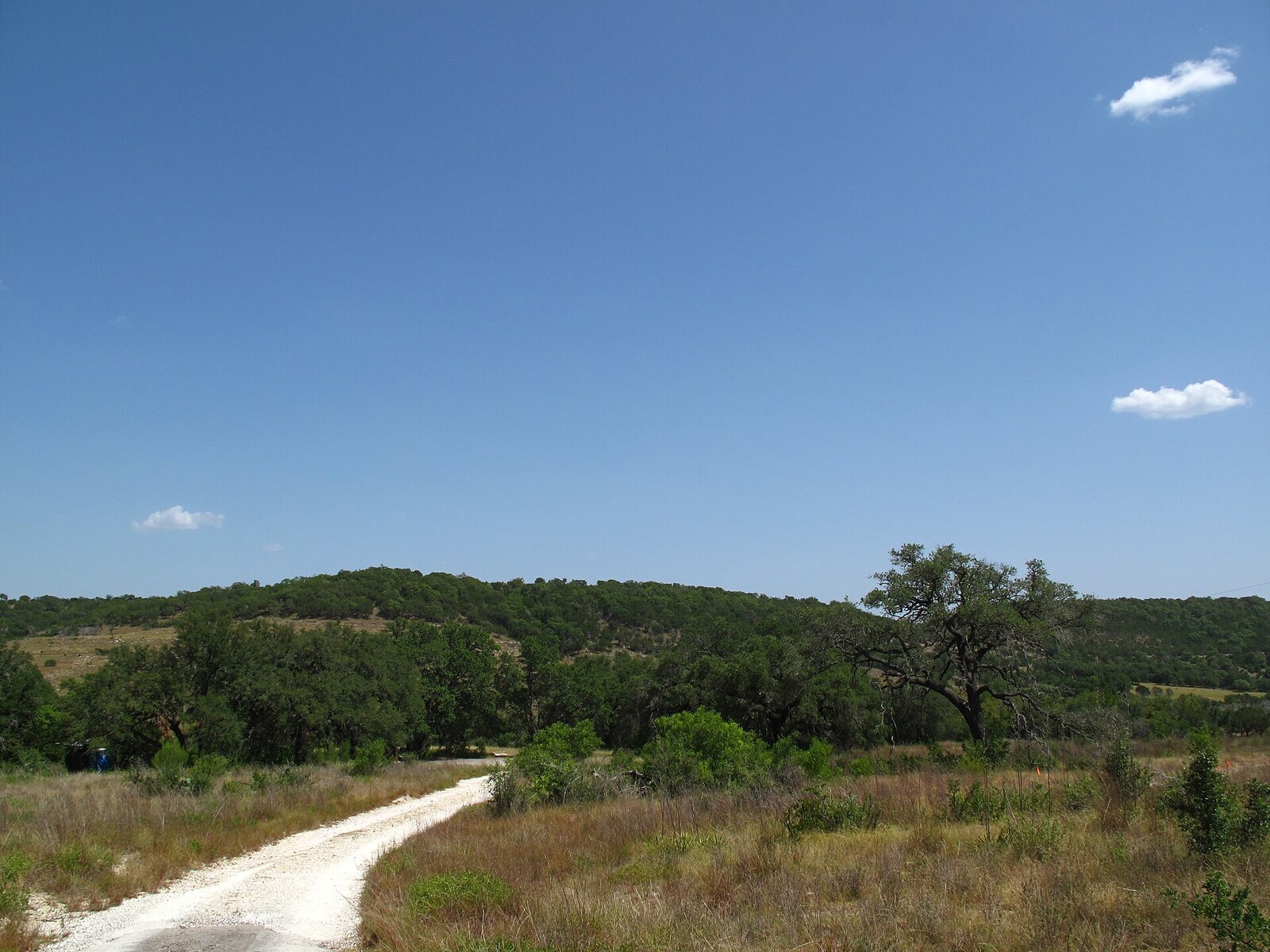
Texas Hill Country limestone landscape with rugged hills and river-cut terrain

Texas Defined archive image. The region’s familiar relief comes primarily from erosion of an elevated limestone surface, not from a young mountain chain.

How it formed

Four processes built the landscape Texans recognize

The hills are the visible result of a sequence: marine limestone first, structural deformation next, then prolonged river and groundwater erosion.

01

A shallow sea laid down the limestone

During the Cretaceous, warm shallow seas covered much of Central Texas. Carbonate mud, shells and reef material accumulated and hardened into thick limestone units. Those resistant layers became the bedrock platform later exposed across the Edwards Plateau and Hill Country.

02

The plateau margin fractured and shifted

Normal faulting along the Balcones system broke and displaced Cretaceous rocks near the eastern and southeastern plateau edge. The faults did not create every hill, but they established a major structural and elevation transition that later erosion could exploit.

03

Rivers cut down through the rock

The Guadalupe, Blanco, Pedernales, Llano, Frio, Nueces and their tributaries incised the elevated limestone. Valleys and canyons deepened while more resistant rock remained as ridges and uplands, turning a broad tableland into deeply dissected terrain.

04

Groundwater dissolved the limestone from within

Rainwater moving through joints, bedding planes and faults slowly dissolves limestone. That karst process enlarges fractures, creates caves and sink features, and connects aquifers and springs to the same landscape-building system visible at the surface.

Read the terrain

The plateau edge matters more than the word ‘mountains’

A simple cross section explains why the land gets so broken and steep along the eastern Hill Country.

Simplified cross section of the Texas Hill Country and Balcones marginA simplified west-to-east diagram showing the Edwards Plateau, river incision, faulted limestone along the Balcones zone and lower plains to the east.Edwards PlateauBalcones fault zoneLower plainsriver-cut valleyfractured limestonebroad limestone upland
Simplified, not to scale. The Hill Country is best understood as an eroded limestone plateau margin rather than a chain of folded mountains. Faulting helped establish the structural break; streams, groundwater and erosion did most of the sculpting afterward.

The important exception

The Llano Uplift is a different geologic world inside the Hill Country

The classic Hill Country story is dominated by Cretaceous limestone, but the central mineral region around Llano, Burnet and Gillespie counties exposes far older rocks. Texas Parks and Wildlife describes Precambrian igneous and metamorphic rocks here, including the granite landscapes associated with Enchanted Rock and the gneiss exposed around Inks Lake.

That is why a drive through the central Hill Country can move from pale limestone shelves and cedar-covered ridges into pink granite domes, coarse sandy soils and exposed crystalline rock. The visual change is geologic, not just scenic.

Why the water is so distinctive

Karst connects the caves, aquifers, springs and clear rivers

The same limestone that forms the hills also controls how water moves beneath them.

Fractures become plumbing

Faults, joints and bedding planes give rainwater pathways into the limestone. Dissolution enlarges those openings over time and creates highly permeable karst aquifers.

Aquifers feed springs

The Edwards (Balcones Fault Zone) Aquifer consists largely of partially dissolved limestone and feeds major springs including Comal and San Marcos. Spring discharge turns underground flow back into visible Hill Country water.

Surface valleys keep cutting

Once water reaches stream channels, gravity and flood events continue to deepen valleys and expose bedrock. The landscape above and drainage below are two expressions of the same rock-water relationship.

Why one Hill Country drive can look completely different from another

The terrain changes across three geologic settings

Most dissected

Eastern and southeastern Hill Country

Near Austin, San Marcos, New Braunfels and San Antonio, the plateau margin meets the Balcones fault-and-escarpment zone. Short, steep drainages and deeply cut limestone valleys make the relief feel especially abrupt.

Broader uplands

Plateau interior

Farther onto the Edwards Plateau, the surface is generally broader and less sharply dissected. River valleys can still be dramatic, but larger areas of rolling upland remain between them.

Older rocks

Llano Uplift / Central Mineral Region

Around Llano, Burnet, Mason and Enchanted Rock, granite, gneiss and other ancient rocks interrupt the limestone story. This is why parts of the central Hill Country look fundamentally different from the classic Edwards Plateau landscape.

Geologic timeline

From ancient basement rock to modern river valleys

  1. Precambrian: ancient igneous and metamorphic rocks now exposed in the Llano Uplift formed long before the limestone plateau.
  2. Cretaceous: shallow marine environments deposited thick carbonate units across Central Texas.
  3. Late Oligocene–early Miocene: extensional Balcones faulting fractured and displaced Cretaceous rock along the eastern Edwards Plateau margin.
  4. Ongoing erosion: rivers, floods, weathering and groundwater dissolution continue to deepen valleys and enlarge karst pathways today.

Common misconception

The Hill Country is not a miniature Rocky Mountains

The region can feel mountainous because local relief is strong, roads repeatedly climb and drop, and limestone canyons produce dramatic walls. But most of the terrain is better described as an elevated and deeply dissected plateau margin. That distinction explains both the broad uplands and the sudden steep valleys.

Explore the Edwards Plateau landscape →

Quick answers

Texas Hill Country geology FAQ

Short answers to the questions people ask most often about the region’s hills, faults, limestone and water.

Is the Texas Hill Country actually a mountain range?

Not in the usual sense. Most of the Hill Country is the deeply dissected eastern and southeastern margin of the Edwards Plateau. Local relief can feel mountainous because rivers have cut steep valleys and canyons into the limestone, but the regional landform is better described as an eroded plateau than a young folded mountain chain.

Did the Balcones Fault Zone create the Hill Country hills?

It helped set the stage, but it did not carve every hill. Normal faulting fractured and displaced Cretaceous rocks and created a major structural and elevation transition along the plateau margin. Rivers, floods, weathering and groundwater then exploited that relief and those fractures over millions of years.

Why are there so many caves, springs and clear rivers in the Hill Country?

Limestone dissolves slowly as slightly acidic groundwater moves through joints, bedding planes and faults. That karst process enlarges underground pathways, forms caves and sink features, stores and transmits groundwater, and feeds major springs. River clarity varies with flow and storms, but spring-fed systems are one of the region’s defining geologic signatures.

Why does Enchanted Rock look so different from the limestone Hill Country?

Enchanted Rock belongs to the Llano Uplift, where much older Precambrian igneous and metamorphic rocks are exposed inside the broader Hill Country region. That older crystalline terrain interrupts the younger Cretaceous limestone landscape found across much of the Edwards Plateau.

Is the eastern Hill Country hillier than the plateau farther west?

Generally, yes. The eastern and southeastern plateau margin is more deeply dissected, especially near the Balcones fault-and-escarpment zone. Farther onto the Edwards Plateau, broader uplands become more common between major river valleys.

Research desk

Sources, method and citation

This guide synthesizes physical-geography, aquifer and park-geology material from Texas public agencies and the U.S. Geological Survey. The diagram is interpretive and intentionally simplified; it is not a geologic map or survey cross section.

Experience this landscape through Texas travel regions

Natural landscapes and travel regions overlap but are not interchangeable. These related regional guides explain where the terrain shapes real visits, nearby attractions and seasonal planning.