Skip to content
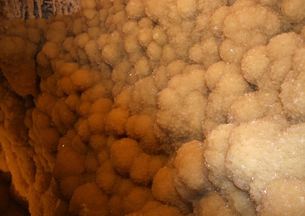
Dogtooth spar crystal formations inside the Caverns of Sonora near Sonora, Texas

Big Bend Country · Caverns & Caves

Caverns of Sonora

A highly decorated show cave 15 miles southwest of Sonora where intimate guided tours descend through crystal-rich limestone passages, dense speleothems and warm, humid rooms 155 feet below the surface.

Photography: DanielCD · CC BY-SA 3.0 / CC BY 2.5 · Wikimedia Commons

Quick trip facts

Caverns of Sonora at a glance

Where is Caverns of Sonora?
Caverns of Sonora is at 1711 PR 4468, Sonora, TX 76950, in Sutton County.
When is the best time to visit Caverns of Sonora?
Year-round; the cavern stays about 72°F with roughly 98% humidity
Do I need to plan ahead for Caverns of Sonora?
The Crystal Palace Tour lasts about 1 hour 45 minutes, descends 155 feet and includes roughly 360 stair steps. Specialty adventure and photography tours require advance booking.

The experience

What to know about Caverns of Sonora

Caverns of Sonora sits where the Hill Country gives way to the Chihuahuan Desert and is known less for enormous chambers than for the density and delicacy of its formations. Visitors move unusually close to active crystal features on a carefully managed guided route.

The standard Crystal Palace Tour covers nearly two miles of passage and reaches about 155 feet below the surface. A more demanding Discovery Challenge adds off-trail caving and rappelling, while specialty photography access is available by advance arrangement.

This is a warm cave rather than a chilly one: high humidity makes the roughly 72-degree air feel significantly warmer. Wear comfortable walking shoes, travel light because bags are restricted underground, and reserve specialty tours before making the drive.

The details

Planning your visit

Area
Sonora, Texas
Best season
Year-round; the cavern stays about 72°F with roughly 98% humidity
Address
1711 PR 4468, Sonora, TX 76950
Entry & reservations
The Crystal Palace Tour lasts about 1 hour 45 minutes, descends 155 feet and includes roughly 360 stair steps. Specialty adventure and photography tours require advance booking.

Plan the route

Explore related places

Editorially paired stops near Caverns of Sonora appear first, followed by nearby destinations. Distances are approximate straight-line miles.

  • Sonora · Sutton County

    Sonora

    Sonora is an I-10 Sutton County town at the meeting point of the Hill Country and West Texas, combining a historic courthouse and Main Street, Eaton Hill trails, ranching history and one of the state's most celebrated show caves just southwest of town.

    Best season: Fall through spring for Eaton Hill and downtown walking; the Caverns of Sonora stays warm and humid year-round and requires separate tour planningUpdated Sep 2026
    • Caverns of Sonora
    • Sutton County Courthouse
    • Eaton Hill Nature Center
    Explore this place

    Approx. 10 miles away

  • Approx. 45 miles away

  • Fort McKavett · Menard County

    Fort McKavett State Historic Site

    The remarkably preserved West Texas post interprets U.S. Army life and conflict on the 19th-century frontier, including the service of Buffalo Soldiers. Its surviving buildings and remote setting create one of Texas' clearest physical impressions of an Indian Wars-era military post.

    Best season: Year-round; spring and fall are usually the most comfortable for outdoor portions of a visit.Updated Aug 2026
    • Buffalo Soldiers
    • frontier forts
    • military history
    Explore this place

    Approx. 46 miles away

  • Rocksprings · Edwards County

    Rocksprings

    Rocksprings is an Edwards Plateau courthouse town best known as the required departure point for Devil's Sinkhole State Natural Area, where reservation-only tours lead to a National Natural Landmark cave and one of Texas' largest seasonal Mexican free-tailed bat colonies.

    Best season: Late spring through early fall for seasonal bat flights; fall through spring for quieter plateau drives and courthouse-town explorationUpdated Sep 2026
    • Devil's Sinkhole visitor center
    • seasonal bat flights
    • Edwards County Courthouse
    Explore this place

    Approx. 52 miles away

  • Sheffield · Crockett County · Big Bend Country

    Fort Lancaster State Historic Site

    Established in 1855, Fort Lancaster protected a strategic overland route linking San Antonio and El Paso across West Texas. The isolated ruins make the scale, distance and logistical difficulty of 19th-century travel across the Edwards Plateau immediately understandable.

    Best season: Year-round; spring and fall are usually the most comfortable for outdoor portions of a visit.Updated Aug 2026
    • frontier forts
    • San Antonio-El Paso road
    • West Texas
    Explore this place

    Approx. 53 miles away

  • Approx. 60 miles away

Read next

More from Caverns & Caves

Caverns & Caves

Texas Underground

The state’s limestone hides rooms, rivers and formations you would never guess were beneath the highway. A first-timer’s guide to seeing caves without turning them into a checklist.

August 7, 2026 · About 3 minutes