Skip to content
South Llano River State Park in Texas

Hill Country · Lakes & Rivers

South Llano River State Park

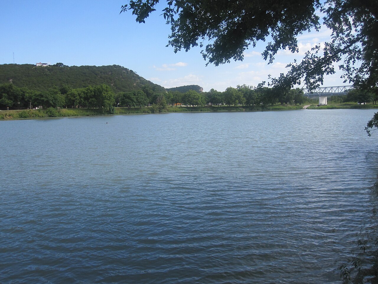
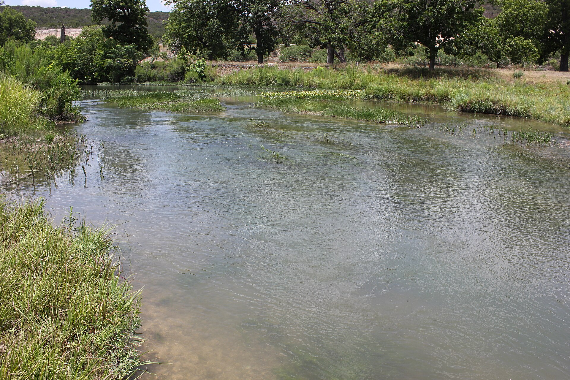
A clear-river Hill Country park near Junction where swimming, tubing, paddling, turkey habitat, pecan bottomlands and miles of trails come together along the spring-fed South Llano River.

Photography: Nicolas Henderson from Coppell, Texas · CC BY 2.0 · Wikimedia Commons

Quick trip facts

South Llano River State Park at a glance

Where is South Llano River State Park?
South Llano River State Park is near Junction, Texas, in Kimble County.
When is the best time to visit South Llano River State Park?
Spring and fall for trails and river weather; summer for swimming and tubing with heat precautions
Do I need to plan ahead for South Llano River State Park?
River conditions and parts of the turkey-roost area can change access. Check current park alerts before a float; the park has multiple tuber put-in and take-out points and rents tubes when operations allow.
Who manages South Llano River State Park?
Texas Parks and Wildlife Department

The experience

On the water at South Llano River State Park

South Llano River State Park combines one of the Hill Country's inviting rivers with unusually rich wildlife habitat.

The park's two miles of river frontage support swimming, floating and paddling, with multiple put-in and take-out points for tubers and tube rentals available through the park when operations allow.

Seasonal wildlife protections and river conditions can alter access, so check current alerts before building the day around a specific trail, launch or float.

The details

Planning your visit

Area
Junction, Texas
Best season
Spring and fall for trails and river weather; summer for swimming and tubing with heat precautions
Entry & reservations
River conditions and parts of the turkey-roost area can change access. Check current park alerts before a float; the park has multiple tuber put-in and take-out points and rents tubes when operations allow.

Texas State Parks · trip planning

Park entrances, facilities and visitor maps

Amenities can differ by park unit, campsite and season. The details below are park-specific where checked against TPWD. For changing hours, reservations, trail conditions and facility availability, use the park's official visitor resources.

Restrooms and showers
56 water/electric camps have nearby showers and restrooms. Six walk-in water-only campsites 30–70 yards from parking have chemical toilets plus shower restrooms nearby. Five hike-in primitive areas have composting toilets.
Parking, entrance and access
56 30-amp electric/water campsites #1–56; 6 walk-in water-only campsites require carrying gear 30–70 yards; 5 primitive hiking camps require at least 1.5 miles from the trailhead.
Camping, RV hookups and drinking water
56 water/30-amp-electric camps, 6 water-only walk-in sites, 5 primitive hike-in sites with composting toilets and NO ground fires. Check river/crossing restrictions before planning paddling.
Trails, parking and visitor maps
Official state-park map distinguishes river access, developed campground, walk-in camping and remote primitive hillside trails.
Access restrictions and current visitor rules
Primitive overnight areas are 1.5+ miles from parking and prohibit ground fires. TPWD lists nearby chemical toilets and shower restrooms at the 6 short walk-in camp sites.

Park-specific visitor facts checked 2026-10-12 against the TPWD source.

Explore Texas state parks

Plan the route

Explore related places

Editorially paired stops near South Llano River State Park appear first, followed by nearby destinations. Distances are approximate straight-line miles.

  • Junction · Kimble County · Hill Country

    Junction

    Junction is a Kimble County river town where the North and South Llano meet, combining a compact county-seat core with paddling, tubing, fishing, birding, dark skies, Lovers Leap overlooks and South Llano River State Park just south of town.

    Best season: Spring through early fall for river recreation; fall through spring for hiking, birding, dark skies and cooler scenic drivesUpdated Sep 2026
    • South Llano River
    • North Llano River
    • South Llano River State Park
    Explore this place

    Approx. 4 miles away

  • Fort McKavett · Menard County · Hill Country

    Fort McKavett State Historic Site

    The remarkably preserved West Texas post interprets U.S. Army life and conflict on the 19th-century frontier, including the service of Buffalo Soldiers. Its surviving buildings and remote setting create one of Texas' clearest physical impressions of an Indian Wars-era military post.

    Best season: Year-round; spring and fall are usually the most comfortable for outdoor portions of a visit.Updated Aug 2026
    • Buffalo Soldiers
    • frontier forts
    • military history
    Explore this place

    Approx. 32 miles away

  • Menard · Menard County · Hill Country

    Menard

    Menard is a San Saba River town on the northern Edwards Plateau where frontier-era history, a restored Art Deco courthouse, the historic irrigation ditch, river parks, fishing and a quiet ranch-country landscape support a low-key Texas heritage stop.

    Best season: Fall through spring for historic walking, river parks and ranch-country drives; warm months for fishing and paddling with heat and river conditions checkedUpdated Sep 2026
    • San Saba River
    • Menard County Courthouse
    • Historic Ditch Walk
    Explore this place

    Approx. 33 miles away

  • Hunt · Kerr County · Hill Country

    Kerr Wildlife Management Area

    Kerr WMA near Hunt is a 6,459-acre Hill Country research and demonstration landscape known for long-running white-tailed deer studies, habitat-management education and a self-guided driving and birding route.

    Best season: Fall through spring for comfortable driving, birding and wildlife viewing; spring adds Hill Country wildflowers and nesting birds.Updated Sep 2026
    • White-tailed deer research
    • Four-mile educational driving tour
    • Guadalupe River frontage
    Explore this place

    Approx. 33 miles away

  • Rocksprings · Edwards County · Hill Country

    Rocksprings

    Rocksprings is an Edwards Plateau courthouse town best known as the required departure point for Devil's Sinkhole State Natural Area, where reservation-only tours lead to a National Natural Landmark cave and one of Texas' largest seasonal Mexican free-tailed bat colonies.

    Best season: Late spring through early fall for seasonal bat flights; fall through spring for quieter plateau drives and courthouse-town explorationUpdated Sep 2026
    • Devil's Sinkhole visitor center
    • seasonal bat flights
    • Edwards County Courthouse
    Explore this place

    Approx. 38 miles away

  • Mason · Mason County · Hill Country

    Mason

    Mason is a western Hill Country courthouse town where restored civic architecture, Fort Mason history, German-Texan roots, nearby river country and wide-open dark skies create a quieter heritage-and-outdoors alternative to busier regional destinations.

    Best season: Fall through spring for walking, scenic driving and outdoor history; summer works best with morning activities and evening stargazing rather than long exposed midday stopsUpdated Sep 2026
    • Mason County Courthouse
    • Fort Mason history
    • historic square
    Explore this place

    Approx. 40 miles away

Read next

More from Lakes & Rivers