Comstock · Val Verde County · Big Bend Country
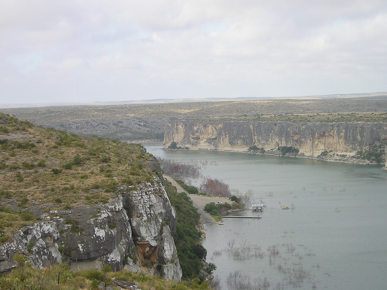
Seminole Canyon State Park & Historic Site
Lower Pecos canyon landscapes with hiking, camping, scenic overlooks, and guided access to ancient rock art in Fate Bell Shelter.
- History
- Hiking
- Camping
Big Bend Country · Lakes & Rivers
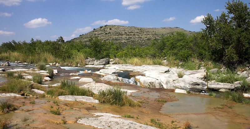
A remote, exceptionally clear spring-fed river natural area in Southwest Texas with two reservation-only units—Del Norte and Dan A. Hughes—protecting rugged limestone canyon country and primitive backcountry access.
Photography: Clinton & Charles Robertson · CC BY-SA 2.0 · Wikimedia Commons · Original, not modified · CC BY-SA license and credit terms
Quick trip facts
The experience
Devils River State Natural Area protects one of Texas' clearest and least-developed river corridors, but it is not a single trailhead or campground. TPWD currently operates the Del Norte Unit and Dan A. Hughes Unit as separate reservation-only destinations.
The river attracts paddlers and anglers, while both units offer primitive backcountry experiences in exposed limestone and desert terrain. Extended river trips have additional access-permit requirements designed to control use and protect the river corridor.
Study the exact unit, road, check-in time and permit requirements before leaving Del Rio. Cell service is unreliable, summer heat is dangerous and an older 'Big Satan Unit' name in legacy data refers to property now identified by TPWD as the Dan A. Hughes Unit.
The details
Texas State Parks · trip planning
Amenities can differ by park unit, campsite and season. The details below are park-specific where checked against TPWD. For changing hours, reservations, trail conditions and facility availability, use the park's official visitor resources.
Park-specific visitor facts checked 2026-10-12 against the TPWD source.
Plan the route
Editorially paired stops near Devils River State Natural Area appear first, followed by nearby destinations. Distances are approximate straight-line miles.
Comstock · Val Verde County · Big Bend Country
Lower Pecos canyon landscapes with hiking, camping, scenic overlooks, and guided access to ancient rock art in Fate Bell Shelter.
Approx. 25 miles away
Del Rio · Val Verde County · Big Bend Country
A vast reservoir for boating, fishing, paddling, camping, and desert scenery.
Approx. 32 miles away
Brackettville · Kinney County · Big Bend Country
A remote park with guided cavern tours, seasonal bat flights, rugged trails, birding, mountain biking, and primitive camping.
Approx. 39 miles away
Del Rio · Val Verde County
Del Rio's 1929 Southern Pacific Passenger Depot is a Spanish Mediterranean Revival landmark that still anchors the city's rail and regional-transportation story. Its February 2, 2026 National Register listing recognizes the depot's railroad-era architecture and its role in southwest Texas commerce, travel and wartime mobility.
Approx. 39 miles away
Del Rio · Val Verde County · Big Bend Country
Del Rio's Whitehead Memorial Museum is a multi-building pioneer-village museum preserving Val Verde County history through historic structures, regional artifacts, borderlands culture, irrigation history and community exhibits spread across more than two acres.
Approx. 40 miles away
Rocksprings · Edwards County
Rocksprings is an Edwards Plateau courthouse town best known as the required departure point for Devil's Sinkhole State Natural Area, where reservation-only tours lead to a National Natural Landmark cave and one of Texas' largest seasonal Mexican free-tailed bat colonies.
Approx. 47 miles away
Texas Explained
Go beyond the destination with the systems, landscapes and history that explain why this part of Texas looks and works the way it does.
Continue exploring
Read next
Lakes & Rivers
Plan a responsible visit to the 196-mile federally protected Rio Grande corridor, from Big Bend canyon views to remote multi-day floats, with NPS permit, border and safety guidance.
October 17, 2026 · About 4 minutes
Lakes & Rivers
An evidence-led West Texas Pecos River guide from the New Mexico line through remote desert country to the Rio Grande and Amistad, with realistic access expectations, conservation and historical places.
October 12, 2026 · About 5 minutes
Lakes & Rivers
Compare the North and South Llano branches, Junction and South Llano River State Park with the main Llano near Mason, Llano and Kingsland; plan verified fishing, paddling and overnight visits.
October 12, 2026 · About 5 minutes