Skip to content

South Texas Border · Weekend trips

Weekend Trips From Laredo, Texas

Overnight-worthy towns, parks, water, caves, coast and history that can anchor a one- or two-night escape from the metro.

Source-backed options30

Distance window45–230 straight-line miles

OrderingGeographic distance

Straight-line distances are screening estimates from central Laredo. They are not road miles or drive-time promises. Use the “Check current drive” links in the map and guide sections below for current Google Maps routing, road mileage and travel-time estimates.

Plan around the calendar

Upcoming events in these weekend destinations

These events are limited to towns represented by the weekend-trip destinations on this page.

View all Texas events →

Map & routes

Find it on the map and compare routes

Easy day-trip range

1 full TexasDefined guide in this geographic band

About 67 geographic miles

Falcon Heights

Falcon Heights · Starr County

Falcon State Park

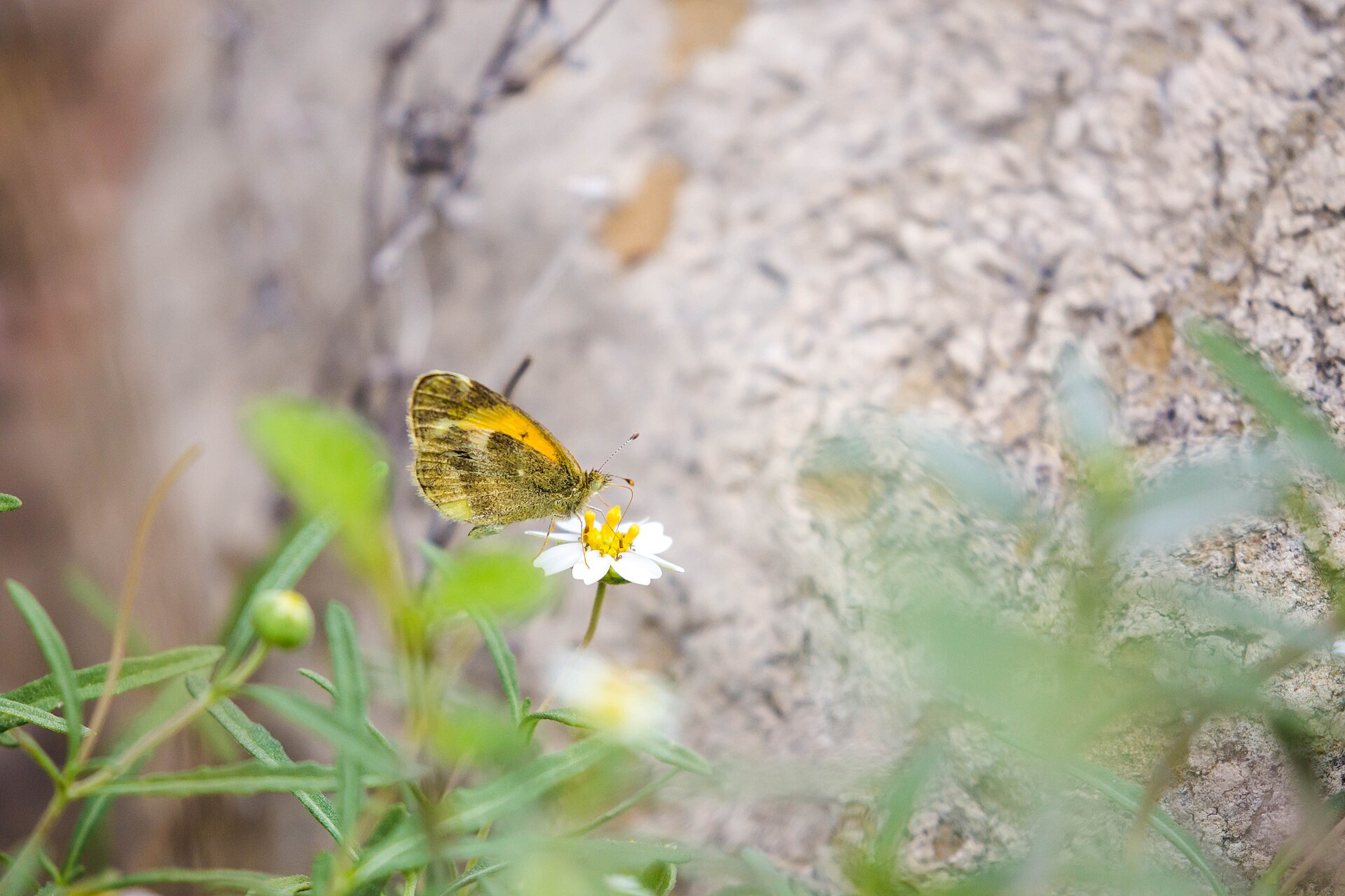
Falcon State Park on Falcon International Reservoir in South Texas pairs lake fishing and camping with dry-brush birding, butterfly habitat and the history of the Rio Grande dam near Roma.

Best season: Fall and winter for milder weather and brush-country birding; fishing and camping require attention to current heat and lake levels year-round.Updated Oct 2026
  • Falcon International Reservoir fishing and boat access
  • Dry-brush birding and tropical South Texas species
  • Camping, cabins and screened shelters
Explore this place
Check current drive from Laredo ↗

Longer day trip

29 full TexasDefined guides in this geographic band

About 83 geographic miles

Crystal City

Crystal City · Zavala County

My Story Museum

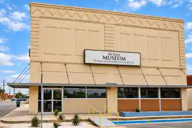
My Story Museum is Crystal City's first permanent local-history museum, preserving Zavala County stories through exhibits on the 1969 student walkouts and Chicano movement, the Crystal City Family Internment Camp, and local military veterans.

Updated Oct 2026
  • 1969 Crystal City student walkouts and Chicano movement
  • Crystal City Family Internment Camp and its WWII confinement history
  • Zavala County veterans and community memory
Explore this place
Check current drive from Laredo ↗

About 97 geographic miles

Three Rivers

Three Rivers · McMullen County

Choke Canyon State Park

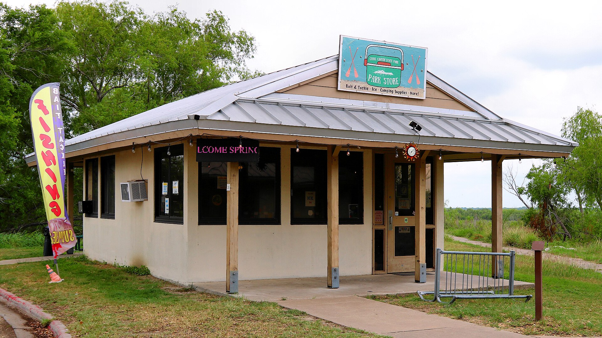
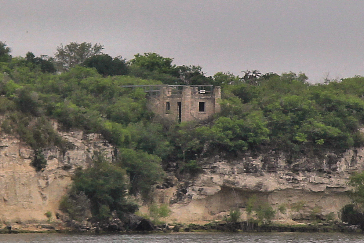
A South Texas reservoir state park with two separate public units: full-service Calliham for camping and broader park facilities, and day-use South Shore for boating, fishing and birding.

Best season: Fall through spring for birding, camping and comfortable shore time; fishing remains popular year-roundUpdated Sep 2026
  • Calliham Unit camping, cabins and recreation
  • South Shore day-use fishing, boating and birding
  • Choke Canyon Reservoir fishing
Explore this place
Check current drive from Laredo ↗

About 107 geographic miles

Mathis

Mathis · San Patricio County

Lake Corpus Christi State Park

A South Texas reservoir park near Mathis with fishing, boating, swimming and a landmark CCC-built stone pavilion overlooking Lake Corpus Christi.

Best season: Fall through spring for camping and fishing; summer for water recreation with heat precautions
  • CCC-built stone pavilion
  • Lake Corpus Christi fishing
  • Boating and paddling
Explore this place
Check current drive from Laredo ↗

About 114 geographic miles

Mission

Mission · Hidalgo County

Bentsen-Rio Grande Valley State Park

The World Birding Center headquarters near Mission, protecting Lower Rio Grande Valley resaca, woodland and thornscrub habitat with exceptional birding, car-free trails and wildlife viewing.

Best season: September through April is the park's busy season; fall through spring generally brings milder weather and strong migration and birding.Updated Sep 2026
  • World Birding Center headquarters
  • About 360 recorded bird species
  • Hawk Observation Tower and migration viewing
Explore this place
Check current drive from Laredo ↗

About 117 geographic miles

Edinburg

Edinburg · Hidalgo County

Museum of South Texas History

Museum of South Texas History in Edinburg preserves and interprets the borderland heritage of South Texas and northeastern Mexico through archaeology, ranching, river commerce, railroads, agriculture, military history and Rio Grande Valley community life.

Updated Sep 2026
  • Rio Grande Legacy permanent exhibition
  • 1910 Hidalgo County Jail historic core
  • South Texas and northeastern Mexico borderland history
Explore this place
Check current drive from Laredo ↗

About 124 geographic miles

Hidalgo

Hidalgo · Hidalgo County

Old Hidalgo Pumphouse Museum and World Birding Center

Explore a preserved 1909 Rio Grande irrigation pumping station in Hidalgo, where historic machinery explains the agricultural transformation of the Lower Valley and riverside trails add birding, butterfly gardens and a different kind of local history outing.

Updated Oct 2026
  • Original irrigation-era pumping machinery and the story of the 1909 installation
  • Why the Rio Grande's course and canal engineering shaped Valley farming
  • World Birding Center grounds, butterfly habitat and a trails-focused outdoor visit
Explore this place
Check current drive from Laredo ↗

About 130 geographic miles

Alamo

Alamo · Hidalgo County

Santa Ana National Wildlife Refuge

A compact but exceptionally diverse Lower Rio Grande Valley refuge along the Rio Grande, protecting subtropical forest, wetlands and thornscrub used by tropical birds and migrants.

Best season: Fall through spring for birding and mild weatherUpdated Sep 2026
  • Lower Rio Grande forest
  • Tropical bird species
  • Wetlands and butterflies
Explore this place
Check current drive from Laredo ↗

About 130 geographic miles

Alamo

Alamo · Hidalgo County

Lower Rio Grande Valley National Wildlife Refuge

Lower Rio Grande Valley National Wildlife Refuge protects a distributed wildlife corridor across deep South Texas, reconnecting thornscrub, resaca, river and brush habitats used by migratory birds and rare borderland species.

Best season: Fall through spring for cooler temperatures, migration and peak birding activity.Updated Sep 2026
  • Lower Rio Grande wildlife corridor
  • Nearly 40,000 acres of public-use lands
  • Birding and wildlife photography
Explore this place
Check current drive from Laredo ↗

About 131 geographic miles

Corpus Christi

Corpus Christi · Nueces County

McGee Beach

A downtown Corpus Christi Bay beach on Shoreline Boulevard within walking distance of the marina, hotels, museums and convention-center district.

Best season: March through May and September through November for milder beach weather; summer is busiest and hottestUpdated Sep 2026
  • Protected-bay beach
  • Mustang Island & Corpus Christi Bay setting
  • Corpus Christi access
Explore this place
Check current drive from Laredo ↗

About 131 geographic miles

Corpus Christi

Corpus Christi · Nueces County

Corpus Christi Museum of Science and History

The Corpus Christi Museum of Science and History combines South Texas cultural history, coastal ecology, archaeology and hands-on science in the city's S.E.A. District near the harbor.

Updated Aug 2026
  • Science and South Texas history
  • Coastal ecology
  • Archaeology
Explore this place
Check current drive from Laredo ↗

About 131 geographic miles

Corpus Christi

Corpus Christi · Nueces County

Cole Park Beach

The Corpus Christi Bay waterfront at Cole Park, best understood as a major city park and bayfront promenade with shoreline access rather than a formal open-Gulf beach.

Best season: Fall through spring for comfortable exploring and birding; summer requires more heat, storm and insect planningUpdated Sep 2026
  • Coastal shoreline and habitat area
  • Mustang Island & Corpus Christi Bay setting
  • Corpus Christi access
Explore this place
Check current drive from Laredo ↗

About 131 geographic miles

Corpus Christi

Corpus Christi · Nueces County

Art Museum of South Texas

The Art Museum of South Texas overlooks Corpus Christi Bay with collections and changing exhibitions emphasizing art of the Americas, Texas and the region inside landmark buildings associated with architects Philip Johnson and Ricardo Legorreta.

Updated Aug 2026
  • Art of Texas and the Americas
  • Corpus Christi Bayfront
  • Philip Johnson and Ricardo Legorreta architecture
Explore this place
Check current drive from Laredo ↗

About 131 geographic miles

Corpus Christi

Corpus Christi · Nueces County

Texas State Aquarium

A major Gulf Coast aquarium in Corpus Christi focused on marine life, coastal habitats and wildlife conservation, with indoor galleries, large tanks and family exhibits on North Beach.

Updated Aug 2026
  • Gulf of Mexico marine life
  • Large aquatic habitats
  • Wildlife presentations
Explore this place
Check current drive from Laredo ↗

About 131 geographic miles

Corpus Christi

Corpus Christi · Nueces County

USS Lexington Museum

The World War II Essex-class aircraft carrier USS Lexington (CV-16), preserved on Corpus Christi's North Beach as a National Historic Landmark and aviation museum.

Updated Oct 2026
  • World War II aircraft carrier
  • Flight deck aircraft
  • Wheelchair-accessible hangar and flight decks with LEX LIFT
Explore this place
Check current drive from Laredo ↗

About 132 geographic miles

Corpus Christi

Corpus Christi · Kleberg County

Yarborough Pass

A remote primitive camping and small-boat access area on the Laguna Madre side of Padre Island National Seashore, reached from South Beach by a high-clearance four-wheel-drive route.

Best season: October through May for milder weather; summer works for beach days with heat, storms and surf conditions checked closelyUpdated Sep 2026
  • Coastal shoreline and habitat area
  • Padre Island & South Texas setting
  • Corpus Christi access
Explore this place
Check current drive from Laredo ↗

About 134 geographic miles

Castroville

Castroville · Medina County

Castroville

Castroville is a Medina River town west of San Antonio where Alsatian settlement history, preserved nineteenth-century architecture, a large historic district, Landmark Inn and riverfront parks create one of Texas's most distinctive European-heritage small-town visits.

Best season: Fall through spring for historic walking and riverfront trails; warm months for park and pool recreation with heat planningUpdated Sep 2026
  • Castroville Historic District
  • Alsatian heritage
  • Landmark Inn
Explore this place
Check current drive from Laredo ↗

About 134 geographic miles

Castroville

Castroville · Medina County

Landmark Inn State Historic Site

The 19th-century complex served travelers and residents as a tavern, store, hotel and mill along the Medina River. An overnight stay can turn a historic-site visit into part of the experience while introducing Castroville's distinctive Alsatian heritage.

Best season: Year-round; spring and fall are usually the most comfortable for outdoor portions of a visit.Updated Oct 2026
  • historic lodging
  • Castroville
  • Alsatian Texas
Explore this place
Check current drive from Laredo ↗

About 134 geographic miles

Corpus Christi

Corpus Christi · Nueces County

Oso Bay Coast & Wetlands Preserve

The shallow Oso Bay shoreline and wetland system on Corpus Christi's south side, important for habitat, birding, nature education and paddling rather than conventional beach swimming.

Best season: Fall through spring for comfortable exploring and birding; summer requires more heat, storm and insect planningUpdated Sep 2026
  • Coastal shoreline and habitat area
  • Mustang Island & Corpus Christi Bay setting
  • Corpus Christi access
Explore this place
Check current drive from Laredo ↗

About 135 geographic miles

Weslaco

Weslaco · Hidalgo County

Estero Llano Grande State Park

A Rio Grande Valley birding and wildlife sanctuary near Weslaco with accessible wetland viewing decks, trail loops, Indigo Nature Blind, all-terrain wheelchairs and alligator habitat.

Best season: Winter migration and cooler months reward birders; spring can bring migrating birds and butterflies, while summer afternoons are hot and humid.Updated Oct 2026
  • World Birding Center wetland, woodland and tropical-zone habitats
  • More than five miles of trails and accessible viewing decks
  • Green Jay and Spoonbill accessible trail options with weather caveats
Explore this place
Check current drive from Laredo ↗

About 135 geographic miles

Corpus Christi

Corpus Christi · Nueces County

Padre Island National Seashore Backcountry / South Beach

The long undeveloped South Beach and down-island Gulf shoreline of Padre Island National Seashore, where remote beach driving, primitive camping and exceptional barrier-island solitude replace developed amenities.

Best season: October through May for milder weather; summer works for beach days with heat, storms and surf conditions checked closelyUpdated Sep 2026
  • National-seashore coastline
  • Padre Island & South Texas setting
  • Corpus Christi access
Explore this place
Check current drive from Laredo ↗

About 135 geographic miles

Corpus Christi

Corpus Christi · Nueces County

Padre Island National Seashore

Visit the federally protected North Padre Island shoreline south of Corpus Christi with NPS rules for Malaquite and other beaches, changing surf and rip currents, sand-driving limits and distinct camping areas.

Best season: Fall through spring for mild beach weather and birding; summer brings heat, humidity and storm risk but also seasonal sea-turtle activity, so conditions should guide every visitUpdated Oct 2026
  • Malaquite Visitor Center beach access and Gulf scenery
  • Long barrier-island habitat and coastal wildlife
  • North and South Beach vehicle access subject to sand conditions
Explore this place
Check current drive from Laredo ↗

About 136 geographic miles

Corpus Christi

Corpus Christi · Nueces County

Malaquite Beach

The vehicle-free beach beside Malaquite Visitor Center in Padre Island National Seashore, offering a quieter developed access point with parking, restrooms and showers.

Best season: October through May for milder weather; summer works for beach days with heat, storms and surf conditions checked closelyUpdated Sep 2026
  • National-seashore coastline
  • Padre Island & South Texas setting
  • Corpus Christi access
Explore this place
Check current drive from Laredo ↗

About 140 geographic miles

Corpus Christi

Corpus Christi · Nueces County

Whitecap Beach

A North Padre Island Gulf beach at the end of Whitecap Boulevard with both pedestrian-only shoreline and vehicle-access areas near the Corpus Christi beach corridor.

Best season: October through May for milder weather; summer works for beach days with heat, storms and surf conditions checked closelyUpdated Sep 2026
  • Open-Gulf beach
  • Padre Island & South Texas setting
  • Corpus Christi access
Explore this place
Check current drive from Laredo ↗

About 141 geographic miles

San Antonio

San Antonio · Bexar County

Mission Espada

The oldest mission enterprise in Texas by founding date, Espada moved to San Antonio in 1731; its church, textile history and nearby aqueduct reveal a settlement built around irrigation and labor.

Best season: Visit in cooler months or earlier in the day; the aqueduct and grounds are outdoors.Updated Oct 2026
  • Founded in East Texas in 1690
  • Current church completed in 1756
  • Historic loom interpretation
Explore this place
Check current drive from Laredo ↗

About 141 geographic miles

San Antonio

San Antonio · Bexar County

Mission San Juan Capistrano

Mission San Juan's surviving church and acequia-fed demonstration farm reveal the agricultural, Indigenous and living-community story behind San Antonio's colonial mission system.

Best season: Fall and spring are most comfortable for a farm and river landscape walk.Updated Oct 2026
  • Active mission church
  • Historic acequia
  • Modern demonstration farm
Explore this place
Check current drive from Laredo ↗

About 143 geographic miles

San Antonio

San Antonio · Bexar County

Mission San José

San José, the largest Spanish colonial mission complex in San Antonio, is the National Park Service orientation hub, with a church, granary, former residential quarters, gristmill and Rose Window.

Best season: Fall through spring for walking the extensive compound; summer visits are most pleasant in the morning.Updated Nov 2026
  • Park visitor center
  • Rose Window
  • Operational gristmill interpretation
Explore this place
Check current drive from Laredo ↗

About 143 geographic miles

San Antonio

San Antonio · Bexar County

San Antonio Missions National Historical Park

Visit the four National Park Service Spanish colonial mission sites along San Antonio's Mission Reach, understanding active parish access and the separate status of the Alamo within the five-mission UNESCO World Heritage area.

Best season: Fall through spring for comfortable walking and biking; summer visits are best early in the day with shade and water built into the routeUpdated Oct 2026
  • Four NPS missions: Concepción, San José, San Juan and Espada
  • Active Catholic parishes with services that affect church access
  • Mission Reach trail linking river corridors and mission sites
Explore this place
Check current drive from Laredo ↗

About 143 geographic miles

Port Aransas

Port Aransas · Nueces County

Mustang Island State Park

A Gulf Coast barrier-island park near Corpus Christi with miles of beach, paddling trails, surf fishing, birding and primitive or developed camping close to the water.

Best season: Fall through spring for mild weather and birding; summer for beach use with heat precautionsUpdated Sep 2026
  • Gulf beach
  • Mustang Island paddling trail
  • Surf fishing
Explore this place
Check current drive from Laredo ↗

About 144 geographic miles

Harlingen

Harlingen · Cameron County

Iwo Jima Museum and Monument

The monument and museum commemorate the Marines associated with the famous flag-raising on Mount Suribachi during the 1945 Battle of Iwo Jima. The site links the Rio Grande Valley to one of World War II's most recognizable images and to the military training history of South Texas.

Updated Aug 2026
  • World War II
  • U.S. Marines
  • Rio Grande Valley
Explore this place
Check current drive from Laredo ↗

Before you go

Use geography as a shortlist, then check the real route.

TexasDefined uses location data to make the statewide catalog easier to search. Open the current driving route for the places you are considering, then verify opening hours, reservations, park alerts, water conditions and weather with the current official source.