
Texas Panhandle · Randall County · Geography and history
Tierra Blanca Creek: the waterway behind the canyon country near Amarillo
The High Plains appear almost level until a drainage cuts into them. Tierra Blanca Creek helps explain that surprise. It flows toward Canyon, meets Palo Duro Creek, and contributes to the river system that carved the Panhandle's best-known canyon.
By TexasDefined's Travel & Outdoors Desk · Geography, access and museum closure sources checked November 16, 2026 · Research method
Start here
Is Tierra Blanca Creek the same place as Palo Duro Canyon?
No. Tierra Blanca is an upstream watercourse, not an alternate name for Palo Duro Canyon State Park. The Texas State Historical Association traces the creek from eastern New Mexico through Deaf Smith and Randall counties to a junction with Palo Duro Creek east of Canyon. That meeting forms the Prairie Dog Town Fork of the Red River. The waterway continues into Palo Duro Canyon.
The distinction matters for a visitor. A creek on a geographic map does not establish a trailhead, parking lot or right of entry. Large stretches of rural Panhandle creek land are privately held. For legitimate, managed outings, use Buffalo Lake National Wildlife Refuge west of Canyon or the separately operated Palo Duro Canyon State Park east of Canyon.
Geography without invented access
Find the real public entrances—and see where the creek belongs
Tierra Blanca Creek rises in New Mexico's Curry County, enters Texas in Deaf Smith County, then crosses Randall County toward the Palo Duro Creek confluence northeast of Canyon. The Texas State Historical Association describes an approximately 75-mile east-northeast reach through Texas. Buffalo Lake refuge is on the upper creek; the red cliffs in the state park are farther downstream along the Prairie Dog Town Fork of the Red River.
Map shown at regional scale. The single marker identifies the USFWS-published Buffalo Lake refuge entrance, not a creek-bank trailhead, archaeological site or continuous public waterway route. OpenStreetMap is a geographic reference, not an authoritative boundary or safe-navigation source. Check agency maps at each entrance.
Reliable geographic orientation, even without third-party map tiles
West: Buffalo Lake refuge entrance (USFWS: 34.919517, -102.111118). East: Palo Duro Canyon park headquarters (TPWD: 34.984709, -101.701867). These are two officially published public facilities, not creek-bank access points. Only their relative positions are drawn; no road, trail or stream course is inferred.
Why not plot the entire creek as a driving or hiking route? Its course crosses multiple property boundaries and a mapped watercourse does not provide a lawful right of entry. Nor do historical descriptions of arrowhead finds authorize artifact collecting. We intentionally omit private access points and sensitive archaeological coordinates.
What the upper drainage actually looks like
The grassland and old lakebed are part of the story, not a second Palo Duro

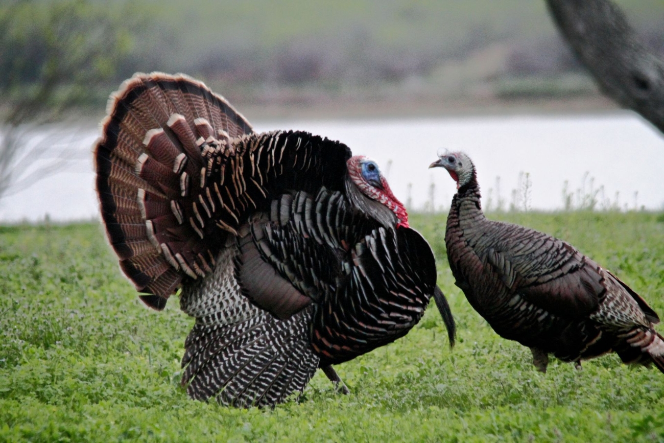
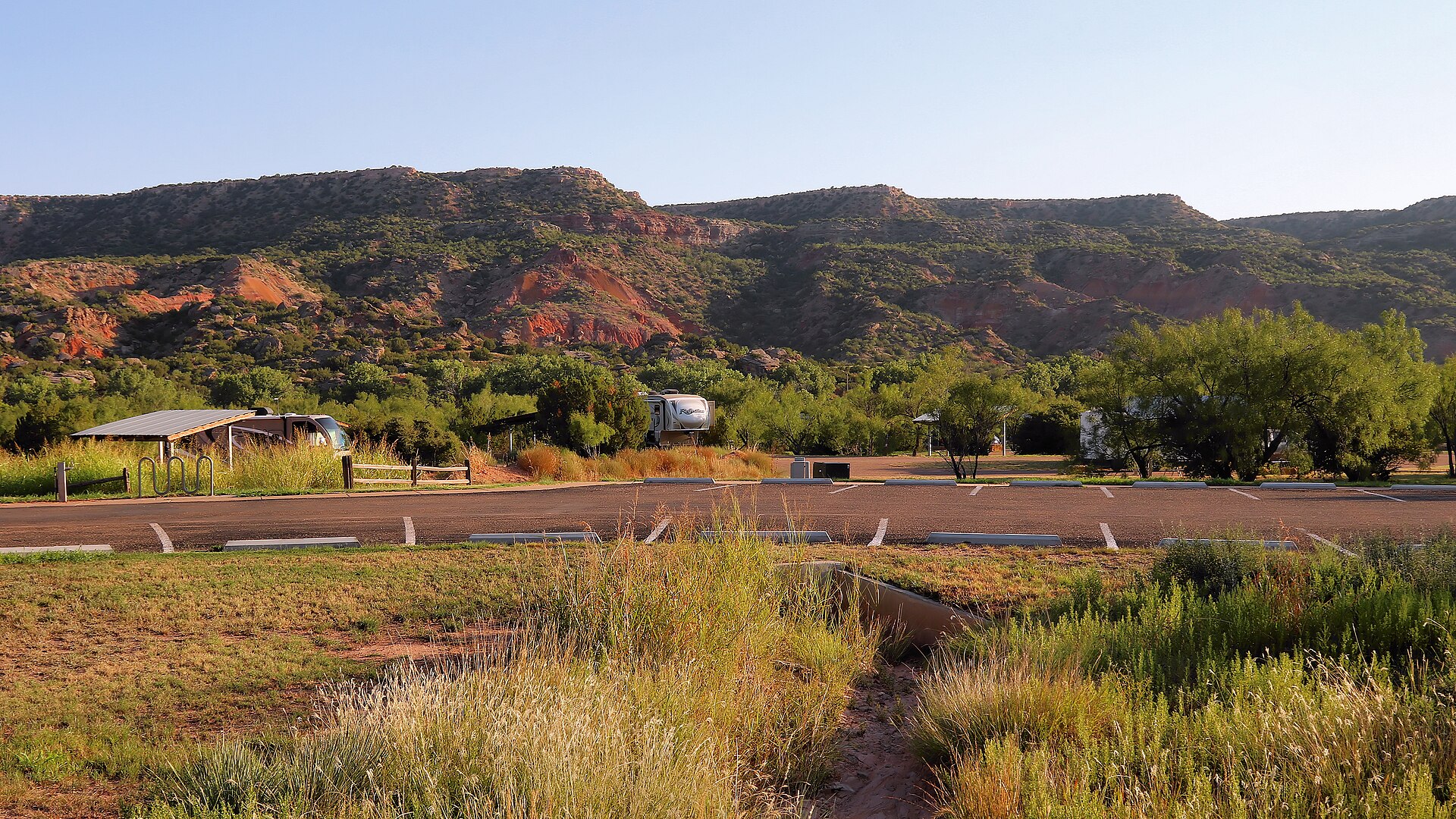
The photographs above document the refuge; neither is represented as an exact creek channel or an archaeological discovery location. The 1965 Tierra Blanca flood is also documented in a named historic photograph held by UNT's Portal to Texas History. We link rather than reproduce that archive image because its reuse rights require separate review.
Actually useful trip choices
Which public walk fits your group?
USFWS has four named walks on the refuge. The trail descriptions and shorter trail-card distances on its own webpage are not completely consistent, so the lengths below are the descriptive values printed by FWS rather than verified GPS distances. Check entrance signs and the official trail page before committing to a route.
| Public trail | FWS description | Start | Who should choose it? |
|---|---|---|---|
| Prairie Dog Trail | 0.25 mile (description); Easy; crushed caliche | FM 168 Prairie Dog Town parking area | Best short wildlife stop. FWS describes its surface as ADA-compliant; confirm current conditions. |
| Cottonwood Canyon Birding Trail | 1 mile (description); Moderate; natural dirt and grass | Parking below the Overlook; north trail | Old lakebed, cottonwoods and birding; uneven terrain on upper section. |
| Cottonwood Hiking Trail | 1.25 miles (description); Moderate; natural surface | Parking below the Overlook; south trail | Old lakebed, cottonwoods; optional connection to Grassland Loop. |
| Grassland Loop | 2 miles (description); Challenging; uneven dirt and caliche | Overlook | Higher prairie terrain and caprock; not a good accessible-surface substitute. |
Access note: The FWS descriptive entry calls the Prairie Dog Trail ADA-compliant; other trails are described as natural and uneven. That does not guarantee every parking surface, restroom or trail segment meets an individual visitor's access needs today. For up-to-date mobility accommodations and trail conditions, call the refuge at (806) 499-3382.
No false drive-time promise
Build the Amarillo–Umbarger–Canyon outing around what is open
From Amarillo
USFWS places Umbarger roughly 30 miles southwest of Amarillo. Approach via the U.S. 60 corridor and check current road conditions. The refuge entrance road is 1.5 miles south of Umbarger on FM 168; its administrative address is listed 3 miles south, so use the published entrance coordinates rather than guessing from the address alone.
From Canyon
Umbarger is about 10 miles west of Canyon along U.S. 60, per USFWS. The Panhandle-Plains Historical Museum building in Canyon has been closed to visitors since March 2025 for fire/life-safety repairs; do not plan it as a walk-in attraction. Check the museum's official closure and traveling-exhibition updates for current off-site programs. Public historical markers in Canyon are an alternative.
Palo Duro on a separate leg
Use TPWD's signed state-park approach east of Canyon, rather than treating the refuge as a connecting trail. Reserve a separate morning for major canyon hikes and check park alerts, daytime heat and weather closures.
For the refuge, FWS lists $2 per vehicle per day for entry and $2 per vehicle per day for designated primitive camping. Campground vault restrooms are available, but primitive camping has no water, sewer or electricity. Refuge trails and the auto-tour road are listed as open 8 a.m.–8 p.m. April–September and 8 a.m.–6 p.m. October–March. These are agency-posted details, not TexasDefined guarantees; verify on the day of travel.
For an accessible short outing, ask FWS about current Prairie Dog Trail access. For the dramatic red cliffs, choose the state park instead. For a true creek-bank experience, no general public trail along Tierra Blanca Creek is documented here: do not cross fences or stop on private ranch roads.
How the terrain works
Where flat farmland becomes broken canyon country
Much of the Llano Estacado is a broad, high, gently sloping surface. Streams reveal the relief that disappears across a distant horizon: cutbanks, local escarpments and branching valleys. The TSHA describes Tierra Blanca's upper course in flat-to-rolling country with local escarpments, followed by shallow depressions and changing soils. This is not the same exposed rock corridor at every point along its course.
Water and erosion connect the visual extremes. Tierra Blanca and Palo Duro creeks converge near the old T Anchor Ranch headquarters area; downstream the Prairie Dog Town Fork exposes deeper geological layers in Palo Duro Canyon. The rust, ocher and pale rock bands that visitors photograph at the state park are the visible result of different sediments and long periods of erosion, not evidence that all the creek's banks look like the Lighthouse formation.
Buffalo Lake, near Umbarger, is an impoundment on Tierra Blanca Creek. The U.S. Fish and Wildlife Service dates the conservation project to 1937 and Umbarger Dam to 1938. Springs and the creek's reliable flow declined in the 1970s as agricultural and urban groundwater use increased. FWS now describes the lake as typically dry, recharged mainly by major storm runoff. Plan around the refuge's birds, grasslands, marked trails and designated public viewing areas, not an expectation of swimming or boating.
Human history
Water, Indigenous histories and what an arrow point does—and doesn't—tell us
Waterways shaped travel, wildlife movement and human life on the Southern High Plains long before the ranching period. Evidence from documented archaeological sites across the Texas Panhandle includes stone projectile points and tools, pottery and settlement features. The Antelope Creek phase, chiefly dated about A.D. 1200–1500, refers to a regional Plains Village archaeological tradition; it is not another name for Tierra Blanca Creek, and its better-studied core is along the Canadian River/Lake Meredith drainage.
People may describe finding arrowheads along a creek. Such accounts alone cannot establish the age, cultural affiliation or exact provenience of an artifact. A projectile point could be a hunting implement from a different period than a nearby dwelling or another find. The context in which an object is found matters as much as its appearance. This article does not identify unrecorded artifact concentrations or provide coordinates to archaeological sites.
The Tierra Blanca archaeological complex is real—but it is not a trail of collectible arrowheads
Archaeologists also use Tierra Blanca complex for a protohistoric group of sites in the upper Red River headwaters of the Texas Panhandle, broadly dated to about A.D. 1450–1650. The name comes from archaeological investigations in this region, not from a modern attraction or a single legally accessible creek bank. Research describes camps and some village contexts associated with mobile bison hunting, stone tools and pottery indicating interaction with Rio Grande Pueblo communities. The finds are evidence of different human lives along the waterways, not a guarantee that a visitor will see artifacts on a marked public trail.
Researchers have proposed connections between some Tierra Blanca complex sites and Apachean-speaking groups, including Querechos in early Spanish accounts, but linking archaeological materials to a present-day people is interpretive rather than an automatically established identity. The earlier Antelope Creek phase (approximately A.D. 1200–1500) has its strongest documented concentration farther north along the Canadian River and Lake Meredith; it should not be substituted for Tierra Blanca complex in a creek-specific account. These distinctions draw on Texas Beyond History's interpretation and the published Southwest–Plains research.
The later ranching landscape is also tied to water. The XIT Ranch's Escarbada Division was associated with Tierra Blanca Creek; the old T Anchor Ranch headquarters stood near the creek junction. Those ranch-era histories can be interpreted in the Canyon area without suggesting a public path onto working ranch property.
If you find an artifact
Do not dig, move or collect archaeological objects in a state park, national wildlife refuge or other protected public place. The Texas Historical Commission explains that public-land artifact collecting generally requires a professional antiquities permit. Private-property rights differ, but landowner permission does not justify damage or trespass. Leave the object undisturbed, avoid sharing precise location coordinates publicly, and contact the appropriate land manager or THC archaeology staff for advice.
Texas Historical Commission: archaeology and landowner questionsArt history without mythmaking
What Georgia O'Keeffe actually painted here
Georgia O'Keeffe taught in Canyon in the 1910s and made works based on Palo Duro Canyon. The Georgia O'Keeffe Museum catalogs an Untitled (Palo Duro Canyon) drawing from 1916–1917; the New Mexico Museum of Art holds Palo Duro Canyon (Special No. 21), also dated 1916–1917. Those museum records substantiate the area's artistic significance without relying on an unattributed quotation.
Neither record proves that O'Keeffe made a particular sketch on a Tierra Blanca creek bank. The association is geographic and cultural: Canyon and the wider Palo Duro landscape inspired her, while Tierra Blanca helps explain the upstream drainage. Readers wanting the paintings should use museum collection records rather than mislabeled commercial copies.
Visit without trespassing
Three genuine, different visitor options
Upper creek setting
Buffalo Lake National Wildlife Refuge
South of Umbarger on FM 168, roughly 10 miles west of Canyon. Public auto tour, signed trails and refuge-managed viewing areas. Current FWS listing: $2 per vehicle day entry; refuge trails and auto-tour road open 8 a.m.–8 p.m. April–September and 8 a.m.–6 p.m. October–March. Carry water and follow no-collecting, no-drone and no-swimming rules.
Official access, fee and seasonal hoursMuseum and town context
Canyon, Texas
Visit Canyon's outdoor historic markers and other public sites for local ranching and community history. Do not plan a walk-in museum visit: Panhandle-Plains Historical Museum at West Texas A&M has been closed to the public since March 2025 due to fire and life-safety concerns. The museum continues some off-site educational programs. Public landmarks do not grant access to adjacent private creek properties.
Randall County and Canyon guideOfficial museum closure and off-site program updatesDownstream rock scenery
Palo Duro Canyon State Park
East of Canyon, with managed overlook access, trails and campsites. TPWD currently lists $8 per adult day entry, children 12 and under free; reservations are strongly recommended and trails may close for heat or weather.
TexasDefined state park guideImportant: this is a geographic and historical guide, not a claim that Tierra Blanca Creek has an established continuous public trail, kayak route, fishing access, swimming hole or open archaeological site. The creek's course crosses different properties; seek permission where required. Conditions and fees can change after the source-review date.
Build a realistic Panhandle route
Amarillo and Canyon road trips that tell the whole story
The right trip depends on whether you want the upper creek's grassland ecology, the county's museums and ranching context, or the state's most spectacular downstream canyon scenery. These are separate outings. No drive-time promise is made because weather, park access and traffic vary.
See the upper creek landscape at a public refuge
Drive southwest from Amarillo toward Umbarger and use the established entrance to Buffalo Lake National Wildlife Refuge, off FM 168 about 1.5 miles south of Umbarger. From its designated roads, overlook and marked trails, study the grassland-to-drainage transition. The impoundment is not a promise of a full lake: levels and surface water vary. The refuge's Cottonwood Canyon and Grassland Loop trails are different from Palo Duro's cliff trails.
Check refuge hours before leavingCanyon's history, then the state park
Begin in Canyon for the regional-history context, then take State Highway 217 east to the official Palo Duro Canyon State Park entrance on Park Road 5. The park's developed trails and overlooks show the dramatic downstream canyon landscape. It is not a public trail following Tierra Blanca Creek from the town of Canyon, and the two locations should never be presented as interchangeable.
Check Palo Duro maps, access and alertsAmarillo, Canyon and the creek's two very different faces
Give the first day to Canyon's public historical markers and western High Plains setting, with Buffalo Lake refuge as the public-access creek stop. The Panhandle-Plains Historical Museum building remains closed to walk-in visitors; check its official updates for off-site programs. Keep a separate morning for Palo Duro Canyon so heat, daylight and trail choice do not get squeezed by road time. Route 66 sights can fill a flexible final afternoon; they are not physically on Tierra Blanca Creek.
Compare Amarillo road-trip choicesPractical questions
What travelers often get wrong
- Can I walk to the creek from Palo Duro Canyon State Park?
- Not by assuming that its mapped state-park trails follow Tierra Blanca Creek. That creek meets Palo Duro Creek upstream of the named canyon stretch. Use TPWD's signed trails and property boundaries for the state park; do not invent a trail connection.
- Is Buffalo Lake full of water?
- Usually not. FWS says the once-impounded lake is typically dry and receives water during major flood events. The refuge emphasizes birding, habitat, auto touring, hiking and established facilities; swimming and wading are prohibited. Do not plan a boating or swimming trip from the name.
- Is Tierra Blanca the same as the Canadian River Breaks?
- No. The Canadian River valley toward Canadian and Lake Meredith is a different drainage system farther north. Both help explain why the Texas Panhandle is not uniformly flat, but one cannot be used as directions to the other.
- Where should I go if I want the red cliff photographs?
- Choose Palo Duro Canyon State Park, using TPWD's current park map and access guidance. Buffalo Lake refuge shows another face of the High Plains; it is not a guaranteed substitute for Palo Duro's monumental rock formations.
- Where is the easiest short walk along the upper drainage?
- Start with Buffalo Lake refuge's Prairie Dog Trail near FM 168, which USFWS describes as an easy crushed-caliche walk. Ask about current surface accessibility before leaving; the Cottonwood and Grassland trails are longer and more uneven.
- Are there restrooms, campsites or safe places to swim?
- The refuge lists vault toilets and designated primitive camping, without water, sewer or electricity hookups. Swimming and wading are prohibited. The refuge and the state park have different rules, access hours and fees.
- Can I collect arrowheads or artifacts found beside the creek?
- Do not collect or disturb cultural features in a national refuge or a state park. Additional creek banks are privately owned. Report suspected archaeological discoveries to the relevant land manager or Texas Historical Commission without publishing precise site locations.
Continue exploring the Amarillo–Canyon region
This research is published by the TexasDefined editorial desk. Read our publisher information, editorial policy and source methodology. No on-the-ground visit or privately accessed archaeological site is claimed.
Editorial verification
Primary sources and what each supports
How this guide was researched: TexasDefined's Travel & Outdoors Desk compared TSHA watercourse records with federal wildlife refuge access and trail documents, TPWD state-park information, archaeological research, museum catalogs and identified historic photography. We noted discrepancies in FWS trail descriptive lengths versus its summary-card measurements instead of silently selecting a single value. This is desk research, not a claim of first-hand travel, field photography or an archaeological survey. Historical creek imagery is linked rather than republished without rights review. The FWS images reproduced here have official public-domain records.
Research, access and substantive content reviewed November 16, 2026. Short-lived visitor details receive an additional monthly source-check workflow; longer-lived heritage material receives quarterly checks. An unchanged HTTP response never automatically advances an editorial review date. Confirm fees, closures, weather and access directly with the land manager before departing.
- Texas State Historical Association — Tierra Blanca Creek
Course, confluence, settlements, reservoirs and the creek's High Plains setting
- U.S. Fish & Wildlife Service — Buffalo Lake NWR visitor information
Public access, trails, seasonal hours, fees and directions near Umbarger
- U.S. Fish & Wildlife Service — Buffalo Lake detailed trail descriptions
Trail names, descriptive lengths, summary-card discrepancies, natural surfaces and mobility notes
- U.S. Fish & Wildlife Service — Buffalo Lake activities
Primitive camping, toilets and wildlife activities
- U.S. Fish & Wildlife Service — Buffalo Lake winter photograph and license
Actual winter refuge scenery, Christena Stephens; media record explicitly marked public domain
- U.S. Fish & Wildlife Service — Buffalo Lake turkeys photograph and license
Documented refuge wildlife photo credited Robert Burton/USFWS, public domain
- UNT Portal to Texas History — Tierra Blanca flood in 1965
Named primary-source creek flood photo; linked rather than republished without reuse permission
- U.S. Fish & Wildlife Service — Buffalo Lake refuge history
1937 water-conservation project, 1938 dam, 1970s creek drying, typically dry modern refuge
- U.S. Fish & Wildlife Service — Refuge rules
No collecting, access boundaries, wildlife and trail protections
- Panhandle-Plains Historical Museum — temporary closure and outreach
Closed building, current visitor restrictions and alternatives through traveling exhibitions and off-site programs
- Texas Parks & Wildlife — Palo Duro Canyon State Park
Park access, activities, warnings and reservations
- Texas Parks & Wildlife — Palo Duro Canyon maps and directions
Public park entrance, road approach and boundaries
- Texas Historical Commission — Archeology FAQ
Artifact protections, private land and reporting finds
- Texas Beyond History — Protohistoric Panhandle cultures
Tierra Blanca archaeological complex and its distinction from Antelope Creek; affiliation hypotheses remain tentative
- University of Arizona Press — Panhandle–Pueblo interactions
Published research on Tierra Blanca complex, Pueblo trade connections and 15th–17th-century interpretation
- Texas State Historical Association — Antelope Creek phase
Regional Panhandle archaeology; NOT evidence for a particular Tierra Blanca creek bank
- Georgia O'Keeffe Museum — Untitled (Palo Duro Canyon), 1916–1917
Documented artwork and subject, without assuming a Tierra Blanca painting site
- New Mexico Museum of Art — Palo Duro Canyon (Special No. 21)
Museum-held Palo Duro Canyon painting, 1916–1917