Skip to content

Texas Panhandle · Road trips

Road Trips From Amarillo, Texas

Route anchors for scenic drives and multi-stop Texas trips, emphasizing towns, parks, water, history and dedicated road-trip destinations.

Source-backed options18

Distance window25–220 straight-line miles

OrderingGeographic distance

Straight-line distances are screening estimates from central Amarillo. They are not road miles or drive-time promises. Use the “Check current drive” links in the map and guide sections below for current Google Maps routing, road mileage and travel-time estimates.

A different side of the Panhandle

Tierra Blanca Creek: Canyon country before the canyon

Not every Amarillo-area canyon outing is a hike down the Lighthouse Trail. Tierra Blanca Creek crosses the High Plains near Umbarger and Canyon before joining Palo Duro Creek east of town. Explore its ranching, archaeology and drainage history, then decide between the established public trails at Buffalo Lake National Wildlife Refuge and the separate Palo Duro Canyon State Park. Much of the creek corridor is private; do not assume riverbank access.

Map & routes

Find it on the map and compare routes

Close to the metro

2 full TexasDefined guides in this geographic band

About 26 geographic miles

Fritch

Fritch · Potter County

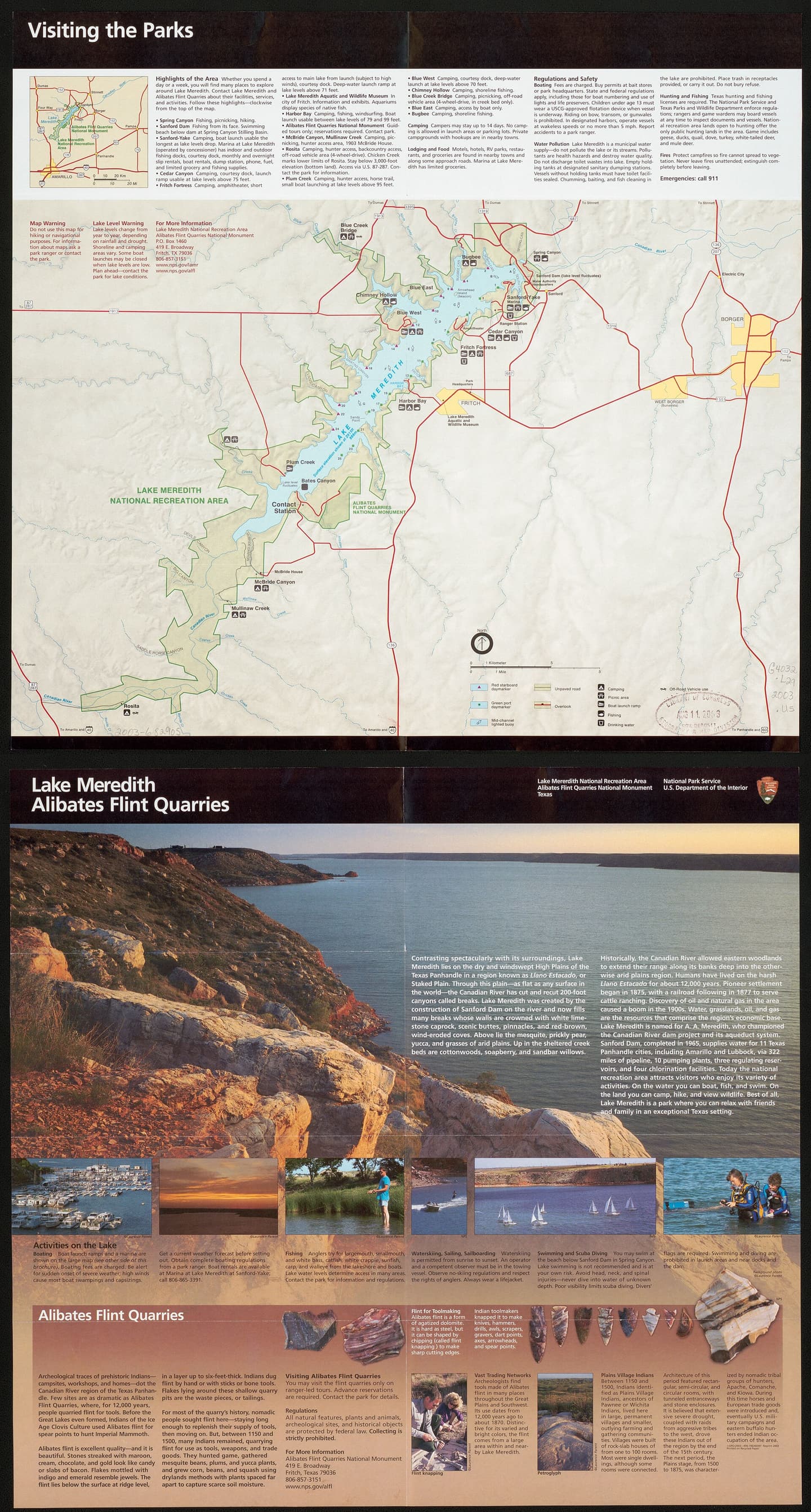
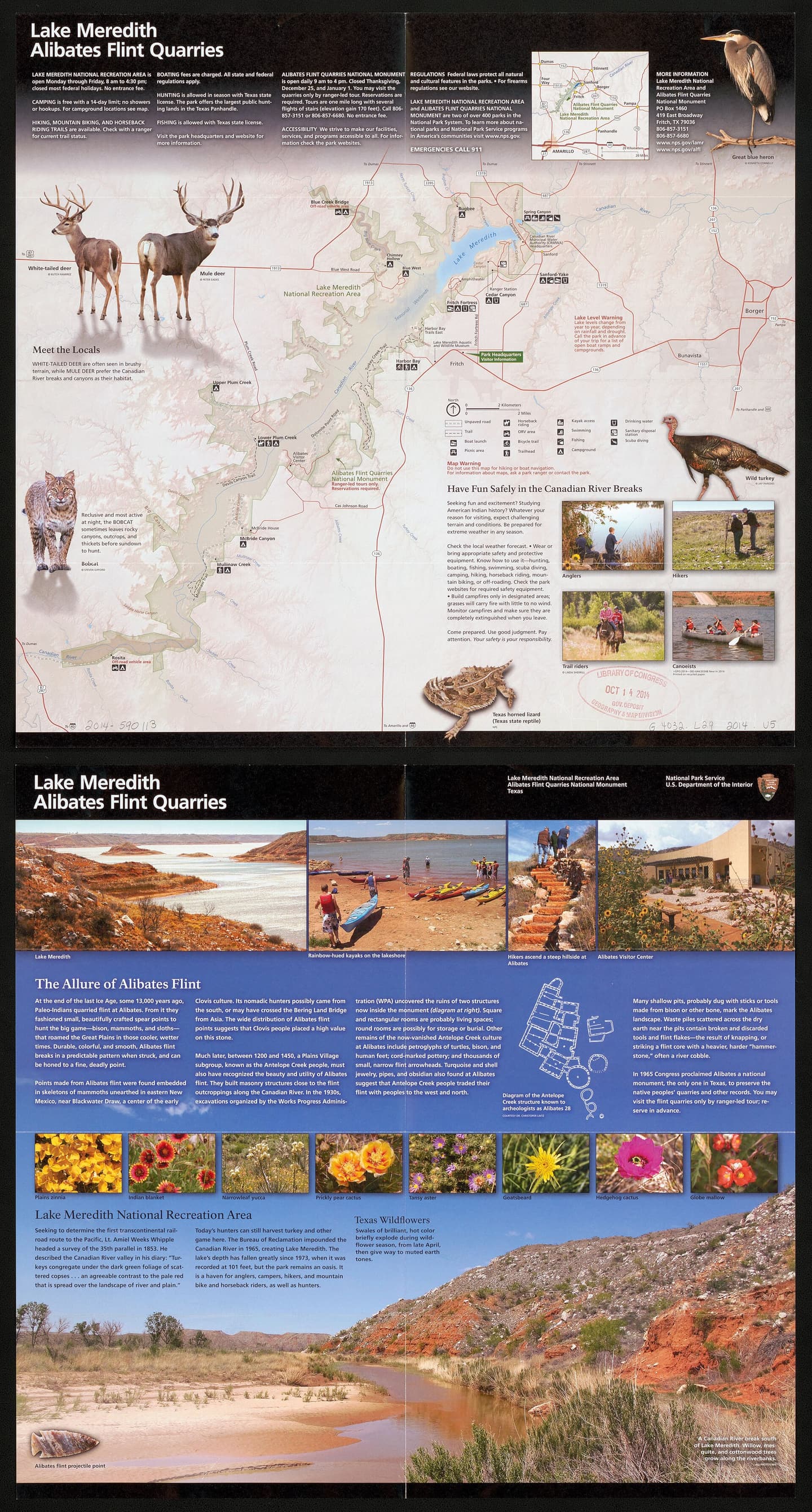
Alibates Flint Quarries National Monument

See the ancient flint quarry landscape of the Texas Panhandle on a reservation-only ranger-guided outing, with a challenging two-mile hike, geology and Indigenous craftsmanship interpreted by the National Park Service.

Best season: April through October for the main ranger-program season; shoulder months can be cooler for outdoor walksUpdated Oct 2026
  • Ancient multicolored Alibates flint source in the Canadian River region
  • Reservation-only NPS quarry tour and two-mile challenging hike
  • Visitor-center exhibits about Indigenous quarry use and geology
Explore this place
Check current drive from Amarillo ↗

About 29 geographic miles

Fritch

Fritch · Hutchinson County

Lake Meredith National Recreation Area

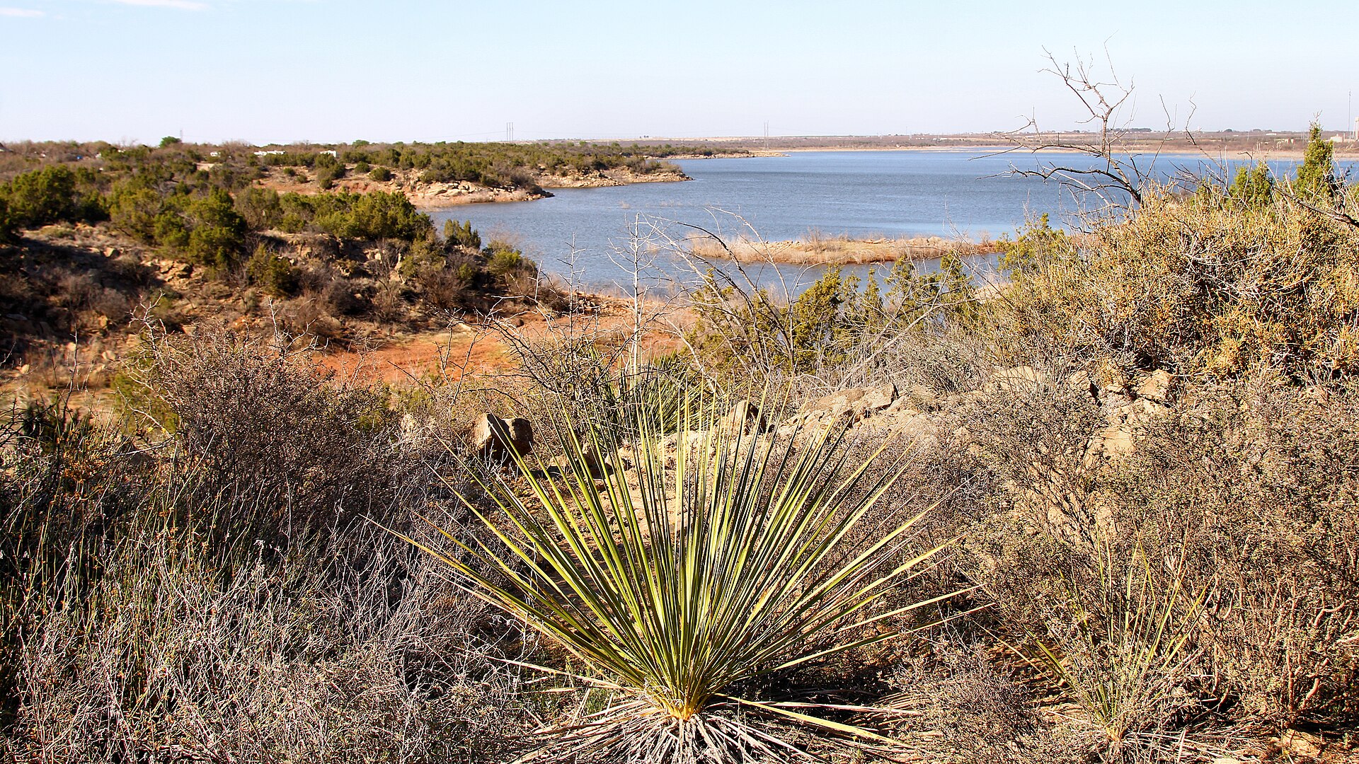
Camp, boat and explore High Plains canyon country at Lake Meredith, with NPS first-come camping, a small reservable full-hookup section at Sanford-Yake and no assumed all-lake launch availability.

Best season: Year-round; spring and fall are especially comfortable for hiking while summer favors water recreationUpdated Oct 2026
  • Canyon landscape and Lake Meredith shoreline access
  • Mostly free, first-come NPS camping areas
  • Ten specifically reservable Sanford-Yake electric/water RV sites
Explore this place
Check current drive from Amarillo ↗

Easy day-trip range

3 full TexasDefined guides in this geographic band

About 39 geographic miles

Goodnight

Goodnight · Armstrong County

Goodnight Ranch State Historic Site

The ranch interprets Charles and Mary Ann Goodnight and the cattle, conservation and business history of the Texas Panhandle. It is a natural companion to Palo Duro Canyon for visitors interested in how ranching transformed the Southern Plains.

Best season: Year-round; spring and fall are usually the most comfortable for outdoor portions of a visit.Updated Oct 2026
  • Charles Goodnight
  • ranching
  • Panhandle history
Explore this place
Check current drive from Amarillo ↗

About 54 geographic miles

Dimmitt

Dimmitt · Castro County

Castro County Courthouse

Dimmitt's active 1939 Castro County Courthouse is a New Deal-era civic landmark in Moderne Classical style, designed by Townes & Funk and enlarged in 1971. Its 2026 National Register listing tells a wider story of county government, federally funded construction and High Plains agriculture.

Best season: Year-round public exterior viewing, with cooler hours preferred for the courthouse-square walk; county offices operate on weekday schedules.Updated Oct 2026
  • 1939 Public Works Administration-funded courthouse; county's third on this square
  • Townes & Funk design with Moderne Classical architectural features
  • 1971 addition by architect Laverne H. Kirby nearly doubled building size
Explore this place
Check current drive from Amarillo ↗

About 71 geographic miles

Quitaque

Quitaque · Briscoe County

Caprock Canyons State Park & Trailway

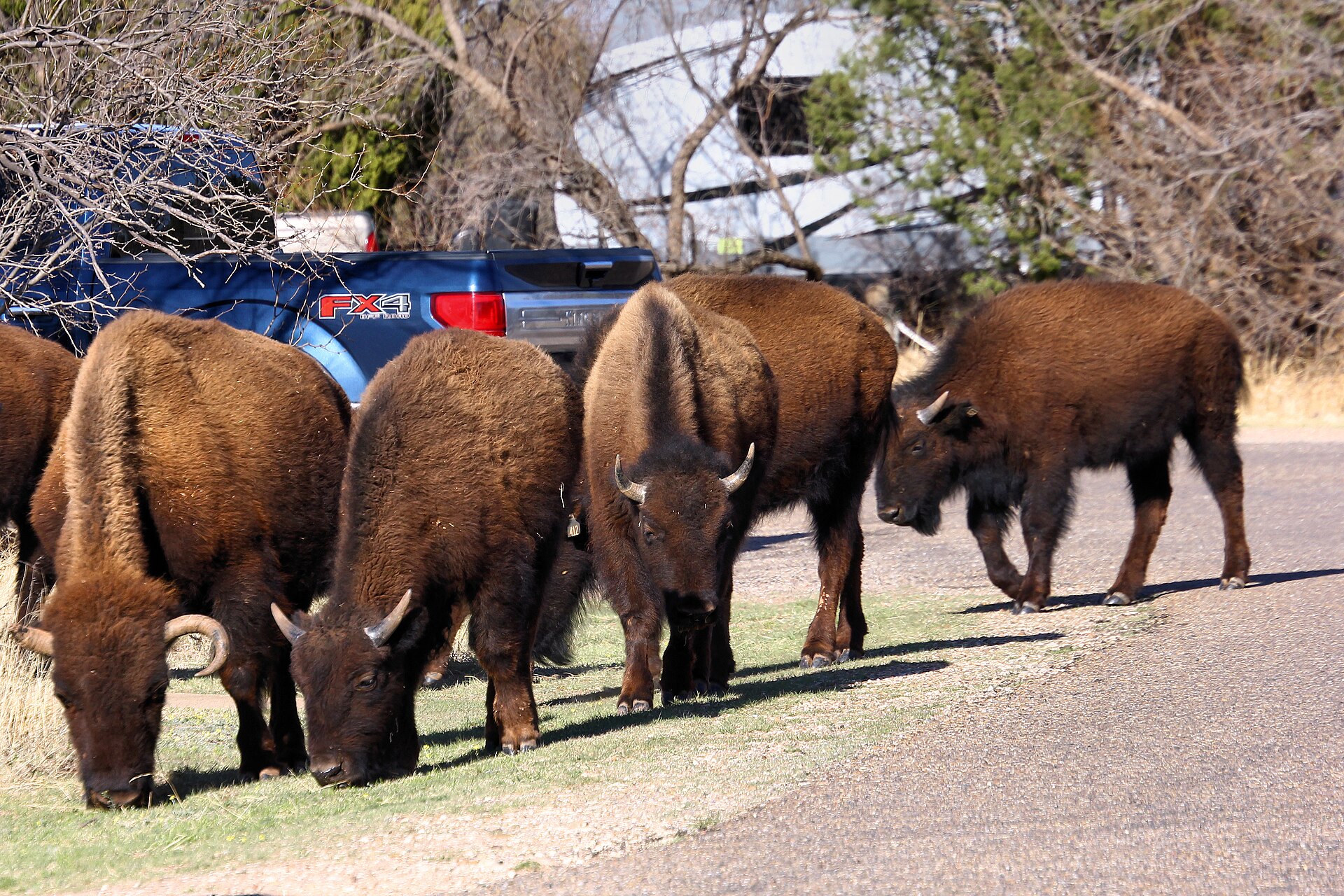
Red-rock canyon country beneath the Caprock Escarpment, home to the official Texas State Bison Herd, Lake Theo and a trail network that connects with a long converted-rail Trailway across the Panhandle.

Best season: Spring and fall for hiking and biking; summer heat can be severeUpdated Oct 2026
  • Free-ranging Texas State Bison Herd; stay at least 50 yards away
  • Redrock canyon hikes and the separate Caprock Trailway
  • Lake Theo swimming and water recreation subject to level and access
Explore this place
Check current drive from Amarillo ↗

Longer day trip

13 full TexasDefined guides in this geographic band

About 85 geographic miles

Muleshoe

Muleshoe · Bailey County

Bailey County Courthouse

Muleshoe's 1925 Bailey County Courthouse is a still-working Classical Revival civic building designed by M. C. Butler. From the county's 1918 organization to the 2026 National Register listing, the brick-and-cast-stone building documents the permanence of county government on the Texas High Plains.

Best season: Spring and autumn are usually comfortable for an exterior courthouse-square visit; county government hours apply separately.Updated Oct 2026
  • Built in 1925 as the enduring courthouse of Bailey County
  • Architect M. C. Butler designed the Classical Revival masonry building
  • Brickwork, cast-stone details, a capped parapet and pedimented entries
Explore this place
Check current drive from Amarillo ↗

About 94 geographic miles

Canadian

Canadian · Hemphill County

Canadian

Canadian is a Hemphill County Panhandle town in the Canadian River Valley where an active cultural district, art and pioneer museums, a restored river wagon bridge, wildlife habitat, historic Main Street and fall-color country create an unusually deep arts-and-outdoors destination.

Best season: Spring and fall for river-valley trails, wildlife and comfortable walking; fall for foliage; year-round for museums, galleries and cultural programmingUpdated Sep 2026
  • Canadian Cultural District
  • Canadian River Wagon Bridge
  • The Citadelle Art Foundation
Explore this place
Check current drive from Amarillo ↗

About 108 geographic miles

Lubbock

Lubbock · Lubbock County

Silent Wings Museum

Lubbock's museum of the World War II military glider program, built on the former South Plains Army Air Field where American glider pilots trained.

Updated Aug 2026
  • CG-4A glider
  • World War II glider pilots
  • South Plains Army Air Field
Explore this place
Check current drive from Amarillo ↗

About 113 geographic miles

Lubbock

Lubbock · Lubbock County

Museum of Texas Tech University

The Museum of Texas Tech University in Lubbock is a multidisciplinary university museum with collections and exhibitions in anthropology, art, clothing and textiles, history, paleontology and natural science, plus the Moody Planetarium.

Updated Oct 2026
  • Free admission
  • Natural history and paleontology
  • Anthropology and regional history
Explore this place
Check current drive from Amarillo ↗

About 124 geographic miles

Slaton

Slaton · Lubbock County

Slaton Harvey House

Built in 1912 for the Fred Harvey Company, the Mission Revival Harvey House served Santa Fe Railway passengers and employees on the South Plains. The restored building is a strong railroad-history stop near Lubbock and a reminder that Harvey Houses helped shape travel culture across the Southwest.

Best season: Year-round; spring and fall are usually the most comfortable for outdoor portions of a visit.Updated Aug 2026
  • railroad history
  • Fred Harvey Company
  • South Plains
Explore this place
Check current drive from Amarillo ↗

About 141 geographic miles

Quanah

Quanah · Hardeman County

Copper Breaks State Park

Quiet red-earth breaks and rolling prairie near Quanah, known for dark skies, rugged short trails, Lake Copper Breaks and a landscape tied to the history of the Texas Longhorn herd.

Best season: Fall through spring; clear moonless nights are best for stargazing
  • International Dark Sky setting and astronomy programs
  • Red-earth breaks and prairie trails
  • Lake Copper Breaks fishing and paddling
Explore this place
Check current drive from Amarillo ↗

About 185 geographic miles

Seymour

Seymour · Baylor County

Seymour

Seymour is a North Texas Baylor County town whose standout identity comes from world-class Permian fossil beds, the Whiteside Museum of Natural History, a historic downtown, large city park and an unusually broad set of family recreation spaces.

Best season: Fall through spring for downtown and park time; museums work year-round, while summer outdoor recreation is best in cooler hoursUpdated Sep 2026
  • Whiteside Museum of Natural History
  • Permian Red Beds
  • Seymour Memorial Park
Explore this place
Check current drive from Amarillo ↗

About 206 geographic miles

Sweetwater

Sweetwater · Nolan County

National WASP WWII Museum

A Sweetwater museum at historic Avenger Field preserving the Women Airforce Service Pilots who trained here during World War II.

Updated Aug 2026
  • Women Airforce Service Pilots
  • Avenger Field
  • World War II aviation
Explore this place
Check current drive from Amarillo ↗

About 207 geographic miles

Colorado City

Colorado City · Mitchell County

Lake Colorado City State Park

A quiet West Texas reservoir park near Colorado City with fishing, boating, camping and open prairie-and-mesquite scenery under big skies.

Best season: Fall through spring; summer heat can be intenseUpdated Oct 2026
  • Lake Colorado City
  • Fishing and boating
  • Open West Texas scenery
Explore this place
Check current drive from Amarillo ↗

About 207 geographic miles

Big Spring

Big Spring · Howard County

Big Spring State Park

A compact West Texas park atop Scenic Mountain, where a CCC-built loop road and overlooks provide broad views across Big Spring and the surrounding plains.

Best season: Fall through spring; sunrise and sunset are especially rewarding
  • Scenic Mountain overlooks
  • CCC-built loop road and stonework
  • Sunrise and sunset views
Explore this place
Check current drive from Amarillo ↗

About 217 geographic miles

Abilene

Abilene · Jones County

Fort Phantom Hill

A preserved U.S. Army frontier-post site north of Abilene where three original stone buildings, chimneys and foundations survive from a post occupied from 1851 to 1854 and now form one of the signature stops on the Texas Forts Trail.

Best season: Fall through spring for comfortable walking across the exposed historic site; summer visits are best early or late in the dayUpdated Oct 2026
  • Original stone powder magazine and guardhouse
  • Historic chimneys and building foundations
  • 1851–1854 U.S. Army frontier-post history
Explore this place
Check current drive from Amarillo ↗

About 218 geographic miles

Albany

Albany · Shackelford County

Fort Griffin State Historic Site

Fort Griffin operated from 1867 to 1881 as part of the U.S. Army's network of frontier posts on the Southern Plains. Ruins, military history and the surrounding ranch landscape make this one of the strongest places to connect frontier expansion with the cattle era.

Best season: Year-round; spring and fall are usually the most comfortable for outdoor portions of a visit.Updated Oct 2026
  • frontier forts
  • Indian Wars era
  • cattle trails
Explore this place
Check current drive from Amarillo ↗

About 218 geographic miles

Albany

Albany · Shackelford County

Official State of Texas Longhorn Herd

The official state herd preserves and interprets the Texas Longhorn, the cattle breed inseparable from trail-driving and ranching history. Seeing the herd at Fort Griffin adds living context to the fort, ranching and cattle-trail stories preserved across North and West Texas.

Best season: Year-round; spring and fall are usually the most comfortable for outdoor portions of a visit.Updated Aug 2026
  • Texas Longhorns
  • ranching
  • cattle trails
Explore this place
Check current drive from Amarillo ↗

Before you go

Use geography as a shortlist, then check the real route.

TexasDefined uses location data to make the statewide catalog easier to search. Open the current driving route for the places you are considering, then verify opening hours, reservations, park alerts, water conditions and weather with the current official source.