About 1–3 hours or as facilities allow
First-time place-specific visit
- Explore the NPS orientation and selected historic buildings
- Walk the restored parade ground and interpretive stops
- Confirm weather before choosing an adjacent trail
Big Bend Country · Historic Sites & Museums
Explore restored frontier military buildings and Buffalo Soldiers history beneath the Davis Mountains, with separate National Park Service visitor-center hours, self-guided interpretation and connecting hiking routes.
Photography: National Park Service Digital Image Archives · Public domain · Wikimedia Commons
Quick trip facts
The experience
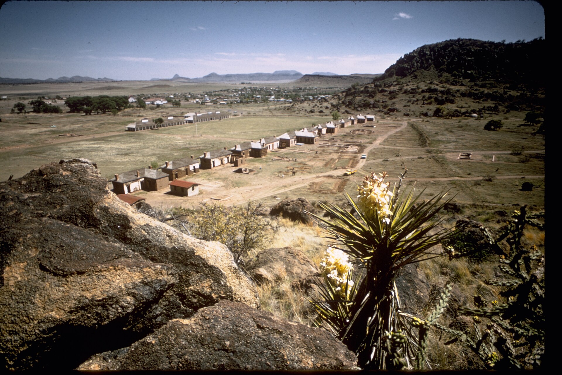
Fort Davis National Historic Site preserves one of the best surviving frontier military-post landscapes in the American Southwest. Fort buildings, surrounding hills and documented military history illuminate the soldiers, families and workers living in an isolated West Texas post. The story must include Black U.S. Army regiments later known as Buffalo Soldiers and the Indigenous peoples whose homelands and movement were affected by federal military expansion.
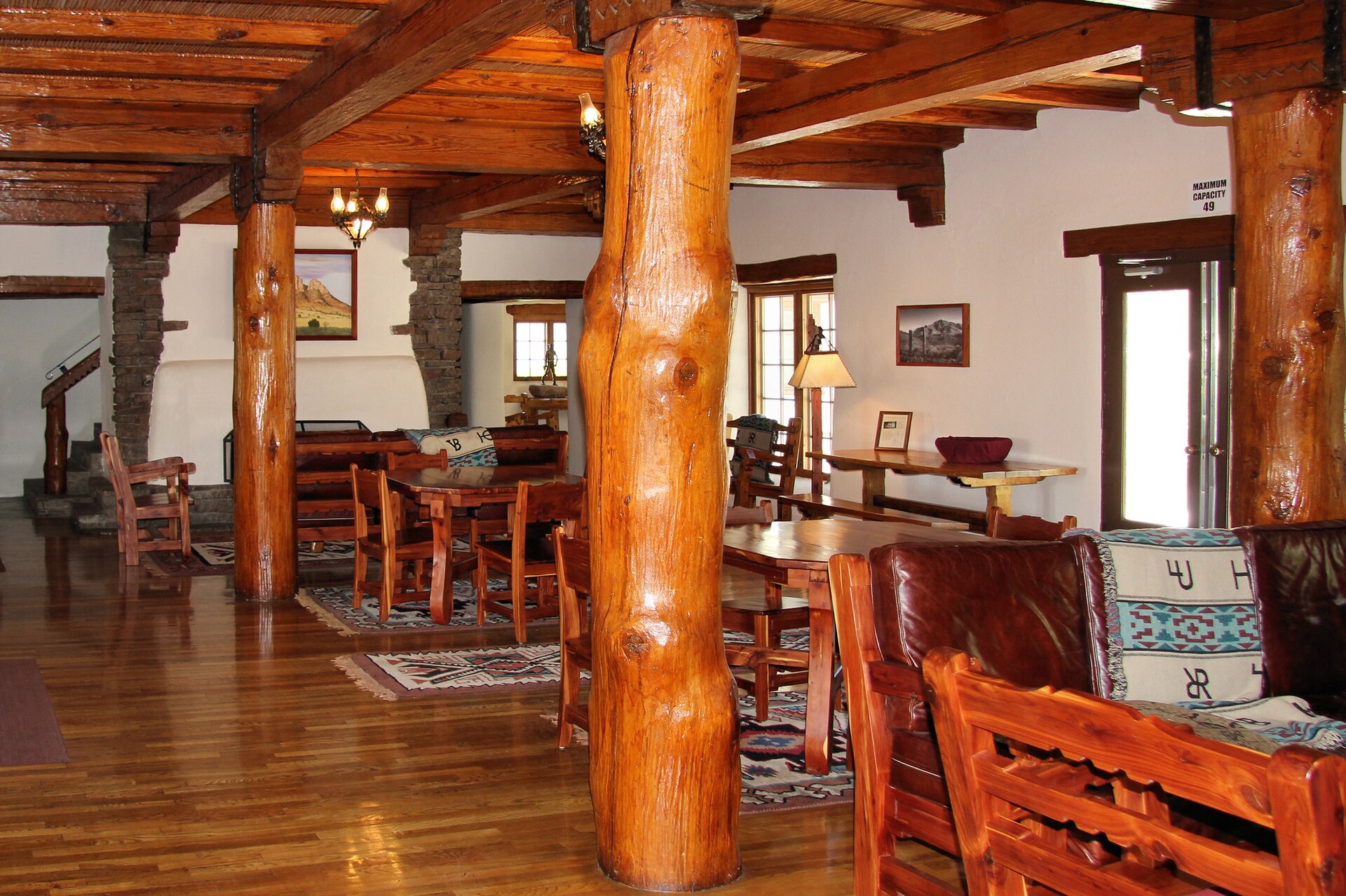
The National Park Service lists the park grounds open from 8 a.m. to 5 p.m., while the visitor center generally closes at 4:30 p.m., both in Central Time. Holiday closures include Thanksgiving, Christmas, New Year's Day and Martin Luther King Jr. Day. Visitors may see restored and furnished historic buildings, follow self-guided interpretation and watch a short introductory park film. The normal park entrance fee is separate from any neighboring state-park fee or lodging reservation.
Interpretation is distributed among parade-ground areas, restored structures and nearby terrain. Some hillside trails connect toward the adjacent Davis Mountains State Park; they are not all short, flat museum walks. Bring water and appropriate shoes, confirm the NPS trail map and distinguish which agency controls each entrance. A visit centered on a few buildings and the orientation film suits many families better than a strenuous afternoon hike.
Fort Davis is in Jeff Davis County, not a stand-in for Big Bend National Park. The neighboring town, McDonald Observatory and Davis Mountains State Park can support a multi-day regional itinerary, but separate operators have their own tickets, arrival requirements and activity times. Allow at least a focused historic-site session to understand army life instead of treating the post as a quick drive-through photography stop.
For a history-first visit, begin at the NPS visitor center, then work through buildings with interpretation of the post's changing garrison and local relationships. Pay attention to both preservation and absence: not every historic building survives or has been restored. Do not advertise unrelated exhibits, operating hours or modern military facilities as part of this federal historic site.
The National Park Service distinguishes the original 1854 post from the larger installation reoccupied and rebuilt after the Civil War. Exploring the surviving parade ground and furnished structures with that distinction in mind explains why the post looks as it does today.
For families, a visitor-center film and Junior Ranger materials provide orientation before walking among the buildings. There is no lodging or camping inside the national historic site; nearby Fort Davis and Davis Mountains State Park are separate places to investigate for an overnight stay.
The fort’s layout is a useful historical document in its own right. The National Park Service describes six furnished buildings, more than twenty additional buildings and approximately one hundred ruins. Visitors should compare what has been restored with what survives only as foundations; the post was not all constructed at one time and was rebuilt on a new alignment beginning in 1867.
The first military occupation began in 1854 beside the San Antonio–El Paso Road, then ended during the Civil War. When the U.S. Army returned in 1867, the 9th Cavalry and later Black Regular regiments helped turn it into the larger post represented by Officers’ Row and the parade ground. That rebuilding explains both the scale of the ruins and the variety of surviving architecture.
Fort Davis also provides a place to discuss the interests of the people the Army confronted. Protecting migrants, mail and freight was part of federal westward expansion into territories that Indigenous peoples already occupied; the campaigns involving Comanche, Kiowa and Apache communities must remain central rather than reduced to a brief note about frontier danger.
For an efficient visit, begin with the official visitor-center orientation, then inspect furnished and unfurnished spaces in sequence. The mountain trails provide a different way to read the fort’s strategic position, but are optional and require separate attention to heat and exertion. The national historic site itself offers neither lodging nor camping.
The details
Evidence and citations
Read the original operator records and supporting research for this guide.
Separate center, grounds, holidays and fees
Historic site address and visitor access
Historic garrison and people
Practical questions
The visit
Texas context
Fort Davis National Historic Site preserves one of the best surviving frontier military-post landscapes in the American Southwest. Fort buildings, surrounding hills and documented military history illuminate the soldiers, families and worke
Use the time you have
About 1–3 hours or as facilities allow
Half day
Full day, including travel
Key dates
A short chronology of dates that materially shaped this place. Each entry links to the source used for the date and historical context.
1854
The first post occupies a strategically watered mountain location on the San Antonio–El Paso Road.
Source: NPS — Frontier Post1867
Black Regular Army cavalry soldiers reoccupy the site and help build the larger post seen today.
Source: NPS — Frontier Post1891
Army consolidation ends the military installation after nearly four decades of changing frontier duty.
Source: NPS — Frontier PostBefore you go
Plan the route
Editorially paired stops near Fort Davis National Historic Site appear first, followed by nearby destinations. Distances are approximate straight-line miles.
Fort Davis · Jeff Davis County · Big Bend Country
Fort Davis is a high-elevation Jeff Davis County community in the Davis Mountains where a nationally significant frontier military post, Buffalo Soldier history, mountain scenery, dark skies, Davis Mountains State Park and McDonald Observatory create a concentrated Far West Texas base.
Approx. 1 mile away
Fort Davis · Jeff Davis County · Big Bend Country
High-desert mountain scenery, Skyline Drive overlooks, extensive trails, camping, birding, and the historic Indian Lodge.
Approx. 2 miles away
Fort Davis · Jeff Davis County · Big Bend Country
Indian Lodge is a historic white-adobe Civilian Conservation Corps hotel inside Davis Mountains State Park near Fort Davis. Check its separate overnight-room operations and January 2027 closure alert before planning a stay.
Approx. 3 miles away
Alpine · Brewster County · Big Bend Country
Alpine's 1947 Kokernot Field is a remarkably elaborate West Texas baseball park commissioned by rancher Herbert L. Kokernot Jr. Its local stonework, o6 Ranch identity, NAIA World Series history and continuing Alpine Cowboys games explain why this 2026 National Register listing matters beyond baseball fans.
Approx. 21 miles away
Marfa · Presidio County · Big Bend Country
Marfa is a remote high-desert town where Presidio County history, internationally known contemporary art, adobe streetscapes, the Marfa Lights and immense West Texas skies create a destination that rewards slow travel rather than a rushed roadside stop.
Approx. 21 miles away
Alpine · Brewster County · Big Bend Country
Spanning roughly 40 blocks and almost 96 acres, Alpine's 2026 National Register historic district links the arrival of the Southern Pacific Railroad in 1882 with its Brewster County courthouse, historic hotels, Hispanic community institutions, stone architecture and Big Bend gateway economy.
Approx. 22 miles away
Texas Explained
Go beyond the destination with the systems, landscapes and history that explain why this part of Texas looks and works the way it does.
Continue exploring
Read next
Historic Sites
A practical Texas lighthouse guide comparing public access, climbs, viewing methods and trip logistics from Port Isabel to the Sabine gateway.
August 21, 2026 · About 12 minutes
Historic Sites
Missions, battlefields, courthouses and museums make more sense as a road map than a timeline. These are the places that turn state history back into geography.
August 7, 2026 · About 2 minutes