
County Guide
Jeff Davis County
Fort Davis, the Davis Mountains, McDonald Observatory and tiny Valentine make Jeff Davis County one of the clearest examples of how much history, science and scenery can fit inside a sparsely populated corner of Texas.
- Guide type
- Texas county guide
- County seat
- Fort Davis, Texas
- Source check
- Official source checked
- Last reviewed
- August 4, 2026
Verified county profile
What the data says about Jeff Davis County
The 2020 Census counted 1,996 residents across about 2,265 square miles of land. Dividing those two Census figures gives roughly 0.88 residents per square mile.
Census geography also records about 0 square miles of water. Water represents approximately 0.0% of the county's mapped land-and-water area.
Fort Davis is the verified county seat.
Texas Defined does not add an unsourced list of local communities. Additional places appear here only when the structured place directory contains a verified county relationship.
Understand the bigger picture
These Texas Explained guides add statewide context to the geography, settlement and infrastructure behind Jeff Davis County.
Explore Texas Explained →Historic places in this county
History you can visit in Jeff Davis County
Texas Defined currently connects 2 historic destinations to this county guide.
Statewide context
Where Jeff Davis County sits in the county data
These ranks use the same Texas State Library and U.S. Census county dataset as the statewide comparison. A rank is shown only when that metric is available for the county and the comparison set; missing source values are excluded rather than estimated.
- 2020 population
- #232
- of 254 counties with source data
- land area
- #11
- of 254 counties with source data
- population density
- #244
- of 254 counties with source data
- water share
- #249
- of 254 counties with source data
Property tax rates
Taxing units in Jeff Davis County
Texas property taxes are imposed by separate local taxing units. The table below lists finalized statewide records associated with Jeff Davis County. A district appearing here does not mean every property in the county pays that district; use the exact parcel record to determine jurisdiction.
Checking finalized local tax rates…
At a glance
The county in numbers
- County seat
- Fort Davis, Texas
- 2020 population
- 1,996
- Land area
- 2,265 sq. mi.
- Water area
- 0 sq. mi.
- Population density
- 0.88 / sq. mi.
- Water share
- 0.0%
County questions
Quick answers about Jeff Davis County
What is the county seat of Jeff Davis County?
Fort Davis, Texas is the county seat of Jeff Davis County.
How many people live in Jeff Davis County?
The 2020 U.S. Census counted 1,996 residents in Jeff Davis County.
How densely populated is Jeff Davis County?
Using the 2020 Census population and Census land-area figure, Jeff Davis County has about 0.88 residents per square mile. This is a derived density figure, not a separate Census estimate.
What cities and communities are in Jeff Davis County?
Jeff Davis County includes communities such as Fort Davis. City limits, mailing addresses and county boundaries do not always match, so verify an exact address when county jurisdiction matters.
Where do I look up property taxes in Jeff Davis County?
TexasDefined has not yet published a county-specific property-tax guide for Jeff Davis County because its local source verification is still incomplete. Use the statewide county property-tax directory and the official local office links on this page while verification is pending.
How do I research industries and employers around Jeff Davis County?
Start with the Texas industries hub to understand the statewide sector system, then use Made in Texas and local sources to verify which companies and facilities are actually tied to Jeff Davis County. TexasDefined does not treat a statewide industry page as proof that a specific employer operates in this county.
How do I find official Jeff Davis County government information?
Start with the official Jeff Davis County website for county departments, services, courts and records. For property values, exemptions and protests use the appraisal district; for tax bills and payments use the office designated by the taxing unit. TexasDefined links to the statewide property-tax county directory until this county-specific tax guide passes source verification.
Property taxes
County property-tax resources
Property-tax questions in Jeff Davis County involve several separate authorities. Until the county-specific tax guide passes source verification, use the statewide county property-tax directory plus the official appraisal and tax-office resources shown here.
Property & county services
Official local resources
Property appraisal
The Comptroller directory entry is undated or more than two years old. This guide does not display potentially outdated individual contact details. Follow the official county directory link to verify the current office.
Comptroller office listing updated 2022-08-25; confirm contact details with the district before visiting.
Tax office
Tax assessor-collector: Sheriff Victor Lopez
Phone: 432-426-3962
105 Court Ave. Fort Davis, Texas 79734
Comptroller office listing updated 2025-04-15; confirm vehicle and tax service details with the office before visiting.
County feature
The story of Jeff Davis County
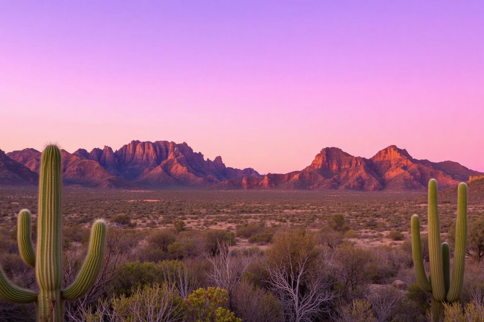
Jeff Davis County: Forts, Dark Skies and the Mountain Side of West Texas
Fort Davis, the Davis Mountains, McDonald Observatory and tiny Valentine make Jeff Davis County one of the clearest examples of how much history, science and scenery can fit inside a sparsely populated corner of Texas.
Published August 8, 2026 · 10 min read
Jeff Davis County is the kind of place that makes the usual picture of Texas feel incomplete. Instead of endless flatland, much of the county rises into the Davis Mountains. Instead of city glow, its night sky is dark enough to support one of the world's major astronomical observatories. And instead of a single frontier story, the county holds layers of Indigenous history, military history, ranching, railroad development, conservation and science.
It is also exceptionally lightly populated. The 2020 Census counted 1,996 residents across more than 2,200 square miles. Fort Davis is the county seat and principal community; Valentine is the other town most travelers recognize. Between them lie ranches, mountain roads and long stretches where the scale of the landscape does most of the talking.
Jeff Davis County was born from a county-seat fight
The county's creation in 1887 was tied directly to the rivalry between Fort Davis and Marfa. Both communities were then part of Presidio County. Fort Davis had served as the county seat, but when the Southern Pacific Railroad bypassed it and helped Marfa grow, voters moved the seat to Marfa in 1885.
Fort Davis residents responded by pushing for a new county. The Texas Legislature created Jeff Davis County on March 15, 1887, with Fort Davis as its seat. The episode is a perfect example of why Texas ended up with so many counties: in a huge state, transportation and access to local government could decide political geography.
The county, the mountains and the fort all carry the Davis name. Fort Davis was named in 1854 for then-U.S. Secretary of War Jefferson Davis, who later became president of the Confederacy.
The mountains were a refuge long before they were a destination
Human occupation in the Davis Mountains reaches back at least 10,000 years. Springs, creeks, canyons and higher elevations made the range an important refuge in an otherwise demanding part of the Chihuahuan Desert. Indigenous peoples used the mountains and surrounding country for generations before modern towns, ranches or military roads appeared.
Spanish expeditions also passed through the region. Texas Parks and Wildlife notes that Antonio de Espejo's 1583 expedition camped in what is now Keesey Canyon. Those early routes were part of a much older human geography organized around water, passes and movement through the mountains.
Fort Davis guarded one of the roads west
The U.S. Army established Fort Davis in 1854 along the San Antonio-El Paso Road. The site offered water, wood, forage and a strategic position along a route used by mail coaches, freighters, emigrants and other travelers crossing the Trans-Pecos.
The first fort operated until the Civil War era. Federal troops left after Texas seceded, and the post was eventually abandoned for several years. In 1867 the Army returned and rebuilt Fort Davis as western travel resumed.
Among the troops stationed there were soldiers of the Ninth and Tenth Cavalry and the Twenty-fourth and Twenty-fifth Infantry, Black regiments whose members became widely known as Buffalo Soldiers. Their service is central to the fort's post-Civil War history. Fort Davis remained active until 1891.
Today Fort Davis National Historic Site preserves what the National Park Service calls one of the best surviving examples of a frontier military post in the Southwest. The parade ground, officers' quarters, barracks and hospital ruins make the scale of the old installation easier to grasp than a roadside marker ever could.
Fort Davis the town outlived Fort Davis the post
The civilian settlement beside the military post grew because the fort created demand for food, livestock, freight, labor and services. Even after the Army left, the town remained the county seat and a center for surrounding ranch country.
That separation matters. The national historic site is the preserved military post; Fort Davis is the living community next to it. The town's identity now combines courthouse life, ranching, tourism, mountain recreation and the astronomy economy farther up the road.
The New Deal left one of its prettiest Texas footprints here
Davis Mountains State Park was established during the Great Depression after local landowners donated acreage to the state. Beginning in the 1930s, Civilian Conservation Corps crews built roads, overlooks, picnic structures and buildings that still shape the park experience.
Their most distinctive project is Indian Lodge, a white-adobe, pueblo-inspired hotel inside the park. The original lodge opened in 1935 and retains thick adobe walls, hand-crafted details and the kind of architecture that seems inseparable from its mountain setting.
The CCC also constructed Skyline Drive, a winding road that climbs to broad views over the Davis Mountains. It is a reminder that some of Texas' most beloved park infrastructure was created as both conservation work and employment during the economic crisis of the 1930s.
Then the mountains became a window into the universe
Jeff Davis County's elevation, dry climate and dark skies made the Davis Mountains an extraordinary place for astronomy. McDonald Observatory, a research unit of the University of Texas at Austin, occupies Mount Locke and Mount Fowlkes northwest of Fort Davis.
The observatory was dedicated in 1939. Its first major telescope, now named for astronomer Otto Struve, helped establish the site as a serious research center. In 1944 astronomer Gerard Kuiper used observations from McDonald to detect an atmosphere around Saturn's moon Titan — the first atmosphere identified around any moon.
McDonald remains an active research institution rather than a museum of old telescopes. Its facilities include major modern instruments, while the visitors center, tours and public Star Parties turn professional astronomy into one of the county's signature visitor experiences.
Darkness itself has become something worth protecting
The remarkable night sky is not simply a happy accident. Communities, parks, researchers and conservation groups across the region have worked to reduce unnecessary outdoor light. In 2022 the Greater Big Bend International Dark Sky Reserve was designated across more than nine million acres of Texas and northern Mexico.
Its core includes McDonald Observatory and the Davis Mountains Preserve. The designation recognizes a useful truth about Jeff Davis County: darkness is part of the landscape. Protecting it benefits astronomy, wildlife and the experience of standing outside on a clear night and seeing a sky that many urban Texans rarely encounter.
Valentine really did get its name on Valentine's Day
Southwest of Fort Davis, the town of Valentine grew beside the Southern Pacific Railroad. According to the Handbook of Texas, railroad crews reached the site on February 14, 1882, and the community took the name Valentine.
The town became a shipping point for area ranches and at times supported several hundred residents. It later shrank dramatically, but its name and roadside setting have given it an outsized cultural presence. Valentine is the sort of Texas place whose fame is much larger than its population.
Ranch country ties the county together
The dramatic attractions can make Jeff Davis County look like a collection of destinations — fort, state park, observatory, tiny town — but ranching is the connective tissue across much of the landscape. Cattle operations expanded in the late nineteenth century and remain part of the county's visual and cultural identity.
That working landscape also explains why the county feels so open. Large properties, sparse settlement and mountain terrain leave long distances between services. A trip here rewards the traveler who stops treating miles as dead space and starts seeing the ranch roads, fences, grasslands, volcanic slopes and sky as part of the experience.
A few Jeff Davis County facts worth remembering
- Jeff Davis County was created in 1887 after Fort Davis lost the Presidio County seat to Marfa.
- The 2020 Census counted just 1,996 residents in a county covering more than 2,200 square miles.
- Fort Davis was established by the U.S. Army in 1854 and remained active, with a Civil War interruption, until 1891.
- Black soldiers later known as Buffalo Soldiers served at Fort Davis after the Civil War.
- Davis Mountains State Park was developed as an early Texas Civilian Conservation Corps project in the 1930s.
- Indian Lodge opened in 1935 and preserves distinctive CCC-era adobe craftsmanship.
- McDonald Observatory was dedicated in 1939 and remains a major astronomical research and public-education center.
- The Greater Big Bend International Dark Sky Reserve, designated in 2022, includes McDonald Observatory in its core area.
- Valentine was named after railroad crews reached the site on February 14, 1882.
Why Jeff Davis County belongs on a Texas map in your head
Jeff Davis County is useful because it overturns several Texas clichés at once. It is mountain country in a state often imagined as flat. It is a frontier-history destination where the story includes Buffalo Soldiers and Indigenous travel routes, not merely wagon trains. It is ranch country that also supports internationally important astronomy. And it is a place where conserving darkness has become as important as conserving land.
It also connects naturally to neighboring Presidio, Brewster and Culberson counties. Drive south toward Marfa and the borderlands story deepens. Continue toward Alpine and Big Bend and the mountains open into desert basins, canyons and the Rio Grande. Head north toward Van Horn and Guadalupe Peak and the mountain story continues into Texas' highest country.
For a county with fewer than two thousand people at the last census, Jeff Davis County carries an extraordinary amount of Texas: military history, ranching, New Deal architecture, railroad lore, mountain ecology, scientific discovery and one of the darkest night skies most Texans will ever see.
Sources & verification
Research and official records
Research references support the editorial history and places described above. The official directories below help verify current county seats, census geography, property tax offices and vehicle services. Office personnel, contact details and links can change; check the agency website before traveling.
A claim-by-claim county-specific source list has not yet been published for this guide. The official starting points below are not a substitute for documented historical research.
Further county history research
Use the published county history as independent background reading, not as proof that every claim in this guide has been checked against that reference.
Town and local attraction guides
Explore Jeff Davis County in more depth
Explore these independent town guides for history, primary-source links, area attractions, trip timing, access considerations and nearby places. Town boundaries and regional side trips are distinguished from the county itself.
- Fort Davis
Locally researched history, travel logistics, attractions, itineraries and primary visitor sources.
Explore this county
State parks in Jeff Davis County
Visit-ready local park guides with official maps, facilities research and nearby trip ideas. Review current park alerts and reservations before setting out.
A high-desert mountain park above Fort Davis with Skyline Drive, CCC history, hiking, birding and access to Indian Lodge amid cooler elevations and broad Trans-Pecos views.
Local places to visit
More to explore in Jeff Davis County
These additional local places complement the park, museum, beach and other destination guides on this county page. They are not ranked. For events, swimming, tours or restricted properties, always check current visitor information before traveling.
- History & heritage
Fort Davis National Historic Site
Preserved frontier military post with restored buildings, interpretive exhibits and trails near Fort Davis; check NPS operations and alerts before arriving.
RV parks & campgrounds
RV camping around Jeff Davis County
TexasDefined currently connects 3 RV park or campground directory entries to this county. Verify hookups, rig limits, rates and reservations with the operator before travel.
- Davis Mountains State Park RV LoopFort Davis, Texas
- Fort Davis KOA JourneyFort Davis, Texas
- Overland Trail RV ParkFort Davis, Texas
Texas tournaments
Tournaments & competitions near Jeff Davis County
Browse TexasDefined’s statewide tournament directory across golf, rodeo, team sports, fishing, BBQ, chess, esports, academic competitions and more. County relationships are published only when a location can be assigned confidently; current dates, venues and entry details require organizer verification.
Texas high school football
High school football in Jeff Davis County
See current UIL football programs whose TEA school-directory records are in Jeff Davis County. Use the statewide finder to compare a specific high school or ISD before choosing where to live.
Open the statewide football finder →Loading current UIL football programs…
What this tells you: current 2026–28 UIL classification, football division, district and six-man/11-man format. School, ISD, city and county context is attached only when Texas Education Agency AskTED produces an unambiguous campus match; uncertain matches are deliberately omitted.
All-time state-final history: title and appearance totals use UIL’s Football All-Time Appearances table, supplemented with newer completed state-final rows from the official State Archives when that all-time table trails the latest archive. Totals appear only on an exact normalized UIL school-name match.
Recent state-final detail: the game-level list covers the eight completed UIL championship seasons from 2018–19 through 2025–26. No history badge does not mean a weak program; it means the source did not produce an exact normalized school-name match.
This is not a “best school” rating. Football placement and recent championship history are only parts of researching a program. Attendance zones, transfers, eligibility and campus assignments can change, so confirm an exact address and student eligibility with the school district and UIL before making a move.
Local football history
A researched school program
Read the 2003 six-man championship-game history and the district’s announced cancellation of its 2026 season.
Campus county checked against federal school records ↗. This independent football guide is not an official school website.