Skip to content
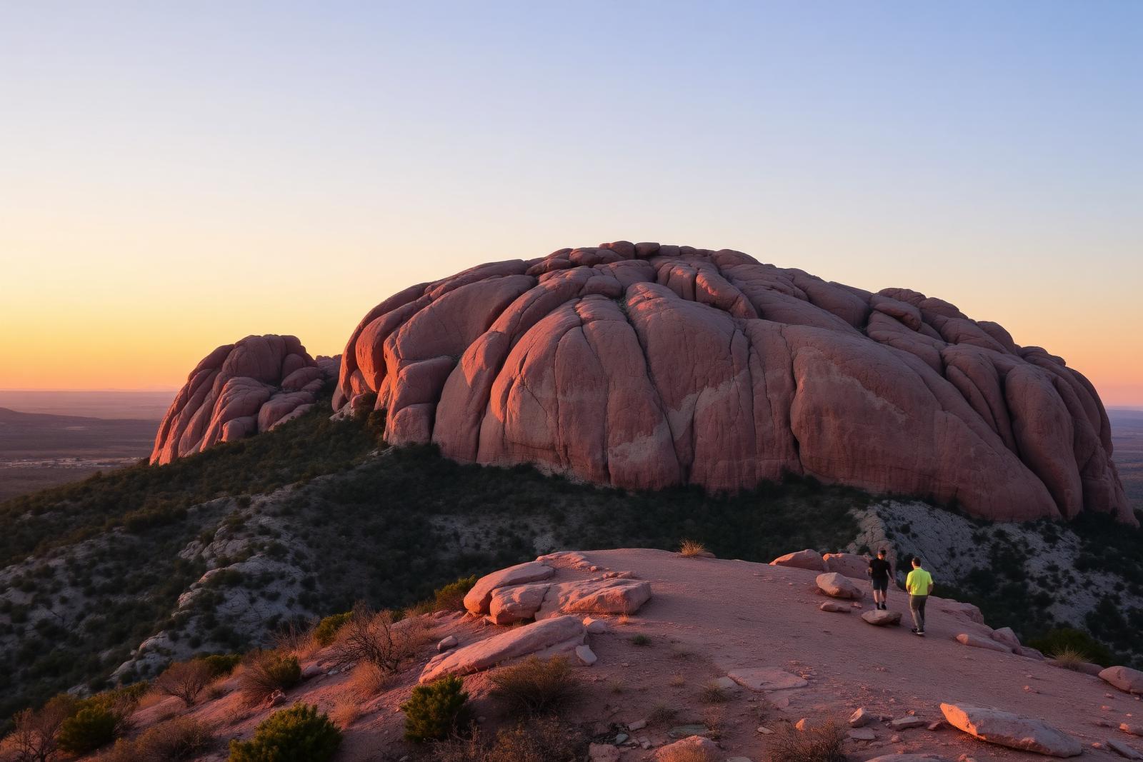
Sweeping panorama of rocky Franklin Mountains ridges, with the Tom Mays access road and El Paso visible below

Big Bend Country · State Parks

Franklin Mountains State Park

El Paso's nearly 27,000-acre mountain wilderness offers more than 100 miles of Chihuahuan Desert trails, rugged North Franklin Peak climbs, mountain biking, rock climbing and primitive camping in the Tom Mays Unit.

Photography: Susan Barnum · CC BY-SA 4.0 · Wikimedia Commons · panorama cropped for display · CC BY-SA 4.0 license ↗

Quick trip facts

Franklin Mountains State Park at a glance

Where is Franklin Mountains State Park?
Franklin Mountains State Park is at 2900 Tom Mays Access Rd., El Paso, TX 79911, in El Paso County.
When is the best time to visit Franklin Mountains State Park?
October through April for most hiking; spring and fall can be pleasant but busy. Check heat, wind, storms and TPWD alerts year-round.
Do I need to plan ahead for Franklin Mountains State Park?
TPWD lists adult day admission at $5; children 12 and younger enter free. The usual gate schedule is 8 a.m.–5 p.m.; Friday–Sunday gates open at 6:30 a.m. from the first Saturday in April through the first Saturday in September. Office hours are 8 a.m.–4 p.m. Capacity is limited: reserve camping and, ideally, day-use passes before arriving. Check current alerts and prices.
Who manages Franklin Mountains State Park?
Texas Parks and Wildlife Department

The experience

Visiting Franklin Mountains State Park

The striking thing about Franklin Mountains State Park is its setting: almost 27,000 acres of steep Chihuahuan Desert relief rise right through El Paso. The park is not one trailhead. Its west-side Tom Mays facilities, northeast trail network, McKelligon Canyon and Smugglers Pass approach provide noticeably different outings.

For a first visit, choose a route before choosing an entrance. Tom Mays has the ¾-mile Nature Walk, a bird blind and access to the demanding North Franklin Peak route. The northeast side has the Cardiac Road–Maze Loop and the longer Tin Mines walk, reached near Chuck Heinrich Memorial Park. Check the official interactive trails map rather than relying on a generic city-center navigation pin.

The mountains reveal some of the Borderland's geology in plain sight: uplifted and faulted rock exposures testify to the region's complex history and the Rio Grande rift. North Franklin Peak reaches 7,192 feet; the exposed approach involves substantial climbing and is unsuitable as a casual family stroll.

Chihuahuan Desert plant communities include sotol, lechuguilla, yucca, ocotillo and cacti. The park shelters mule deer, reptiles and many birds, and its Tom Mays bird blind is a rewarding low-mileage nature stop. Wildlife is never guaranteed, and visitors should leave plants, rocks and animals undisturbed.

TPWD identifies primitive overnight camping only in the Tom Mays Unit: 14 walk-in tent sites, five self-contained drive-up RV sites and group camps. There is no water or electricity at the campsites. An RV campsite is not an RV hookup; carry water for drinking, food preparation and cleaning.

The park is shared by hikers, mountain bikers, climbers and wildlife watchers. TPWD permits climbing at designated locations in McKelligon Canyon and Sneed's Cory in the Tom Mays Unit. Carry proper equipment, avoid unmarked shortcuts, observe trail-use rules and check wind, lightning and summer heat before committing to exposed routes.

The details

Planning your visit

Area
El Paso, Texas
Best season
October through April for most hiking; spring and fall can be pleasant but busy. Check heat, wind, storms and TPWD alerts year-round.
Address
2900 Tom Mays Access Rd., El Paso, TX 79911
Entry & reservations
TPWD lists adult day admission at $5; children 12 and younger enter free. The usual gate schedule is 8 a.m.–5 p.m.; Friday–Sunday gates open at 6:30 a.m. from the first Saturday in April through the first Saturday in September. Office hours are 8 a.m.–4 p.m. Capacity is limited: reserve camping and, ideally, day-use passes before arriving. Check current alerts and prices.
Getting there
For park headquarters, day-use facilities and camping, use the Tom Mays Unit off Trans Mountain Road (Loop 375), about 3.5 miles east of I-10. Other trailheads have separate access: McKelligon Canyon from Fred Wilson Road, Ron Coleman Trail at Smugglers Pass on Loop 375, and the northeast trails at the end of Jon Cunningham Boulevard near Chuck Heinrich Memorial Park. Do not route northeast hikers to Tom Mays by default.

Evidence and citations

Research sources

Read the original operator records and supporting research for this guide.

Start here · verified October 19, 2026

Admission, hours and day-use planning

Four different access areas serve different activities. Prices and hours below reflect TPWD's published information, not a guarantee of today's availability. Check active park alerts ↗ before leaving.

Daily admission
$5 adults; ages 12 and under free
Gate hours
Usually 8 a.m.–5 p.m.

Fridays–Sundays: 6:30 a.m. opening from the first Saturday in April through the first Saturday in September.

Office / phone
8 a.m.–4 p.m. · (915) 444-9100
Passes and campsites
Capacity may sell out. Reserve with TPWD's booking system ↗ or call (512) 389-8900.

Choose the hike before the trailhead

Franklin Mountains hiking trails compared

Times are TPWD's approximate hiking estimates, not arrival guarantees. Distances are for the specified routes; check the official route map for navigation, seasonal closures and mountain-bike permissions. Summer heat, wind and exposed rocky grades can substantially change what is safe.

Trail distance, difficulty, starting unit and estimated hiking duration
TrailDistanceDifficultyTime
Nature Walk

Tom Mays Unit

¾-mile loopEasyAbout 30 minutes
Cardiac Road–Maze Loop

Northeast, near Chuck Heinrich Memorial Park

3-mile loopModerateAbout 2½ hours
West Cottonwood Springs via Agave Loop

Tom Mays Unit

3 milesModerateAbout 3 hours
Tin Mines

Northeast, near Chuck Heinrich Memorial Park

6 milesModerate–difficult3–4 hours
North Franklin Peak

Tom Mays Unit

8 milesStrenuous4–6 hours

Nature Walk

Best short introduction for families: desert plants and a bird blind near the start.

Cardiac Road–Maze Loop

Climb a low ridge before winding back through desert shrubs. Buy the day pass ahead of time.

West Cottonwood Springs via Agave Loop

Westward vistas, a spring shaded by a cottonwood and loose scree on the return.

Tin Mines

Old jeep-road grade leads to historic mine workings and smelter remains; do not enter shafts.

North Franklin Peak

High-elevation summit at 7,192 feet via rocky, exposed terrain. Not a beginner hike.

Read TPWD's first-hand trail recommendations ↗

Camping · Tom Mays Unit only

Primitive tent, RV and group camping

Every overnight site listed by TPWD is in the Tom Mays Unit, near 31.908166, -106.525458. These are primitive sites: no drinking-water hookups and no electricity. Nightly fees are in addition to daily entrance fees and may change.

Primitive walk-in tent

14 sites · $10/night

No water; tent pads, grills and tables at listed sites. Some parking approaches require high clearance.

Primitive drive-up RV

5 sites · $10/night

Self-contained RVs only. No water or electricity; not full-hookup camping.

Group tent camps (20 people)

2 sites · $20/night

Sites #36 and #38. No water. Group capacity and booking terms apply.

Group tent camp (30 people)

1 site · $30/night

Site #39. No water; contact the park about reservations.

Important: Some walk-in sites (C1, C2, C3 and C5) require high clearance to reach the parking approach. Do not assume a full-size RV can use tent-site tracks. TPWD's listings do not promise campsite showers; call the park about current restrooms and accessibility.

Compare official campsites and reserve ↗

Getting there

Four access points — not one interchangeable entrance

Tom Mays Unit

Best for: HQ, day use, camping, Nature Walk, West Cottonwood Springs and North Franklin Peak

2900 Tom Mays Access Rd., off Loop 375 about 3.5 miles east of I-10

Northeast / Chuck Heinrich

Best for: Tin Mines and Cardiac Road–Maze trails

End of Jon Cunningham Boulevard; separate from Tom Mays

McKelligon Canyon

Best for: East-side access and designated climbing

From Highway 54 take Fred Wilson Road west

Smugglers Pass

Best for: Ron Coleman Trail

Trailhead parking near the summit of Trans Mountain Road (Loop 375)

Official Tom Mays headquarters: 2900 Tom Mays Access Rd., El Paso, TX 79911 · map ↗.

What makes the park different

A wilderness ridge above the city

North Franklin Peak beyond Fusselman Canyon and Trans Mountain Road, photographed from The Elephant in the Franklin Mountains
North Franklin Mountain from The Elephant, Brian Stansberry (2006), original photograph, CC BY-SA 3.0. Image displayed without editorial alteration.

Geology you can see

The Franklins expose ancient rock layers and younger faults associated with the tectonic forces that shaped the Rio Grande rift. The sharp relief creates a remarkable contrast with El Paso's built-up basins. For a grounded explanation of the bedrock and roadcuts, see the University of Texas Bureau of Economic Geology ↗.

Life in the Chihuahuan Desert

Lechuguilla, sotol, ocotillo, yuccas and cacti anchor the vegetation. TPWD documents more than 100 bird species across the park, including golden eagles, flycatchers, hummingbirds and pyrrhuloxia. Mule deer, reptiles and coyotes also occur here. The bird blind near the Tom Mays Nature Walk is a practical stop for patient wildlife watching.

History, climbing and stewardship

For generations, the mountains supplied resources to people living in the Borderland. Today the park preserves desert habitats while providing hiking, cycling, birding and designated rock climbing at McKelligon Canyon and Sneed's Cory. Stay on marked trails, do not collect rock or plants, and avoid entering historic mine workings.

Trail and overnight safety

What to bring and what not to assume

  • Carry more water than a normal city walk requires, including a reserve for delays, children and pets; camping facilities do not provide water.
  • Begin exposed hikes early, review heat and wind forecasts, and turn around before extreme conditions. Do not attempt summit trails in lightning or rapidly deteriorating weather.
  • Download the trail map before entering; identify your return trailhead, sunset time and gate closing time.
  • Wear sturdy footwear for loose rock and sharp vegetation. Stay on designated trails and tell someone your route.
  • Respect wildlife, keep pets leashed, take rubbish out and use fire rings only where fires are allowed under current restrictions.

Plan a complete El Paso trip

Hike in the cooler hours, then switch to indoor galleries or historic El Paso. These are separate destinations; park admission does not cover museums or other attractions.

Quick answers

Frequently asked questions

Which entrance is right for North Franklin Peak?
Use the Tom Mays Unit and follow TPWD's specific North Franklin Peak trail guidance. Do not navigate to a generic El Paso or park-center pin.
Do I need a reservation?
TPWD recommends reserving both day-use and camping passes in advance because the park often reaches capacity. Northeast hikes such as Tin Mines require a day pass purchased ahead of time.
Can I bring a dog?
Dogs are subject to Texas state-park rules, including a six-foot leash and waste cleanup. Bring additional water for pets, and contact park staff about trail-specific restrictions.
Is there drinking water at the campsites?
No. TPWD lists no water at the Tom Mays primitive campsites and no electrical hookups at the RV sites. Bring drinking, cooking and washing water.
Are there showers?
The current TPWD campsite listing does not promise showers. Do not book expecting shower facilities; verify restrooms, accessibility and other amenities with park staff.
Can I go rock climbing?
TPWD identifies climbing in designated McKelligon Canyon areas and Sneed's Cory in Tom Mays. Bring suitable equipment and verify any closures or rules before climbing.

Last independently reviewed October 19, 2026. Texas Parks and Wildlife Department controls actual fees, hours, closures and reservations.

Texas State Parks · trip planning

Park entrances, facilities and visitor maps

Amenities can differ by park unit, campsite and season. The details below are park-specific where checked against TPWD. For changing hours, reservations, trail conditions and facility availability, use the park's official visitor resources.

Restrooms; no verified showers
TPWD documented composting restrooms in the Tom Mays Unit in its June 2018 visitor-center announcement. That dated report does not establish today's operation, accessibility or distance from each campsite. TPWD's current primitive campsite listing does not promise showers; confirm toilets and accessible facilities with park staff at (915) 444-9100.
Parking, entrance and access
Headquarters: 2900 Tom Mays Access Rd., El Paso, TX 79911 (31.910522, -106.518182). Four access points are NOT interchangeable: Tom Mays from Loop 375; McKelligon Canyon via Fred Wilson Road; Smugglers Pass/Ron Coleman Trail at Loop 375 summit; and northeast trail access from Jon Cunningham Boulevard.
Camping, RV hookups and drinking water
All camping is in Tom Mays: 14 primitive walk-in tent sites at $10/night, 5 self-contained primitive drive-up RV sites at $10/night, 2 group sites for up to 20 at $20/night, and one group site for up to 30 at $30/night. Daily entry fees apply separately. No campsite water or electricity.
Trails, parking and visitor maps
TPWD publishes directions for all four access points, printable maps and an interactive trails map. Use Tom Mays for Nature Walk and North Franklin Peak, or northeast access near Chuck Heinrich Memorial Park for Tin Mines and the Cardiac Road–Maze Loop.
Access restrictions and current visitor rules
General daily entry: $5 adults, free ages 12 and under. Gate usually 8 a.m.–5 p.m., with 6:30 a.m. opening Friday–Sunday seasonally from early April to early September; office 8 a.m.–4 p.m. TPWD recommends reserving day passes and campsites due to capacity. High clearance is necessary to reach the approach for tent sites C1, C2, C3 and C5. Check park alerts.

Park-specific visitor facts checked 2026-10-19 against the TPWD source. Additional campsite or day-use details: official TPWD facilities record. Additional official TPWD reference: TPWD source page.

Explore Texas state parks

Independent Texas Defined research

Why this place matters

The rugged Franklins make El Paso unusual: from a city street, visitors can reach steep desert ridges, long mountain-bike routes and primitive overnight camps. Knowing which entrance matches your itinerary matters as much as choosing the trail.

Our trip-planning assessment

Recommended visit
A morning for Nature Walk or a half-day for Tin Mines; allow a full day for North Franklin Peak and extra time for the correct access point.
Physical effort
Moderate to high
Weather exposure
Fully outdoors
Planning required
High
Family fit
Nature Walk and the bird blind can work for families; peak routes and long exposed trails are not beginner outings.
First-visit value
The Tom Mays Nature Walk is the best low-commitment introduction; choose your trailhead in advance.

Itineraries that fit real trips

1–2 hours

First-time nature outing

  1. Enter the Tom Mays Unit with a day pass.
  2. Walk the ¾-mile Nature Walk and visit the bird blind.
  3. Spend time photographing the desert slopes, then depart before the hottest hours.

3–4 hours

Half-day northeast hike

  1. Reserve admission in advance and use northeast access near Chuck Heinrich Memorial Park.
  2. Hike the 6-mile Tin Mines round trip with sufficient water.
  3. Return to El Paso for an indoor museum or meal; do not add a second exposed hike without time and water.

4–6 hours

Experienced summit outing

  1. Check weather, alerts and official trail map and start early from Tom Mays.
  2. Hike the strenuous 8-mile North Franklin Peak route.
  3. Descend before dark; allow additional time for breaks and a safety margin.

Practical questions

Frequently asked questions about Franklin Mountains State Park

How much does Franklin Mountains State Park cost?
TPWD lists $5 per day for adults and free admission for children 12 and under. Primitive campsites have separate nightly charges. Verify up-to-date fees and purchase passes with TPWD before arrival.Check official details ↗
Which entrance should I use?
Use Tom Mays for park headquarters, camping, the Nature Walk and North Franklin Peak. Use the northeast access near Chuck Heinrich Memorial Park for Tin Mines and Cardiac Road–Maze. McKelligon Canyon and Smugglers Pass/Ron Coleman have separate trailheads. Follow the official park map.Check official details ↗
Can you camp with an RV, water and electricity?
TPWD lists five primitive drive-up sites for self-contained RVs. There are no water or electric hookups. There are also 14 walk-in tent sites and group sites in Tom Mays; reserve in advance.Check official details ↗
Is North Franklin Peak an easy hike?
No. TPWD rates the 8-mile summit outing strenuous and estimates four to six hours. It is exposed and rocky, and hikers should prepare for large elevation changes, weather shifts and abundant water needs.Check official details ↗
Are dogs allowed at Franklin Mountains State Park?
Pets are allowed under state-park rules; keep dogs on a leash no longer than six feet, carry water and clean up waste. Pets generally cannot enter state park buildings. Confirm any special restrictions with park staff.Check official details ↗
Does the park have drinking water or showers at campsites?
TPWD explicitly says the primitive campsites lack water, and its campsite inventory does not promise showers. Bring all water you will need and call (915) 444-9100 to verify current restrooms and accessible facilities.Check official details ↗

Verify before you travel

Primary sources and fact checks

Our itineraries and recommendations are independent editorial judgments. Hours, ticket prices, access, closures and conditions belong to the official operators and can change after our most recent review.

Last source review:

Connected museum guides

Museums to explore nearby

Museum guides relevant to El Paso and its surrounding history. Tickets, hours and travel arrangements are separate at each institution.

Plan the route

Explore related places

Editorially paired stops near Franklin Mountains State Park appear first, followed by nearby destinations. Distances are approximate straight-line miles.

  • El Paso · El Paso County · Big Bend Country

    Hotel Paso del Norte

    Opened in 1912 and designed by Henry C. Trost, downtown El Paso's Hotel Paso del Norte is a restored National Register landmark with a dramatic stained-glass Dome Bar, historic public spaces and modern lodging near the Plaza Theatre and convention center.

    Best season: Year-round for a hotel stay or architecture-focused downtown visit. Late fall through spring generally suits outdoor El Paso walking; summer afternoons can be very hot.Updated Oct 2026
    • Thanksgiving Day 1912 opening as Zach T. White's ambitious downtown hotel, designed by Trost & Trost
    • Original Chicago School and Beaux-Arts architectural character with terra-cotta details and a landmark lobby
    • Stained-glass lobby dome and circular Dome Bar: examine the artistry without assuming the glass was made by Tiffany
    Explore this place

    Approx. 11 miles away

  • El Paso · El Paso County · Big Bend Country

    El Paso Museum of Archaeology

    Visit El Paso Museum of Archaeology: free Southwestern and Indigenous history exhibits, family visits, desert trails, accessibility, guided tours and parking-gate timing.

    Updated Oct 2026
    • Southwestern Indigenous cultures through time
    • Paleoindian and later lifeways
    • Changing auditorium and North Gallery exhibitions
    Explore this place

    Approx. 4 miles away

  • El Paso · El Paso County · Big Bend Country

    El Paso Holocaust Museum and Study Center

    El Paso Holocaust Museum and Study Center is an intimate, bilingual museum focused on the lives of Jewish people before, during and after the Nazi genocide, and on survivors who made their homes in the borderla

    Updated Oct 2026
    • Europe before Nazism and the rise of persecution
    • Ghettos, rail transport and concentration camps
    • Liberation, resistance and the Righteous
    Explore this place

    Approx. 10 miles away

  • El Paso · El Paso County · Big Bend Country

    Magoffin Home State Historic Site

    This 1870s adobe residence preserves the lives of the Magoffin and Glasgow families, their household staff, and El Paso's cross-border trade and civic history. The architecture and family story provide a strong introduction to El Paso as a borderlands city shaped by overlapping Mexican, American and regional traditions.

    Best season: Year-round; spring and fall are usually the most comfortable for outdoor portions of a visit.Updated Oct 2026
    • borderlands history
    • adobe architecture
    • El Paso
    Explore this place

    Approx. 10 miles away

  • Approx. 11 miles away

  • El Paso · El Paso County · Big Bend Country

    El Paso Museum of Art

    Plan a free visit to El Paso Museum of Art in Arts Festival Plaza: temporary and permanent galleries, admission hours, downtown paid parking, wheelchair access, family classes and current exhibitions.

    Updated Oct 2026
    • European, American and contemporary art selections
    • Borderlands and community interpretation
    • America, The Beautiful: Selections from the Zoe Diaz Collection (through January 3, 2027)
    Explore this place

    Approx. 11 miles away

Read next

More from State Parks

State Parks

Down Into the Panhandle

A complete first-timer’s guide to the Lighthouse Trail at Palo Duro Canyon: distance, heat, water, timing, the final climb, and how to make the canyon a full day instead of one photograph.

August 20, 2026 · About 8 minutes

State Parks

The Texas State Park You Should Start With

There is no single best park. There is a best first park for the kind of Texas you want to understand — canyon, coast, granite, forest or river.

August 7, 2026 · About 3 minutes