
County Guide
El Paso County
El Paso County is where Texas narrows into a mountain pass and opens into one of the oldest, most layered borderlands in the state — home to Ysleta del Sur, historic missions, Fort Bliss, the Franklin Mountains and a city shaped as much by Mexico as by Texas.
- Guide type
- Texas county guide
- County seat
- El Paso, Texas
- Source check
- Official source checked
- Last reviewed
- August 4, 2026
Verified county profile
What the data says about El Paso County
The 2020 Census counted 865,657 residents across about 1,013 square miles of land. Dividing those two Census figures gives roughly 854 residents per square mile.
The U.S. Census Bureau's July 1, 2025 estimate is 877,858 residents. This is an estimate, not a new decennial census count; land-area density above continues to use the comparable 2020 figures.
Census geography also records about 2 square miles of water. Water represents approximately 0.2% of the county's mapped land-and-water area.
El Paso is the verified county seat.
Beyond the county seat, the current structured place directory links this county to Anthony, Vinton, Canutillo, Westway, and Horizon City, among additional listed communities. This is a directory relationship, not a claim that the list contains every incorporated place or settlement in the county.
Understand the bigger picture
These Texas Explained guides add statewide context to the geography, settlement and infrastructure behind El Paso County.
Explore Texas Explained →Historic places in this county
History you can visit in El Paso County
Texas Defined currently connects 6 historic destinations to this county guide.
Statewide context
Where El Paso County sits in the county data
These ranks use the same Texas State Library and U.S. Census county dataset as the statewide comparison. A rank is shown only when that metric is available for the county and the comparison set; missing source values are excluded rather than estimated.
- 2020 population
- #9
- of 254 counties with source data
- land area
- #70
- of 254 counties with source data
- population density
- #10
- of 254 counties with source data
- water share
- #191
- of 254 counties with source data
Property tax rates
Taxing units in El Paso County
Texas property taxes are imposed by separate local taxing units. The table below lists finalized statewide records associated with El Paso County. A district appearing here does not mean every property in the county pays that district; use the exact parcel record to determine jurisdiction.
Checking finalized local tax rates…
Made, built & born here
Texas products and companies tied to this county
Texas Defined separates products actually made or processed locally from companies that were founded, headquartered or operate major facilities here.
Made or processed here
Lucchese Bootmaker
El Paso
Historic bootmaker with a longstanding El Paso manufacturing identity.
Verified source: Lucchese ↗Major Texas operations
Tony Lama
El Paso
Bootmaking brand with deep El Paso roots.
Major Texas operations
Rancho Boots
El Paso
Western boot company associated with El Paso.
Manufacturing footprints change. A Texas headquarters or founding city is not presented as proof that every current product is made in Texas.
Browse the statewide Made in Texas guide →At a glance
The county in numbers
- County seat
- El Paso, Texas
- 2025 population (estimate)
- 877,858
- 2020 population
- 865,657
- Land area
- 1,013 sq. mi.
- Water area
- 2 sq. mi.
- Population density
- 854 / sq. mi.
- Water share
- 0.2%
County questions
Quick answers about El Paso County
What is the county seat of El Paso County?
El Paso, Texas is the county seat of El Paso County.
How many people live in El Paso County?
The U.S. Census Bureau estimated 877,858 residents in El Paso County on July 1, 2025. The 2020 Census counted 865,657.
How densely populated is El Paso County?
Using the 2020 Census population and Census land-area figure, El Paso County has about 854 residents per square mile. This is a derived density figure, not a separate Census estimate.
What cities and communities are in El Paso County?
El Paso County includes communities such as El Paso, Anthony, Vinton, Canutillo, Westway, Horizon City, and others. City limits, mailing addresses and county boundaries do not always match, so verify an exact address when county jurisdiction matters.
Where do I look up property taxes in El Paso County?
TexasDefined has not yet published a county-specific property-tax guide for El Paso County because its local source verification is still incomplete. Use the statewide county property-tax directory and the official local office links on this page while verification is pending.
How do I research industries and employers around El Paso County?
Start with the Texas industries hub to understand the statewide sector system, then use Made in Texas and local sources to verify which companies and facilities are actually tied to El Paso County. TexasDefined does not treat a statewide industry page as proof that a specific employer operates in this county.
How do I find official El Paso County government information?
Start with the official El Paso County website for county departments, services, courts and records. For property values, exemptions and protests use the appraisal district; for tax bills and payments use the office designated by the taxing unit. TexasDefined links to the statewide property-tax county directory until this county-specific tax guide passes source verification.
Property taxes
County property-tax resources
Property-tax questions in El Paso County involve several separate authorities. Until the county-specific tax guide passes source verification, use the statewide county property-tax directory plus the official appraisal and tax-office resources shown here.
El Paso collection clarification: The Texas Comptroller lists the county assessor-collector as a non-collecting office for property taxes. The El Paso Consolidated Tax Office, operated by the City of El Paso, collects taxes for participating units. The county also lists payment locations under the interlocal arrangement. Follow your bill's collector instructions and confirm location before paying.
Property & county services
Official local resources
Property appraisal
The Comptroller directory entry is undated or more than two years old. This guide does not display potentially outdated individual contact details. Follow the official county directory link to verify the current office.
Comptroller office listing updated 2024-03-13; confirm contact details with the district before visiting.
Tax office
The county assessor-collector is distinct from the City-operated consolidated property-tax collection office. Use the official links above for the appropriate service.
Tax assessor-collector: Ruben P. Gonzales
Phone: 915-273-3430
301 Manny Martinez Dr., 1st Floor El Paso, Texas 79905
Comptroller office listing updated 2025-03-24; confirm vehicle and tax service details with the office before visiting.
Waterways
Rivers connected to El Paso County
Explore these rivers in their regional context. A county connection alone does not establish public river access, camping, parking or a safe paddling launch.
County feature
The story of El Paso County
El Paso County: The Pass, the Missions and a Texas Story Written on Both Sides of the Rio Grande
El Paso County is where Texas narrows into a mountain pass and opens into one of the oldest, most layered borderlands in the state — home to Ysleta del Sur, historic missions, Fort Bliss, the Franklin Mountains and a city shaped as much by Mexico as by Texas.
Published August 8, 2026 · Updated October 19, 2026 · 11 min read
El Paso County sits at one of the most important geographic doorways in North America. The Franklin Mountains rise through the middle of the modern metro area while the Rio Grande bends along the international boundary. For centuries, travelers moving between the deserts of northern Mexico and the interior of what is now the American Southwest funneled through this pass.
That geography is why the county's story feels older than the usual Texas timeline. Long before railroads, interstates or even the Republic of Texas, Indigenous communities lived along the river. Spanish roads and missions followed. Mexican communities grew on both sides of the river. The United States later added forts, railroads and a border line that turned one connected valley into two countries.
The name tells you what the landscape does
El Paso means 'the pass.' The name grew from El Paso del Norte, the historic settlement on the south side of the Rio Grande that became modern Ciudad Juárez. The pass between mountain ranges made this corridor a natural route through the Chihuahuan Desert.
That detail matters because transportation is not a later chapter here. It is the organizing principle of the place. Indigenous trails, El Camino Real de Tierra Adentro, wagon roads, military routes, railroads, highways and modern international bridges all reused the same basic geographic advantage.
Ysleta del Sur gives the county one of Texas' deepest living histories
The Pueblo Revolt of 1680 in present-day New Mexico pushed Spanish settlers and allied Pueblo peoples south toward the El Paso del Norte region. Tigua people from Isleta Pueblo established a community in what is now El Paso County, and the Ysleta Mission was founded in 1682.
The mission is more than an old building. It remains the spiritual center of Ysleta del Sur Pueblo, the only federally recognized Pueblo tribe in Texas. Native motifs inside the church sit alongside Catholic imagery, reflecting more than three centuries of cultural continuity and adaptation.
The National Park Service describes Ysleta as one of the longest continually occupied religious sites in the United States. That makes El Paso County a useful corrective to the idea that Texas history begins with Anglo settlement. Some of the state's oldest continuously rooted communities are here in the far west.
For a Pueblo-led interpretation, the Ysleta del Sur Pueblo Cultural Center Museum at 305 Yaya Lane presents Tigua history, photographs, art and education. The museum is distinct from the active Ysleta Mission church; check the Pueblo's visitor hours and program access before visiting.
The Mission Trail is a borderlands history lesson you can drive
Ysleta is part of a larger string of historic sites along the El Paso Mission Trail. Socorro Mission and the San Elizario presidio chapel extend the story eastward through communities shaped by Indigenous, Spanish, Mexican and later American life.
The route follows a landscape that was once organized around the Rio Grande rather than an international boundary. Floods repeatedly shifted the river channel, and political lines changed around communities that had existed long before modern borders.
That is why the Mission Trail works best as more than a sightseeing loop. The churches, plazas and adobe traditions show how cultures overlapped here rather than replacing one another in neat historical stages.
A river that moved also moved the border
The Rio Grande has never behaved like a ruler-straight political line. Flooding and erosion repeatedly changed its channel, creating disputes over whether land that shifted from one side of the river to the other had also changed countries.
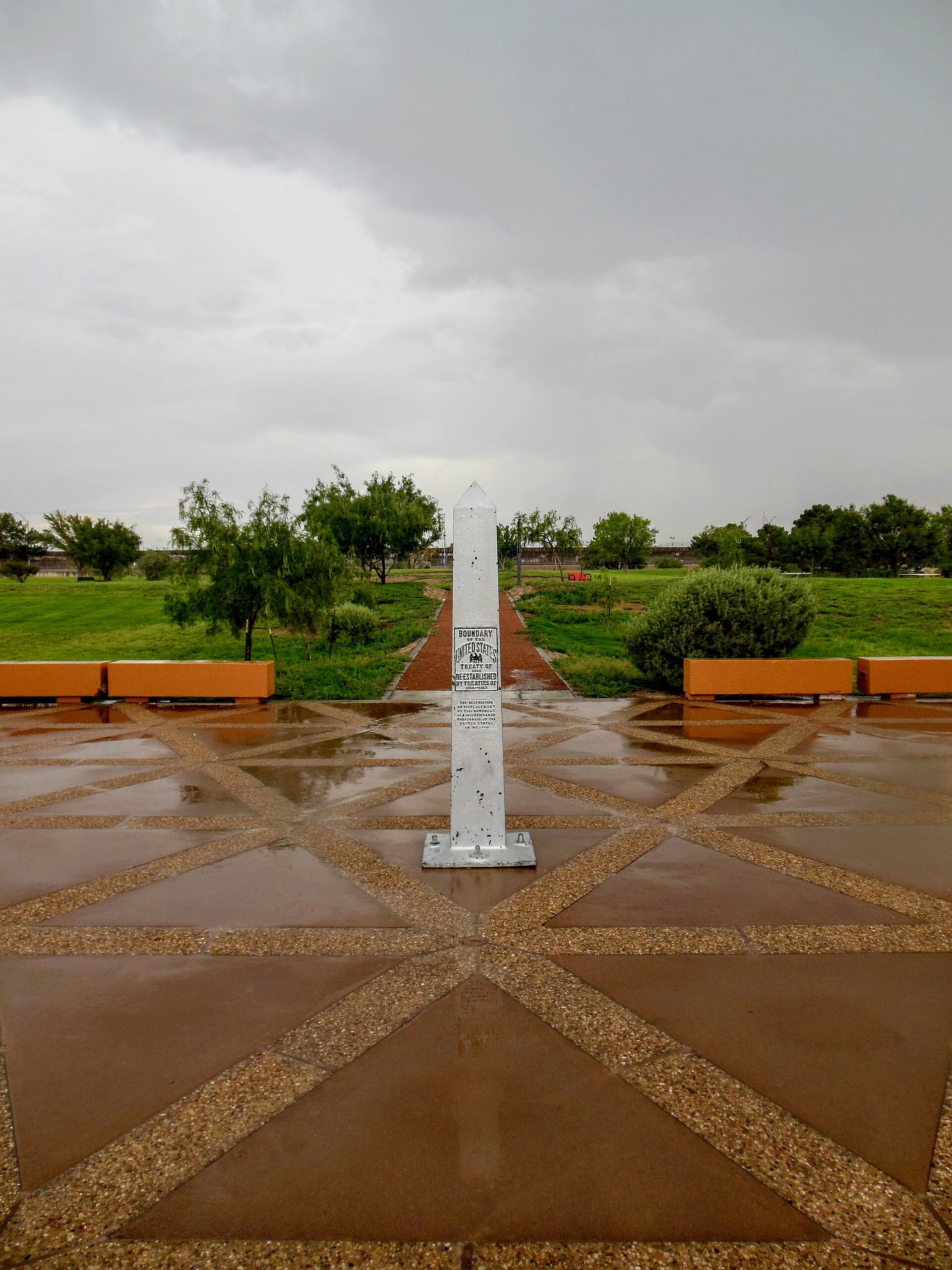
The most famous of those disputes involved the Chamizal tract between El Paso and Ciudad Juárez. The disagreement lasted roughly a century before the United States and Mexico reached a diplomatic settlement in the 1960s. Part of the river was channelized, territory was transferred, and the boundary was stabilized.
Chamizal National Memorial now preserves the story as an example of an international dispute resolved through negotiation. It is an unusually hopeful historic site: the central event is not a battle but a settlement.
Fort Bliss grew from border defense into one of the region's defining institutions
The U.S. Army established a military presence in the El Paso area in the mid-nineteenth century as American control expanded across the Southwest. Fort Bliss moved locations several times before settling permanently northeast of the city.
Its role changed with the country around it. The post guarded travel routes, supported campaigns in the Southwest and later became deeply tied to modern artillery, air defense and missile development. Its growth also made the military one of the enduring economic and cultural forces in El Paso County.
The fort is another example of how the pass shaped institutions. A military installation here could watch a border, protect major transportation corridors and connect operations across a huge desert region.
Then the railroad turned a border settlement into a major city
El Paso's explosive modern growth began when railroads arrived in the early 1880s. Multiple lines connected the city to California, the Gulf Coast, the Midwest and Mexico, transforming a remote border settlement into a transportation and commercial hub.
Rail access drew merchants, workers, hotels, warehouses and industry. It also strengthened the economic relationship between El Paso and Ciudad Juárez. The two cities grew as distinct municipalities in different countries, but their labor markets, families and commerce remained intertwined.
That binational reality is still one of the county's defining facts. You can understand El Paso as a Texas city, but you cannot understand it fully without understanding Juárez.
The Franklin Mountains make this one of Texas' strangest big-city landscapes
The Franklin Mountains run directly through El Paso, splitting the urban area and rising abruptly from the desert floor. Unlike many metropolitan mountain backdrops, the range is not merely something on the horizon; it physically shapes neighborhoods, roads and the city's geography.
Franklin Mountains State Park protects a large portion of that range and gives residents unusual access to hiking, mountain biking, rock climbing and desert views without leaving the metro area.
From high points in the range, the county's central fact becomes visible at once: one urban landscape extends across an international boundary, while mountains and desert frame both sides.
Agriculture survived because the valley could be irrigated
The lower El Paso Valley has supported farming for centuries because river water could be directed onto otherwise arid land. Indigenous farmers, Spanish missions, Mexican settlements and later commercial growers all depended on irrigation.
Modern El Paso County agriculture has included cotton, pecans, vegetables and other crops suited to irrigated desert farming. The green ribbon of the valley can feel startling beside surrounding desert and mountains.
That contrast also links El Paso County directly to neighboring Hudspeth County, where Rio Grande communities such as Fort Hancock developed through the same basic relationship between water, agriculture and border geography.
A few El Paso County facts worth remembering
- The name El Paso comes from the historic 'pass' through the mountains used by travelers moving through the Chihuahuan Desert.
- Ysleta Mission was founded in 1682 after Tigua people and Spanish settlers moved south following the Pueblo Revolt.
- Ysleta del Sur Pueblo is the only federally recognized Pueblo tribe in Texas.
- The El Paso Mission Trail connects Ysleta, Socorro and San Elizario through one of the oldest continuously settled cultural landscapes in the state.
- The Chamizal dispute between the United States and Mexico grew from changes in the Rio Grande channel and was settled diplomatically in the twentieth century.
- Railroads arriving in the early 1880s transformed El Paso into a major transportation and commercial center.
- The Franklin Mountains rise through the metropolitan area and form one of Texas' most distinctive urban landscapes.
- Fort Bliss became one of the most important military installations in the Southwest and remains a major presence in the county.
Why El Paso County feels unlike anywhere else in Texas
El Paso County does not fit comfortably into the usual east-to-west story of Texas settlement. Its oldest communities look south and north along the Rio Grande before they look east toward the rest of the state. Its architecture, language, food and family history are inseparable from northern Mexico and New Mexico.
That does not make the county less Texan. It makes Texas harder to reduce to a single origin story. Here, Pueblo history, Spanish missions, Mexican borderlands, U.S. military expansion, railroad capitalism, immigration and modern binational life all occupy the same landscape.
The county also gives the Far West Texas series a natural western anchor. To the east, Hudspeth County carries the Rio Grande and railroad story into Sierra Blanca and the desert basins. Beyond that, Culberson, Jeff Davis, Presidio and Brewster counties continue through mountains, ranch country and the Big Bend.
Taken together, those counties show why the western edge of Texas deserves to be understood as more than empty mileage. El Paso County is the clearest proof: the pass has been bringing people together for centuries, and the modern border city is only the latest version of that much older geography.
Sources & verification
Research and official records
Research references support the editorial history and places described above. The official directories below help verify current county seats, census geography, property tax offices and vehicle services. Office personnel, contact details and links can change; check the agency website before traveling.
County-specific research references
- Texas State Historical Association — El Paso County history ↗
- U.S. Census Bureau — El Paso County QuickFacts ↗
- El Paso County Elections — municipality maps ↗
- National Park Service — Chamizal National Memorial ↗
- National Park Service — El Camino Real de Tierra Adentro ↗
- Texas Parks & Wildlife — Franklin Mountains State Park ↗
- City of El Paso — Consolidated Tax Office ↗
Further county history research
Use the published county history as independent background reading, not as proof that every claim in this guide has been checked against that reference.
Texas food destinations
Food & drink in El Paso County
This guide includes 1 source-checked food destination tied to this county. The profiles emphasize durable history, regional significance and official-source verification rather than volatile menus, prices or hours.
Browse the Texas Food & BBQ guide →Museum and heritage guides
Museums connected to El Paso County
Independent guides to collections, exhibits, visitor planning, accessibility and historical research. Verify each museum's current hours and admissions before traveling.
- Ysleta del Sur Pueblo Cultural Center Museum
Pueblo-led interpretation of Tigua history and living heritage; verify access and program dates.
- El Paso Museum of History ↗
Downtown museum of regional borderlands history, interactive digital heritage and changing exhibitions. TexasDefined has not yet published an individual authority guide for this museum.
- La Nube STEAM Discovery Center ↗
Downtown interactive science and STEAM experiences for families; check current admission and access. TexasDefined has not yet published an individual authority guide for this museum.
- National Border Patrol Museum ↗
Nonprofit museum tracing Border Patrol history through equipment, artifacts, vehicles and exhibitions. TexasDefined has not yet published an individual authority guide for this museum.
- El Paso Museum of Art
El Paso, El Paso County · Exhibits and visitor planning
- El Paso Holocaust Museum and Study Center
El Paso, El Paso County · Exhibits and visitor planning
- El Paso Museum of Archaeology
El Paso, El Paso County · Exhibits and visitor planning
Explore this county
State parks in El Paso County
Visit-ready local park guides with official maps, facilities research and nearby trip ideas. Review current park alerts and reservations before setting out.
El Paso's nearly 27,000-acre mountain wilderness offers more than 100 miles of Chihuahuan Desert trails, rugged North Franklin Peak climbs, mountain biking, rock climbing and primitive camping in the Tom Mays Unit.
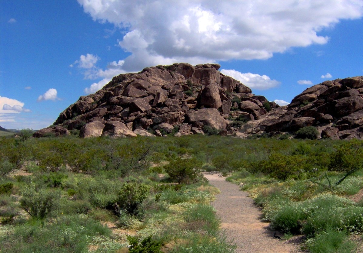
Protect and explore Hueco Tanks' ancient pictographs and desert rock basins east of El Paso, with strict North Mountain permits, advance-booked guided access, climbing rules and limited camping.
Water parks & family aquatics
Water parks in El Paso County
5 recorded indoor, outdoor or resort water-play facilities in this county. Most outdoor venues operate seasonally and resort access may be restricted. Confirm the official schedule, admission eligibility and rides directly before visiting.
- Wet N' Wild Waterworld
Anthony · Outdoor · Destination park
Day tickets, passes and optional upgrades
- Camp Cohen Water Park
El Paso · Outdoor · Municipal water park
City water-park general admission or neighborhood pass
- Chapoteo Water Park
El Paso · Outdoor · Municipal water park
City general admission, seasonal passes, and special-event tickets
- Lost Kingdom Water Park
El Paso · Outdoor · Municipal water park
City day admission or qualifying location/City Wave passes
- Oasis Water Park
El Paso · Outdoor · Municipal water park
City water-park tickets or location/City Wave passes
Local places to visit
More to explore in El Paso County
These additional local places complement the park, museum, beach and other destination guides on this county page. They are not ranked. For events, swimming, tours or restricted properties, always check current visitor information before traveling.
- Art & architecture
Hotel Paso del Norte
A historic 1912 Trost-designed hotel in downtown El Paso, notable for its stained-glass dome and 2020 preservation rehabilitation. An operating hotel, not an unrestricted museum.
RV parks & campgrounds
RV camping around El Paso County
TexasDefined currently connects 1 RV park or campground directory entry to this county. Verify hookups, rig limits, rates and reservations with the operator before travel.
Browse all Texas RV parks & campgrounds →Major annual events
Events worth planning around in El Paso County
Texas Defined links only to event guides backed by organizer or equivalent first-party evidence. Future recurrence-derived dates are labeled on the event guide.
Texas tournaments
Tournaments & competitions near El Paso County
Browse TexasDefined’s statewide tournament directory across golf, rodeo, team sports, fishing, BBQ, chess, esports, academic competitions and more. County relationships are published only when a location can be assigned confidently; current dates, venues and entry details require organizer verification.
Texas high school football
High school football in El Paso County
See current UIL football programs whose TEA school-directory records are in El Paso County. Use the statewide finder to compare a specific high school or ISD before choosing where to live.
Open the statewide football finder →Loading current UIL football programs…
What this tells you: current 2026–28 UIL classification, football division, district and six-man/11-man format. School, ISD, city and county context is attached only when Texas Education Agency AskTED produces an unambiguous campus match; uncertain matches are deliberately omitted.
All-time state-final history: title and appearance totals use UIL’s Football All-Time Appearances table, supplemented with newer completed state-final rows from the official State Archives when that all-time table trails the latest archive. Totals appear only on an exact normalized UIL school-name match.
Recent state-final detail: the game-level list covers the eight completed UIL championship seasons from 2018–19 through 2025–26. No history badge does not mean a weak program; it means the source did not produce an exact normalized school-name match.
This is not a “best school” rating. Football placement and recent championship history are only parts of researching a program. Attendance zones, transfers, eligibility and campus assignments can change, so confirm an exact address and student eligibility with the school district and UIL before making a move.
Researched local football programs
Football history connected to El Paso County
- Anthony Wildcats football authority guide →
Anthony Texas varsity history and 2026 UIL football context
- Canutillo Eagles football authority guide →
Canutillo High: Scott Brooks final season, 2026 District 1-5A DII results, Lowenberg Eagles Stadium and current official schedule links
- Clint Lions football authority guide →
School-listed Rosuel Martinez is Clint Lions head coach; 4A Division II District 1 and separate Alameda Avenue school
- Horizon Scorpions football authority guide →
Omar Garcia current 2026 football coach at Horizon High; 5A Division I District 1 and Horizon City campus
- Mountain View Lobos football authority guide →
DJ Check coaches Lobos; 4A Division II District 1 and October 23 source-dated Fabens final
- El Paso High Tigers football authority guide →
El Paso High Tigers, EPISD, 5A Division II
- Americas Trail Blazers football authority guide →
Americas High, Socorro ISD, 5A Division I
- Andress Eagles football authority guide →
Andress High, EPISD, 4A Division I
- El Paso Austin Panthers football authority guide →
Austin High in El Paso, not Austin, Texas; EPISD 4A Division I
- Bel Air Highlanders football authority guide →
Bel Air High, Ysleta ISD, 5A Division I
- El Paso Bowie Bears football authority guide →
El Paso Bowie High, not Bowie in Montague County; EPISD 4A Division II
- Burges Mustangs football authority guide →
Burges High, EPISD, 5A Division II
- Chapin Huskies football authority guide →
Chapin High, EPISD, 5A Division II
- Coronado Thunderbirds football authority guide →
Coronado High Thunderbirds campus in El Paso County, EPISD, UIL 6A District 1
- El Paso Del Valle Conquistadores football authority guide →
Del Valle High, Ysleta ISD, not Travis County Del Valle; 5A Division II
- Eastlake Falcons football authority guide →
Socorro ISD Eastlake High School campus, 13000 Emerald Pass Ave; UIL 6A District 1
- Eastwood Troopers football authority guide →
Ysleta ISD Eastwood High School campus, 2430 McRae Blvd; UIL 6A District 1
- El Dorado Aztecs football authority guide →
Socorro ISD El Dorado High School campus, 12401 Edgemere Blvd; UIL 5A Division I District 1; not Schleicher County Eldorado
- Franklin Cougars football authority guide →
El Paso ISD Franklin High School campus, 900 Resler Drive; UIL 6A District 1
- J.M. Hanks Knights football authority guide →
Ysleta ISD Hanks High School campus, 2001 Lee Trevino; UIL 5A Division I District 1
- Irvin Rockets football authority guide →
El Paso ISD Irvin High School current campus, 5400 Sanders Ave; UIL 4A Division II District 1
- Jefferson Silver Foxes football authority guide →
El Paso ISD Jefferson High School, 4700 Alameda Ave; UIL 5A Division II District 1
- Montwood Rams football authority guide →
Socorro ISD Montwood High School, 12000 Montwood Drive; UIL 6A District 1
- Parkland Matadors football authority guide →
Ysleta ISD Parkland High School, 5932 Quail Ave; UIL 5A Division I District 1
- Pebble Hills Spartans football authority guide →
Socorro ISD Pebble Hills High School, 14400 Pebble Hills Blvd; UIL 6A District 1
- Riverside Rangers football authority guide →
Ysleta ISD Riverside High School campus, 301 Midway Dr; UIL 4A Division I District 1
- Socorro Bulldogs football authority guide →
Socorro ISD Socorro High School campus, 10150 Alameda Ave in Socorro; UIL 6A District 1
- Ysleta Indians football authority guide →
Ysleta ISD Ysleta High School campus, 8600 Alameda Ave; UIL 4A Division I District 1
- Fabens Wildcats football authority guide →
Fabens High School, 601 NE G Avenue, El Paso County; distinct Fabens ISD athletics office at 600 NE 4th Street; UIL 2026–28 4A Division II District 1. Verify host venue and tickets separately.
Independent editorial guides. Game sites and district boundaries may span county lines; each listed school is linked by its campus county.