Skip to content

Rio Grande Valley · Weekend trips

Weekend Trips From McAllen, Texas

Overnight-worthy towns, parks, water, caves, coast and history that can anchor a one- or two-night escape from the metro.

Source-backed options30

Distance window45–230 straight-line miles

OrderingGeographic distance

Straight-line distances are screening estimates from central McAllen. They are not road miles or drive-time promises. Use the “Check current drive” links in the map and guide sections below for current Google Maps routing, road mileage and travel-time estimates.

Plan around the calendar

Upcoming events in these weekend destinations

These events are limited to towns represented by the weekend-trip destinations on this page.

View all Texas events →

Map & routes

Find it on the map and compare routes

Easy day-trip range

15 full TexasDefined guides in this geographic band

About 48 geographic miles

Brownsville

Brownsville · Cameron County

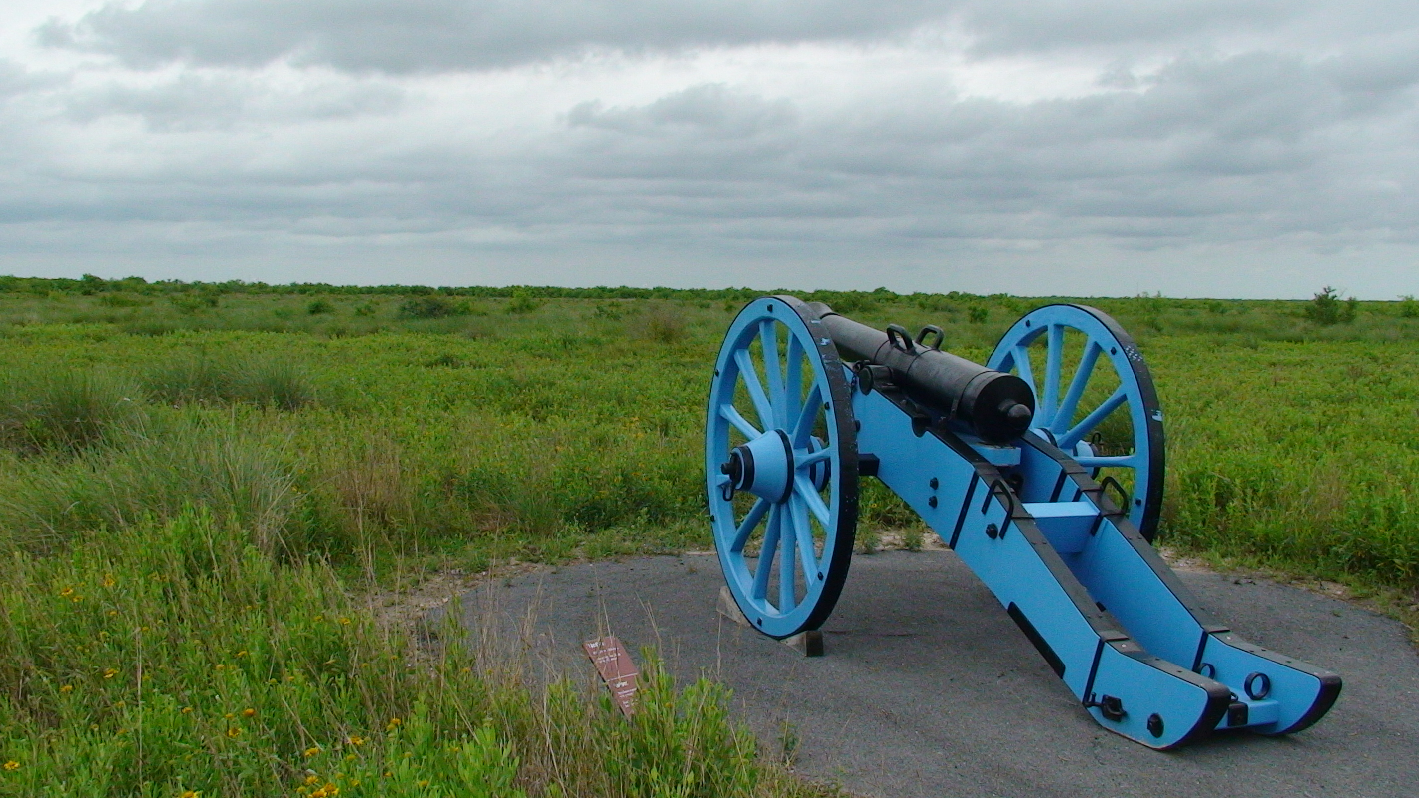
Palo Alto Battlefield National Historical Park

Walk the preserved South Texas battlefield where U.S. and Mexican armies fought on May 8, 1846, with separate visitor-center hours and interpretation of the contested border and war from both nations' perspectives.

Best season: November through May offers milder South Texas weather; check current park conditions before visiting.Updated Oct 2026
  • First major U.S.–Mexican War battlefield landscape (May 8, 1846)
  • Exhibits interpreting U.S. and Mexican military perspectives
  • Separate grounds, walking-trail and visitor-center schedules
Explore this place
Check current drive from McAllen ↗

About 50 geographic miles

Brownsville

Brownsville · Cameron County

Historic Brownsville Museum

The Historic Brownsville Museum occupies the restored 1928 Southern Pacific Railroad Depot and interprets the founding and development of Brownsville through local-history exhibits, a rare 1872 Rio Grande Railroad locomotive and an adjoining education center.

Updated Aug 2026
  • 1928 Southern Pacific Railroad Depot
  • 1872 Rio Grande Railroad locomotive
  • Brownsville founding history
Explore this place
Check current drive from McAllen ↗

About 55 geographic miles

Los Fresnos

Los Fresnos · Cameron County

Laguna Atascosa National Wildlife Refuge

A Lower Rio Grande Valley refuge protecting thornscrub, coastal prairie, wetlands and Laguna Madre habitat used by ocelots, aplomado falcons and hundreds of bird species.

Best season: Fall through spring for birding and comfortable wildlife viewingUpdated Sep 2026
  • Ocelot conservation habitat
  • Exceptional Lower Valley birding
  • Coastal prairie and thornscrub
Explore this place
Check current drive from McAllen ↗

About 62 geographic miles

Brownsville

Brownsville · Cameron County

Palmito Ranch Battlefield

Palmito Ranch is associated with the final land battle of the American Civil War, fought near the Rio Grande in May 1865. The remote battlefield is best approached as a landscape-history stop that explains why fighting continued in Texas after major Confederate armies had surrendered elsewhere.

Best season: Year-round; spring and fall are usually the most comfortable for outdoor portions of a visit.Updated Oct 2026
  • Civil War
  • battlefields
  • Rio Grande
Explore this place
Check current drive from McAllen ↗

About 62 geographic miles

Falcon Heights

Falcon Heights · Starr County

Falcon State Park

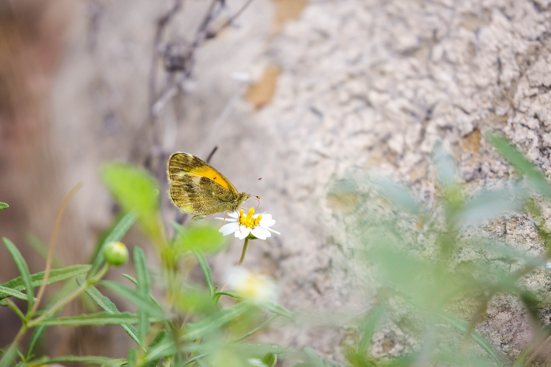
Falcon State Park on Falcon International Reservoir in South Texas pairs lake fishing and camping with dry-brush birding, butterfly habitat and the history of the Rio Grande dam near Roma.

Best season: Fall and winter for milder weather and brush-country birding; fishing and camping require attention to current heat and lake levels year-round.Updated Oct 2026
  • Falcon International Reservoir fishing and boat access
  • Dry-brush birding and tropical South Texas species
  • Camping, cabins and screened shelters
Explore this place
Check current drive from McAllen ↗

About 64 geographic miles

Port Isabel

Port Isabel · Cameron County

Port Isabel Lighthouse State Historic Site

Texas' only lighthouse open to the public, an 1852 brick tower in Port Isabel where 75 winding stairs and short ladders lead to coastal views toward South Padre Island and a restored third-order Fresnel lens.

Best season: Fall through spring for mild coastal weather; summer offers extended hours but greater heat and storm riskUpdated Oct 2026
  • Climb Texas' only publicly accessible lighthouse
  • Third-order Fresnel lens illuminated again since 2022
  • Views toward South Padre Island and Laguna Madre
Explore this place
Check current drive from McAllen ↗

About 64 geographic miles

Port Isabel

Port Isabel · Cameron County

Port Isabel

Port Isabel is a Lower Laguna Madre coastal town anchored by the historic 1852 lighthouse, a walkable town square, maritime museums, fishing access and the Queen Isabella Causeway connection to South Padre Island.

Best season: Fall through spring for mild coastal touring; summer for fishing and beach-region trips with heat, storms and lighthouse weather closures consideredUpdated Sep 2026
  • Port Isabel Lighthouse
  • Lower Laguna Madre
  • historic museums
Explore this place
Check current drive from McAllen ↗

About 64 geographic miles

Port Isabel

Port Isabel · Cameron County

Port Isabel Historical Museum

The Port Isabel Historical Museum occupies the 1899 Champion Building and interprets the Laguna Madre area's maritime, border and community history beneath the building's distinctive early twentieth-century fish mural.

Updated Oct 2026
  • 1899 Champion Building
  • Laguna Madre history
  • 1906 fish mural
Explore this place
Check current drive from McAllen ↗

About 66 geographic miles

South Padre Island

South Padre Island · Cameron County

E.K. Atwood Park

A Cameron County beach access north of town that connects State Park Road 100 to Gulf shoreline and the island's vehicle-access beach corridor.

Best season: October through May for milder weather; summer works for beach days with heat, storms and surf conditions checked closelyUpdated Sep 2026
  • Named public beach-access point
  • Padre Island & South Texas setting
  • South Padre Island access
Explore this place
Check current drive from McAllen ↗

About 66 geographic miles

South Padre Island

South Padre Island · Cameron County

Sea Turtle, Inc.

South Padre Island’s sea-turtle rescue and education center lets visitors learn about rehabilitation, resident turtles and Gulf conservation beside the Laguna Madre.

Best season: Year-round; summer connects naturally with a South Padre beach trip, while winter can be especially meaningful for understanding cold-stun rescue work.Updated Aug 2026
  • Sea-turtle rehabilitation
  • Resident turtles
  • Conservation education
Explore this place
Check current drive from McAllen ↗

About 66 geographic miles

South Padre Island

South Padre Island · Cameron County

Andy Bowie County Park

A Cameron County Gulf beach park just north of South Padre Island's developed core, with beach access, parking, pavilions, restrooms and RV facilities.

Best season: October through May for milder weather; summer works for beach days with heat, storms and surf conditions checked closelyUpdated Sep 2026
  • Managed coastal park
  • Padre Island & South Texas setting
  • South Padre Island access
Explore this place
Check current drive from McAllen ↗

About 66 geographic miles

South Padre Island

South Padre Island · Cameron County

South Padre Island

A subtropical barrier island at the southern tip of Texas with broad Gulf beaches, Laguna Madre sunsets, birding, sea-turtle conservation and year-round coastal recreation.

Best season: Fall through spring for mild weather; summer for beach recreation with heat and storm awarenessUpdated Oct 2026
  • Gulf beaches
  • Laguna Madre
  • Sea Turtle Inc.
Explore this place
Check current drive from McAllen ↗

About 66 geographic miles

South Padre Island

South Padre Island · Cameron County

South Padre Island Sandcastle Trail

A year-round public-art trail of roughly 30 semi-permanent sand sculptures spread around South Padre Island, extending the island's sandcastle culture beyond the beach itself.

Best season: Year-round; spring and fall offer the easiest weather for exploring the trail, while summer requires more attention to heat and sun exposure.Updated Sep 2026
  • Roughly 30 sand sculptures
  • Free island-wide public-art trail
  • Professional sand artists
Explore this place
Check current drive from McAllen ↗

About 66 geographic miles

South Padre Island

South Padre Island · Cameron County

South Padre Island Beaches

The developed resort-city Gulf shoreline of South Padre Island, connected by city and county beach accesses and extending north toward drive-on county beach areas.

Best season: October through May for milder weather; summer works for beach days with heat, storms and surf conditions checked closelyUpdated Sep 2026
  • Open-Gulf beach
  • Padre Island & South Texas setting
  • South Padre Island access
Explore this place
Check current drive from McAllen ↗

About 67 geographic miles

South Padre Island

South Padre Island · Cameron County

Isla Blanca Park

Cameron County's major coastal park at the southern end of South Padre Island, with more than a mile of Gulf beach, pavilions, jetties, marina access, RV facilities and seasonal beach services.

Best season: October through May for milder weather; summer works for beach days with heat, storms and surf conditions checked closelyUpdated Sep 2026
  • Managed coastal park
  • Padre Island & South Texas setting
  • South Padre Island access
Explore this place
Check current drive from McAllen ↗

Longer day trip

15 full TexasDefined guides in this geographic band

About 80 geographic miles

Zapata

Zapata · Zapata County

Zapata County Museum of History

Visit Zapata County Museum of History in South Texas for the story of Old Zapata's relocation, Falcon Dam and the Rio Grande borderlands, plus exhibits on energy, wildlife, military service, geology and religious heritage.

Updated Oct 2026
  • Old Zapata relocation and the construction of Falcon Reservoir
  • Ranching, trade and communities along the Rio Grande
  • Oil-and-gas geology and regional energy development
Explore this place
Check current drive from McAllen ↗

About 86 geographic miles

Corpus Christi

Corpus Christi · Kleberg County

Yarborough Pass

A remote primitive camping and small-boat access area on the Laguna Madre side of Padre Island National Seashore, reached from South Beach by a high-clearance four-wheel-drive route.

Best season: October through May for milder weather; summer works for beach days with heat, storms and surf conditions checked closelyUpdated Sep 2026
  • Coastal shoreline and habitat area
  • Padre Island & South Texas setting
  • Corpus Christi access
Explore this place
Check current drive from McAllen ↗

About 101 geographic miles

Corpus Christi

Corpus Christi · Nueces County

Padre Island National Seashore Backcountry / South Beach

The long undeveloped South Beach and down-island Gulf shoreline of Padre Island National Seashore, where remote beach driving, primitive camping and exceptional barrier-island solitude replace developed amenities.

Best season: October through May for milder weather; summer works for beach days with heat, storms and surf conditions checked closelyUpdated Sep 2026
  • National-seashore coastline
  • Padre Island & South Texas setting
  • Corpus Christi access
Explore this place
Check current drive from McAllen ↗

About 102 geographic miles

Corpus Christi

Corpus Christi · Nueces County

Padre Island National Seashore

Visit the federally protected North Padre Island shoreline south of Corpus Christi with NPS rules for Malaquite and other beaches, changing surf and rip currents, sand-driving limits and distinct camping areas.

Best season: Fall through spring for mild beach weather and birding; summer brings heat, humidity and storm risk but also seasonal sea-turtle activity, so conditions should guide every visitUpdated Oct 2026
  • Malaquite Visitor Center beach access and Gulf scenery
  • Long barrier-island habitat and coastal wildlife
  • North and South Beach vehicle access subject to sand conditions
Explore this place
Check current drive from McAllen ↗

About 104 geographic miles

Corpus Christi

Corpus Christi · Nueces County

Malaquite Beach

The vehicle-free beach beside Malaquite Visitor Center in Padre Island National Seashore, offering a quieter developed access point with parking, restrooms and showers.

Best season: October through May for milder weather; summer works for beach days with heat, storms and surf conditions checked closelyUpdated Sep 2026
  • National-seashore coastline
  • Padre Island & South Texas setting
  • Corpus Christi access
Explore this place
Check current drive from McAllen ↗

About 114 geographic miles

Corpus Christi

Corpus Christi · Nueces County

Whitecap Beach

A North Padre Island Gulf beach at the end of Whitecap Boulevard with both pedestrian-only shoreline and vehicle-access areas near the Corpus Christi beach corridor.

Best season: October through May for milder weather; summer works for beach days with heat, storms and surf conditions checked closelyUpdated Sep 2026
  • Open-Gulf beach
  • Padre Island & South Texas setting
  • Corpus Christi access
Explore this place
Check current drive from McAllen ↗

About 115 geographic miles

Corpus Christi

Corpus Christi · Nueces County

Oso Bay Coast & Wetlands Preserve

The shallow Oso Bay shoreline and wetland system on Corpus Christi's south side, important for habitat, birding, nature education and paddling rather than conventional beach swimming.

Best season: Fall through spring for comfortable exploring and birding; summer requires more heat, storm and insect planningUpdated Sep 2026
  • Coastal shoreline and habitat area
  • Mustang Island & Corpus Christi Bay setting
  • Corpus Christi access
Explore this place
Check current drive from McAllen ↗

About 119 geographic miles

Laredo

Laredo · Webb County

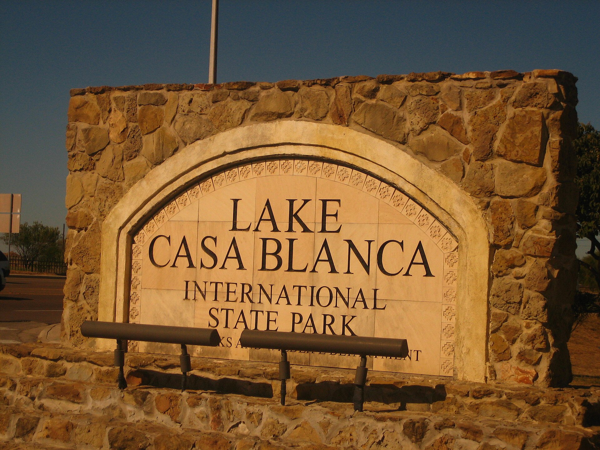
Lake Casa Blanca International State Park

A Laredo lake park on the edge of the South Texas brush country, offering fishing, paddling, swimming, camping and an accessible outdoor stop close to the city.

Best season: Fall through spring; summer requires strong heat precautionsUpdated Oct 2026
  • Lake Casa Blanca fishing
  • Paddling and boating
  • Swimming and lakeside picnics
Explore this place
Check current drive from McAllen ↗

About 120 geographic miles

Corpus Christi

Corpus Christi · Nueces County

Cole Park Beach

The Corpus Christi Bay waterfront at Cole Park, best understood as a major city park and bayfront promenade with shoreline access rather than a formal open-Gulf beach.

Best season: Fall through spring for comfortable exploring and birding; summer requires more heat, storm and insect planningUpdated Sep 2026
  • Coastal shoreline and habitat area
  • Mustang Island & Corpus Christi Bay setting
  • Corpus Christi access
Explore this place
Check current drive from McAllen ↗

About 120 geographic miles

Port Aransas

Port Aransas · Nueces County

Mustang Island State Park

A Gulf Coast barrier-island park near Corpus Christi with miles of beach, paddling trails, surf fishing, birding and primitive or developed camping close to the water.

Best season: Fall through spring for mild weather and birding; summer for beach use with heat precautionsUpdated Sep 2026
  • Gulf beach
  • Mustang Island paddling trail
  • Surf fishing
Explore this place
Check current drive from McAllen ↗

About 121 geographic miles

Corpus Christi

Corpus Christi · Nueces County

McGee Beach

A downtown Corpus Christi Bay beach on Shoreline Boulevard within walking distance of the marina, hotels, museums and convention-center district.

Best season: March through May and September through November for milder beach weather; summer is busiest and hottestUpdated Sep 2026
  • Protected-bay beach
  • Mustang Island & Corpus Christi Bay setting
  • Corpus Christi access
Explore this place
Check current drive from McAllen ↗

About 122 geographic miles

Corpus Christi

Corpus Christi · Nueces County

Corpus Christi Museum of Science and History

The Corpus Christi Museum of Science and History combines South Texas cultural history, coastal ecology, archaeology and hands-on science in the city's S.E.A. District near the harbor.

Updated Aug 2026
  • Science and South Texas history
  • Coastal ecology
  • Archaeology
Explore this place
Check current drive from McAllen ↗

About 122 geographic miles

Corpus Christi

Corpus Christi · Nueces County

Art Museum of South Texas

The Art Museum of South Texas overlooks Corpus Christi Bay with collections and changing exhibitions emphasizing art of the Americas, Texas and the region inside landmark buildings associated with architects Philip Johnson and Ricardo Legorreta.

Updated Aug 2026
  • Art of Texas and the Americas
  • Corpus Christi Bayfront
  • Philip Johnson and Ricardo Legorreta architecture
Explore this place
Check current drive from McAllen ↗

About 123 geographic miles

Corpus Christi

Corpus Christi · Nueces County

Texas State Aquarium

A major Gulf Coast aquarium in Corpus Christi focused on marine life, coastal habitats and wildlife conservation, with indoor galleries, large tanks and family exhibits on North Beach.

Updated Aug 2026
  • Gulf of Mexico marine life
  • Large aquatic habitats
  • Wildlife presentations
Explore this place
Check current drive from McAllen ↗

About 123 geographic miles

Corpus Christi

Corpus Christi · Nueces County

USS Lexington Museum

The World War II Essex-class aircraft carrier USS Lexington (CV-16), preserved on Corpus Christi's North Beach as a National Historic Landmark and aviation museum.

Updated Oct 2026
  • World War II aircraft carrier
  • Flight deck aircraft
  • Wheelchair-accessible hangar and flight decks with LEX LIFT
Explore this place
Check current drive from McAllen ↗

Before you go

Use geography as a shortlist, then check the real route.

TexasDefined uses location data to make the statewide catalog easier to search. Open the current driving route for the places you are considering, then verify opening hours, reservations, park alerts, water conditions and weather with the current official source.