Skip to content

Turn the list into a trip

Seven road trips built around TexasDefined's Top 25

These are editorial route structures, not turn-by-turn directions. Each one groups Top-25 attractions that make geographic and trip-planning sense together, then hands every stop back to its verified destination guide and the TexasDefined Trip Planner.

Route 1 · 4–6 days

San Antonio & Hill Country essentials

Build from San Antonio's mission-and-river core into caverns, wildlife, Gruene and Fredericksburg for the densest Top-25 cluster in the state.

Planning logic

Keep the first two days centered in San Antonio, then move north toward the Natural Bridge area, New Braunfels and Fredericksburg instead of backtracking each night.

Start this route in Trip Planner →
  1. 1Route stop

    San Antonio · Bexar County

    The Alamo

    San Antonio's best-known historic landmark: the former Mission San Antonio de Valero, where more than three centuries of mission, military, revolutionary and preservation history converge in the heart of downtown.

    Best season: Fall through spring for comfortable downtown walking; in summer, visit near opening for cooler temperatures and lighter crowdsUpdated Oct 2026
    • Historic Alamo Church and Long Barrack
    • Alamo Exhibit and the Ralston Family Collections Center
    • Living History demonstrations and interpretation of the mission and 1836 battle
    Explore this place
  2. 2Route stop

    San Antonio · Bexar County

    San Antonio River Walk

    San Antonio's 15-mile river corridor links the famous below-street downtown promenade with the Museum Reach, Pearl and the Mission Reach, combining cypress-shaded walks, restaurants, public art, river cruises and some of the city's most important historic places.

    Best season: Fall through spring for the most comfortable walking weather; summer is best early in the morning or after sunset, while the holiday season brings some of the River Walk's most recognizable evening lightsUpdated Aug 2026
    • The classic below-street downtown river loop with cypress trees, stone bridges, restaurants and river cruises
    • Museum Reach trail and public art extending north toward Pearl
    • Mission Reach trails connecting the river corridor with San Antonio's Spanish colonial mission landscape
    Explore this place
  3. 3Route stop

    San Antonio · Bexar County

    San Antonio Missions National Historical Park

    Visit the four National Park Service Spanish colonial mission sites along San Antonio's Mission Reach, understanding active parish access and the separate status of the Alamo within the five-mission UNESCO World Heritage area.

    Best season: Fall through spring for comfortable walking and biking; summer visits are best early in the day with shade and water built into the routeUpdated Oct 2026
    • Four NPS missions: Concepción, San José, San Juan and Espada
    • Active Catholic parishes with services that affect church access
    • Mission Reach trail linking river corridors and mission sites
    Explore this place
  4. 4Route stop

    San Antonio · Comal County

    Natural Bridge Caverns

    A major Hill Country cave attraction north-east of San Antonio where guided routes descend through enormous limestone rooms, stalactites, stalagmites and flowstone, with multiple cavern experiences and above-ground family attractions surrounding the natural limestone bridge that gave the site its name.

    Best season: Year-round underground, where cavern temperatures stay comparatively stable; spring and fall are most comfortable for combining cave tours with above-ground attractionsUpdated Aug 2026
    • Discovery Tour through the original cavern rooms
    • Hidden Wonders tour and large underground chambers
    • Natural limestone bridge at the cavern entrance
    Explore this place
  5. 5Route stop

    San Antonio · Comal County

    Natural Bridge Wildlife Ranch

    A 500-acre drive-through safari beside Natural Bridge Caverns where visitors travel in their own enclosed vehicles among more than 500 animals from dozens of species, then continue through walkable animal areas and optional guided safari experiences.

    Best season: Fall through spring for comfortable temperatures; the ranch recommends morning arrival for animal activity and lighter crowds, especially on weekends, holidays and summer daysUpdated Aug 2026
    • Self-guided drive-through safari across 500 acres
    • More than 500 animals representing roughly 40 species
    • Giraffes, antelope, bison and other free-ranging hoofstock
    Explore this place
  6. 6Route stop

    New Braunfels · Comal County

    Gruene Historic District

    A compact National Historic District on the Guadalupe River in New Braunfels where nineteenth-century German-Texan buildings now hold Gruene Hall, shops, restaurants, lodging and live music, preserving the scale of the original township while remaining an active entertainment district.

    Best season: Spring and fall for comfortable walking and river weather; summer is lively but crowded and hot, while evenings are attractive year-round when live music is part of the planUpdated Aug 2026
    • Gruene Hall and its long-running live-music tradition
    • Walkable nineteenth-century commercial buildings
    • Guadalupe River access and Hill Country river culture
    Explore this place
  7. 7Route stop

    Fredericksburg · Gillespie County

    Fredericksburg Historic District

    Fredericksburg's National Historic District centers on a broad Hill Country Main Street lined with limestone commercial buildings, German-Texan landmarks, museums, churches and more than 80 points of historic interest that turn the town's nineteenth-century immigrant story into a walkable living district.

    Best season: Fall through spring for comfortable walking; spring wildflowers and the winter holiday season add atmosphere, while summer mornings are better than exposed afternoonsUpdated Aug 2026
    • Historic limestone buildings along Main Street
    • More than 80 documented points of historic interest
    • Vereins Kirche and Marktplatz in the center of town
    Explore this place

Route 2 · 3–4 days

Austin & Central Texas history, nature and caves

Combine the Capitol and Bullock Museum with the Wildflower Center, Hamilton Pool and Inner Space Cavern for a compact Central Texas mix of civic history and natural systems.

Planning logic

Treat Hamilton Pool as the schedule-sensitive stop and build the flexible Austin museums, gardens and Georgetown cavern around its current access requirements.

Start this route in Trip Planner →
  1. 1Route stop

    Austin · Travis County

    Texas State Capitol

    Austin's landmark pink-granite Capitol, where free public tours, legislative chambers, historic grounds and exhibits connect Texas government with the architecture and civic history of the state in the center of Downtown Austin.

    Best season: Year-round; spring and fall are especially comfortable for combining the interior with the Capitol grounds and nearby museums on footUpdated Nov 2026
    • Texas Senate and House chambers
    • Rotunda, dome and historic portraits
    • Free guided Capitol tours
    Explore this place
  2. 2Route stop

    Austin · Travis County

    Bullock Texas State History Museum

    Austin's state history museum beside the Capitol Mall, using three floors of artifacts, immersive galleries, films and changing exhibitions to connect Indigenous Texas, exploration, revolution, statehood, ranching, energy, immigration and modern life into one broad statewide narrative.

    Updated Aug 2026
    • Three floors tracing major eras of Texas history
    • La Belle shipwreck artifacts and colonial-era interpretation
    • Texas Revolution, statehood and twentieth-century galleries
    Explore this place
  3. 3Route stop

    Austin · Travis County

    Lady Bird Johnson Wildflower Center

    The University of Texas at Austin's native-plant botanical garden in South Austin, where designed gardens, prairie restoration, an arboretum, family garden and nature trails show how Texas wildflowers and native landscapes can be beautiful, resilient and ecologically useful year-round.

    Best season: Spring for wildflowers, fall for comfortable trails and native grasses, and year-round for designed native gardens; bloom timing always depends on weather rather than a fixed calendar dateUpdated Aug 2026
    • Texas native-plant gardens and ecological landscape design
    • Seasonal wildflower displays and bluebonnet areas
    • Texas Arboretum and walking trails
    Explore this place
  4. 4Route stop

    Dripping Springs · Travis County

    Hamilton Pool Preserve

    A protected Hill Country canyon and collapsed limestone grotto west of Austin, where Hamilton Creek drops into a jade-green pool beneath a broad rock overhang, reached by a rugged trail and managed through required reservations to protect sensitive habitat.

    Best season: Spring and fall for comfortable hiking; summer reservations are popular but swimming is never guaranteed because water quality and safety conditions can changeUpdated Aug 2026
    • Collapsed limestone grotto and overhanging rock shelter
    • Hamilton Creek waterfall and natural pool
    • Protected Balcones Canyonlands Preserve habitat
    Explore this place
  5. 5Route stop

    Georgetown · Williamson County

    Inner Space Cavern

    A limestone show cave beside Interstate 35 in Georgetown, where guided tours descend into decorated chambers, fossil-rich passages and active formations on routes ranging from the paved Adventure Tour to more rugged flashlight and wild-cave experiences.

    Best season: Year-round; the cavern stays around 72°F with high humidity, making it especially useful during Central Texas summer heat or rainy weatherUpdated Aug 2026
    • Classic one-mile Adventure Tour on a paved, lighted cavern route
    • Large decorated rooms and active limestone formations
    • Hidden Passages flashlight tour on a more rugged route
    Explore this place

Route 3 · 4–5 days

Houston, Galveston & the upper Gulf Coast

Use Houston's science and wildlife institutions as the inland anchor, then continue south-east to Galveston's pyramids and historic Pleasure Pier.

Planning logic

Space Center Houston deserves the most advance planning. Group the Museum District attractions on one day and Galveston's two Top-25 stops on another.

Start this route in Trip Planner →
  1. 1Route stop

    Houston · Harris County

    Space Center Houston

    Houston's public gateway to NASA's Johnson Space Center, where historic spacecraft, the shuttle-era Independence Plaza, astronaut training stories, Mission Control access and a flight-certified Saturn V connect the history of human spaceflight with NASA's current work.

    Best season: Year-round; weekdays outside major school breaks are usually easiest for tram-tour availability, while hot or stormy days can affect outdoor NASA toursUpdated Aug 2026
    • NASA Tram Tours into working areas of Johnson Space Center
    • Historic Mission Control and the Apollo-era control room
    • Independence Plaza with shuttle replica Independence mounted on historic NASA 905
    Explore this place
  2. 2Route stop

    Houston · Harris County

    Houston Museum of Natural Science

    Houston's flagship natural-science museum in Hermann Park, with four floors of permanent halls covering dinosaurs, gems, energy, ancient cultures and Texas wildlife plus a planetarium, giant-screen theater, butterfly center and rotating special exhibitions.

    Updated Nov 2026
    • Morian Hall of Paleontology and large dinosaur displays
    • Gem, mineral and energy halls
    • Burke Baker Planetarium
    Explore this place
  3. 3Route stop

    Houston · Harris County

    Houston Zoo

    A major conservation-focused zoo in Hermann Park with modern habitat complexes, more than a century of Houston history and an unusually strong location beside the city's Museum District, making it easy to combine wildlife, science and park time without crossing the metro area.

    Best season: Fall through spring for comfortable outdoor walking; summer visits are best near opening when temperatures are lower and animals may be more activeUpdated Sep 2026
    • Galápagos Islands habitat and conservation interpretation
    • African Forest and large-animal habitats
    • Texas Wetlands and regional wildlife
    Explore this place
  4. 4Route stop

    Galveston · Galveston County

    Moody Gardens

    Galveston's pyramid-shaped education and family-attraction complex, where a large aquarium, indoor rainforest, discovery exhibits, theaters, seasonal water attractions and resort facilities create an all-weather counterpart to the island's beaches and historic districts.

    Best season: Year-round; especially useful during hot, cold or rainy beach weather, with spring and fall offering the easiest conditions for combining indoor attractions with the island outdoorsUpdated Nov 2026
    • Aquarium Pyramid with marine habitats
    • Rainforest Pyramid with tropical plants and wildlife
    • Audience Recognition Theater and 3D/4D programming
    Explore this place
  5. 5Route stop

    Galveston · Galveston County

    Galveston Island Historic Pleasure Pier

    A Gulf-front amusement pier extending over the water from Galveston's Seawall, combining roller-coaster and thrill rides, family rides, midway games, food and broad coastal views in the tradition of the island's historic entertainment piers.

    Best season: Spring and fall for the easiest combination of mild weather and outdoor rides; summer brings the fullest beach-season atmosphere but also heat, storms and larger crowdsUpdated Aug 2026
    • Iron Shark roller coaster and thrill rides over the Gulf
    • Galaxy Wheel and elevated coastal views
    • Family rides and midway games
    Explore this place

Route 4 · 2–3 days

Dallas–Fort Worth history and culture

Pair presidential history and gardens in Dallas with the working Western heritage of the Fort Worth Stockyards for a compact North Texas city trip.

Planning logic

Keep the Dallas stops together before changing cities; the Stockyards can anchor a separate Fort Worth day and evening.

Start this route in Trip Planner →
  1. 1Route stop

    Dallas · Dallas County

    The Sixth Floor Museum at Dealey Plaza

    A Dallas history museum inside the former Texas School Book Depository that examines President John F. Kennedy's life, the November 22, 1963 assassination in Dealey Plaza, the investigations that followed and the event's lasting place in American memory.

    Updated Aug 2026
    • John F. Kennedy and the Memory of a Nation permanent exhibition
    • The former Texas School Book Depository and sixth-floor historical setting
    • Dealey Plaza and the assassination landscape outside
    Explore this place
  2. 2Route stop

    Dallas · Dallas County

    Dallas Arboretum and Botanical Garden

    A 66-acre botanical garden on the shore of White Rock Lake, known for large seasonal flower displays, formal garden rooms, mature trees, the Rory Meyers Children's Adventure Garden and changing spring and autumn festivals just east of Downtown Dallas.

    Best season: Spring for major flower displays and fall for cooler weather and seasonal gardens; summer is best near opening before afternoon heat buildsUpdated Aug 2026
    • Sixty-six acres of formal and seasonal gardens
    • White Rock Lake views and mature landscape
    • Rory Meyers Children's Adventure Garden
    Explore this place
  3. 3Route stop

    Fort Worth · Tarrant County

    Fort Worth Stockyards

    Fort Worth's preserved livestock district, where brick streets, historic stock pens, the twice-daily Fort Worth Herd, rodeo traditions, Western museums, live music and Mule Alley keep the city's cattle-market history active rather than frozen behind glass.

    Best season: Fall through spring for comfortable outdoor walking; summer visits work best with indoor breaks and cattle-drive viewing planned around the day's heatUpdated Aug 2026
    • Fort Worth Herd longhorn cattle drive along East Exchange Avenue
    • Historic Livestock Exchange Building and stockyards district
    • Cowtown Coliseum and year-round rodeo culture
    Explore this place

Route 5 · 5–7 days

West Texas national-park expedition

Connect Big Bend and Guadalupe Mountains for the most ambitious outdoors trip in the Top 25, with enough time to respect the scale, heat and driving distances of far West Texas.

Planning logic

Do not treat the parks as adjacent day-trip stops. Give each park its own base and build in a transfer day or a deliberately paced drive between them.

Start this route in Trip Planner →
  1. 1Route stop

    Terlingua · Brewster County

    Big Bend National Park

    Explore Big Bend's Chisos Mountains, Chihuahuan Desert and Rio Grande canyons using current NPS road closures, campground reservations and correct 2026 Chisos Basin construction status.

    Best season: Fall through spring for hiking and lower-elevation exploring; summer heat can be extreme, so warm-season plans should favor early starts, higher elevations and conservative distancesUpdated Oct 2026
    • Chisos Basin access remains available despite canceled renovation closure
    • Santa Elena Canyon: Terlingua Creek crossing varies with floods
    • Ross Maxwell Scenic Drive: check closure and turnaround
    Explore this place
  2. 2Route stop

    Salt Flat · Culberson County

    Guadalupe Mountains National Park

    Hike Guadalupe Peak, the Pine Springs area and McKittrick Canyon with accurate Mountain Time visitor schedules, trail elevation gain, short-day gate closures and limited West Texas services.

    Best season: Spring and fall for hiking; fall is especially popular for McKittrick Canyon color, while winter can bring strong winds and summer demands conservative heat planningUpdated Oct 2026
    • Guadalupe Peak: Texas highest natural point, strenuous climb
    • Pine Springs visitor center and campground gateway
    • McKittrick Canyon day-use gate closes at 5 p.m. Mountain
    Explore this place

Route 6 · 2–3 days

Texas Panhandle canyon & Route 66 road trip

Combine Palo Duro Canyon's landscape with Cadillac Ranch and Amarillo's Route 66 identity for a short Panhandle route built around two very different Texas icons.

Planning logic

Use cooler daylight hours for the state-park canyon and reserve Amarillo's roadside-art stops for the flexible part of the schedule. The separate Tierra Blanca Creek guide explains the upper watershed and refuge access; do not treat private creek banks as another state-park entrance.

Drive the complete Texas Route 66 guide →Start this route in Trip Planner →
  1. 1Route stop

    Canyon · Randall County

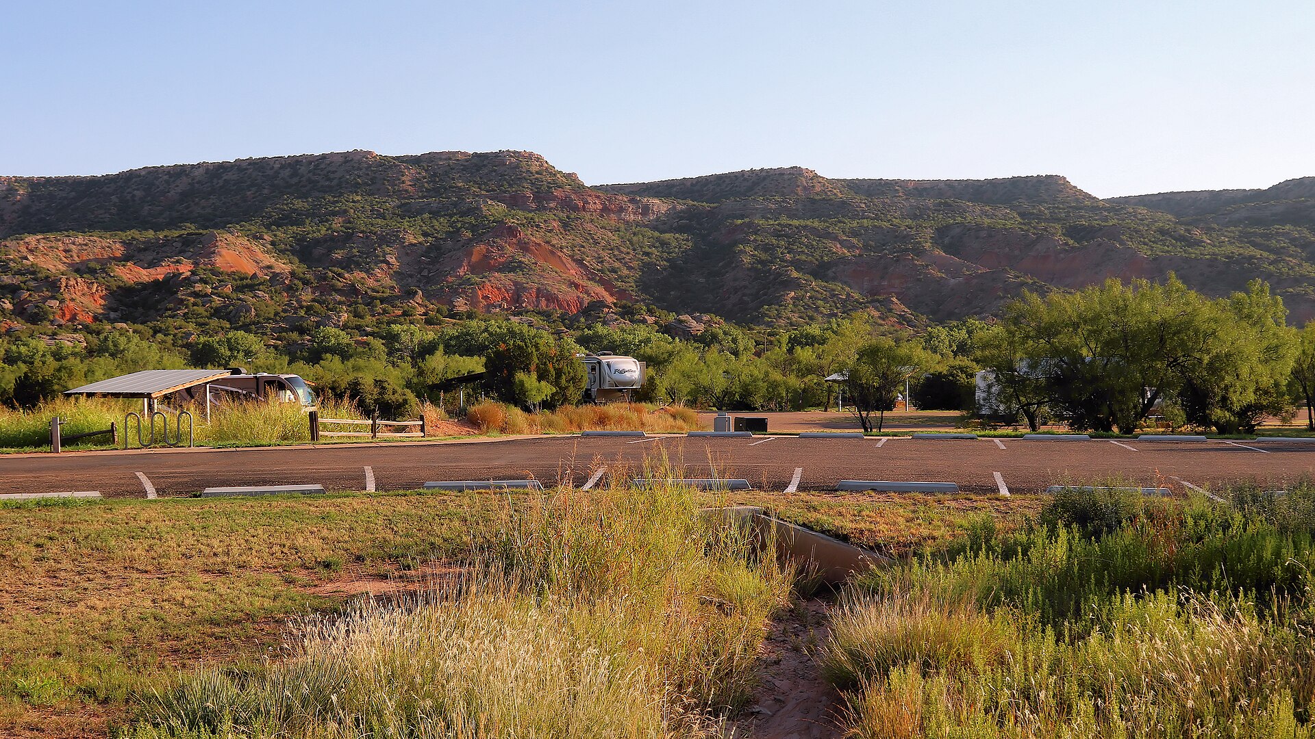
    Palo Duro Canyon State Park

    The Panhandle's immense red-rock canyon state park, often called the Grand Canyon of Texas, with more than 30 miles of hiking, biking and equestrian trails, dramatic rim-to-floor drives, CCC history and the iconic Lighthouse formation near Canyon and Amarillo.

    Best season: Spring and fall for hiking; winter can be excellent on mild days, while summer requires early starts, heat awareness and frequent water breaks on exposed canyon trailsUpdated Aug 2026
    • Lighthouse Trail and the park's signature rock formation
    • Canyon rim overlooks and scenic drive to the floor
    • More than 30 miles of hiking, biking and equestrian trails
    Explore this place
  2. 2Route stop

    Amarillo · Potter County

    Cadillac Ranch

    Amarillo's landmark roadside-art installation of ten vintage Cadillacs buried nose-first in a Panhandle field, created by Ant Farm in 1974 and transformed by decades of visitor-applied paint into an ever-changing symbol of Route 66 car culture.

    Best season: Spring and fall for comfortable temperatures; sunrise and late afternoon give the flat Panhandle landscape its best light, while rain can turn the dirt approach muddyUpdated Aug 2026
    • Ten Cadillacs buried nose-first in a Panhandle field
    • Visitor-applied spray paint that continually changes the artwork
    • A defining roadside-art stop on the Route 66 corridor
    Explore this place

Route 7 · 2–3 days

South Texas coast extension

Make Padre Island National Seashore the anchor rather than a quick beach stop, with enough time for barrier-island ecology, shoreline conditions and a Corpus Christi base.

Planning logic

This route has one Top-25 anchor by design. Use the attraction's area guide and Trip Planner to add Corpus Christi museums, coastal nature and other nearby stops without inventing a second Top-25 requirement.

Start this route in Trip Planner →
  1. 1Route stop

    Corpus Christi · Nueces County

    Padre Island National Seashore

    Visit the federally protected North Padre Island shoreline south of Corpus Christi with NPS rules for Malaquite and other beaches, changing surf and rip currents, sand-driving limits and distinct camping areas.

    Best season: Fall through spring for mild beach weather and birding; summer brings heat, humidity and storm risk but also seasonal sea-turtle activity, so conditions should guide every visitUpdated Oct 2026
    • Malaquite Visitor Center beach access and Gulf scenery
    • Long barrier-island habitat and coastal wildlife
    • North and South Beach vehicle access subject to sand conditions
    Explore this place

Route discipline

Use official operating information before you lock the day

These route groupings are durable editorial planning structures. Hours, reservations, closures, weather restrictions and event-day access can change, so each linked attraction guide points back to the current controlling source.

Sources & notes

Top 25 road-trip methodology

Methodology

The seven route structures are TexasDefined editorial trip-planning synthesis built only from the main Top-25 attraction guides. They are not live navigation instructions. Each attraction’s official source controls current hours, reservations, closures and operating restrictions.

Last verified

Top 25 route groupings and main stop links reviewed August 18, 2026.