Skip to content
Fort Leaton State Historic Site in Texas

Big Bend Country · Historic Sites & Museums

Fort Leaton State Historic Site

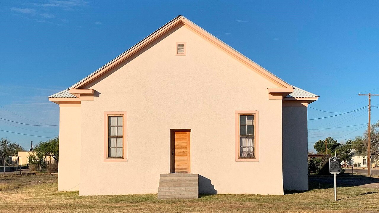
Walk a fortified nineteenth-century adobe trading post east of Presidio, learn about the older La Junta settlements, and use the site as Big Bend Ranch State Park's western permit and information gateway.

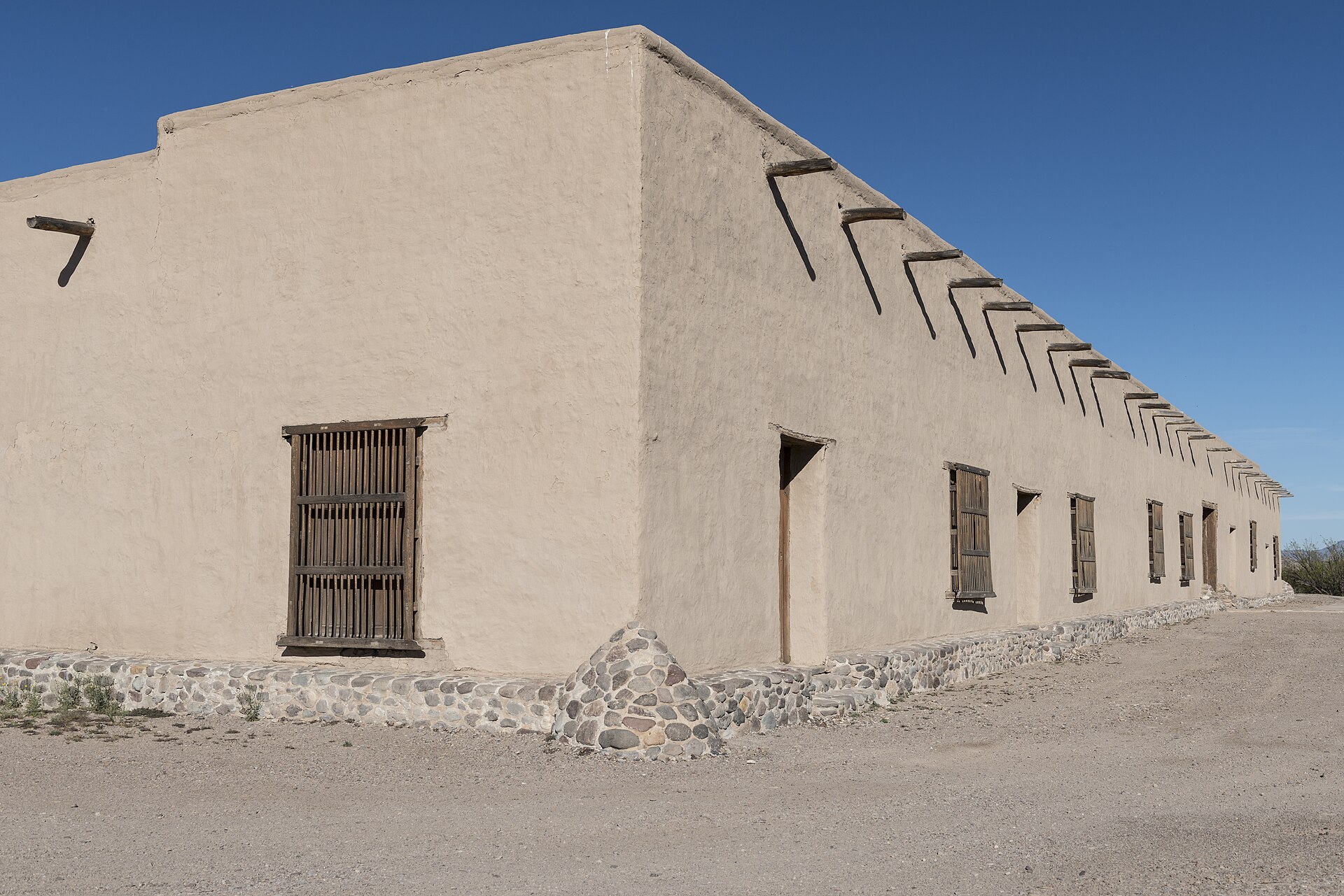
Photography: Carol M. Highsmith · Public domain · Wikimedia Commons

Quick trip facts

Fort Leaton State Historic Site at a glance

Where is Fort Leaton State Historic Site?
Fort Leaton State Historic Site is at 16952 FM 170 East, Presidio, TX 79845, in Presidio County.
When is the best time to visit Fort Leaton State Historic Site?
September through April is the busier season; cooler weather is generally safer for a self-guided desert history visit.
Do I need to plan ahead for Fort Leaton State Historic Site?
TPWD lists the site open daily, with its park office 8 a.m.–4:30 p.m. and closed December 25. Adult day use is currently listed at $5, children 12 and under free. Check TPWD's live hours, admission, availability and alerts before driving.
Who manages Fort Leaton State Historic Site?
Texas Parks and Wildlife Department

Practical visitor details

Before you go

Historic site and west entrance office
Listed open daily; office 8 a.m.–4:30 p.m., closed December 25. Verify seasonal programs and alert notices before visiting.
Checked · Official details ↗
Published day-use fee
TPWD lists $5 for visitors 13 and older and free admission for children 12 and under; confirm current rates and capacity with the operator.
Checked · Official details ↗
Western park gateway
Use the official Fort Leaton map and enter on FM 170 east of Presidio. Separate Big Bend Ranch River/Interior campsite and permit rules still apply.
Checked · Official details ↗
Separate camping and day passes
Do not treat the fort as a developed campground. TPWD recommends advance reservations for park day access and camping; some backcountry permits are obtained on arrival.
Checked · Official details ↗

The experience

The story of Fort Leaton State Historic Site

Fort Leaton is about four miles southeast of Presidio on FM 170, close to the Rio Grande. Its adobe rooms and walled compound are the attraction: they tell a trading and settlement story that predates modern state-park tourism. The site also functions as the western entrance office for Big Bend Ranch State Park. Those are two different reasons to stop, and the visitor should not mistake a historic-site admission for a reservation at an interior backcountry campsite.

The place stands in the La Junta de los Ríos region, where the Río Conchos meets the Rio Grande. Long before the adobe fort, Indigenous farming communities used fertile river soils and water to grow crops, settle permanently and exchange goods across the borderlands. TPWD places the fort in that much longer history rather than starting the region's story with nineteenth-century Anglo merchants. That matters when reading the exhibits: a trading post did not create the agricultural and cultural significance of La Junta.

Ben Leaton and Juana Pedrasa established their fortified adobe commercial compound in 1848 as the Mexican-American War was ending. Traders, travelers and some military parties used the route between settlements in Texas and communities farther into northern Mexico. The site's thick-walled architecture reflects both the need for storage and the uncertainty of travel through the borderlands. TPWD records that its trading activity ended in 1884 and it was abandoned in 1925; the state acquired the property in 1967 and opened the historic site to visitors in 1978. Today, that physical continuity is what makes the fort different from a recreated frontier display.

A first visit works best as a self-guided walk through the adobe compound paired with the state park's historic interpretation. TPWD publishes a specific Fort Leaton interpretive guide and walking tour; download the documents before leaving town if cellular service may be weak. Move carefully on uneven outdoor surfaces and observe all posted protections for the adobe fabric. Do not assume every room, tour or interpretive program is open on the same schedule as the entrance office.

The office's second role is logistics. Big Bend Ranch State Park is divided between the River District and the remote Interior District. Fort Leaton is the WEST gateway near Presidio; Barton Warnock Visitor Center on FM 170 east of Lajitas is the EAST gateway. The Sauceda Ranger Station is another 27 miles of rugged dirt road into the interior and its office is closed under TPWD's current guidance. A camping or river itinerary must match the permitted area, check-in point, vehicle clearance and current closure alerts, not just a map pin for the sprawling park.

For a short stop from Presidio, allow time to understand La Junta and take the adobe walking route instead of using the fort only as a permit counter. Visitors continuing east should follow FM 170's scenic corridor along the Rio Grande with water and fuel already aboard. The route is exposed to seasonal heat and storm runoff; the park warns of abrupt flash flooding in normally dry channels. Families can combine a historic visit with the river scenery without treating the remote park interior as an easy, paved drive.

Fort Leaton is not an ordinary standalone state-park campground. TPWD's Big Bend Ranch visitor guidance places primitive overnight camping in designated River and Interior District areas, with permit and reservation rules that depend on the site. Before planning an overnight stay, open the official Big Bend Ranch complex map, identify the exact campground and confirm which permit is needed at Fort Leaton. If you only want to explore the adobe fort, plan a day-use historic-site stop rather than buying a camping trip you do not need.

The details

Planning your visit

Area
Presidio, Texas
Best season
September through April is the busier season; cooler weather is generally safer for a self-guided desert history visit.
Address
16952 FM 170 East, Presidio, TX 79845
Entry & reservations
TPWD lists the site open daily, with its park office 8 a.m.–4:30 p.m. and closed December 25. Adult day use is currently listed at $5, children 12 and under free. Check TPWD's live hours, admission, availability and alerts before driving.
Accessibility
This is a historic adobe site in desert terrain. Ask TPWD at 432-229-3613 about the accessibility of the specific rooms, surfaces, tours and restrooms before relying on step-free access; do not assume every historic interior is wheelchair accessible.
Getting there
Four miles southeast of downtown Presidio on FM 170 (River Road), at 16952 FM 170 East; GPS 29.542511, -104.326348. Fort Leaton is the Big Bend Ranch WEST visitor/permit entrance, not the Sauceda station.

Practical questions

Frequently asked questions about Fort Leaton State Historic Site

Is Fort Leaton the same place as Big Bend Ranch State Park?
No. Fort Leaton is a historic adobe attraction and the park's western visitor/permit gateway. Big Bend Ranch stretches far beyond it, with separate River and Interior districts, campsites and entrances.Check official details ↗
Can I camp at Fort Leaton?
Do not plan the adobe fort as an ordinary developed campsite. Big Bend Ranch camping takes place in separately permitted park locations; check the exact TPWD campsite and permit details before traveling.Check official details ↗
Where is the other Big Bend Ranch visitor center?
Barton Warnock Visitor Center is the eastern entrance on FM 170 at 21800 FM 170, Terlingua, near Lajitas. Fort Leaton is the western entrance near Presidio.Check official details ↗

Plan the route

Explore related places

Editorially paired stops near Fort Leaton State Historic Site appear first, followed by nearby destinations. Distances are approximate straight-line miles.

  • Presidio · Presidio County · Big Bend Country

    Presidio

    Presidio is a remote Rio Grande border community and western gateway to Big Bend Ranch State Park, combining deep La Junta history, Mexican-American border culture, Fort Leaton, dark skies and the celebrated FM 170 River Road through one of Texas' most dramatic desert landscapes.

    Best season: Late fall through early spring for desert travel; February through April for possible Big Bend bluebonnets; year-round for border culture with strong summer heat precautionsUpdated Sep 2026
    • Fort Leaton
    • FM 170 River Road
    • Big Bend Ranch State Park gateway
    Explore this place

    Approx. 3 miles away

  • Presidio · Presidio County · Big Bend Country

    Big Bend Ranch State Park

    Texas's largest state park, with rugged Chihuahuan Desert mountains, Rio Grande access, primitive camping, and remote backcountry trails.

    • Hiking
    • Camping
    • Biking
    Explore this place

    Approx. 25 miles away

  • Terlingua · Brewster County · Big Bend Country

    Terlingua

    Terlingua is a remote Brewster County desert community and former quicksilver-mining district immediately outside Big Bend National Park, known for its living ghost-town landscape, mountain views, dark skies, local gathering places and role as a practical Big Bend basecamp.

    Best season: Late fall through early spring for desert hiking and outdoor touring; summer requires extreme-heat precautions and shorter outdoor windowsUpdated Sep 2026
    • Terlingua Ghost Town
    • quicksilver-mining history
    • Big Bend gateway
    Explore this place

    Approx. 45 miles away

  • Alpine · Brewster County · Big Bend Country

    Elephant Mountain Wildlife Management Area

    Elephant Mountain WMA protects 23,147 acres of Trans-Pecos desert and mountain habitat south of Alpine and is especially important to Texas desert bighorn sheep conservation and research.

    Best season: Late spring through summer for the seasonal driving tour, or fall through spring for cooler general wildlife viewing when access is open.Updated Sep 2026
    • Desert bighorn sheep conservation
    • Trans-Pecos mountain habitat
    • Seasonal driving tour
    Explore this place

    Approx. 56 miles away

  • Marfa · Presidio County · Big Bend Country

    Blackwell School National Historic Site

    Visit Marfa's surviving segregated school and hear Mexican American students' accounts of education, language suppression and community preservation at a National Park Service historic site.

    Best season: Year-round, with opening days and the availability of tours more important than season; check the National Park Service schedule before traveling.Updated Oct 2026
    • Original 1909 adobe schoolhouse and 1927 Band Hall
    • Student and teacher photographs, recollections and interpretive exhibits
    • A Mexican American civil-rights history stop in residential Marfa
    Explore this place

    Approx. 56 miles away

  • Marfa · Presidio County · Big Bend Country

    Marfa

    Marfa is a remote high-desert town where Presidio County history, internationally known contemporary art, adobe streetscapes, the Marfa Lights and immense West Texas skies create a destination that rewards slow travel rather than a rushed roadside stop.

    Best season: Spring and fall for milder high-desert weather; winter can be crisp and quiet, while summer days are hot and seasonal storms can affect regional drivingUpdated Sep 2026
    • contemporary art
    • Presidio County Courthouse
    • Central Marfa Historic District
    Explore this place

    Approx. 56 miles away

Read next

More from Historic Sites & Museums