Presidio · Presidio County · Big Bend Country
Big Bend Ranch State Park
Texas's largest state park, with rugged Chihuahuan Desert mountains, Rio Grande access, primitive camping, and remote backcountry trails.
- Hiking
- Camping
- Biking

Big Bend Country · Small Towns
Terlingua is a remote Brewster County desert community and former quicksilver-mining district immediately outside Big Bend National Park, known for its living ghost-town landscape, mountain views, dark skies, local gathering places and role as a practical Big Bend basecamp.
Photography: ClaudiaDurand · CC BY-SA 4.0 · Wikimedia Commons · CC BY-SA 4.0 license ↗
Quick trip facts
The experience
Terlingua's ghost-town identity comes from the mining era that drew workers to this isolated Chihuahuan Desert landscape. Ruins, the cemetery and surviving structures still reveal the settlement pattern, but modern Terlingua is also a living community rather than an abandoned historic site.
Its practical importance comes from location. Terlingua and nearby Study Butte sit just outside Big Bend National Park and give travelers lodging, food, guides and a base for exploring mountains, desert, river country and the scenic road toward Lajitas.
The best visit respects remoteness. Build driving time into every day, carry water, confirm fuel and food hours, and avoid overloading a park itinerary. Evenings deserve protected time because the sunset, dark sky and social life around the historic district are part of the Terlingua experience rather than downtime between attractions.
The details
Evidence and citations
Read the original operator records and supporting research for this guide.
Brewster County Tourism Council destination overview, history and current planning
Current regional activities and gateway context
Current lodging and basecamp context
Tours & bookable experiences
TexasDefined handles the destination planning. Viator can be useful for guided tours, tickets and organized activities near Terlingua. Availability changes, so the booking link checks current inventory rather than promising a specific product.
Previously observed Big Bend & Terlingua inventory categories: Outdoor adventure · On the water. Snapshot reviewed ; this is historical context, not confirmation of currently bookable products. Check current listings before choosing an experience.
Affiliate disclosure: TexasDefined may earn a commission from qualifying Viator bookings, at no additional cost to you.
Independent Texas Defined research
Terlingua is both a surviving mining landscape and one of the most important visitor basecamps in the Big Bend region, where remoteness, desert culture and access to public lands shape the trip as much as any single attraction.
4-5 hours
8-10 hours
3 nights
Verify before you travel
Our itineraries and recommendations are independent editorial judgments. Hours, ticket prices, access, closures and conditions belong to the official operators and can change after our most recent review.
Last source review:
Brewster County Tourism Council destination overview, history and current planning
Current regional activities and gateway context
Current lodging and basecamp context
Connected museum guides
Museum guides relevant to Terlingua and its surrounding history. Tickets, hours and travel arrangements are separate at each institution.
Alpine · Brewster County
Around the area
Use Terlingua as both a destination and a basecamp: give the ghost-town landscape time of its own, then build Big Bend driving days conservatively around distance, heat and daylight.
Easy additions that fit naturally around the main stop.
The mining-era historic district, cemetery, ruins and modern gathering places form the community's cultural center.
Terlingua's location near the western park entrance makes it a practical base for desert, mountain and river itineraries.
Dining districts and food areas worth building into the same outing.
The principal concentration of restaurants and gathering places; hours should be confirmed because the region is remote.
The most practical lodging areas for minimizing driving and maximizing time on the ground.
Cabins, casitas, motels, RV sites and off-grid stays provide the main lodging base outside the western side of the national park.
Nearby parts of the city that add character, shopping, history or nightlife.
The core zone for mining history, local art, gathering places and the most recognizable Terlingua landscape.
Good nearby additions when the itinerary includes younger travelers.
A visually engaging history stop, but families should plan for sun, uneven terrain and limited shade.
Places that justify extending the visit beyond the immediate area.
Connect Terlingua with desert, mountain, river and border destinations across Far West Texas.
Use Alpine as a larger regional service, culture and supply stop before or after the remote Big Bend corridor.
Plan the route
Editorially paired stops near Terlingua appear first, followed by nearby destinations. Distances are approximate straight-line miles.
Presidio · Presidio County · Big Bend Country
Texas's largest state park, with rugged Chihuahuan Desert mountains, Rio Grande access, primitive camping, and remote backcountry trails.
Approx. 21 miles away
Terlingua · Brewster County · Big Bend Country
A vast Chihuahuan Desert national park where the Rio Grande, the Chisos Mountains and some of Texas's most dramatic canyon country meet, with scenic drives, long-distance hiking, dark skies and enough geographic range to reward several days rather than a single overlook stop.
Approx. 25 miles away
Presidio · Presidio County · Big Bend Country
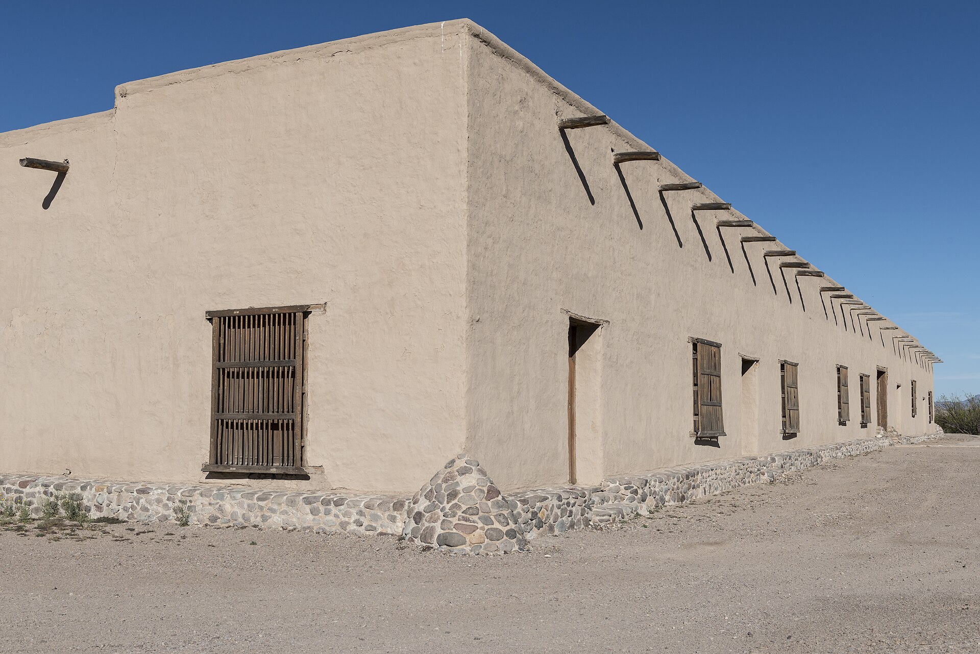
Walk a fortified nineteenth-century adobe trading post east of Presidio, learn about the older La Junta settlements, and use the site as Big Bend Ranch State Park's western permit and information gateway.
Approx. 45 miles away
Marathon · Brewster County · Big Bend Country
Black Gap WMA spans about 103,000 acres of Chihuahuan Desert mountains and Rio Grande country beside Big Bend National Park, making it one of Texas's largest and most remote wildlife-management landscapes.
Approx. 48 miles away
Alpine · Brewster County · Big Bend Country
Elephant Mountain WMA protects 23,147 acres of Trans-Pecos desert and mountain habitat south of Alpine and is especially important to Texas desert bighorn sheep conservation and research.
Approx. 48 miles away
Presidio · Presidio County · Big Bend Country
Presidio is a remote Rio Grande border community and western gateway to Big Bend Ranch State Park, combining deep La Junta history, Mexican-American border culture, Fort Leaton, dark skies and the celebrated FM 170 River Road through one of Texas' most dramatic desert landscapes.
Approx. 48 miles away
Texas Explained
Go beyond the destination with the systems, landscapes and history that explain why this part of Texas looks and works the way it does.
Continue exploring
Read next
Small Towns
Start at the courthouse, find the old commercial street, ask what still opens before eight and stay long enough to see the town as more than a photo stop.
August 7, 2026 · About 2 minutes