Skip to content

Golden Triangle · Day trips

Best Day Trips From Beaumont–Port Arthur, Texas

An intentionally varied geographic shortlist of parks, towns, history and outdoor trips. Some farther results are long driving days or better as overnights; compare real road times before choosing.

Source-backed options30

Distance window18–150 straight-line miles

OrderingGeographic distance

Straight-line distances are screening estimates from central Beaumont–Port Arthur. They are not road miles or drive-time promises. Use the “Check current drive” links in the map and guide sections below for current Google Maps routing, road mileage and travel-time estimates.

A better starting point than the mileage list

These researched destinations have full TexasDefined guides in the current catalog. Each choice includes the operating authority's visitor source and live driving directions. This is independent editorial selection, not a paid ranking. Distances elsewhere on this page are geographic screening estimates—not road times.

Paddle or hike near the Big Thicket

Village Creek State Park

Explore an East Texas creek corridor, sandy woods and forest trails just north of Beaumont; choose paddling only when conditions and rentals permit.

Check before going: Verify water conditions, paddling access and alligator guidance before heading out.

Piney Woods biodiversity

Big Thicket National Preserve

Center the day on one Big Thicket trail or visitor area and discover the unusual plant and wetland habitats, rather than trying to cover scattered preserve units.

Check before going: Choose the correct trailhead and read current National Park Service trail and flood conditions.

Longer Piney Woods water day

Martin Dies, Jr. State Park

Travel toward Jasper for paddling trails and waterside forests at the meeting of East Texas river habitats; allow more time than for nearby Golden Triangle stops.

Check before going: Check the Hen House unit closures and current burn ban, as well as day-use reservations, before a visit.

Map & routes

Find it on the map and compare routes

Closer geographic choices

2 full TexasDefined guides in this geographic band

About 19 geographic miles

Sabine Pass

Sabine Pass · Jefferson County

Sabine Pass Battleground State Historic Site

The site marks the 1863 Civil War battle in which a small Confederate force stopped a much larger Union operation near the mouth of the Sabine River. Its Gulf Coast setting helps explain the strategic importance of ports, waterways and access to Texas during the Civil War.

Best season: Year-round; spring and fall are usually the most comfortable for outdoor portions of a visit.Updated Aug 2026
  • Civil War
  • Gulf Coast
  • military history
Explore this place
Check current drive from Beaumont–Port Arthur ↗

About 25 geographic miles

Sour Lake

Sour Lake · Hardin County

Sour Lake Downtown Historic District

Sour Lake's National Register-listed commercial core centers on Sixth and Merchant streets. Its 14 buildings trace a dramatic turn from nineteenth-century mineral-springs resort to 1903 oil-boom town, through destructive fire, brick rebuilding and decades of commercial life in Southeast Texas.

Best season: Cooler autumn or spring weather is more comfortable for the short outdoor route; expect heat, humidity and thunderstorms in warm months.Updated Oct 2026
  • Fourteen buildings dating between 1903 and 1966 along Sixth and Merchant
  • 1903 Carpenter Building originally housed First National Bank and survived the 1904 fire
  • Oil discovery attracted thousands of workers to an earlier sulfur-springs resort
Explore this place
Check current drive from Beaumont–Port Arthur ↗

Middle-distance choices · check the road route

21 full TexasDefined guides in this geographic band

About 36 geographic miles

High Island

High Island · Galveston County

High Island Beach

The northeastern Bolivar Peninsula shoreline near High Island, valued for open Gulf access and proximity to one of the Upper Coast's best-known spring-migration birding areas.

Best season: March through May and September through November for milder beach weather; summer is busiest and hottestUpdated Sep 2026
  • Open-Gulf beach
  • Upper Gulf Coast setting
  • High Island access
Explore this place
Check current drive from Beaumont–Port Arthur ↗

About 40 geographic miles

Anahuac

Anahuac · Chambers County

Jocelyn Nungaray National Wildlife Refuge

Jocelyn Nungaray National Wildlife Refuge protects coastal marsh, prairie, bayou and shoreline habitat east of Houston, with the Shoveler Pond auto loop, boardwalks, wildlife blinds, fishing access and seasonal waterfowl opportunities.

Best season: Fall through spring for migratory birds and cooler wildlife watching; summer visits are best early in the day because of heat and insects.Updated Sep 2026
  • Shoveler Pond auto loop
  • Coastal marsh birding
  • Boardwalk and wildlife blinds
Explore this place
Check current drive from Beaumont–Port Arthur ↗

About 42 geographic miles

Anahuac

Anahuac · Chambers County

Anahuac

Anahuac is an upper Texas Gulf Coast county seat on Trinity Bay, combining a historic courthouse and small-town core with coastal marshes, nationally significant birding, wildlife-viewing drives, fishing and the annual Texas Gatorfest tradition.

Best season: Fall through spring for birding, marsh drives and cooler coastal weather; event dates for Texas Gatorfest; summer only with heat, storm and mosquito precautionsUpdated Sep 2026
  • Chambers County Courthouse
  • Trinity Bay
  • coastal marshes
Explore this place
Check current drive from Beaumont–Port Arthur ↗

About 53 geographic miles

Crystal Beach

Crystal Beach · Galveston County

Crystal Beach

The central Bolivar Peninsula beach zone, with drive-on sand, public beach access, restrooms and rinse stations at key access roads, and a long shoreline used for fishing, camping and family beach days.

Best season: March through May and September through November for milder beach weather; summer is busiest and hottestUpdated Sep 2026
  • Open-Gulf beach
  • Upper Gulf Coast setting
  • Crystal Beach access
Explore this place
Check current drive from Beaumont–Port Arthur ↗

About 59 geographic miles

Baytown

Baytown · Harris County

Baytown Historical Museum

Free community history museum in the former 1930s Goose Creek Post Office, tracing the region from Karankawa history through the oil era and the formation of modern Baytown.

Updated Oct 2026
  • Original Goose Creek federal post office building
  • Karankawa and early area history
  • Oil industry, the Humble era and the 1948 city merger
Explore this place
Check current drive from Beaumont–Port Arthur ↗

About 61 geographic miles

Port Bolivar

Port Bolivar · Galveston County

Retillion Road Beach Access

A Bolivar Peninsula access corridor commonly described online as Retillon or Retillion Beach, located near the western free-parking beach area and Bolivar Flats shoreline.

Best season: March through May and September through November for milder beach weather; summer is busiest and hottestUpdated Sep 2026
  • Named public beach-access point
  • Upper Gulf Coast setting
  • Port Bolivar access
Explore this place
Check current drive from Beaumont–Port Arthur ↗

About 61 geographic miles

Port Bolivar

Port Bolivar · Galveston County

Fort Travis Seashore Park

A county seashore park at the western tip of Bolivar Peninsula combining historic fortifications, ship-channel views, picnic space and coastal wetland scenery.

Best season: March through May and September through November for milder beach weather; summer is busiest and hottestUpdated Sep 2026
  • Managed coastal park
  • Upper Gulf Coast setting
  • Port Bolivar access
Explore this place
Check current drive from Beaumont–Port Arthur ↗

About 62 geographic miles

Galveston

Galveston · Galveston County

East Beach

Galveston's broad eastern-tip beach park, with views toward the ship channel and East End Lagoon plus a pavilion, restrooms, showers, concessions and seasonal rentals.

Best season: March through May and September through November for milder beach weather; summer is busiest and hottestUpdated Sep 2026
  • Open-Gulf beach
  • Galveston Island & surrounding bays setting
  • Galveston access
Explore this place
Check current drive from Beaumont–Port Arthur ↗

About 63 geographic miles

San Leon

San Leon · Galveston County

Mooner Beach

A locally named waterfront strip in San Leon on Galveston Bay, better understood as a small community shoreline access than as a formal staffed beach park.

Best season: Fall through spring for comfortable exploring and birding; summer requires more heat, storm and insect planningUpdated Sep 2026
  • Coastal shoreline and habitat area
  • Galveston Island & surrounding bays setting
  • San Leon access
Explore this place
Check current drive from Beaumont–Port Arthur ↗

About 63 geographic miles

La Porte

La Porte · Harris County

Sylvan Beach Park

A developed bayside park in La Porte on Galveston Bay, offering a calmer-shore alternative to open Gulf surf along with park amenities and waterfront recreation.

Best season: March through May and September through November for milder beach weather; summer is busiest and hottestUpdated Sep 2026
  • Protected-bay beach
  • Galveston Island & surrounding bays setting
  • La Porte access
Explore this place
Check current drive from Beaumont–Port Arthur ↗

About 63 geographic miles

Galveston

Galveston

Galveston Bay

Texas' largest estuary, where freshwater flowing toward the Upper Gulf Coast mixes with Gulf saltwater across a broad network of open bay, marsh, oyster reef and shoreline habitat used for fishing, boating, paddling and wildlife watching.

Best season: Fall through spring for milder temperatures and comfortable shoreline time; summer trips require more planning for heat, humidity, thunderstorms and tropical-weather risk.Updated Sep 2026
  • Largest estuary in Texas
  • Marshes, oyster reefs and open-bay habitat
  • Fishing, paddling, sailing and wildlife watching
Explore this place
Check current drive from Beaumont–Port Arthur ↗

About 63 geographic miles

Seabrook

Seabrook · Harris County

El Jardin Beach

A compact bayside public beach park operated by Pasadena near Seabrook, used for shoreline views, fishing, picnics and a low-key Galveston Bay beach stop.

Best season: March through May and September through November for milder beach weather; summer is busiest and hottestUpdated Sep 2026
  • Protected-bay beach
  • Galveston Island & surrounding bays setting
  • Seabrook access
Explore this place
Check current drive from Beaumont–Port Arthur ↗

About 65 geographic miles

La Porte

La Porte · Harris County

San Jacinto Battleground State Historic Site

The Houston Ship Channel battlefield where the Texian army defeated Santa Anna's forces on April 21, 1836, interpreted through the landscape, museum collections and the towering San Jacinto Monument.

Best season: Fall through spring for comfortable walking across the exposed battlefieldUpdated Oct 2026
  • San Jacinto Monument
  • 1836 battlefield landscape
  • San Jacinto Museum
Explore this place
Check current drive from Beaumont–Port Arthur ↗

About 65 geographic miles

Jasper

Jasper · Jasper County

Jasper

Jasper is a deep Piney Woods county seat with a historic courthouse square, murals, galleries and parks, positioned within easy reach of Lake Sam Rayburn and the forested recreation landscape that defines far East Texas.

Best season: Fall through spring for downtown, parks and forest exploration; spring for azaleas; warm months for Lake Sam Rayburn when heat and storm conditions are suitableUpdated Sep 2026
  • Jasper County Courthouse
  • historic town square
  • Sandy Creek Park
Explore this place
Check current drive from Beaumont–Port Arthur ↗

About 66 geographic miles

Kemah

Kemah · Galveston County

Kemah Boardwalk

Kemah Boardwalk is a Galveston Bay amusement-and-dining district with rides, games, restaurants, seasonal entertainment and waterfront views about 30 miles southeast of central Houston.

Best season: Fall through spring for milder waterfront weather; summer brings more heat, humidity and crowds.Updated Sep 2026
  • Boardwalk Bullet wooden coaster
  • Galveston Bay waterfront
  • Family rides and midway games
Explore this place
Check current drive from Beaumont–Port Arthur ↗

About 68 geographic miles

Houston

Houston · Harris County

Sheldon Lake State Park & Environmental Learning Center

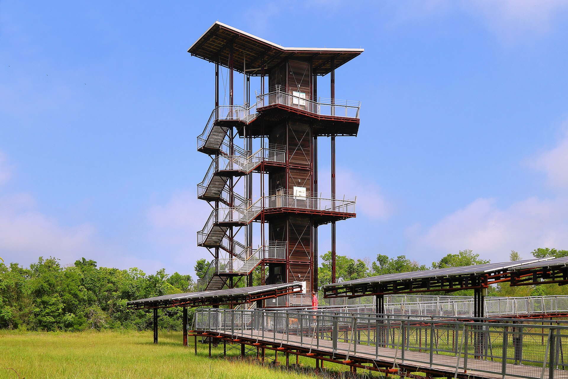
A 2,800-acre pocket of wetlands, prairie, ponds and woods on Houston’s northeast side, with free entry, accessible trails, fishing and an 82-foot observation tower overlooking the park and distant skyline.

Best season: Spring and fall for comfortable trail weather and birding; the park is open year-round
  • John Jacob Observation Tower with views across the wetlands and toward Houston
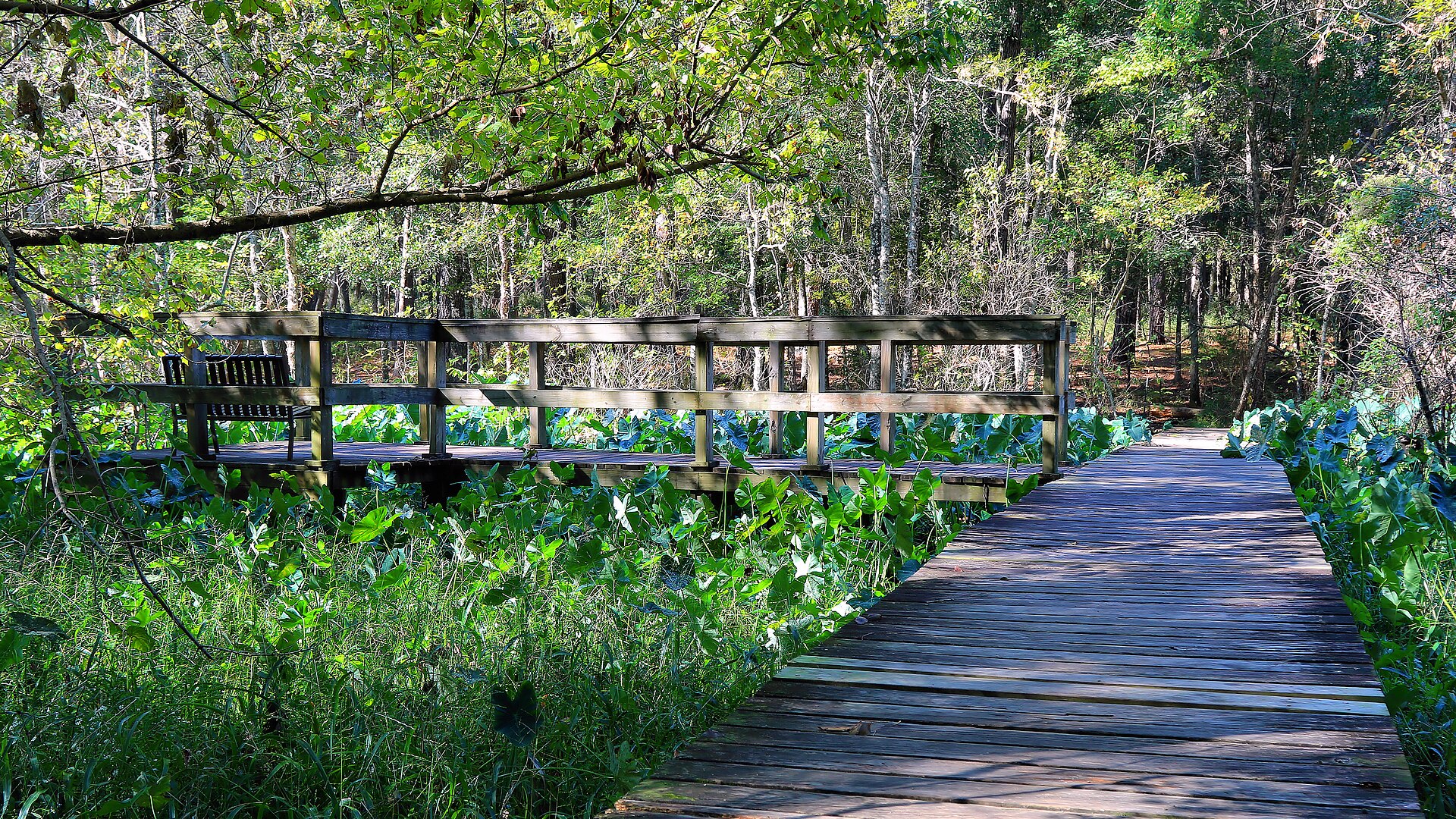
  • Two miles of trails through restored prairie, wetlands, woods and former hatchery ponds
  • Fishing, paddling and wildlife watching around Sheldon Lake and the park ponds
Explore this place
Check current drive from Beaumont–Port Arthur ↗

About 70 geographic miles

Houston

Houston · Harris County

Space Center Houston

Houston's public gateway to NASA's Johnson Space Center, where historic spacecraft, the shuttle-era Independence Plaza, astronaut training stories, Mission Control access and a flight-certified Saturn V connect the history of human spaceflight with NASA's current work.

Best season: Year-round; weekdays outside major school breaks are usually easiest for tram-tour availability, while hot or stormy days can affect outdoor NASA toursUpdated Aug 2026
  • NASA Tram Tours into working areas of Johnson Space Center
  • Historic Mission Control and the Apollo-era control room
  • Independence Plaza with shuttle replica Independence mounted on historic NASA 905
Explore this place
Check current drive from Beaumont–Port Arthur ↗

About 74 geographic miles

Livingston

Livingston · Polk County

Lake Livingston State Park

A Piney Woods reservoir park north of Houston with fishing, paddling, boating, forest trails and campsites along one of East Texas' largest lakes.

Best season: Fall through spring for camping and trails; fishing is popular year-roundUpdated Oct 2026
  • Lake Livingston fishing
  • Piney Woods shoreline
  • Boating and paddling
Explore this place
Check current drive from Beaumont–Port Arthur ↗

About 74 geographic miles

Zavalla

Zavalla · Jasper County

Aldridge Sawmill Ruins and Historic Townsite

National Register-listed remains of an early twentieth-century East Texas lumber town and sawmill, reached on foot within Angelina National Forest.

Best season: Cooler months for longer forest walks; avoid after heavy rainfall when trails can be slippery or flooded.Updated Oct 2026
  • National Register listing 01000209 (2001)
  • Early lumber-industry ruins
  • Former Aldridge timber town
Explore this place
Check current drive from Beaumont–Port Arthur ↗

About 75 geographic miles

Zavalla

Zavalla · Angelina County

Angelina National Forest

A 153,334-acre federal Piney Woods forest encompassing parts of four East Texas counties, Sam Rayburn shorelines, woodland wildlife habitats, hiking, history and distinct recreation areas.

Best season: Fall through spring for comfortable long hikes; spring migration and blooms and year-round forest birding depend on local conditions.Updated Oct 2026
  • 153,334 acres in four counties
  • Boykin Springs Recreation Area
  • Sam Rayburn Reservoir shorelines
Explore this place
Check current drive from Beaumont–Port Arthur ↗

About 79 geographic miles

Jamaica Beach

Jamaica Beach · Galveston County

Jamaica Beach

A free public Gulf beach in the City of Jamaica Beach, with the public sand extending from the vegetation line to the water and a mix of pedestrian and regulated vehicle access.

Best season: March through May and September through November for milder beach weather; summer is busiest and hottestUpdated Sep 2026
  • Open-Gulf beach
  • Galveston Island & surrounding bays setting
  • Jamaica Beach access
Explore this place
Check current drive from Beaumont–Port Arthur ↗

Farther geographic choices · check if an overnight fits better

3 full TexasDefined guides in this geographic band

About 82 geographic miles

Alvin

Alvin · Brazoria County

Alvin Historical Museum

Alvin Historical Museum is a volunteer-run local-history museum where the former 1940 Alvin post office is itself an important part of the visit. Instead of attempting to interpret all Texas history, its exhibi

Updated Oct 2026
  • Nolan Ryan's Alvin baseball story
  • Historic 1940 post office and restored mural
  • Schools, railroads and dairy farming
Explore this place
Check current drive from Beaumont–Port Arthur ↗

About 94 geographic miles

Diboll

Diboll · Angelina County

The History Center (Diboll)

The History Center in Diboll offers free visits to historic exhibits, a stationary 1920 steam locomotive, a 1948 caboose, and the region's lumber, railroad and community history.

Best season: Year-round indoor exhibits; avoid high heat for the outdoor railroad display.Updated Oct 2026
  • Outdoor 1920 Baldwin Engine 13 and a 1948 caboose
  • Diboll: An Enduring Community exhibition
  • Southern Pine Lumber logging history
Explore this place
Check current drive from Beaumont–Port Arthur ↗

About 100 geographic miles

Huntsville

Huntsville · Walker County

Huntsville State Park

A Piney Woods park north of Houston centered on Lake Raven, with fishing, paddling, swimming, forest trails and camping beneath tall East Texas pines.

Best season: Fall through spring for trails and camping; summer for lake recreationUpdated Oct 2026
  • Lake Raven
  • Pine forest trails
  • Fishing and paddling
Explore this place
Check current drive from Beaumont–Port Arthur ↗

Optional overnight planning

Make a longer trip without rushing home

Some destinations are better with an evening or overnight. Compare nearby hotels and rentals using the existing booking options after choosing your destination; no stay or availability is guaranteed.

See optional hotel and rental choices ↓

Affiliate disclosure: TexasDefined may earn a commission from qualifying booking links, at no additional cost to you. Booking terms and availability come from the provider.

For local visitor businesses

Reach readers planning Texas day trips

Hotels, outfitters, attractions, chambers and travel businesses can request information about disclosed advertising or sponsorship. Editorial destinations and rankings are never for sale; no placement is implied or guaranteed.

Inquire about local travel partnerships →

Before you go

Use geography as a shortlist, then check the real route.

TexasDefined uses location data to make the statewide catalog easier to search. Open the current driving route for the places you are considering, then verify opening hours, reservations, park alerts, water conditions and weather with the current official source.