
Water-shaped Texas
Texas Rivers & River Valleys
How rivers carve canyons, build floodplains, connect aquifers to springs and carry Texas from high plains and limestone country to bays and the Gulf.
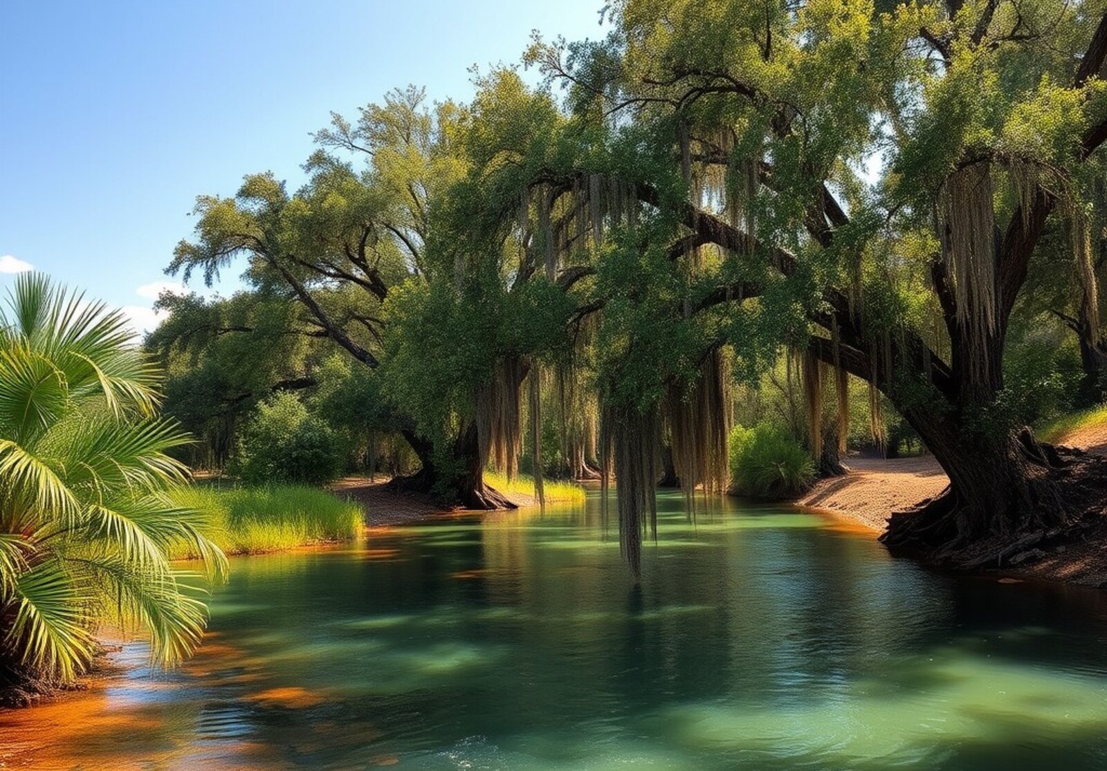
How water shapes Texas
Texas rivers connect regions that otherwise look unrelated. Clear spring-fed streams begin on limestone uplands, prairie rivers widen across central Texas, and low-gradient waterways build floodplains and estuaries near the coast. A river is more than the water between its banks. Over thousands of years it cuts bedrock, shifts sediment, abandons old channels, builds bottomlands and links uplands to bays. Follow one Texas river from its source to the coast and the surrounding landscape can change several times.
See the systems
Texas Rivers, Region by Region
The map is the fastest way to understand why a Hill Country river can look nothing like one in East Texas, the Panhandle or Big Bend.
Texas river basins
One state, very different river systems
Texas Water Development Board identifies 15 major river basins plus eight coastal basins. This simplified map is for orientation; basin boundaries follow drainage divides rather than political borders.
Open the official TWDB basin map ↗River mechanics
How a Texas river valley forms
A valley records both erosion and deposition. The channel is only the most active part of a much larger system.
Stage 1
Headwaters
Small streams, springs or rainfall-fed channels collect water at higher elevations. In Texas this may mean Panhandle draws, Edwards Plateau springs or mountain drainage in the Trans-Pecos.
Stage 2
Incised valley
Where slope is steeper or bedrock is resistant, the channel cuts downward. Limestone gorges, canyons and rock-bottomed reaches are common in Central and West Texas.
Stage 3
Middle river
Tributaries add water and sediment. Channels widen, reservoirs interrupt flow, and rivers begin crossing larger agricultural and urban landscapes.
Stage 4
Floodplain
On flatter terrain, rivers meander across broad valleys. Floodwater spreads sediment across bottomlands and may leave terraces, abandoned channels and oxbows.
Stage 5
Bay, estuary or Gulf
Lower rivers slow further as they approach sea level. Freshwater, sediment and nutrients enter bays and coastal wetlands, connecting inland watersheds to the Gulf.
Why they look different
Rainfall, geology and groundwater change the river
Texas rivers do not follow one visual template. Their character changes as the surrounding landscape changes.
Hill Country rivers
Guadalupe · Frio · Nueces · Llano · Blanco · Pedernales
Limestone, springs and aquifers help create some of Texas’s clearest and most recognizable river corridors. Bald cypress, gravel bars, exposed bedrock and sudden flood pulses are common visual clues.
East Texas rivers
Sabine · Neches · Angelina · Cypress
Higher rainfall, forests and lower gradients produce broader floodplains, sloughs, bottomland hardwoods and slower-moving water than most central and western rivers.
Prairie and plains rivers
Brazos · Colorado · Trinity · Red · Canadian
These systems cross large open landscapes, carry sediment over long distances and are heavily shaped by reservoirs, flood-control projects, agriculture and urban water demand.
Desert and border rivers
Rio Grande · Pecos · Devils
Low rainfall makes dependable water especially conspicuous. Canyons, spring-fed tributaries, reservoirs and dramatic changes in flow define river landscapes of far West Texas.
Spring-fed vs. runoff-driven rivers
In limestone country, groundwater emerging from springs can sustain clear baseflow between rain events. Elsewhere, flow depends more heavily on rainfall, tributaries and reservoir releases. That difference affects clarity, temperature, habitat and how dependable a river feels through the year.
Bedrock controls the shape
Hard limestone can produce ledges, falls and narrow gorges. Softer sediments on the coastal plain allow channels to migrate and meander. In the Panhandle and Trans-Pecos, rivers can cut deeply into plateau margins, canyon country and desert basins.
Slope controls the energy
Steeper upstream reaches have more erosive power. As gradient decreases downstream, rivers increasingly deposit sand, gravel and silt, widen their valleys and build floodplains.
Read the landscape
Six river-valley features worth knowing
These plain-language terms explain what you are actually seeing beside a Texas river.
Floodplain
The low ground beside a river that is periodically inundated. Floodplains store sediment, support riparian forests and generally widen as rivers approach lower-gradient country.
Terrace
An older floodplain left above the modern river after the channel cut downward. Terraces often appear as step-like benches along valley walls.
Meander
A sweeping river bend created as water erodes the outside bank and deposits sediment on the inside. Meanders migrate over time across broad valleys.
Oxbow
A curved former river channel cut off when a meander is abandoned. Oxbows are especially common on wide, low-gradient floodplains.
Bottomland
Low, fertile land associated with river floodplains. In East Texas, bottomland hardwood forests can form some of the richest river habitat in the state.
Delta & estuary
Near the coast, river sediment, tides and bay waters interact. Some rivers build deltas while others enter estuaries where fresh and salt water mix.
Major systems
20 rivers that explain Texas
These rivers are useful reference points because together they cross nearly every major Texas landscape.

West Texas & the border
Rio Grande
Texas’s great border river crosses desert basins, cuts spectacular canyons and ties mountain runoff, springs, reservoirs and irrigated valleys into one international system.
Photo: Adbar · CC BY-SA 3.0 · Wikimedia Commons

Far West Texas
Pecos River
A desert river whose flow, salinity and broad valley show how scarce water behaves in the Trans-Pecos before joining the Rio Grande.
Photo: Badener / Lutz Fischer-Lamprecht · CC BY-SA 3.0 · Wikimedia Commons

Plains to Gulf Coast
Brazos River
One of the state’s longest rivers, linking High Plains tributaries, prairie country, reservoirs, agricultural bottomlands and a broad lower coastal valley.
Photo: Larry D. Moore · CC BY 4.0 · Wikimedia Commons

West & Central Texas
Colorado River
The Texas Colorado crosses limestone country, the Highland Lakes and Austin before flattening into a lower coastal river on its way to Matagorda Bay.
Photo: Larry D. Moore · CC BY 4.0 · Wikimedia Commons

Hill Country to coast
Guadalupe River
Spring-influenced Hill Country water, limestone channels and cypress-lined banks give way downstream to wider floodplain country and the Guadalupe estuary.
Photo: Billy Hathorn · CC BY-SA 3.0 · Wikimedia Commons
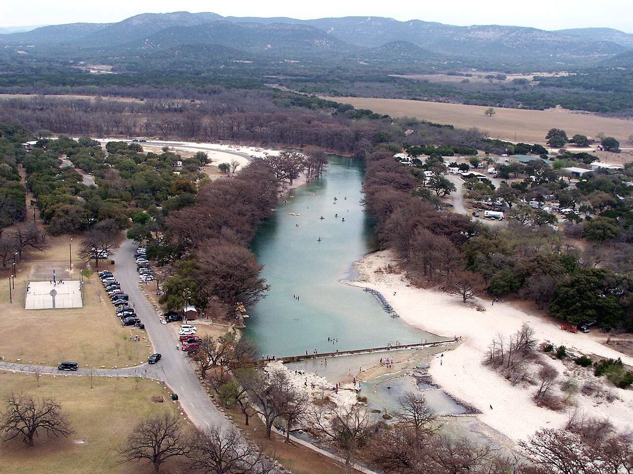
Real and Uvalde counties
Frio River
Garner, Concan and the upper Frio canyon give swimmers and campers an identifiable managed-access river destination.
Photo: Larry D. Moore · CC BY 4.0 · Wikimedia Commons

New Braunfels
Comal River
A short spring-fed city river with visitor-focused tubing rules and a confluence with the Guadalupe.
Photo: Larry D. Moore · CC BY 4.0 · Wikimedia Commons

Hays and Caldwell counties
San Marcos River
Spring Lake headwaters, protected plants, urban river parks and a separate lower-river paddling corridor.
Photo: Larry D. Moore · CC BY 4.0 · Wikimedia Commons
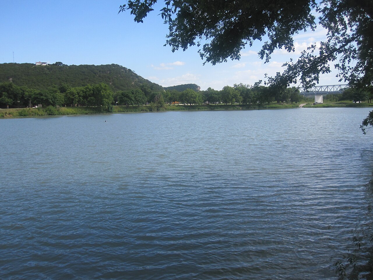
Junction to Highland Lakes
Llano River
North and South Llano forks, spring-fed park access and fishing through Hill Country towns.
Photo: Billy Hathorn · CC BY-SA 3.0 · Wikimedia Commons

North Texas to Trinity Bay
Trinity River
A major urban and water-supply system that drains Dallas–Fort Worth, crosses East Texas bottomlands and reaches the Galveston Bay system.
Photo: Loadmaster (David R. Tribble) · CC BY-SA 3.0 · Wikimedia Commons

East Texas
Sabine River
A humid, forested East Texas river with broad bottomlands, reservoirs and a lower valley influenced by Gulf Coast wetlands.
Photo: Billy Hathorn · CC BY 3.0 · Wikimedia Commons

Piney Woods
Neches River
Forested floodplains, sloughs and bottomland hardwoods make the Neches one of the clearest examples of an East Texas river landscape.
Photo: William L. Farr · CC BY-SA 4.0 · Wikimedia Commons

Edwards Plateau to South Texas
Nueces River
Clear upper reaches in limestone country transition toward drier South Texas landscapes and a much broader lower basin.
Photo: Billy Hathorn · CC BY-SA 3.0 · Wikimedia Commons

Central & South Texas
San Antonio River
A spring-origin river whose upper urban reach gives way to a larger watershed that joins the Guadalupe system downstream.
Photo: Dogfort04 · CC BY-SA 4.0 · Wikimedia Commons

North Texas
Red River
A sediment-rich northern boundary river shaped by plains runoff, wide valleys, tributaries and major reservoirs.
Photo: brewbooks · CC BY-SA 2.0 · Wikimedia Commons

Texas Panhandle
Canadian River
A High Plains and Panhandle river that cuts into canyon and breaks country, showing how streams dissect the edge of the plateau.
Photo: Billy Hathorn · CC BY-SA 3.0 · Wikimedia Commons

Texas river corridor
Big Cypress Bayou and Cypress River Basin
Open the source-led river guide for geography, real access conditions, fishing, camping and nearby destinations.
Photo: William L. Farr · CC BY-SA 4.0 · Wikimedia Commons

Texas river corridor
Lavaca River
Open the source-led river guide for geography, real access conditions, fishing, camping and nearby destinations.
Photo: Patrick Feller · CC BY 2.0 · Wikimedia Commons


Aquifers and springs
Some Texas rivers begin underground
Central Texas limestone is fractured, dissolved and cavernous. Rain can enter the subsurface through recharge features, move through aquifers and re-emerge at springs. Where that groundwater contribution is large, rivers may stay cooler and clearer and can maintain flow between storms. That connection is one reason river health cannot be separated from groundwater management.
The Comal and San Marcos are famous spring rivers, while the Guadalupe, Frio, Nueces, Devils and many smaller streams also depend on spring and groundwater contributions in parts of their basins.
Floods
The floodplain is part of the river
A river valley is built to carry more than ordinary flow. During floods, water spreads onto low ground, deposits sediment, erodes banks and may cut new channels. Central Texas is particularly vulnerable to flash flooding because intense storms can fall on rocky, steep watersheds that route water into confined valleys very quickly.
A dry crossing, gravel bar or broad grassy bottom is not evidence that a river is harmless. It may be part of the active floodplain. River visitors should treat weather upstream as seriously as weather overhead and follow local closure and flood warnings.
Human-shaped rivers
Reservoirs changed the rhythm of Texas rivers
Dams store water, reduce some flood peaks, generate power and create major recreation lakes, but they also interrupt sediment transport and alter downstream flow patterns. Many of the state’s familiar lakes—including the Highland Lakes, Lake Livingston, Toledo Bend and Lake Texoma—occupy river valleys rather than natural lake basins.
Below a dam, the river may carry clearer water but less sediment, experience different seasonal flow timing and respond to release schedules instead of rainfall alone. Cities, irrigation, wastewater return flows, groundwater pumping and channel engineering add additional layers of human influence.
Living corridors
River valleys are ecological highways
Riparian vegetation follows water across landscapes that may otherwise be dry, open or heavily developed. Bald cypress is iconic along many Central Texas rivers; cottonwood and willow appear widely; pecan and other hardwoods occupy richer bottomlands; East Texas floodplains can support extensive bottomland hardwood forests, sloughs and wetlands.
These corridors provide shade, stabilize banks, filter runoff and connect habitat for birds, mammals, reptiles, amphibians, fish and invertebrates. Near the coast, river water becomes part of estuarine systems where freshwater inflow supports bays, marshes and nursery habitat.
Experience the landscape
Where rivers become places to go
Use the physical geography as a starting point, then move into swimming, paddling, fishing, parks and destination guides.
Water destinations
Lakes & Rivers →
Find river corridors, reservoirs, swimming spots and places built around the water.
On the water
Texas Fishing →
Move from landscape context to species, techniques and fishing destinations.
Public access
State Parks →
Explore parks where rivers, canyons, bottomlands and springs shape the visit.
See the change
Road Trips →
Follow the transition from one river landscape and Texas region to another.
Questions answered
Texas river valleys FAQ
Short answers to the questions that make the larger landscape easier to understand.
How many major river basins are in Texas?
The Texas Water Development Board recognizes 15 major river basins and eight coastal basins. Basin boundaries follow drainage divides, not county or city lines.
Why are some Texas rivers clear and others muddy?
Water clarity reflects geology, sediment, rainfall, groundwater input, vegetation, channel type and recent flow conditions. Spring-fed limestone rivers can be exceptionally clear, while long prairie rivers often carry more suspended sediment.
Why do Texas rivers flood so quickly?
Parts of Central and West Texas combine intense thunderstorms, thin soils, steep or rocky watersheds and narrow valleys. Water can reach channels rapidly, causing dangerous flash floods even when skies are clear at the river itself.
What is the difference between a river and a river valley?
The river is the flowing channel. The river valley is the larger landform built and cut by the river over time, including floodplains, terraces, bottomlands, abandoned channels and valley walls.
Are Texas rivers natural if they contain reservoirs?
Yes, but most major systems are now strongly modified. Dams alter flow timing, sediment movement, temperature and aquatic habitat, while the underlying river valley remains part of the original drainage system.
Which Texas rivers are spring-fed?
Many Central Texas rivers receive important groundwater and spring contributions, especially in limestone and karst country. The Comal, San Marcos, upper Guadalupe, Frio, Nueces and Devils systems are among the best-known examples.
Sources
Authoritative river and basin references
This guide focuses on physical geography and statewide patterns. River conditions and access can change quickly, so check current flow, weather, park access, water quality and local closures before travel.
Keep exploring
Other Texas landscapes
Texas Hill Country
Spring-fed rivers, limestone ridges, oak-juniper hills and some of the most recognizable scenery in Texas.
Piney Woods
Pine forests, hardwood bottoms, bayous and wetlands give East Texas a landscape unlike the rest of the state.
Texas Gulf Coast
A long coastal landscape of beaches, dunes, tidal flats, wetlands, estuaries and low coastal prairie.
South Texas Brush Country
Dense thornscrub, mesquite, cactus and broad ranchlands define one of the state’s most distinctive semi-arid landscapes.
Rio Grande Valley
Resacas, thornforest, palms, irrigated farmland and subtropical biodiversity along the lower Rio Grande.
Edwards Plateau
A high limestone tableland dissected by canyons, springs and river systems across west-central Texas.
Experience this landscape through Texas travel regions
Natural landscapes and travel regions overlap but are not interchangeable. These related regional guides explain where the terrain shapes real visits, nearby attractions and seasonal planning.
- Hill Country travel guide →
Follow the valleys, springs and water access that organize much of the Hill Country.
- Gulf Coast travel guide →
Trace watersheds downstream toward deltas, estuaries and the coastal plain.
- South Texas Plains travel guide →
Understand the border river corridor, downstream watersheds and access differences.